The Falmouth Bass Boat Association
Sailing In Fowey - South West Cornwall
050º 20'N 004°38'W - IMRAY chart Y52 (2400.7)
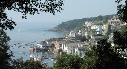
Fowey Harbour is situated on the south coast of Cornwall, approximately halfway between Plymouth and Falmouth. The river Fowey also gives its name to the town of Fowey situated on the western side of the estuary. On the eastern bank of the estuary mouth is the village of Polruan.
Fowey is a deep water harbour and is known as a China Clay port. Commercially it is a very important exporting port on the South West peninsula, being the largest in tonnage terms. It is also in the top twelve ports for non-oil product exports in the United Kingdom. Fowey is a haven for yachtsmen having as many as 7,000 visiting yachts in a season.as well as having up to 1500 resident craft.
The estuary provides good shelter although is exposed to winds from the South to the South West and gales from this direction can cause heavy swells in the lower harbour, particularly on the ebb.
Visitors are well catered for with visitors moorings clearly marked, and the Albert Quay Pontoon provides a convenient place to moor for a shopping trip or wander round the narrow streets.
 |
Entering the harbour you pass Polruan to starboard hand followed by the entrance to Pont Pill, to Port. Opposite Pont Pill is the Royal Fowey Yacht Club, Town Quay and then Albert Quay where the Harbourmaster's Office is located. Proceeding up river crosses the path of the Bodinnick Ferry linking Fowey, on the western bank, with Bodinnick on the east bank of the river. | 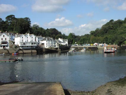 |
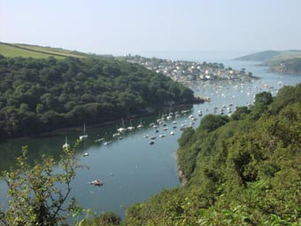
Some 1500 meters upriver from the Ferry lies Mixtow, and Mixtow Pill on the starboard side. At the mouth of Mixtow Pill is a pontoon and the first 200 meters of the Pill has a maintained depth of 2.2m and numerous small boat moorings.
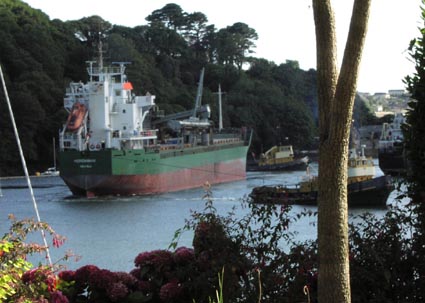 |
Opposite the entrance to Mixtow Pill are the quays for the loading of China Clay. Several commercial vessels a week will come upriver and, with the aid of tugs, turn and moor at the quays to take on China Clay for export. |
Beyond Mixtow Reach lies Wiseman's Reach with its numerous small boat moorings. Passing the village of Golant on the West bank the Fowey forks, left towards Lostwithiel and right up the River Lerryn to the waterside village of Lerryn. Both Lostwithiel and Lerryn are accessible to shallow draught vessels at the right time of tide.
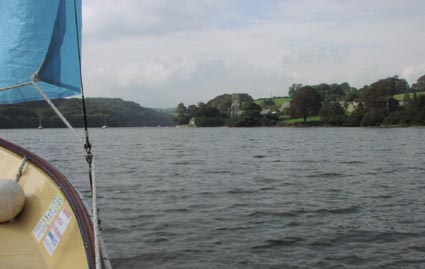 |
The broad stretch of the Fowey to Lostwithiel provides some excellent sailing to just beyond St.Winnow, on the north east bank, after which the river narrows considerably. |
| To the right Lerryn is accessible at high tide although care needs to be taken to negotiate the winding channel between the mud banks. This is an interesting trip making one's way upstream between the wooded banks. Once tied up at Lerryn there is time for a drink or quick meal the pub before catching the ebbing tide back down to Fowey. | 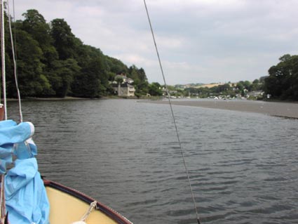 |