 |
 |
||||||||
Welcome To The GIS PageHere you will find links to other GIS sites in the column to your left that should be of intrest to you as well as some examples of our current and past GIS projects. Cascadia State Park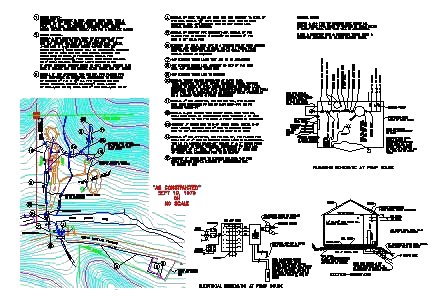
Old CAD procect called Cascadia State Park and was done for The Oregon Parks And Recreation Department (OPRD). The drawing contains contour data, Township & Range data, Road data, as well as details on the instalation of the pump located on site.
Ecola State Park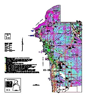
Old CAD procect called Ecola State Park and was done for The Oregon Parks And Recreation Department (OPRD). The drawing contains Contour data, Township & Range data, Road data and Parcel data.
Knollwood Estates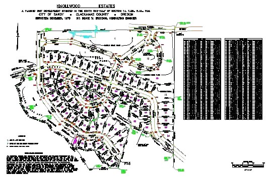
Old CAD procect called Knollwood Estates and was done for The Clakamas County Assesors Office. The drawing contains lot numbers, parcel dimentions, as well as curve data and street names.
|
|||||||||
 |
|||||||||
|
CAD/CAM GIS Web Development Digital Photography About Us GIS Sites of intrest: Directions Mag Esri GeoComm GeoPlace Gis Monitor OmniStar Profserv |
|||||||||