Estuarine Flooding and Dewatering Simulation |
Introduction |
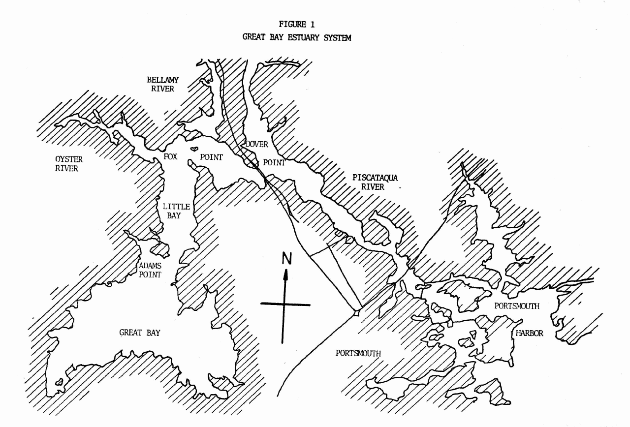
The Great Bay Estuary system is located in the New Hampshire seacoast
region.It is one of the largest estuaries opening on the Gulf of Maine.
The geometry of the estuary is complex. Porstmouth Harbour is the mouth
of the estuary. Together with the lower Piscataqua River it can be described
as a channel. This section s tidal prism is the lowest in the system, but
the section is dominated by the tidal flow of the entire system.
The upper Piscataqua River is formed by the convergence of the Cocheco
and Salmon Falls Rivers in Dover. The upper Piscataqua River is
characterized by a channel approximately five meters deep, with tidal
flats on both sides. The tidal currents are much weaker than the lower
Piscataqua, as it is only affected by its own tidal prism.
Little Bay is an L-shaped segment of the estuary joining the Piscataqua
River at Dover Point, and the Great Bay at Adams Point. It is
characterized by a channel with tidal flats on both sides. The Bellamy
and Oyster Rivers flow into the Little Bay. Little Bay turns sharply
at Fox Point, creating complex flow patterns and a great deal of turbulence.
It is dominated by tidal flow including Great Bay effects. The Great Bay
is a wide, shallow bay characterized by tidal flats, and a network of channels.
A small channel from the Winnicut River, and a larger one from the Squamscott
and Lamprey Rivers join in the center of the Bay and form the main channel,
which connects with Little Bay at Adams Point.
| gbay6.html | Great Bay Simulation Results |
| br5.html | Bellamy River Simulation Results |
| yr5.html | Oyster River Simulation Results |
| pr6.html | Piscataqua River Simulation Results |
| port3.html | Portsmouth Harbour Simulation Results |
| pby.html | Oyster, Bellamy and Piscataqua Rivers Simulation Results |
| gbriv.html | Great Bay with Oyster and Bellamy Rivers Simulation Results |
| phriv.html | Portsmouth Harbour with Piscataqua River Simulation Results |
| gbes4.html | Whole Great Bay Estuary System Simulation Results |

![[back]](images/home.gif)
Last modified: August 25, 1998 (Safak Nur ERTURK)