| A STRETCH OF SONORAN DESERT* Where are we on the AZT? Four miles northeast of Oracle, Arizona, then across the Sonoran Desert to the Gila River. About 52 miles in total and you'll earn every one of them. The trail through this section is now within just a couple of miles from being finished. A remarkable job mostly done by volunteers. Many thank them. This stretch of the Arizona Trail may become the most popular winter and spring hiking, biking and horse riding section of the entire trail. Route: Black Hills Passage -Tucson Wash/Antelope Peak Sections -Tiger Mine Road Trailhead to Freeman Road. This approximately 25 mile section starts at the Tiger Mine Road trailhead. The TH on Tiger Mine Rd is 1.5 miles northeast of where the Arizona Trail segment to the south ended at a culvert under Highway #77 (milepost #105). This segment of the AZT is near completion but there are some areas that are still "in progress". Standing alone and in plain sight alongside Tiger Mine Road are two large AZT trailhead portals that usher you into the awaiting desert. The AZT is easy to follow and reasonably distinct. It drops gently for a short distance before following a ridge for almost 2 miles. Soon it drops down and across the first of several washes which have Arizona Trail signs as the trail enters and leaves the washes. And the AZT almost always exits a wash directly across from where it enters a wash. About 5.5 miles from the Tiger Mine Trailhead you�ll come to a junction of two 4-wheel-drive roads (32 41 918N, 110 45 378W). The one stretching northwesterly, far into the distance is an abandoned utility line road. Take it. It ain�t pretty or exciting but for the next 9 miles you won�t get lost. Undulating is the best description for this road. Up and down, up and down. Hopefully you know a few tunes to sing to yourself through this stretch. There are AZT signs about every mile. After nearly 9 miles on the utility road, the AZT comes to Bloodsucker Wash and some no tresspassing signs blocking further travel on the utility road. Finally, you get to exit the utility road and thankfully, the scenery gets much more interesting. The AZTrail turns east and follows Bloodsucker Wash (named after some wacky Transylvainians who live in the area) for about 2 miles. At that point, look for AZT signs directing you north, into some low lying brush, thickets,etc. The next 1/3 mile is marked with lots of the 1"x4" aluminum strips hanging from trees, bushes and sky hooks plus a few small rock cairns. Soon the trail comes to constructed trail (for about 1/2 mile) then to a ranch road where it passes thru a gate. Following the ranch road north for a mile, the AZT reaches Beehive Well which has a corral, stock tank and usually water (water filter cloging "super skanky" per Alice). The trail exits Beehive Well to the north and immediately turns left. There should be a carsonite AZT marker at that turn. Follow the ranch road west in Putnam Wash for 1/4 mile and then at a AZT sign turn north (be careful, lots of folks miss this turn). The constructed AZT proceeds NW for about 2 miles and, as it comes down a slope looking north at Antelope Tank, an open-to-the-cows watering hole. How thirsty are you at this point? At the bottom of that slope the constructed AZT comes to another ranch road and an AZT sign. The trail crosses the road and soon heads mostly north as it makes its way east of Antelope Peak before turning west and then north on another 2 track that leads to Freeman Road (32 52 356N 110 52 642W). I understand that the trail is pretty decent thru here now, but until I get out there, I'll quote a bikerider named Scott. He and his biker friends road from the Tiger Mine trailhead to Freeman Road in November 2004. "Lee and I marveled at the singletrack that just seemed to never end. We kept expecting it to peter out, get overgrown, or AT LEAST become unrideable. But no! Here we are in one of the more remote areas of Arizona, sampling some of the best singletrack in the state. There's really some big country out there, and we were happy to be enjoying it. Most of all, we were impressed by all the hard work put (recently) into building this trail." At Freeman Road, turn west for about 1/3 mile, cross a cattle guard and at the top of a small rise in Freeman Rd, look for AZT signs and the trail heading northwest. Freeman is a good two-lane dirt road, little used except for an occasional vehicle. It's a good water cache spot. The distance since leaving the pipeline is about 12 miles. Note the waypoints are for general assistance only and are off a bit. Also, FYI, from Freeman Rd it's a) 12 miles east to Dudleyville (no stores) and Hgwy #177 and b) 19 miles west to Hgwy #79 (no nothing there). Tortilla Mts. Passage - Boulders and Ripsey Wash Segments - Freeman Road to the Gila River at Kelvin. This section is a great Sonoran desert experience. It's about 27 miles from Freeman Road to the Gila River at Kelvin. This part of the AZT is being called the Boulders and the Ripsey Segments. And be on your toes as the AZT is not finished through here yet. It�s constructed or marked in most places but disappears in others. So even experienced hikers will find it a challenge to hike northward from Freeman Road and reach the Florence/Kelvin Road without mumbling to themselves a bit.. The trail is often a) marked with the 1" x 4" aluminum strips hanging from bushes, trees, cacti etc, b) distinct enough to follow, or c) on the drawing board. Be sure to bring your compass. A finished trail is coming along nicely although a fully complete one is a few years off. The AZT begins another 10 miles of constructed trail as it leaves Freeman Rd heading north. This is called the "Boulders Segment". It's a sweet bike ride! And in about 5 miles you will pass the obvious boulders. A good spot to climb on top of the rocks for a good view of the nearby area . Soon, you'll come within sight of the Tecolote Ranch. Past the ranch it's more winding trail through the beautiful desert. This a great springtime hike just don't try it in the Arizona summer. The trail then comes to a rough, power line road. This is the end of the Boulders segment. Turn left (northwest) on that semblance of a road and follow it for about 1 1/2 miles NW. There's not much to denote where the proposed AZT will exit to the right from the power line road (32 58 24N 110 58 50W). In January 2004, there was one silver hanger. That point is just as you come out of a wash. I hear the trail leaving the road is marked and done now. If so follow it north for about a half mile and then NNW for about 3/4 of a mile. In that area,the trail comes to a gate on a ranch road (32 59 18N 110 59 20W). Follow the ranch road north, then NW for about 2 miles to a junction with a two track road from the north. Turn north and proceed about 150 yards to a flat, rocky open area next to a fence. Pass thru the new gate and look for old flaging tape and silver hangers that will lead you down into the wash. Or, just head down into the wash the best way you can. Follow the wash east and north as the route goes in and out of it for just over a mile. In the wash, you will come upon a 100 gallon spring fed metal water trough (33 00 48N, 110 59 33W). Hopefully there's water in it. If not check about 50 yards behind it. Shortly after the trough, a power line road takes the AZT up and out of the east side of the wash. After the road reaches the top of the hill, go another 100' and look for the trail on the left (west) side of the road. The trail then leads across and down the ridge for about a mile into Ripsey Wash. In Ripsey Wash, the trail comes to a distinct jeep road that follows the Ripsey Wash 5 1/2 easy miles NW to the unpaved Florence/Kelvin Highway (and within sight of the Gila River). Previously, I have been suggesting hikers take Ripsey Wash north. But as of January, 2004 there's a good trail up and over the Big Hill. And the views from the top are worth it. Cross Ripsey Wash and follow a worn road about 1/4 mile NE thru a gate and then onto a good trail that leads up the Big Hill. It's a very good trail and the 700' elevation gain is mitigated by well constructed switchbacks. Three deer loped by in January 2004 as we made the trek to the ridge. At the ridge, follow the ridge for a few miles (hiker Alice said in 2003 that she found the ridge "3 glorious miles of ridge cruising"). After about 3 miles the trail descendsl. The view of the Ray mine northeast is awesome. Eventually the trail comes out at a wash and road. Follow the road and after a mile+ it comes to the Florence/Kelvin Highway (it's dirt). Turn right (east) and walk 1+ mile to the car bridge over the Gila River. The Florence/Kelvin unpaved highway goes east, crosses the Gila River bridge and into the Kelvin area and Highway #177. There's just a few scattered houses in the area and no stores or services. If you need assistance at this point there's a trail friendly old cowboy named George Hunt that lives on this road. His name is prominent on his large mailbox by the road. Picket Post Segment - due to space constrants, I've added a new chapter for the hike from the Gila River to Picket post trailhead. Double click here: Picket Post Segment. Worthwhile Detours from the AZT: 1) Kearney is way off the trail but it�s a nice clean small town with the General Kearny Motel and Restaurant. Places to Camp � It�s pretty much primitive camping through this entire section. There�s soft sand in places but no big shady trees or a cool stream. The one exception is near the Gila River which has a lot of trees, a few nice grassy places and usually water. Length � My best estimate is about 52 miles. Power Rating � Physically easy to moderate. There are some beautiful views, particularly to the East, as you approach Antelope Peak. The famous Mt. Graham can be seen in the distance. From the top of the Big Hill, the views are exceptional. On the other hand, I found walking the utility line road in the Antelope Peak section very exhausting, not very exciting and hard on my feet. It was a long walk, making this section more difficult than it should be. Water* � Carry plenty. And if possible cache several gallons where the AZT crosses Freeman Road. But here's a few possibilities, but be advised that people are not authorized to use any of the rancher tanks in this area. 1) There's a windmill about 1/4 mile SE of where the AZT meets initially meets the pipeline road (the point 5.5 miles from the Tiger Mine TH). 2) Yellowjacket Well/Tank is about 1/2 west of where the AZT leaves the pipeline road and enters Bloodsucker Wash 3) Behive Well is on the AZTrail in Putnam Wash 4) The trail passes close to and within sight of a ranch 5-6 miles north of Freeman Rd (I don't what kind of reception to epect tho). 5) There's a spring fed water tank in a dry streambed along the AZT, about 6 miles south Florence/Kelvin Road (see above). 6) There�s water in the Gila River but I have been advised to not drink the water west of the Kelvin bridge because of its high mineral content. Also, there are a number of houses in the Kelvin area that might offer a drink. A friend of the AZT is George Hunt who lives north of the bridge alonside the highway in Kelvin. His name is on his mailbox. Bikeable? The segment from Tiger Mine Road to the Gila River at Kelvin may eventually become the AZT�s premier mountain bike challenge. It�s ideal. Nearly 50 miles in length with Freeman Road bisecting it, it offers plenty of rugged terrain but no towering mountains (except for the Big Hill) to climb or cliffs to fall off. The 8 miles on the power line road in the Antelope Peak section provides the chance for a biker to fly. And sliding through many, many washes offers another challenge too. It�s not for the inexperienced mountain biker tho. As of spring 2005, the AZT was completed for about 10-12 miles north of Freeman Rd. The more intrepid biker might continue on the trail from that point. Others may want to leave the trail and follow some of the rancher roads to the Florence Kelvin highway. Then if you are a thru-biker, ride west to the Florence, AZ area. Then it's a paved, busy highwayto Apache Junction, AZ. From there take the Apache Trail (SR #88) that leads to Roosevelt Dam. Permits � None needed that I know of. But stay on the trail as once you are off it, you may meet a less than happy rancher. Maps � See chapter on maps. The ATA sells maps of most AZT segments - 602-417-9300. Advice � Please respect the �No Trespassing� signs in this area. Such signs are not very common in Arizona with all its public land, so I�m usually taken aback when I see one. But, respect them! Cautions � It�s inviting to wade across the Gila River. But, with a backpack and the river�s soft bottom, it�s not a good idea. Life on The AZT � As of Spring 2005, this is still a tuff stretch to cross. The trail is within 3 miles of being complete. Lack of water is a big hurdle, though in the spring of 2005 there was an available cache by the trail for anyone's use a few hundred yards north of Freeman Rd.. And there are few people living in the area with just an occasional ranch. Despite local rancher concerns about the Arizona Trail coming thru here, I believe all will lend a hand if you need it. And, if you hike this section on a weekend, you may run into a volunteer crew working on the trail. They will be glad to see someone using the trail. * Remember just about all water sources are seasonal in Arizona. Check with as many sources as possible before entering an area, including the local National Forest Service. HOME EMAIL ME NEXT CHAPTER |
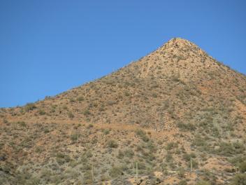
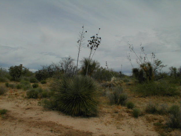
| Desert scenery (above). The Big Hill (left), just north of the Gila River. (Thanks to Larry Snead for the pic) . |
 |
 |