| GETTING FROM THE GILA RIVER TO THE PICKET POSTCKET POST TH Where are we on the AZT? This next piece of the Arizona Trail is a wonderful secret to most Arizonans. But, please don't tell them. It starts at the one time mining settlement of Kelvin near the Gila River and ends 26 miles later at the Picket Post Trailhead, which is just south of Highway #60 near milepost 221, 4 miles west of Superior, AZ. Please note that there is NOT an official Arizona Trail from the Kelvin community by the Gila River to the Tonto National Forest just west of the White Canyon Wilderness. An official AZT route is being planned now. And it will be through some remote, rugged wildly beautiful terrain. But completion of it is several years off. The path described below is only to help hikers traverse this area. Route: Picket Post Segment The challenge in this approximately 26 mile segment is how to get from the Gila River to a point on Battle Axe Road that leads into Walnut Canyon. There's no set way to get there. But which ever way you go, you are in for some outstanding hiking. This is one of my favorite stretches. I don't think any two AZT hikers have gone from the Kelvin/Gila River to Walnut Canyon the same way. The point I believe you want to get to is NE of the Copper Butte Mountain and Mine where Battle Axe Road meets with a jeep road (33 09 56N, 111 03 16W). Following is a route that a group of us took in March 2003: Walk the railroad tracks west from near the Kelvin car bridge for about 2 miles until about 50' before the railroad bridge. At this point look some orange flagging tape that may be hung on trees and bushes. They will lead you north of the tracks about 100-150 feet to a barbed wire fence. Slide under the fence and follow it west for a few hundred yards and soon you will come upon a faint trail that leads up above the river bed and offers some nice views back to the river and RR bridge. Follow this trail for less than a mile where it descends into a wash. Follow the cow trail north (look for orange flagging tape too)for another mile and then head west thru a small, sometimes overgrown dry creekbed. The creekbed will head slightly southwest but in just over a mile, it comes to a large wash. Turn north again and follow that wash for about 1/3 of a mile and then make your way west to a ridge until you see the utility line. Bushwack your way to the utility line road that weaves its way along a rough ridge. The road is rough but the wild poppies were stunning in March 2003. Follow the utility line road north for about 1 1/2 miles until it finally descends into a wash. Turn left, west and walk about 1/4 mile to a very wide wash. There should be a road in the wash. Follow that windy road north. After about 2 1/2 miles it comes to a T, turn left and walk 150 yards and turn right. This road will lead 1+ mile to the Battle Axe Rd way point noted above. Just before reaching Battle Axe Rd you will pass a corral. Turn left at Battle Axe and walk 1/4 mile and then turn right on a rough vehicle used road that will take you 2 miles to an Artesian Well ( 33 09 428N, 111 04 834W) which runs year round. You are now in the Walnut Canyon area. It�s a great place to camp. In fact the artesian water coming from a pipe located in a little camping-like area about 50' off the jeep road will greet you about 2 miles from when you leave Battle Axe Road. [You can actually drive a vehicle to this spot from Highway #177]. Continue past the artesian well on the now rugged jeep road for another 1/2 mile and turn left (south) at another jeep road that is marked with some rock cairns. (Resist staying on the first jeep road that continues alongside the creek leading into a lush area. If you come to a sign-in registry for the White Canyon Wilderness Area, turn around and go back about a half mile). Head south on the jeep road for only about 1/4 mile where you will see off to the right an AZT carsonite marker sign (33 09 603N, 111 05 536W) ) on a mound of dirt that leads to the a faint track. You are now in the White Canyon Wilderness Area, your 5th of 9 Designated Wilderness areas along the AZT. The first part of this track is overgrown and follows a very old, barely visible old miner road, but you can make it out as you ascend the mountain. You'll utilize your trail finding senses here. But it's a very beautiful area. The trail slowly gets easier to discern and eventually you'll come to small rock cairns marking the way. One area in this section where I got a little concerned was the Hole in the Rock location. It's about 3-4 miles from Walnut Canyon. The hole in the rock is a dead give away that you are at the right spot but it's at the intersections of topo map sections 9,10, 15, 16. Anyway, I came to a very overgrown, weedy flat area that looked at the Hole in the Rock but the trail just seemed to vanish in the weeds. I just couldn't spot the trail. Well if you look and look (or explore like I did) you'll see some rock cairns a hundred yards in the distance as the trail passes in the drainage at the left base of Hole in the Rock. Such experiences really utilize your trail sense and patience. Thankfully, a few hundred yards further you'll come upon some AZT signage and large and welcome rock cairns. At this point you now exit the White Canyon Wilderness and back on official Arizona Trail (signs, trail etc). The rest of the hike to Picket Post TH is easier trail-finding wise as you follow some signs and a lot of near art-form rock cairns into Alamo Canyon and then to the new Picket Post Trailhead. But it's still a long, not easy hike from Hole-in-the-Rock to Picket Post. I'd say slightly over 10 miles but the trail is much easier to follow. . FYI: The Arizona Trail crosses Highway #60, just east of Milepost 221. A spot that is about 1 mile+ west of the Boyce Thompson Arboretum. Or, if you are leaving your vehicle, there's a new trailhead with good parking (even for horse trailers) and bathrooms 1/2 mile south of Hgwy #60. Turn right (south) between Milepost 221 and 222 (look for an old windmill) drive approximately 1 1/2 miles to reach the TH.. Mileage: It's about 17 miles from where the jeep road junctions off from Battle Axe Road to highway #60. From the Gila River bridge at Kelvin to the junction of the jeep trail and Battle Axe Road, I estimate another 9 miles. Worthwhile Detours from the AZT: 1) the Boyce Thompson Desert Arboretum is just a mile east from where the AZT crosses Highway #60; and 2) the aging mining town of Superior with Los Hermanos Bar and Mexican food restaurant is just a couple of more miles east of the Arboretum. There�s also one inexpensive motel there, the El Portal (520-689-2886); and 3) for a few of you peak baggers, Picket Post Mt. is a good climb. If you don't climb it, look closely for the American flag waving way up there on the top. Too cool! Places to Camp � Near the Gila River at Kelvin. And as mentioned above, in Walnut Canyon near the Artesian Well it is very nice for putting down the pack and relaxing. It�s a favorite area for a very few weekend campers. Also, about a 1/2 mile into the White Canyon Wilderness there are some flat spots just off the faint mining road that affords great views. And finally, near Hole-in-the Rock would give pleasant views when waking up. But don't camp at Picket Post trailhead (see caution below).. Power Rating � Difficult, particularly trail finding but also lots of up and down hiking.. Water* � 1) There's the Artesian Well in Walnut Canyon mentioned above. And also 2) there are two windmills and water troughs in Alamo Canyon, about 3 miles before reaching the Picket Post trailhead and another one about a 1/2 mile NW of the Picket Post TH, on the dirt road that leads back to the highway. And 3) best of all there's cold Pepsi and cervasa at Los Hermanos in Superior. Bikeable? Nope Permits � None needed . Maps � See chapter on maps. Advice � The AZT doesn't cross many rivers so enjoy the Gila while you are there. Yep, it's bath time. Cautions � Don't camp overnight at the Picket Post Trailhead. It's very noisy all night long from trucks on Highway 60. I suggest hiking north 4 miles to a lush spot beside the creek in Whitford Canyon. Life on The AZT � The Gila River area is known for its Gila monsters of course. I did see one in Walnut Canyon. A skin of black and orange crush colors. But be careful, I'm told they don't let loose if they bite humans. Also, there were plenty of rattlesnakes but they always, well almost always, let you know when you come too close. Beautiful vipers they are.. * Remember just about all water sources are seasonal in Arizona. Check with as many sources as possible before entering an area, including the local National Forest Service. HOME EMAIL ME NEXT CHAPTER |
 |
 |
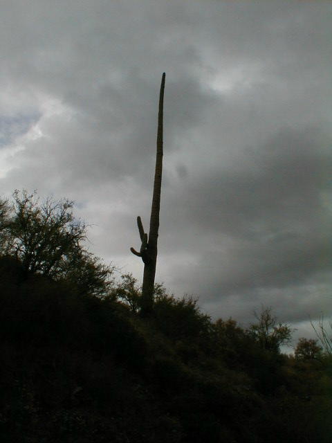
| Pass to the left of Hole-In-the-Rock (above). A lonely Saguaro is about to get some rain. |
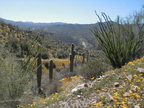 |
| Just north of the Gila River March 2003 |