DECEMBER, 2004 UPDATE - As mentioned in chapter 8, the Arizona Trail has been routed to the Colossal Cave Mt Park area. Several miles of new trail have been constructed north of the Colossal Cave Mt Park. But it will be a few more years before there is a finished trail into Saguaro National Park. More news will be posted as I receive it. The description below will help thru hikers continue their adventure and link to finished trail.
WHERE ARE WE AT ON THE AZT? This segment starts at Colossal Cave Mountian Park, proceeds north to the deserted Hope Camp and then into Saguaro National Park to Manning Camp then north out of the Park to Reddington Road. Approximately 34 miles.
THE ROUTE:
Colossal Cave to Italian Springs(about 23 miles): As a result of some ambitious volunteers in this area, new trail construction north of the Colossal Cave area is moving along quickly. I hiked in this area before any trail work was done but believe you will have a much easier path to follow now to Hope Camp. And if the new trail is contrary to this description, take the new trail.
At La Posta Que Mada Ranch follow trails and roads 2.4 miles to the La Selvilla campground. From La Selvilla campground, follow the road north out of the camp passing through a gate. About 1/2 mile north of La Selvilla, turn left (north) and hike NNW about 1.7 miles to a good dirt road (Pistol Hill Rd). Cross the road and follow the newly constructed AZT NNW another 1.4 miles to another good dirt road, the X-9 Ranch Rd. Again cross the road and continue to follow the new trail NNW another 1.7 miles through a gate and across Rincon Creek (possible springtime water). On the north side of the creek, hike west until finding an old 2 track. Follow that 2 track north about a third of a mile to Hope Camp (N32 07.983, W 110 38.936). There's an old dilapadated, corrugated metal building and an old, non working windmill there. This route to Hope Camp is about 8 miles from La Posta Que Mada Ranch.
The next goal is to get to Manning Camp. There are two choices: One either go to the Saguaro National Park Visitor Center located several miles north of Hope Camp. Basically work your way west to Old Spanish Trail Road and follow it NW to the visitor center. From there get a SNP map and follow Tanque Verde Ridge to Manning Camp. Or, the second choice is the unauthorized, illegal entry into the SNP to the closed Madrona Ranger station (N32 09.070 W110 36.527) just inside the Saguaro National Park about 4 miles from Hope Camp. (Please note that the entrance to the Saguaro National Park at Madrona is closed. The Park folks will not tell you it is OK to enter this way. So please have an overnight camping permit from them for where you plan to camp in the Park. Hike north from Home Camp on the North Hope Trail for its total length of .3 mile. Bushwack east/northeast for about 1 mile until finding an abandoned 2 track which runs E/NE for another 1 1/2 miles before fading out. The old Madrona ranger Station is about a 1/2 mile N/NE across a fence from here. The map handed out at the Saguaro National Park Visitor Center shows the Madrona Ranger Station on it and active, allowable trails that run through it. For some reason SNP officials just don't want the public to enter the Park here tho it appears the people at the contiguous subdivision enter there regularly. Tucson citizens and Arizona Trail Association officials are striving for approval of the AZT in this area.
Prepare to hike upward. 300 meters west of the Madrona Station stables, the Manning Camp Trail begins (N32 09.059, W110 36.549) on the west bank of Cheminea Creek. Hike north about 4.2 miles to the junction with the Douglas Spring Trail (N32 11.207, W110 36.207) The Manning Camp Trail turns right(east) and in .6 milereaches the Grass Shack Campround (N32 11.207, W 110 35.936) This is a developed campground with bear boxes and restrooms. Water is seasonal. Continue N/NE on the Manning Camp Trail another 3.5 miles to the junction with the Devil's Bathtub Trail. Turn left (north) and hike 1 more mile to Manning Camp (N32 12.362, W110 33.322). You are now around 8,000' high. There's water here. And a permit is needed to camp overnight here (and anywhere else in the Park) and there's usually a ranger nearby to be sure you have the permit. It's about 9.3 miles from Madrona Ranger Station to Manning Camp and a 4,600' elevation difference.
When leaving Manning Camp, walk east on the Heartbreak Ridge Trail for a few feet until reaching the Mica Mt. Trail. Follow it for a mile where it T�s with the Fire Loop Trail. Turn right (east) on the Fire Loop Trail and go .3 mile to the junction with the North Slope Trail. Follow the North Slope Trail north for .6 mile to Italian Spring (N32 13.719, W 110 32.165).
ITALIAN SPRING TO REDDINGTON ROAD (About 10.7 miles)
Italian Spring is a cool, serene spot. The trail junction is by a small possible water hole that is almost in the trail tread. It provides a nice spot to take a break. The elevation is still nearly 8,000�. From the spring, turn north on Italian Sp Trail for 1 � mile to the Park boundary (N 32 13.820, W110 32.163).. The aftermath of two major forest fires are very apparent along this section. Next, it�s a stretch that I was happy to be going down and not up. The trail becomes a steep, rocky ditch-like path that is occasionally staircased. Your feet will plead for mercy. But a few miles from the Park Boundary there�s a lovely (seasonal) stream to soak your feet and a small area to camp. Next, the trail follows what looks like a long ago wagon path. And finally, and for the first time in many a mile, the trail comes to a distinct forest road (#37), and there�s an Arizona Trail Marker. This is the Italian Trap Trailhead (N32 13.818), W 110 32.806) which is about 4.5 miles NNW of the Park boundary and about 9 miles from Manning Camp. From this trail head sign, continue north for 2.8 miles on constructed trail to the junction with Reddington Rd FR#371 (N32 18.222, W110 34.269 - This is just east of milepost 12 on Reddington Rd). MY FRIENDS, YOU�VE NOW CROSSED ONE TOUGH MOUNTAIN RANGE!
Worthwhile Detours from the AZT: Reddington Road is fairly well traveled. On most days some cars will pass. So if you long for Tucson you might be able to catch a ride.
Places to Camp � There are lots of good campsites in the Saguaro National Park, including Grass Shack Campground and Manning Camp (especially good). And there�s the nearby Colossal Cave Campsite. And of course, camp anywhere in the National Forest outside the Park, most noteworthy the site 4 miles north of Italian Springs where the trail crosses a seasonally flowing stream. Of course camp away from the water..
Length � 34 miles
Power Rating � I think difficult. A tough mountain, lots of hard surface and elevation gain. And finally, the trail down the north side was, as I mentioned before, rocky, steep and in places a deep little gulley. A hard hike but a great AZT segment.
Water* � In the spring of 2001 there were plenty of water sources in the National Park. There�s water at Manning Camp, Italian Springs and maybe at Madrona.Ranger Station Southwest of the SNP, Rincon Creek has possible springtime water.
Bikeable? Not much actual riding on the AZT as a big part of this area is Wilderness. I suggest once reaching I-10 to head for Vail, Az. along Pantano Road. Then ride to Colossal Cave and camp overnight there. From Colossal Cave, ride the paved Old Spanish Trail road to the Saguaro National Park Visitor Center. The rangers there kindly gave me directions and a map to Reddington Pass.. From the Visitor's Center, continue on Old Spanish Trail for <1 mile and continue north on Freeman Rd. until reaching Speedway. Turn west on Speedway for < 1 mile, then take TV Loop Road or Houghton north to Tanque Verde. Take Tanque Verde east until it turns into Reddington Pass. The route is all on paved streets (stock up on food & water at one of the convenience stores) until reaching Reddington Pass Rd. But from there it's 10.6 miles of very rough, uphill riding to the Belotta Ranch sign (located between mileposts 10 & 11) described in Chapter 12 "The Santa Catalina Mountains- Paradise in the Desert". You'll be wore out at this point, so you may want to camp in "The Lake" area just a couple of miles north. And then you are back on the AZT route and it's an enjoyable 8 mile ride to Molino Basin Camp at the base of the Santa Catalina's.
Permits � You�ll need a site specific camping permit in the Saguaro National Park (520-733-5153).
Maps** - 1. Coronado National Forest Map, Safford and Santa Catalina Ranger Districts, 520-670-4552
2. Two free handouts from Saguaro National Park: a) Rincon Mtns. Wilderness Travel and b) the �Visiting Saguaro National Park� info handout. 520-733-5153. 3. The Arizona Trail Association sells maps of most segments of the AZT- 602 417 9300.
Advice � There are useful information guides with decent maps available from the Saguaro National Park people (520-733-5153).
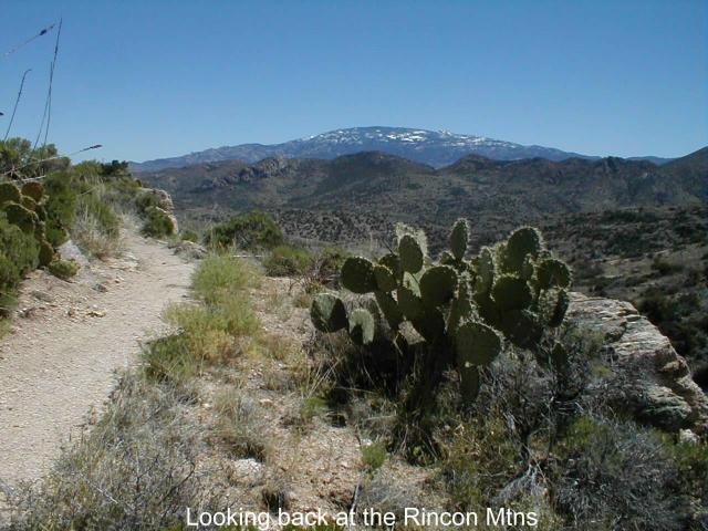
Cautions � The April afternoon hiking up the Rincon Mountains was very warm. But the night was plenty cool. Probably a 40+ degree temperature range. .
Life on The AZT- For some reason though, at Cow Head Saddle (which is not on the route described above), elevation 6,100�, several miles from anything and in the middle of the Saguaro National Park, Mary, John and Amy had niched their names into the trail sign. I hope a mountain lion ate them.
* Remember just about all water sources are seasonal in Arizona. Check with as many sources as possible before entering an area, including the local National Forest Service.
**(In addition to On the Arizona Trail guide book)
EMAIL ME
HOME NEXT CHAPTER