| OAK TREE CANYON TO HOPE CAMP* WHERE ARE WE AT ON THE AZT? Starting in Oak Tree Canyon, approximately .8 mile west of Highway #83, (milemarker 43), then north to Sahuarita Road, then northeast under Interstate 10, then north thru Colossal Cave Mountain Park and then north (almost) to Hope Camp.. Approximately 40 miles miles ROUTE : The established AZT route coming from the Santa Rita Mountain area turns north out of Oak Tree Canyon approx .8 miles west of highway #83. As of 12/2008, there is finished trail for about 6 miles and then flagging tape for about four miles to the Lakes Road which is very near (1/4 mile west) Twin Tanks. At the Lakes Road, finished trail resumes and the trail is complete to a point about 1/4 mile south of Hope Camp. I suggest you buy a State Land Department Recreation permit (call 602-542-2682) before hiking this section as a lot of the trail is on state land. A permit is not needed while on the trail but technically if you wander more than 15' from the trail, you are trespassing. Of course if you are busted just speak Spanish and you'll get a free trip to Mexico. Also, while this route is on federal or state owned land, be aware that nearby some land is privately owned. And remember the old west saying "shoot first and ask questions later"? It isn't just a phrase from a cowboy movie in southern Arizona. Here's a way to get you to Colossal Cave: At a spot in Oak Tree Canyon, .8 mile west of highway #83, the AZT turns north (31 48.640, 110 43.387). The trail then gains a ridge with a wonderful view north and then follows an old two track road a short way before descending to FR 4062. Cross the road and in another 2 miles come to another road (Rosemont Junction Rd). Cross Rosemont Junction Rd and 25 yds east continue on the trail as it climbs slightly. The trail is a bit remote for the next 3-4 miles, passing about 1/4 mile west of Hidden Valley Ranch (friendly and possible water supply), passing by the now defunct Helena Mine, before coming to the end of built trail and continuing on the the Forest Service boundary. It is expected that this last 2 miles of trail will be built by mid 2009. From the Forest Service boundary it is about 2+ miles of bushwacking on State Land until reaching built trail about 1/4 mile west of Twin Tanks on the Lakes Rd. Twin Tanks is an earthen tank but usually has water. The built trail north from the Lakes Road is easy hiking for many miles. The trail approaches the junction of Sahuarita Rd and SR #83 (31 57.815, 110 40.334 on the SW corner. Be carefull crossing the heavily vehicle traveled junction. The trail is east of the junction and fence. Hike north 3/10 of a mile and exit the drainage on the northeast. Then, hopefully find and, follow an old 2 track east about .5 mile to a good dirt road (it's Old Sahuarita Rd). Pass thru a gate and continue NE for about .5 mile (N31 58.679, W 110 39.306). Be aware that the property just SE of this point is private. Continue north for 1 1/2 miles to I-10. Cross under I-10 in a walk thru culvert (N32 59.775, W110 39.166) This point is about 1/4 mile west of the Davidson Canyon Bridge. After exiting the culvert and I-10, follow built trail for 1+ mile to a parking lot/trailhead (N32 00.850 W110 38.841). Follow the paved road (Pantano Rd) north for 1/4 mile, cross the bridge and turn left (west) where the trail begins again. Sit down here and shortly a trail will pass one of the two Railroad tracks that cross over Cienega Creek. This spot is often called three bridges because of the railroad and car bridges. Follow the trail and in a few miles comes to La Posta Que Mada Ranch which is a part of Colossal Cave Mt. Park. There is a snack bar at the ranch, you can rent horses and visit the ranch;s gift shop and history rooms. A great place to stop. Colossal Cave has two campsites which have water and bathrooms. Plus the trail thru the Park is an awesomely scenic place. And FYI, you've come into the Park thru the back door. There's an entrance fee that you need to pay at the entrance gate. I think it's $1 or$3. If you plan to camp overnight in the park, there's two camp grounds to choose from: 1) El Bosquecito (N32 03.392 W110 38.005), which is closer to the actual Cave area and 2) La Selvilla (N32 03.862 W110 37.289) which is on the NE part of the Park. Ask at the Ranch how to hike to them. From La Selvilla campground, follow the road north out of the camp passing through a gate. About 1/2 mile north of La Selvilla, turn left (north) and hike NNW about 1.7 miles across a good dirt road (Pistol Hill Rd). Cross the road and follow the constructed AZT NNW another 1.4 miles to another good dirt road, the X-9 Ranch Rd. Again cross the road and continue to follow the new trail NNW another 1.7 miles through a gate and across Rincon Creek (possible springtime water). On the north side of the creek, hike west until finding an old 2 track. Follow that 2 track north about a third of a mile to Hope Camp (N32 07.983, W 110 38.936). There's an old dilapadated, corrugated metal building and an old, non working windmill there. This route to Hope Camp is about 8 miles from La Posta Que Mada Ranch. Sorry to say that Saguaro National Park has not agreed to an AZT route from Hope Camp to the Manning Camp trail approx 4 miles NE of hope Camp. They have been studying it for many, many years. They advise hikers to come to the Park Visitor Center approximately 11 miles from Hope Camp. Please let them know that you are suffering from bureaucratic process fatigue and urge them to finalize a trail into the Park. What�s nearby? The first half of this section runs close to SR # 83. But, there's not any stores or anything on SR #83. The 3 Bridges area is interesting because of the 2 RR tressels and car bridge over Cienegas Creek. Both La Posta Que Mada Ranch and the actual Cave area are worth checking out, at least to have a Pepsi or something from their snack bars. And the community of Vail is about 6 miles west of the Colossal Cave Mt. Park. It has a convenience store, post office and a Dairy Queen, a restaurant etc. There's no motel but the area is growing fast and I expect more civilized amenities soon. Places to Camp � 1) near Twin Tanks is OK 2) the Cienega Creek area near 3 Bridges is a no trespassing area 3) the two camp grounds at the Colossal Cave Park are good with water, tables and bathrooms, 4 Oak Tree Canyon is nice. Length � Approximately 40 miles. Power Rating - Moderate to easy.. Water � Not much. No fresh water creeks for sure until reaching Las Cienegas at 3 Bridges. But north of Oak Tree Canyon and 1/2 west is Rosemeont Camp Ranch which will offer some fresh water. Also, a few miles further north and about 1/2 mile east of the AZT is Hidden Vally Ranch. Then its 7 miles further north to Twin Tanks..ucky water but usually has some. After that, where the trail goes under I-10, about .25 mile east of whee the trail goes under I-10, the Cienegas Creek might be running in the springtime. Finally, at Colossal Cave Mountain Park there is fresh water at La Posta Que Mada Ranch and the two campgrounds. Bikeable? this will be a great mt. bike area and equestain area. Permits � Get a State Land recreation permit by calling 602-542-2682. Maps - 1. 1:24000 maps from Wide World of Maps are helpful 2) The National geographic Topo - Arizona software for this area 3. Marginally helpful is the Coronado National Forest Map, Nogales and Sierra Vista Ranger Districts, 520-670-4552. 3. The ATA sells maps of most AZT segments - call 602-417-9300. Advice � The two ranches, Rosemont Camp Ranch and Hidden Valley, are owned by a mining company that has big plans for an open pit mine just west of the Arizona Trail. The mine is very Arizona Trail friendly and likely will give a thirsty hike some water. Cautions � I don't know the friendliness of the folks living at the houses before reaching the Twin Tanks area, but most near-border area folks are a bit skittish about strangers. The washes in this area show a little trash and footprints of other travelers, most likely illegals. And, further north, a Park cop patrols the Las Cienegas-Three Bridges area for those citizens venturing down to the creek. The Colossal Cave entrance gate closes at 5 or 6 PM depending on the time of year. And, tho it won't matter if you are a hiker, the gate to the campgrounds and Park aren't reopened until 9 AM. Life on The AZT - I like the stop at Colossal Cave. The Cave tour is interesting. And everyone I have met working at the Mountain Park has been very friendly and helpful. One hot afternoon, I rode my bike to the Park Entrance just after 5 PM. I told the lady at the gate that I wanted to get to the snack bar to buy a cold soda. She then informed me the snack bar closed at 5, but when she saw the disappointment on my face, she reached into her small cooler and gave me a cold Pepsi. Ahh, the kindness of strangers. * Remember just about all water sources are seasonal in Arizona. Check with as many sources as possible before entering an area, including the local National Forest Service. EMAIL ME HOME NEXT CHAPTER |
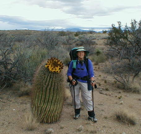 |
| Don't try leap frogging the barrel cactus thru here. |