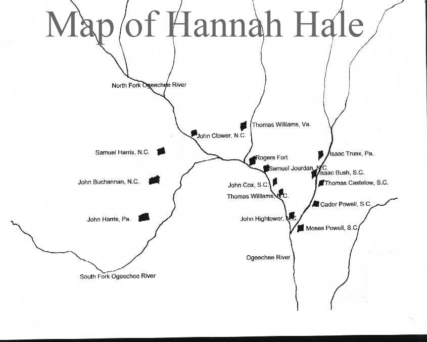
British Land Grants issued from 1773-1775
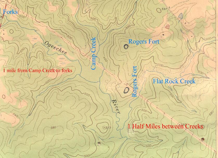
The following image was scanned from a 7.5 minute Topomap.
Click here to see a list of names.
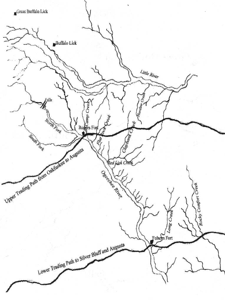
Ogeechee and Little Rivers 1773
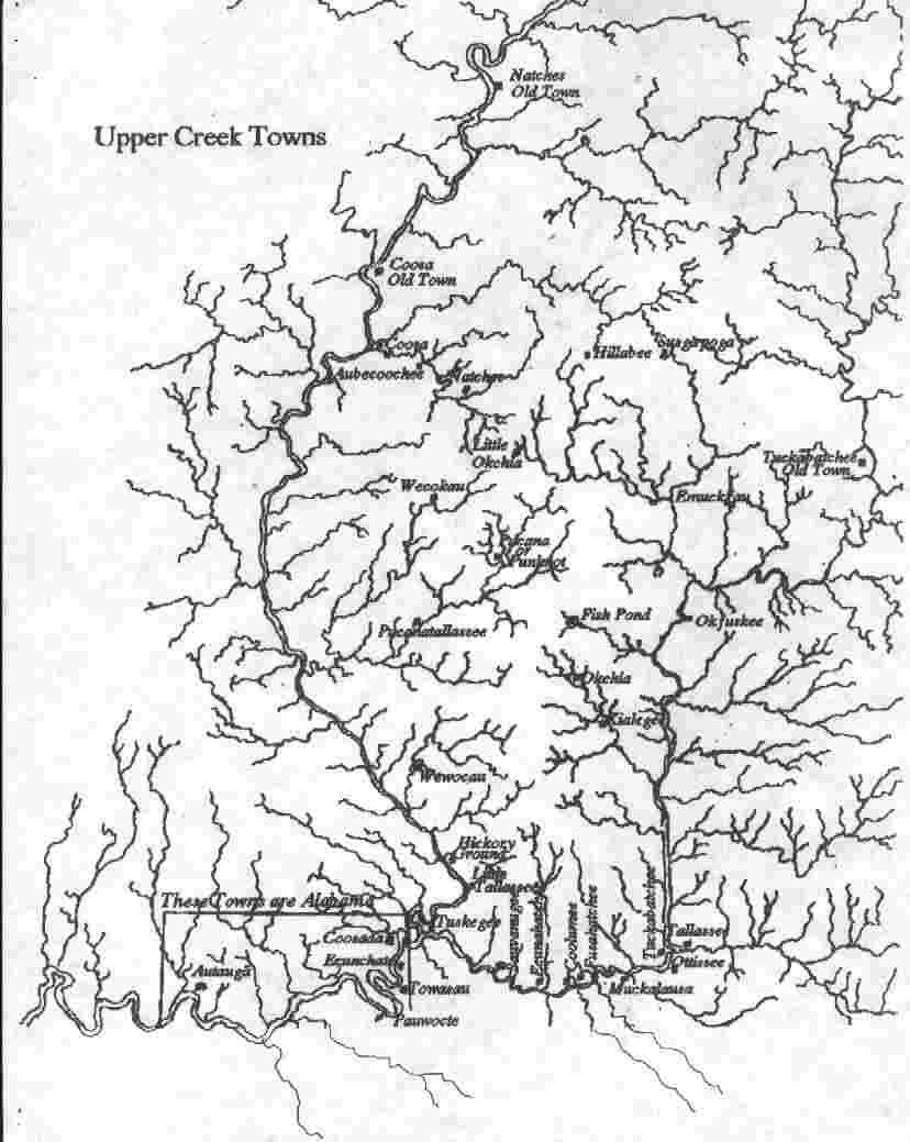
Towns in the Upper Creek Nation
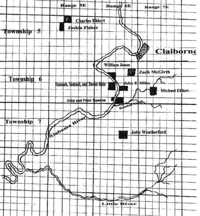
David and Samuel land on the Alabama River
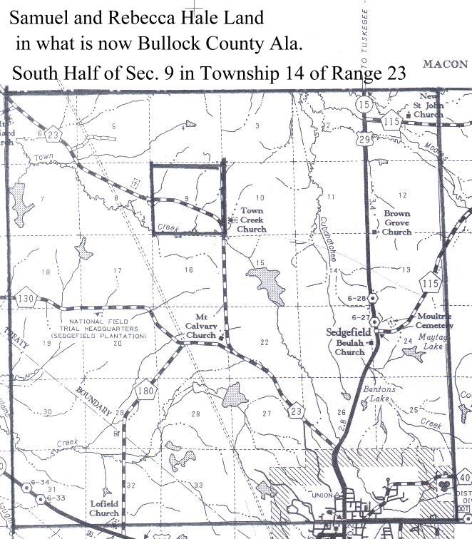
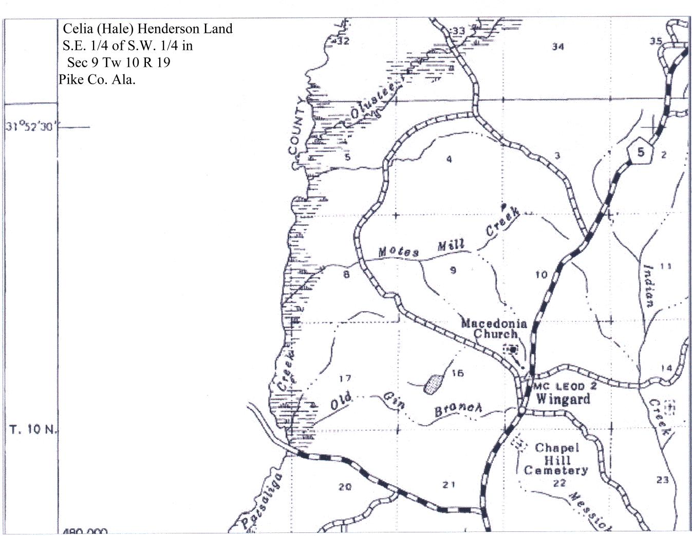
The following are copies of section maps.
Samuel and Rebecca Land Macon County
Celia Hale and husband James Henderson
I have walked over this ground and found no visible signs of the fort.
Researching Pioneer History shows they built close to water on the highest ground available.
I have marked the two most likely places for the Fort.
Most likely place for Rogers Fort.