KKK Maps
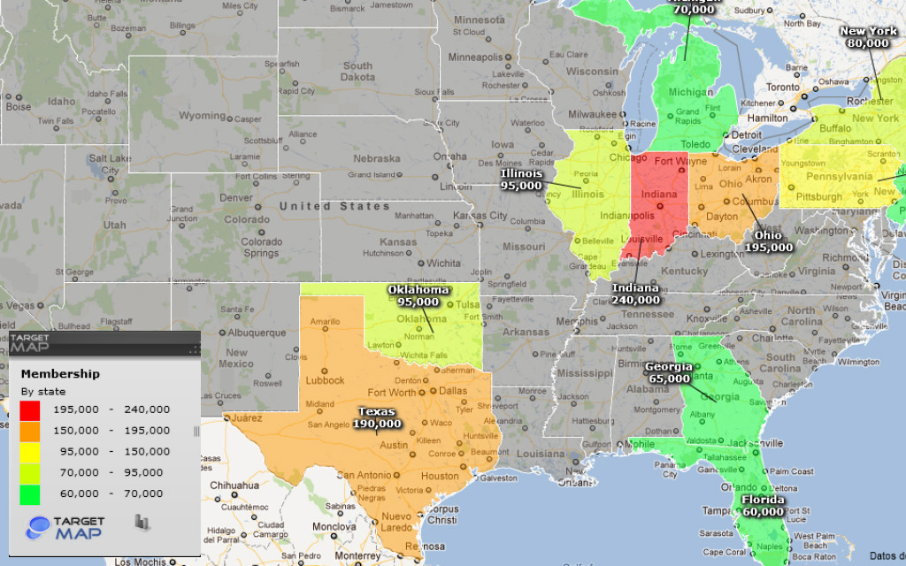
This map is representing the membership in the states which contained the most KKK members. A important factor is that this was between 1915 and 1940 which is the time period some call the peak of the KKK. "Highest KKK membership."(TargetMap)
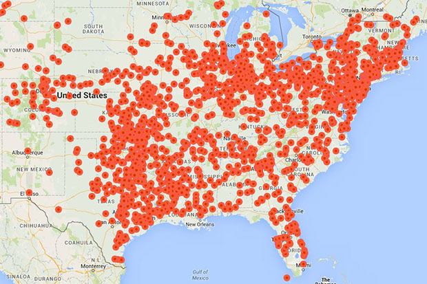
In this map, you see many red dots which represent local Klan chapters. This was again between the time period of 1915 and 1940. This map shows only the South and North East because that was where the Klan was then. "Digital Map of KKK."(VCU)
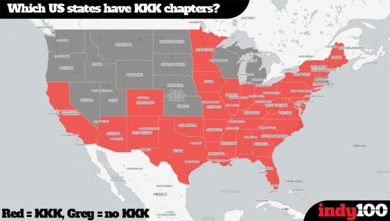
This map is the only one out of the three that is current. The red states represent states that currently have KKK chapters or groups. "Which U.S. States have KKK chapters?"(indy100)