Kimolos lies on the volcanic arch of the Aegean which stretches from Attica to Santorini to Nissyros. Kimolos was in fact born out of an erruption of a volcano. Though not as famous as its sibling island of Santorini, Kimolos has a lot in common with it, as well as with the rest of siblings of the family, such as Anaphi, Nissyros, and most of all with the neighbouring island of Melos.
Kimolos is a small place. It's round with a diameter of only 10km. The walks described below can be all done within one day, by a fast hiker. But I think Kimolos is too attractive, to be walked within a day!
WALK 1.: Follow the main road of the Chora, the island's only town, to the north. Then, at every fork you will encounter on your way, follow the one that is obviously leading to the Isle's highest hill Paleokastro (364m). As its name denotes "old castle" or "old fortified town", the hill once accomodated the island's town. On its top there are traces of prehistoric cyclopean walls, built of collossal stones. In conjuction with the ancient wall runs a medieval wall 1m thick. There are also traces of a round tower called "Portara" which means big gate.
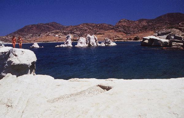
WALK 2.: From the town go south-east to Goupa, then north to Klima. Both small settlements of an ex-fishing community with buildings characteristic of Kimolos and Melos. North of Klima, to the north tip of the island, you will meet several coves with sand, the two northernmost of which, Prassa and Vroma have thermal springs, a gift of the volcano to the bathers of Kimolos.
WALK 3.: Take the road out of Chora towars Alyki beach. You can shortcut this dirt road by taking a
wide flagstone path you will see on your way, to the right. Once on the road again, follow it, until you reach the hill
of Hellenika, where the road ends.
At Hellenika there was the ancient city of Kimolos. In antiquity the hill was connected to the islet of Daskalio
or Agios Andreas just opposide the shore, forming a peninsula with two ports, well protected from all winds.
There is some evidence that the first inhabitants of the place were Phoenicians, who liked to chose spots of
similar topography for their cities. Succeeding the Phoenicians, during the ancient greek era, were the Dorians.
So, besides the geological resemblances of Kimolos with Anaphi, Melos, and
Santorini, these islands shared the same
routes of antique history, being colonised both by Phoenicians and Dorians.
The ancient greek city had commercial relations with Attica, Korinth and Asia Minor, as it was
concluded from the excavations conducted at Hellenika, in the '60s and '70s.
The excavations uncovered three types of graves, dating back to three consecutive periods of antiquity.
Some of the graves are still to be seen today both on the shore, as well as into the sea.
The ancient city at Hellenika was destroyed by an earth quake during the firtst century C.E. The port and part of the city's cemetery drowned into the sea. The city however was not abandoned during the early byzantine times althought it was never totaly revived.
WALK 4.: Chora itself is a fascinating place for walkers who love traditional architecture and medieval archeology. Walking through the labyrinth of the alleys of the Mesa and Exo Kastro, can make you pleasantly walk for hours.
It is quite possible that after the destruction of the ancient city, and during the late byzantine times, the population of Kimolos relocated to the site where Chora is today. The settlement was organized into a typical aegean fortified medieval town by the venetian lords of the island, originally during the 13th century C.E.
The first fortified medieval town, the Eso Kastro, was small. It was rectangle, with one tiny gate to the west, and about 100 miniscule houses.
Despite the fortification, the pirates' raids caused the repeated desolation of the place. So, a second wall around the first fortification was added, in the 16th century. It was again rectangle in shape, with one tower in each corner. It had two gates one to the east and one to the south. The eastern gate was built in 1646, as we learn from an inscription (actually the only ornament of this castle) built into the wall over it. The Kastro numbered 400 small houses. They were two-sroreyed one-room houses, each having only one apperture (one door). The more well-to-do proprietor occupied the upper storey. Both the more-well-to-do and the not-so-well-to-do proprietors and their families shared their one-room houses with their -literally- domestic animals. The back of the houses with their thick walls formed the Castle's external wall. The inhabitants were very poor, and the continuing raids of the pirates rendred their lifes wretched.
Fortified medieval settlements like the Kastro of Kimolos are common in the Aegean. Maria Filippa-Apostolou in her book "To Kastro tis Antiparou", describes the Castle of Antiparos, which is identical to this Kastro of Kimolos, both in arhitecture and in their route in history.
The fortified town is still inhabited today. It has expanded itself outside the walls, during the more safe post revolutionary times (1821), occupying today an area of considerable size.
Ross L.: Reise auf den Griechischen Inseln, 1836, vol.3, p.22
Hauttecoeur H.: � ����� �i�����, ��������� ���.�', 1974 (����. ��. �. ���������)
������������ ��.: ��� ����� ��� ������� �� ���������� ���� ��� ��' ��� ��' �����, ���������, ���.�', 1972, �.55-71
������������� �.: ���� ��� ������� ������������ ��� ��� ����� ������ ��� �������, ��������, ���.�', 1973, �.81-116
Bent J. Th.: Aegean Islands The Cyclades or Life among Insular Greeks, 1885, reprint 1965, by Argonaut Press.
�������-��������� �.: �� ������ ��� ���������, 1978.