| THESE MAPS should help familiarize you with the area. I'm also leaving a book that has very thorough maps of all of Nagoya. |
| THE APARTMENT AREA |
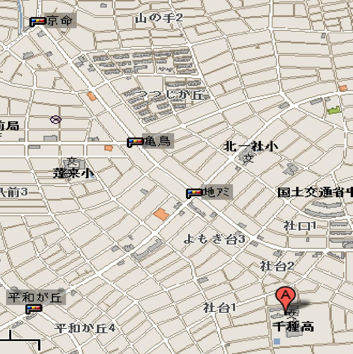
| AROUND SCHOOL |
| ROUTE TO SCHOOL |
| 1. Chigusa Senior High School (W) 2. B&D (SE) |
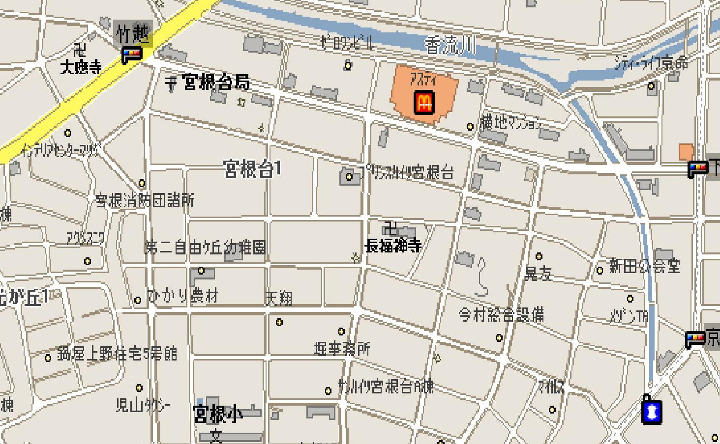 |
| 1. The apartment (N) 2. Mr. Takagi's house (S) |
| 1 |
| 2 |
| 3 |
| 5 |
| 6 |
| 4 |
 |
| Top left-hand corner of next map begins around here |
| 3. Nearest grocery store (S) 4. Post office (N) |
| 5. Nearest bus stop 6. Video store (N) |
| The nearest subway stop, shopping center, and pizza shop are to the southwest of the bus stop, along the same street. ( ) denote which direction the door or entrance faces. |
| 1 |
| 2 |
| 3 |
| 4 |
| 3. Daiso 100-yen shop (SE) 4. Foreign food store (and shopping center) (SE and SW) |
| If you continue south along the street in front of the school, you'll hit the nearest subway station (Issha) on the Higashiyama line. This should give you a better idea as to where the area is in relation to the rest of the city. |
| GO TO: |
| The area. Transportation. |