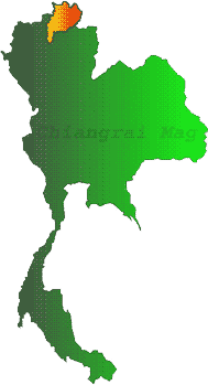
Chaingrai marks the nothernmost borders of Thailand, Several natural
walls of high mountains surround it and separate it from Myanmar
and Laos, our neithbors to the northwest and the northeast , These
mountain ranges are extensions of the Himalayas and some ranges
in the Chinese region of Yunan, which spread down to the basins
of the Kok-Ing-Lao River.
............90% of the whole aria
of Chiang Rai comprises high mountains . Some are as high as 1,500
meters above sea level, especially those along the Phi-Pan-Nam
mountain Range which come down from Mountain from Nan province,
Mt.Langka is its highest peak at the height of 2,030 meters, Chiangrai
, therefore , can boast of being the "Motherland" of
several important rivers that are the lifelines of the north.
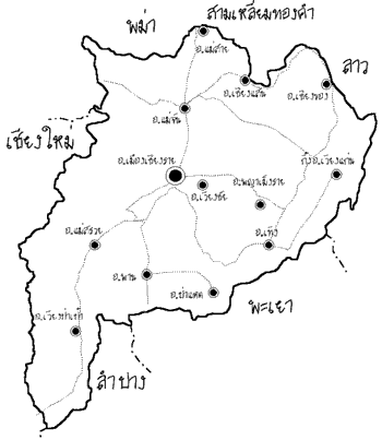
These include Kok, Ing , Lao and Sai Rivers. Of these, Kok is
the most important because it runs through the city of Chiangrai
Tropical montane forests are on top of over-1000-meter mountains.
The moist climate allows moss, fern and lichen to thrive. Pine
forests can be found sparsely on area mountains as well. Along
the riverbanks are wet tropical while mixed deciduous and dry
dipterocarp forests can be found in semi-arid area with some teak
trees.
Some unspoiled forests have been included in preservation areas
such as Doi Luang, and Khun Chae National Park, as well as Khun
Kon Botanical Garden. These forests are sources of Chiangrai waterways
and theirfauna. Many beautiful waterfalls originated in this areas
such as Khun Kon and Pu Kaeng.
In Nong Bong Kai Sanctuary in Amphoe Chiang Saen live a large
flock of birds, especially cold-weather ducks and teals on their
annual migration from the freezing climate in northern Asia.
---------------------------------------------------
..Go Top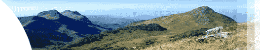

 พวงแสด