Mount Whitney, California, USA (14,494 ft / 4418 m): failed attempt via the Mountaineer's route

November 10-11, 2001


Brief report:

I was familiar with Whitney's mountaineer's route from an earlier solo trip back on July 2001 (click here for that report). This time I wanted to do it in mid Fall.
My observations:

  1. Whitney Portal trailhead: I got to the trailhead parking lot, Friday afternoon, about 4:00pm. I put my food away in the metal boxes. I walked around the area 'til it was dark (about 5:00pm). I slept inside my car. Woke up at 5:30am and started walking by 6:00am, Saturday, November 10, 2001 from the trailhead (8365 ft). No snow here.
  2. Lower Boy Scout Lake: reached Lower Boy Scout lake at about 9:00am. Here I rested for fifteen minutes. There was some snow on the ground, but still can see quite a bit of dirt (mostly frozen) and rock. Lower Boy Scout lake partially frozen (only 1-inch on top). Also, there still was water flowing by mid-morning.
  3. Section from Lower Boy Scout to Upper Boy Scout: the waterfall, by the slabs you see from Lower Boy Scout lake, was mostly frozen (not much water flowing by mid-morning). A few icy sections by the willows and water ice frozen to the granite slabs approaching Upper Boy Scout.
  4. Upper Boy Scout Lake: all liquid, nothing frozen. I arrived here at 10:00am and decided to have lunch and take a rest.
  5. Section from Upper Boy Scout to Iceberg Lake: some icy sections just as you ascended a few hundred feet from the Upper Boy Scout area. Left Upper Boy Scout at 10:45am heading to my base camp: Iceberg lake.
  6. Iceberg Lake: all liquid, nothing frozen. Some amount of snow, knee-deep at some places. Got to Iceberg at 12:30pm with fatigue setting in. I camped here Saturday night (Nov. 10th) and had a small snowfall/flurries overnight. Night time temperatures at Iceberg lake hovered around 20 degrees Fahrenheit.
  7. Mountaineer's gully: Summit day: I planned it for Sunday, November 11. A fair amount of snow in the gully. I only climbed it up to 13,100 ft because I was climbing on waist deep powdery snow (chest deep even at times; I'm 5'8" tall). I turned around at 13,100 because I was making very slow progress with the deep powdery snow, so I did not summit Whitney this past weekend. I wanted to start climbing the gully at 5:00am Sunday morning, however, it snowed until 7:00am or so. With the slow progress and the short daylight, I, along with two other climbing groups I met at Iceberg lake, all decided to go back down to the trailhead on Sunday, Nov. 11th.


Mt.Whitney Mountaineer's Route: Nov. 10-11, 2001 Photos

Click a thumbnail image below to view the full size image.


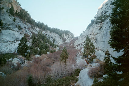
North Fork of Lone Pine (saddle)

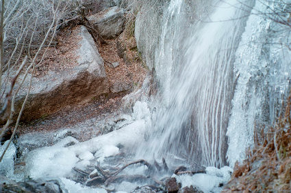
Partially frozen waterfall

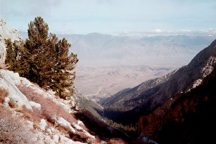
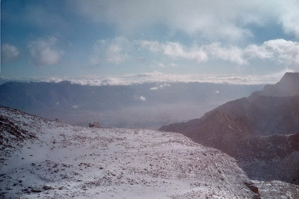
Owens Valley from 10,200 ft

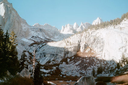
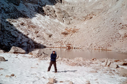
Looking up from Lower Boy Scout Lake

Upper Boy Scout Lake (lunch)

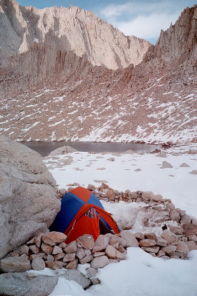
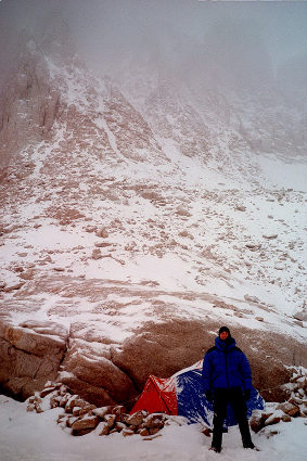
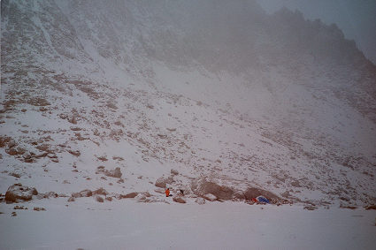
My camp at Iceberg Lake

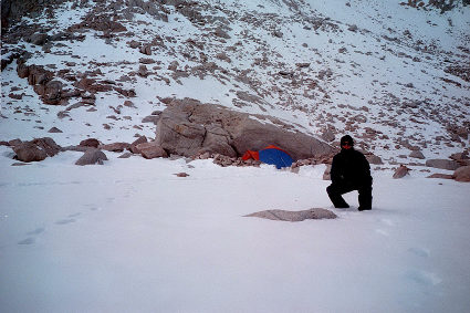
Another shot by my tent

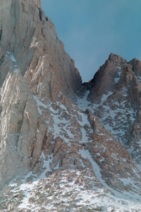
Scouting left mountaineer's gully

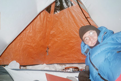
Inside tent - 11/10/01 night

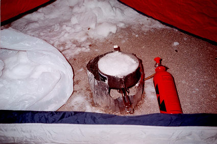
Melting snow in vestibule

Nov 11 morning, after snow fall

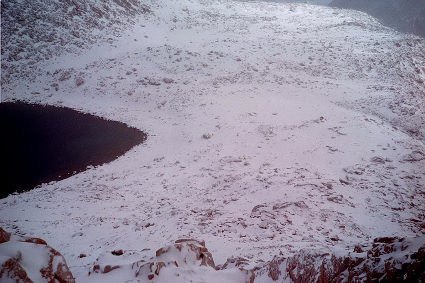
Iceberg Lake plateau from 13,100 ft

Iceberg plateau (White Mtns on background)

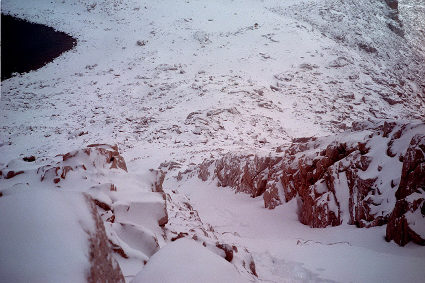
Looking down at left gully

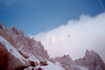
Snowdusted Mt Russell (covered in clouds)

Iceberg area on 11/11/01 morning


Return to my mountaineering page.
Last update: November 26, 2001
By Miguel Forjan
Email: [email protected]
Hosted by www.Geocities.ws

1