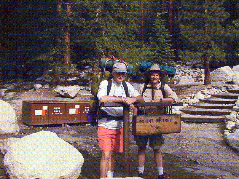
I left work at around 4:00pm, Friday, July 6, 2001. On the way to Lone Pine, I made my usual stop in Mojave to fill up on gas at the Arco station just off Hwy 14. Then, I stopped at Arby's and ate two roast beef 'n cheddar sandwiches. And finally, picked up some beef jerky, bagels, and energy bars at Mojave's State Bros supermarket, just behind Arby's.
As I was driving north on US Hwy 395, I noticed that it was getting wetter and wetter. I cracked the window open when I was passing by Olancha to smell the sage, just after a rain shower. It smelled great! Anyway, I arrived into Lone Pine at about 8:05pm. I stopped by the Mt Whitney Ranger station there and picked up my permit on the "after-hours" night box. Then, I turned left on the only stoplight in town onto Mt Whitney Portal Road. At the time, I was thinking if I should drive all the way to Horseshoe Meadows (10,000 ft) by Cottonwood Lakes to spend the night there to acclimatize. This is about a 45 minute drive, however, since it was dark now and quite cloudy, I decided to go directly to Whitney Portal.
I didn't have reservations for the Whitney Portal campground, but I drove through the campground to see if there were any empty campsites. It was now approximately 8:45pm. Indeed, since the weather wasn't that great (cloudy, slight rain), there were some available campsites. The ground was wet, and I didn't feel like in setting up my tent. So I decided to go over to the overflow parking lot (a few hundred yards from the trailhead) and sleep in the back of my car. Luckly, no ranger came by to bother me. I didn't sleep that well though, tossing and turning. I woked up at 6:00am. Ate some cold breakfast, made sure I didn't left anything in my car with an odor or anything visible that could catch a bear's attention, and started walking towards the trailhead at 7:00am, Saturday, July 7.
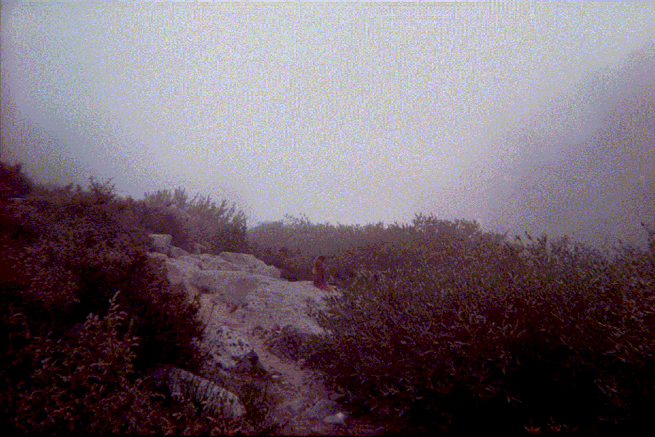
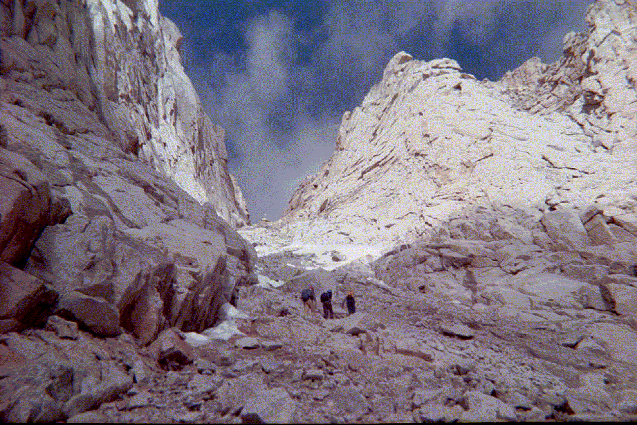
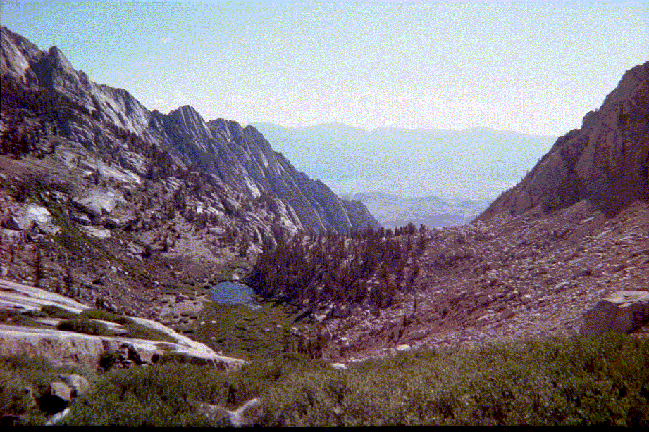
I reset my altimeter at the Whitney Portal trailhead to 8365 ft and began walking. Soon I encountered the right turn into the North Fork of Lone Pine drainage trail (map). This turn should be made just prior to the second creek crossing. There is a wooden sign there. The more I ascended the foggier it got; it did not rain though, just foggy and cloudy and with wet ground mostly. I caught up to a couple from Santa Barbara who passed me earlier on the main trail. They were carrying a day pack. Eventually, they'd stopped at Lower Boy Scout lake and turned around. Their intentions was to go day hike to Lower Boy Scout lake. We all managed to scramble up the Ebersbacher ledges. It was not too difficult to locate the lonely foxtail pine. Below this pine it's where you start to scramble up. We arrived in Lower Boy Scout lake around 10:00am. It was very foggy here. Sometimes the visibility was less than 60 feet. For the couple from Santa Barbara, this was their destination for the day. They sat down for the mid-morning lunch. Around that time, we had a visitor: a hungry marmot (see photos below). I said goodbye to the Santa Barbara couple, crossed the creek, and ended up having lunch myself by the waterfall that you see from Lower Boy Scout lake. At 10:45am I finished eating lunch and continued on to Upper Boy Scout lake. I had to crossed the creek twice and around 11:30am I arrived at Upper Boy Scout lake.
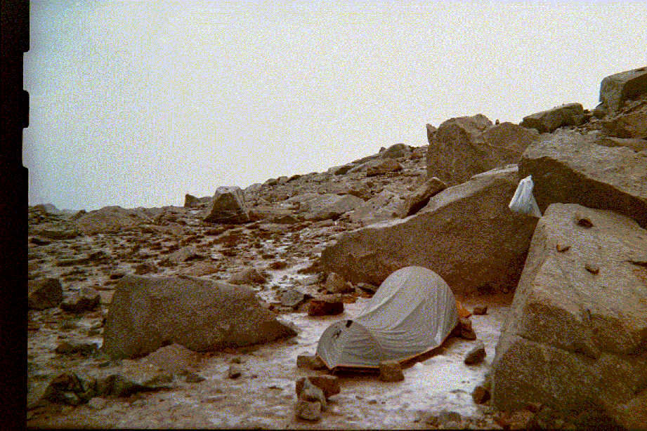
Although it was only 11:30am, I decided to make camp here at Upper Boy Scout lake. It's just that I saw more and more clouds rolling in, dark grey storm clouds, and so I decided to stay in Upper Boy Scout lake for the night instead of going further up to Iceberg lake. At around 2:05pm, it began to rain and soon thereafter it began to hail (small hail though, pea size). It did not stop 'til past 6:30pm Saturday. Now, I'm glad I decided to make camp early that day. If I would have gone onto Iceberg lake, I'd probably be caught up in the middle of the thunderstorm. Later, I made preparations for dinner and went to sleep at 9:00pm.
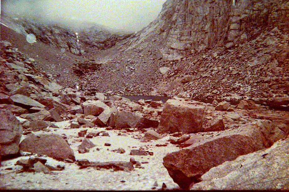
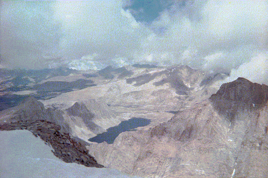
Next morning (Sunday morning), I woke up at 5:30am. I had breakfast, checked my gear, and headed towards Iceberg lake at 6:45am. On my way there, I turned right too soon, missing the prefer route to Iceberg lake. I ended up scrambling up on the southeastern ridge just above Upper Boy Scout lake. This was definitely not the way to go. This was more than I bargained for. There was definitely class 3 and some class 4 rock with exposure at times. I traversed it very carefully. Finally, I reached a plateau and was glad to see flat ground again. After 10 minutes walking on the plateau, Iceberg lake came into view. It was around 8:30am when I got to Iceberg lake.
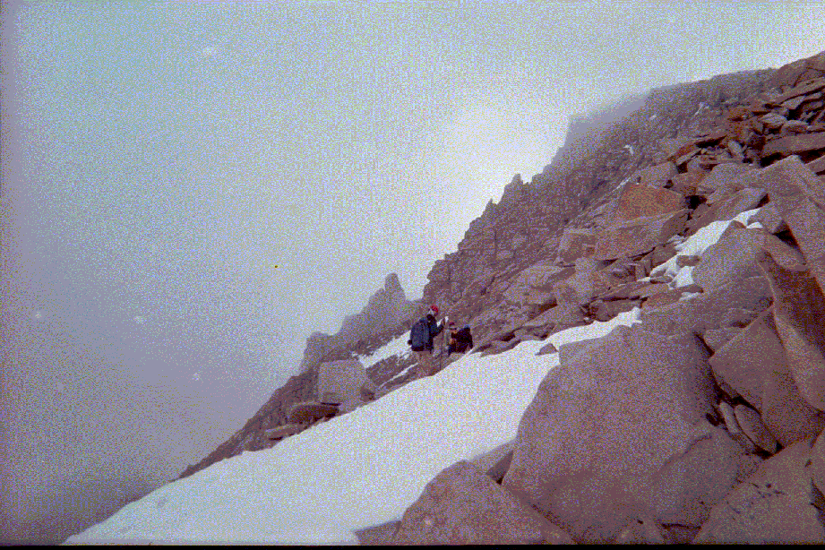
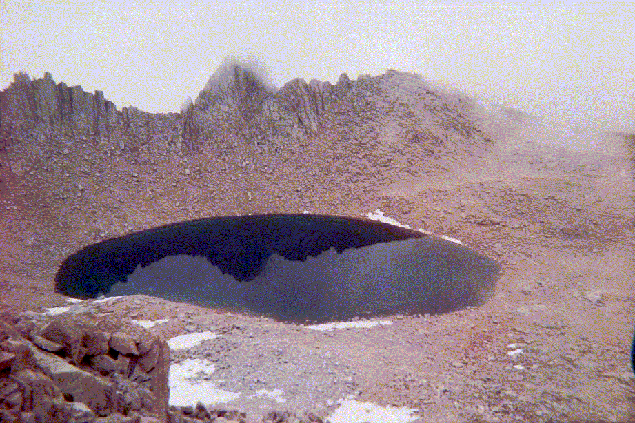
At Iceberg lake, there were campsites from two different groups as well as a couple of other groups who camped at Upper Boy Scout lake the previous night. When I first the main gully of the Mountaineer's route leading to the notch, I thought I could not do this. Definitely, the gully looks more intimidating than pictures I saw in the Internet from other people. Sunday morning it was still mostly cloudy. No one was going up. And then, about 8:45pm, a group of 3 climbers headed up. I just sat there by Iceberg lake debating if I should attempt it or not. For 15 minutes I observed these 3 persons slowly moving up. Finally, at 9:00am, I decided to go for it. I took the same route the other 3 climbers took. Basically, the smaller southern gully to the left as you go up. I caught up to the 3 climbers, who were taking at rest, just a few yards beyond the big boulder (this boulder is a good indicator to turn right [north] onto the main gully). I spoke to them and found out they were from San Diego: Andrew, Jen, and Kevin. Andrew was leading. I asked if I could join them for the remain of the climb. They said yes. All four of us reached the notch at the top of the gully and took a small break here. Then, we started traversing the northwest slope. From the guide book, it says you ascend via the first gully to the left to the summit. However, I looked at it and it had melting ice and water running throught it and decided to keep going following the San Diego climbers. The second left gully came into view and it also looked too hairy for me. But the third left gully did not look too bad. Andrew, Jen and Kevin apparently did not bring their crampons. Their plan was to keep going circumnavigating the northwest slope to the west where it gradually flattens out and then head east towards the summit. I, on the other hand, brought my Grivel G-12 newmatic crampons. I deployed my crampons and started ascending the 3rd left gully. The snow at first was that you could make good kicking steps for a plaform, but later it got firmed and firmer and there was a small section of ice. I had to high dagger with my ice ax and front-point with my crampons. I was sweating so much so that I had to take my prescription eyeglasses off. Because it was foggy and misty, my eyeglasses kept fogging up as sweat was coming down my eyebros and face. I have UVA/UVB dark clip-ons that I can climp on my prescription eyeglasses. Nevertheless, it was a hassle to climb without seeing well. I'm near-sighted (myopia). After spending more than 30 minutes doing this, I reached the flattened area. From here, it was a short 5 minute walk to the summit.
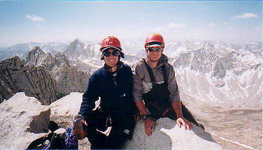
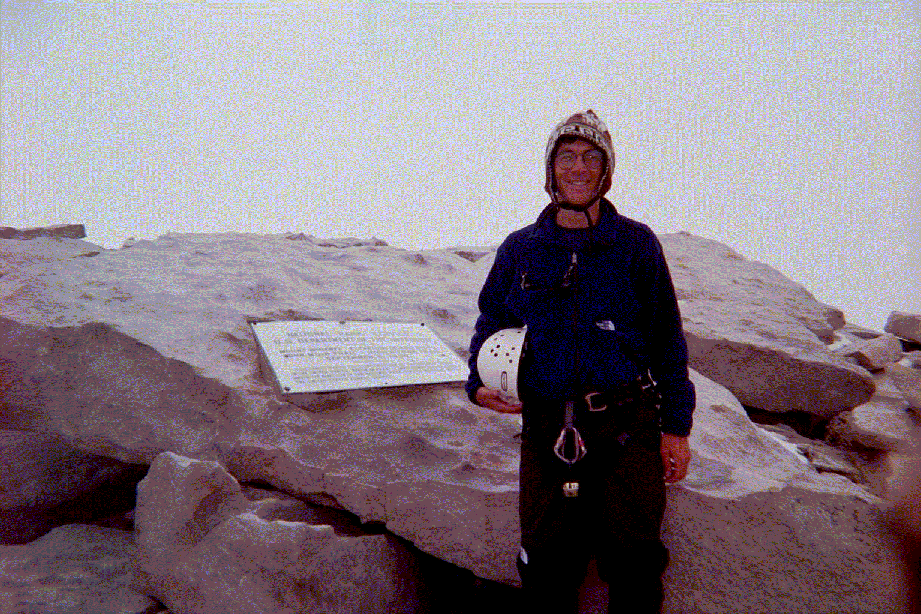
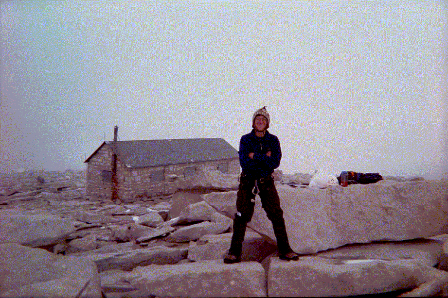
I reached the summit at 11:39am, Sunday, July 8. The 3 San Diego climbers had arrived a few minutes before I did. I was about ready to eat my lunch when we all heard a BOOM. That's when everybody at the top bailed out. I only had chance to have a few pictures taken and quickly signed the register. I only put my name and date on the register. At 11:44am, I was already on my descent (only stayed 5 minutes at the top because of thunderstorms and lightning). I once again re-joined with the 3 San Diego mountaineers, and at 2:30pm or so we were back down in Iceberg lake. Later, I ate lunch in their company and left around 3:00pm for my camp at Upper Boy Scout lake. Now, this time I did follow the correct route down and was back laying in my sleeping bag at 3:55pm. And again, at 4:00pm it started to rain and hail. This time it only lasted two hours and by 6:00pm it began to clear.
This is when I met Dave Lilly and Rob from Hawaii. They came asked me if I had been to Iceberg lake and the summit. We talked for a while. I explained to them the best as I could in how to reach Iceberg lake and what gully feels like. I joined them for dinner and conversation. Then I went to bed at 9:30pm. I woke up Monday morning later at 6:30am. It was a totally clear, cobalt blue sky, day. Very nice, but I had to hike out that morning. Had breakfast, said goodbye to Dave and Rob (who were now heading to Iceberg lake and attempt the summit), and broke up camp. I left my Upper Boy Scout lake camp at 8:05am. I mistakenly got off route couple of times, but quickly got back on. I passed no one 'til I reached the Ebersbacher ledges. I encountered two climbers: one guy and a girl. They asked a couple of questions about where to cross the creek and so forth. I answered their questions as best as I could. I continued on and stopped to take a picture of them while crossing the ledges. Only one of them is visible and it's a tiny spec on the middle right part of the picture, bewteen a good-sized boulder and a pine on the rightmost part of the picture. I plowed on and was back at my car on the overflow parking lot at 10:15am. I relaxed for a bit there, putting my Teva sandals on, releaving myself, drinking more water and so on. I left the parking lot at 11:00am for home. Got back to L.A. at 2:30pm and was relaxing at home by 3pm.
The following 4 photos are the courtesy of Dave Lilly from Hawaii who I met on the afternoon of July 8, 2001 at Upper Boy Scout Lake: