| geography |
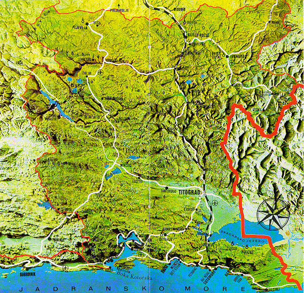
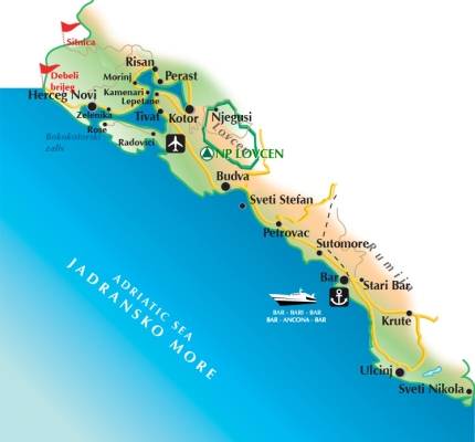
| The Montenegro (meaning "black mountain" is a small mountainous state in south - west Balkans, bordering Croatia, Bosnia and Herzegovina, Serbia, Kosovo, Albania and the Adriatic Sea. The coast of Montenegro iw 294 km. Boka Kotor is very beautiful and together with Ulcinj are the oldest places in the Adriatic Sea. |
| The islands of Montenegro are * Mamula * Otok * St.Marko * St.George * St.Nicola but the most beautiful island and the biggest is Ada Bojanja. |
| The lakes are * Skadar * Lake Biograd * Black Lake * Lake Plav * Lake Piva |
| The major cities and towns are * Podgorica (capital) * Niksic * Pljevlja * Bijelo Polje * Herceg Novi * Berane |
| Total area : 14,026 km2 Land area : 13,812 km2 Water area : 214 km2 Population : 620,145 (2003 census) Highest point : Bobotov Kuk - 2,522 m Lowest point : �driatic Sea - 0 m |
 |
 |
| In the south of Balkan peninsula lies Montenegro. The southern region is covered by the Adriatic sea coast. The Boka Kotorska is one of the prettiest bays of the country. The highest point in the country is the Bobotov Kuk peak that rises almost 2,522 meters above sea level. |
| The climate of Montenegro could be cosidered as coastal climate and the summer months are very pleasant. That is why tourists choose this period of the year to visit the country. |