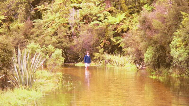
Hmmm, it may be a hire car but this might be a little ambitious. This water was also bloody freezing.
We had now had far too much good weather so the only available option was to head over the west coast which is apparently the second wettest area on the planet with about 6 metres of rain a year (cf. London at less then 1 metre)
We wanted to do some walks around this area near an appropriately named town called Greymouth. There are some limestone hills which have been spectacularly eroded by all the rain with lots of canyons and rivers that disappear underground and then re-emerge in full glory later on. However, we learnt that the walk top of our list was currently not open as the river ford was considered dangerous. We could, though do the first and last parts of it.
As we drove down the track to the start of the walk we found out why the path was closed:
Hmmm, it may be a hire car but this might be a little ambitious. This water was also bloody freezing.
We were still able to get a long way into the limestone country and had lunch in an idyllic little cove next to a river flowing through a small gap between two rocks. Here, our mutual childhood love of Lego created an unstoppable urge. We were doubtful that it was allowed but the stream was very persuasive in insisiting to us that it be dammed. Most of the early rocks we placed were swept away as the stream was strong but an hour or so later we had reduced the flow through this channel by about 90% and created a nice little pool upstream. Definitely a scenic improvement.
After lunch we hiked along a path across a farm with some bullocks that were rather too aggressive for my liking but eventually let us through and reached some caves. One of these is large enought to be walked in some 200m and when you turn out the light there is darkness I have not seen before (if that makes any sense!). However, flash photography is a wonderful invention:
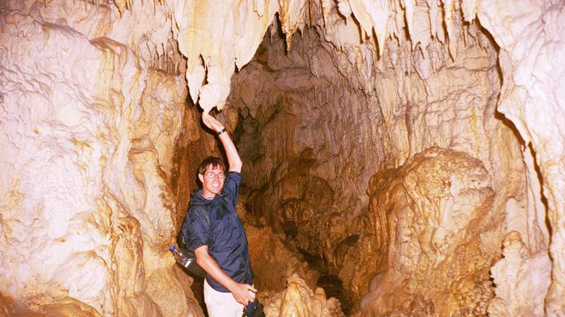
Punakaiki Caves. I banged my head on at least five of those bloody stalactites.
On returning to our car, we found that the lake on the road had mysteriously disappeared. Thank God it had not been the other way round as the road was a dead end and we'd have been trapped at the far end in a small car park!
Further down the coast, we came to the Fox and Franz Joseph glaciers. These glaciers are unlike others in temperate zones in that they flow down way below the snowline and almost to the sea. This is apparently because of the huge amount of precipitation at the top (up to 15m annually!) and a steep slope means that they flow really quickly and offset natural melting until nearly at sea level. In fact, before mankind began burning things they were even closer to the sea but they now turn into perhaps the world's shortest rivers about 10km from the shore.
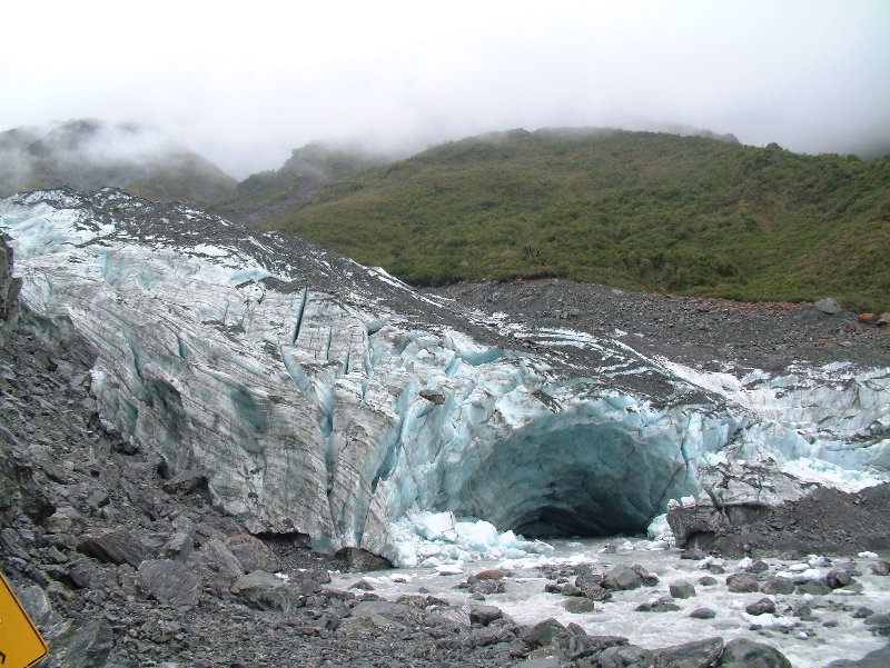
The end of Fox glacier. That arch is about 20m tall.
There was no way any helicopters were going out in the conditions when we were there so the most available fun was to be had doing a guided trip onto the ice. We were issued with crampons, a wickedly cool (if not really necessary) ice axe and lots of waterproof clothing and split into groups of about 10. Every morning the guides go out and cut lots of steps into the first part of the glacier for the unadventurous groups but if you take the full-on option as we did, you end up trundling around looking for interesting features. The guide carries an even more cool pick axe and uses this to hack out steps when it gets tough. The greatest thing about glacier walking on these glaciers is that they move so fast (if you can ever say that 1m - 2m a day is fast) that they look completely different every day and you really get the sense that you're going into the unknown. We ended up finding lots of caves, arches and crevasses but perhaps the coolest fun was taking a mighty swing with one's ice axe and demolishing minor overhangs. Perhaps global warming is innocent in glacial retreat after all.
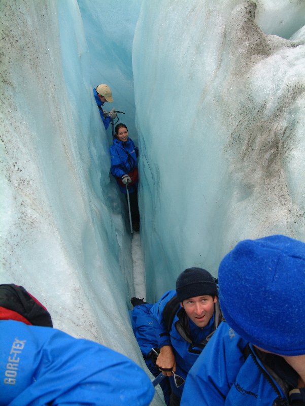
Some of the crevasses were impressively American-proof.
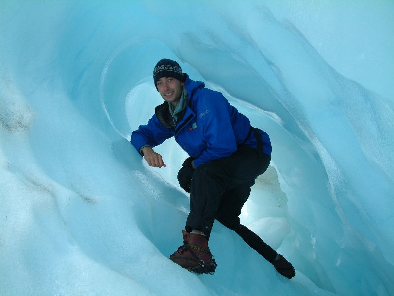
The ice really is this cool (pun intended) blue colour.
Next stop was the almost amusingly named town of Wanaka, which sits next to a massive lake and is overlooked by some mountains tall enough to offer skiing in the winter. The day broke unconventionally with a fair anmount of sun and no wind and we were recommended that this was the weather to go wakeboarding. This is fairly similar to waterskiing but you have both feet strapped to a sort of mini surfboard instead and while it looks impossible, the fact that a malco like me got up first time proves that it is not.
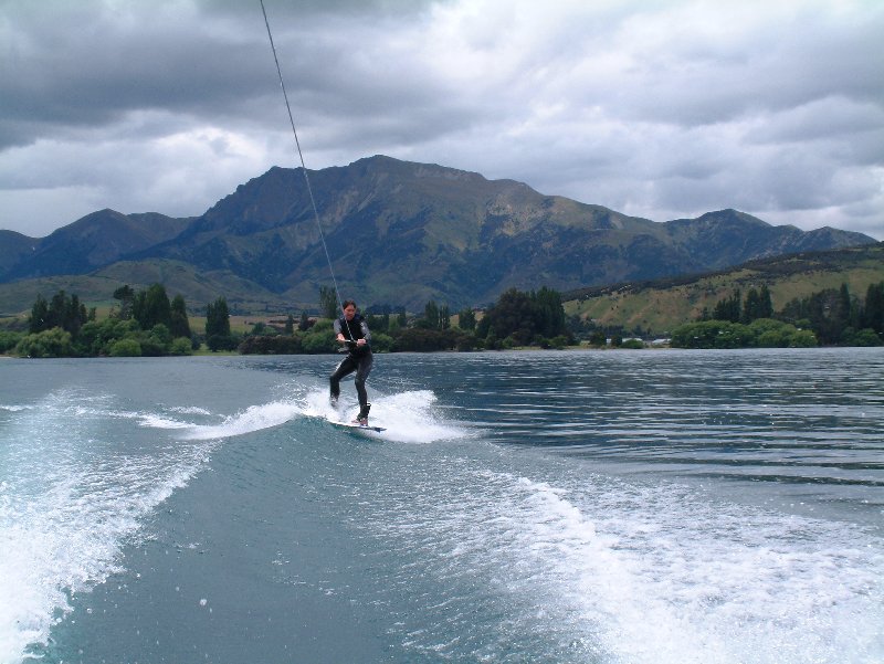
This setting certainly beats a gravel pit in Surrey.
After a while I was building enough confidence to go for a few basic tricks, such as the 180 spin and modest amounts of air on crossing the wake. Needless to say I didn't actually pull any of these attempts off and they usually resulted in this:
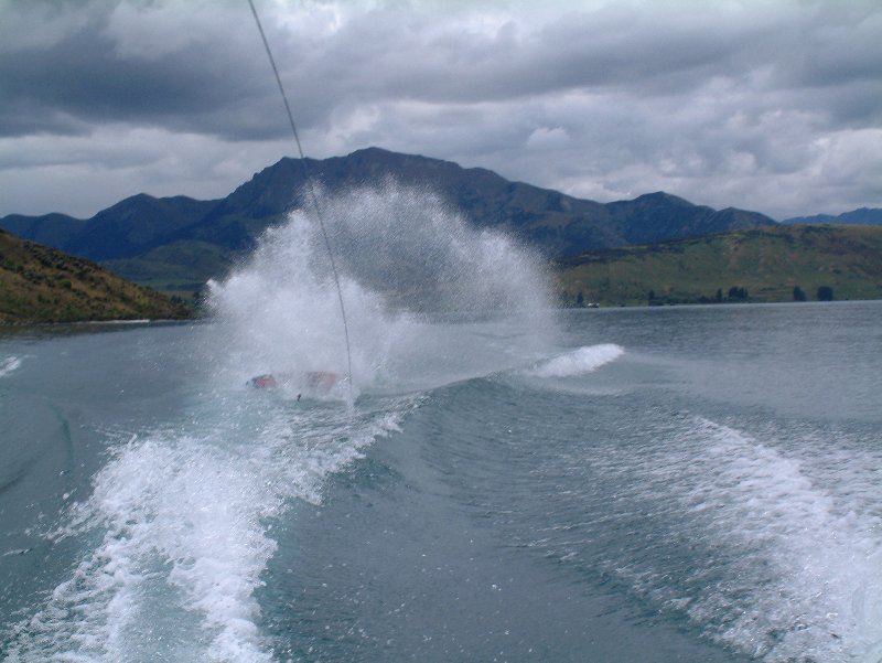
Falling over backwards like this is more spectacular but when you catch the leading edge you face plant into water.
From Wanaka, it was only a short trip to Queenstown, the international capital of extreme (i.e. stupid) sports. However, apart from this obvious attraction, Queenstown has a fantastic location right next to the massive lake Wakatipu. The sun had now decided to stay out, with the green hills, blue water, and white snow caps giving spectacular views.
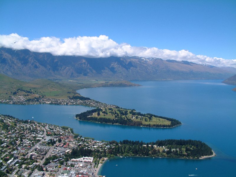
Photo of Queenstown taken from the gondola which climbs up from the town.
However, we were only passing through on our way to Milford Sound so we just had time for another go at luging, this time in the dry which made it far less fun, although the guys running the place couldn't believe that anywhere had allowed us to do it in pouring rain ;-)
Queenstown is only about 60km east from Milford as the crow flies, but the road goes a long way south and then back north meaning it manages to become at least a 4 hour drive. This is not much of a problem since all the scenery leaves you wanting the road to never end as jagged mountain peaks interweave with glorious lakes and grassy meadows to create one of nature's finer tapestries.
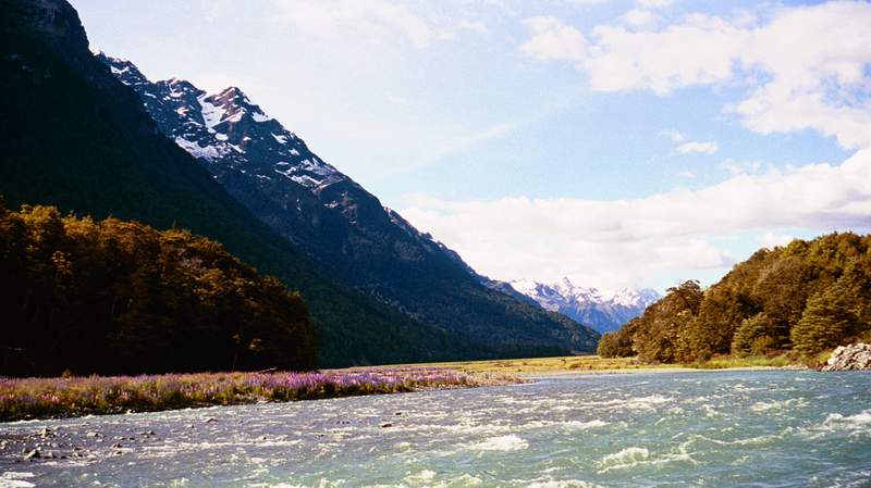
This backdrop is about average for the journey.
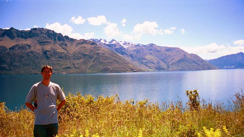
Yet another cheesy photo. Doubt any Fulham logo has been displayed on the web with this background before.
As a result of numerous stops and "oohs" and "aahs", the journey ended up taking even longer. The last part of the drive takes you up to a height of 900m, where snow can fall even in summer and into a massive natural amphitheatre with the Southern Alps barring further progress above ground. This barrier has been breached with the wonderful Homer tunnel. This tunnel is unlined, unlit, unventilated and unlevel with the road dropping 100m over the course of the tunnel and is most entertaining. Bolivia would be proud. One judges the distance to any oncoming traffic by the colour of their headlights, which go from red, though orange and yellow, to white as the vehicle approaches through the smoke/drips.
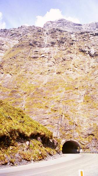
I reckon you could survive a direct nuclear hit in there.
From here, the road twists down steadily to Milford Sound, and still mentally full of luging we found we could manage 13.2km with the car in neutral before we ground to a halt; but not before we had had some comedy carrying of rather too optimistic levels of speed through the corners producing some excellent tyre-screeching.
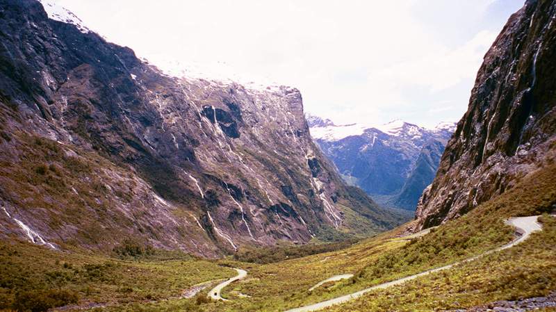
This was a fine road. No traffic, steep downhill, and loads of bends.
We didn't quite get to the Sound in time to see it that day but, given that it faces west, did get there for this rather splendid sunset. [Respect to Jon for this photo - taken without a tripod]:
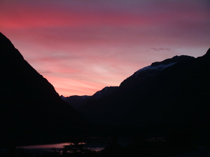
Not a bad set of colours, eh?.
Continuing to receive payback for all the rain/snow the follwing day was also gloriously sunny. This is mentionable because Milford Sound recieves about 8m of rain per year and it rains on more days than not! The Sound is incorrectly named as it is actually a fjord, since it was formed by an ancient glacier and is a flooded U-valley. Linguistical errors, however, pale into insignificance when you see the place. Mile-high near vertical cliffs line the fjord on either side and, remarkably, some trees manage to grow on these walls which continue plummeting at the water level down to some 300m.
We did the standard cruise all the way out to the mouth on a rather nice yacht and even managed to get a little way out into the atypically calm Tasman sea towards that other landmass that the Kiwis brilliantly termed "West Island".
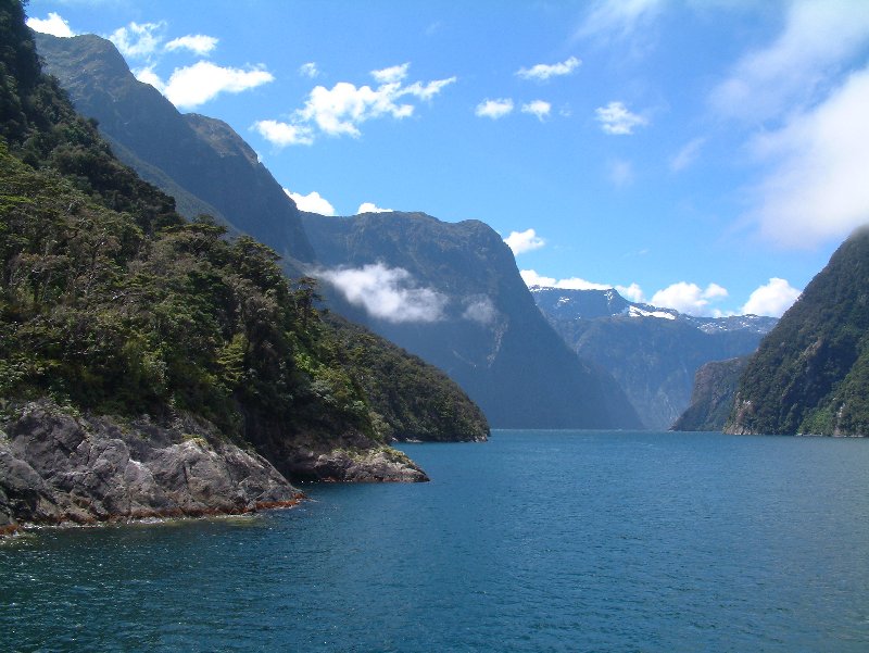
Milford Sound.
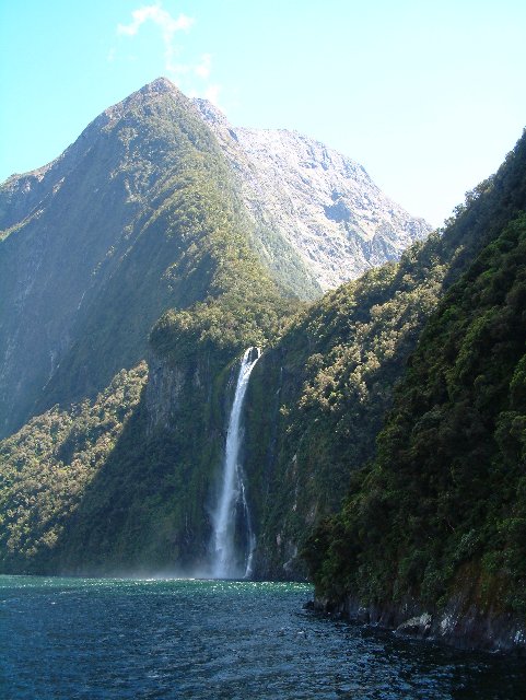
It doesn't look so next the mile high rocks, but this waterfall is three times the height of Niagara.
There is only one road to Milford so now we had to backtrack to Queenstown where we were booked onto the Routeburn track - one of New Zealand's Great Walks - which is about 37km long and is advertised as 2 - 4 days. New Zealand has an excellent system of "huts" along many of their tracks. These are basically simple houses containing bunks, toilets (of varying simplicity), a watersource and sometimes basic cooking facilities. On the more popular tracks these have to be booked in advance thus forcing one to break down the walk into pre-defined day-sectors. The obvious way to do the walk in 2 days (staying at the halfway hut) was booked out and the booking lady scoffed at our suggestion that we could do more than half of it in one day. Thus we ended up with 2 overnight stops and some very short days.
Day one starts a short way from Lake Wakatipu in a bright green beech forest. You follow a crystal clear stream, which has a touch of aquamarine to the water, along a valley and then start to climb up through the beech forest, which becomes more coniferous as you approach the treeline at 1,000m. On this particular day the sky had the deep blue you only get in the southern hemisphere, and there were also the obligatory snow-capped mountains either side of you to add dark greys and bright whites into the visual equation. Please excuse the hyperbole, but it was beautiful - reminiscent of (perhaps even superior to) the Canadian Rockies in many ways.
We reached our overnight stop before 1:00 and, most pleasingly, were the first people at the 48 berth hut. This meant we had first pick of the smooth rocks to spend the afternoon sunbathing, playing cards and drinking red wine. Not exactly the stereotypical picture of a hiker/rambler! [We had remembered, from our Tahiti experience about the importance of refrigeration to virtually all drinks and when the supermarket was offering 3 litre boxes of red wine for less than a fiver it would have been rude not to take one along]. Anyway, the later arrivals were suitably jealous of our portable bar.
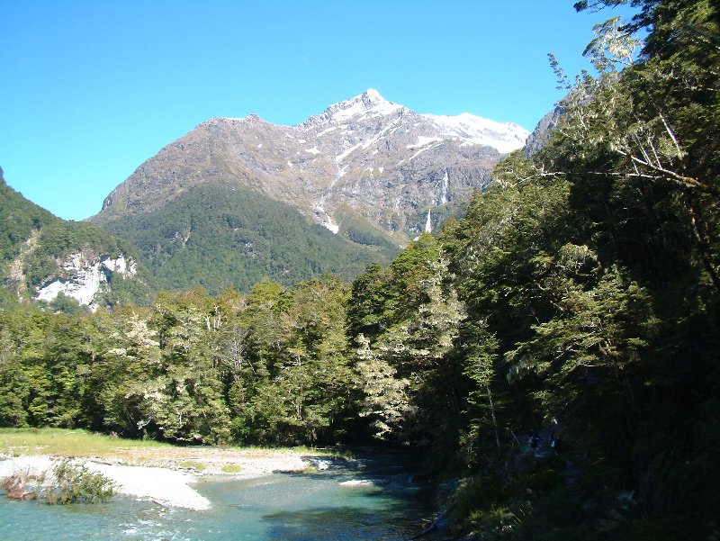
Routeburn Trek along the river below the treeline.
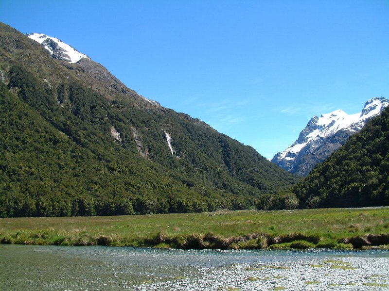
Routeburn Flats just below the first hut. We reckon this natural and perfectly flat meadow would have made the ultimate arena for a cricket or football match but unfortunately possessed neither equipment nor opposition.
The hut is just below the treeline and day 2 takes you immediately above the trees into a heather-covered world criss-crossed by many streams until you reach the Harris Saddle at 1,300m, which despite being a pass, bizarrely contains a lake that has such a perfect dam that it seems like it cannot have been natural. Alas, the clouds were rolling in much of the time this day so the photos don't look as good.
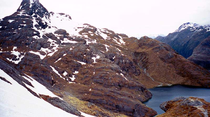
Looking down to the lake from Conical Hill. Yes, that is snow again.
Wanting to get our moneysworth, we did all the available side-tracks off the main path, including one up to the aptly named Conical Hill, which was allegedly closed but we'd been told it was perfectly safe. The reason why it was closed was that it was covered in snow, and so once we got above 1,500m it was like old times and we were tramping through shin deep snow. As ever, going up was easy but the descent was far more fun with the steeper parts being skiable in one's hiking boots if you leant forwards enough!
The middle of day 2 is a long traverse of a ridge above the treeline with huge visibility and then a descent down to Lake Mackenzie through a temperate forest. From Lake Mackenzie the path goes back up to the approximate treeline and past some terrific waterfalls before descending down to another lake in a different valley.
The hut for night 2 was a little more simple but OK enough and it was really nice to get a proper fire going in the evening as it was surprisingly cold when the sun wasn't out. Being quite far south, darkness was not arriving until about 10:00 which felt really, really strange a mere 3 days before Christmas!
Link to some more photos.
The final day was only about an hour to get to the bus, which, owing to the lay of the land, needs 300km to get you back to where you started. Indeed we were now almost back to Milford Sound! Here, I encountered a perfect demonstration of the Kiwi's awesome helpfulness. I had left my mobile in the lodge in Milford and not realised until back in Queenstown. I had phoned up the lodge who went and found it for me and offered to put it onto this bus we were going to take at the end of our trek. I was slightly doubtful as I got on the bus, but the driver greeted the people waiting with a cheery smile and a "which one of you is Chris?" before handing me the phone which had been nicely wrapped up for me. They'd even removed the battery to stop it from running out!
Now back in Queenstown, we get to the bit I'm sure some of you have been waiting for. Yes, I succumbed to temptation and against all my natural risk-aversion and common sense, it was necessary to throw myself off a perfectly good bridge attached only to a giant rubber band. I chose the Kawaera river bungy, which is not the highest, at a piffling 47m, but is both the original and one where you can go for a dunking in the water, should you so desire. I desired.
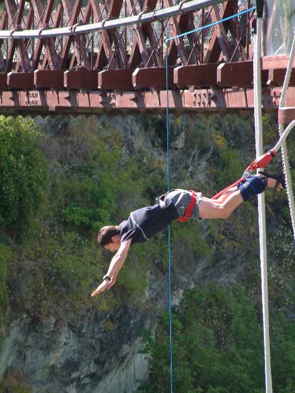
Posture is not exactly Superman, but all Christopher Reeve had to do was lie on a piece of blue carpet.
They say the most scary thing about the jump is the build-up waiting on the edge. I have to say I agree, and my situation was not helped by the person in front of me dallying for a good 5 minutes before finally chickening out. Despite her (and many other people's) request to be pushed, they are highly professional and insist that you do it yourself. While you're being bungied up they ask you how much of a dunking you want and adjust the bungy appropriately. There's no point trying to tone it down at this stage so I chose a waist-deep plunge.
Once out on the edge, the longer you wait the harder it gets so, to make things easier, I went on the 3 of his 5, 4, 3, 2, 1 countdown. The initial rush was everything I'd expected as the ground raced up to meet me but just as things were appearing terminal, I realised that the water was actually slowing down, and I briefly thought I was going to stop before I got there. This belief was vey short-lived as I slowly dipped in to waist deep before re-emerging. The remaining bounces were definitely the best bit as you now feel invincible and can enjoy life again.
Despite all my worries before, I did not suffer detached retinas, bloodshot eyes, headaches or any of the scare stories that go around and can honestly say that I reckon it is safer and less bad for you than any decent roller coaster. Certainly a lot of crap is spoken about the supposed risks and the stats show that a far higher percentage of people suffer serious accidents in things like rafting or even rugby than bungying.
Jon and I celebrated our bungy with a bit of white water sledging the next day which involves swimming down rapids with only a large float for assistance. It is surprisingly tiring as you need to kick your fins a lot to stay in the right direction but is enormous fun, although boringly, you go down far less extreme rapids than the rafts.
Our last journey was back to Christchurch, the only city on South Island. Having a whole day to do this, we took the scenic route past Mt Cook - the tallest peak in New Zealand (at 3,700m far taller than anything in Australia), and several glacial lakes that have the odd fluorescent blue colour that we'd also seen in Canada.
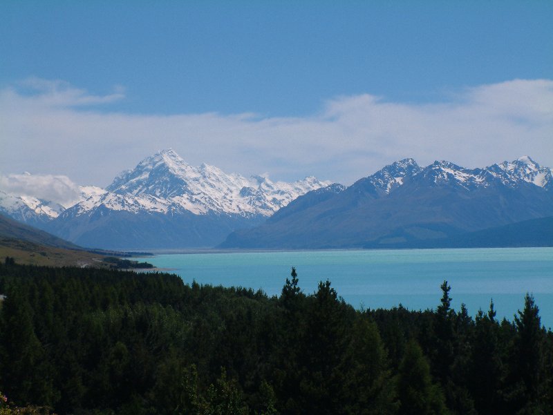
Mount Cook and a nice blue lake.
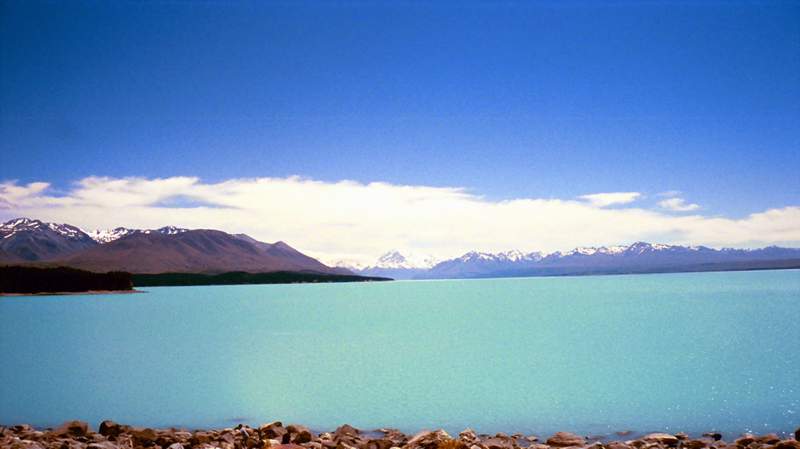
And again from further away.
We had now run out of time in New Zealand, and if you've read this far then you'll be glad anyway! I make no apology for this Tale being the longest as New Zealand was definitely the best place I've ever been. I will be back.
Back to home page.