|
day we were overwhelmed by rain squalls that forced us to drop anchor in Exertion Bay on Tuluran, where mangrove trees surrounded us. It looked to be a nice bay to sit out a storm.
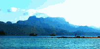
Although lighting flashed in the north all night long, the next morning dawned bright. We sailed out of the south end of Endeavor Strait into the other reaches of 20 mile deep Malampaya Sound. By the names on the chart, it appeared that some British Explorer had sent a skiff into these waters to chart them. What they found was an intriguing area containing hundreds of coves where raiders of coastal shipping could disappear as though invisible. Pirate Bay, tucked behind Lookout Point bears witness to this past activity. Pickets of jagged rocks and stony islets, in many instances rising only a few feet above sea level, guard Worcester strait and the entrance to this sound. Departing we kept a very good lookout.
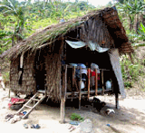
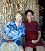
Because of our early retreat the day before, we decided to put in more miles down the coast today. At 4:30 PM we rounded the coast of Boayan Island and dropped anchor in a rolling bay. Lucila P. paddled out bearing with her a giant stem of bananas with which to tade and beg. Like too many poor Filipinos she could not wait to pour out her troubles as though somehow we had the means to solve her problems. Lucila and her brother had inherited large pieces of land from their parents who originally came from Samar. They have lived life as subsistence farmers and fishermen, raising cashew nut trees for the cash crop, but cashews bring in only 17 pesos a kilo. Lucila bore ten children. None of them learned to read or write although she herself is literate.
"Why did you not teach your children?"
She held out her worn hands to me. "Look at my hands. I had to work all the time. If I did not work, we had no food. I simply did not have time to teach any of them."
Now Lucila wants to sell her land and go to the town where she can set up a sari sari shop like thousands of others, selling little necessities and cigarettes on stick at a time.
Port Barton was 11 miles away. Once again we sailed between offshore islands with sparkling white sand beaches. This area was lower in aspect, gentler than El Nido. Rounded hills sloped to beaches or rocky points. There are a few shallow patches on the way into Port Barton's anchorage that you just have to keep a look out for. We did make a couple of quick turns to avoid shallow sandbars.
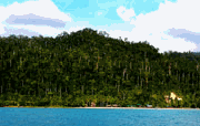
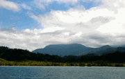
Port Barton is little more than a village spread out behind a fine sand beach that faces west. The surrounding mountains are thickly forested with mahogany, the first stands of these trees I have seen in the Philippines. The main beach is fronted by Guest Houses and restaurants that cater for the few foreign tourist who come here.
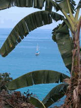
13 April, 2003. In the morning there was no wind. We chugged out of Port Barton cutting between Cacnipa Island and the mainland to save five or six miles. Our 30 mile journey brought us to a broad bay dominated by the cathedral-like dome of St. Paul's Mount. St. Paul's Bay is edged with pretty beaches and thick forests or coconut groves. Michael and I dinghied ashore to make arrangements with a local fisherman to carry us seven kilometers across the bay
|
|