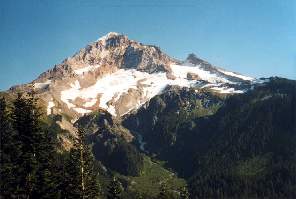
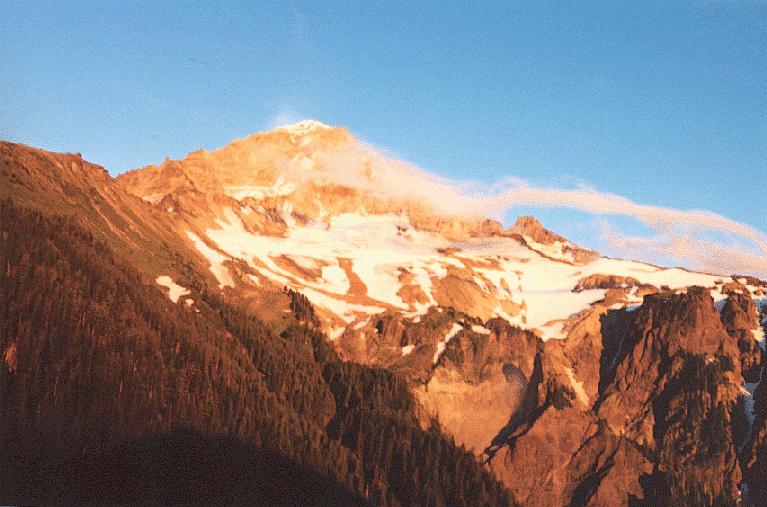
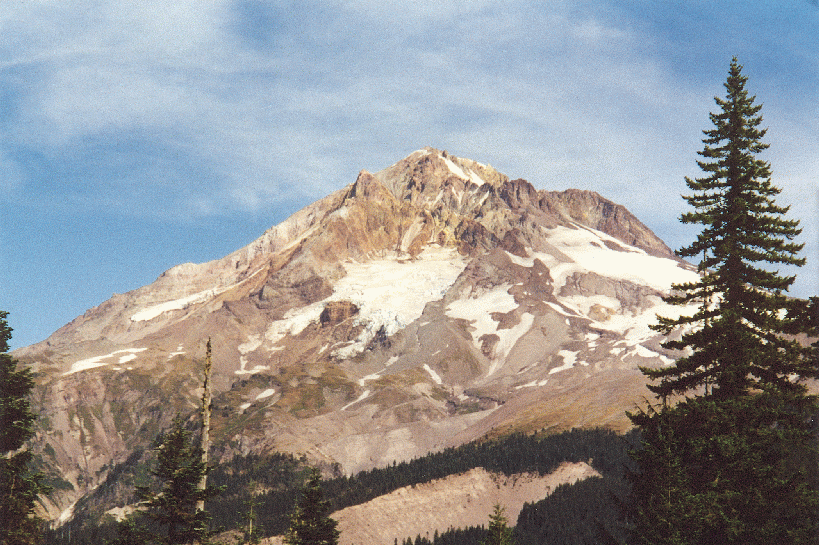
 Cooper Spur (Mt.
Hood North side) : Awesome views of the Elliot Glacier with jagged
seracs and deep crevasses. Also panoramic shots of Mt. Adams, Rainier and
St. Helens. You can hike up the lateral moraine of the glacier and descend
onto the dirt-covered glacier to see the glacier up close (be careful
because its still slippery ice underneath the dirt). The creaks and groans
of splintering glacial ice are an additional feature of the hike. Large
switchbacks snake up the spur to tie-in rock -- so-named because climbers
presumably tie-in with rope to climb the 50 degree Cooper Spur route to
summit of Hood. pic of Adams and Rainier from Cooper
Spur .
Cooper Spur (Mt.
Hood North side) : Awesome views of the Elliot Glacier with jagged
seracs and deep crevasses. Also panoramic shots of Mt. Adams, Rainier and
St. Helens. You can hike up the lateral moraine of the glacier and descend
onto the dirt-covered glacier to see the glacier up close (be careful
because its still slippery ice underneath the dirt). The creaks and groans
of splintering glacial ice are an additional feature of the hike. Large
switchbacks snake up the spur to tie-in rock -- so-named because climbers
presumably tie-in with rope to climb the 50 degree Cooper Spur route to
summit of Hood. pic of Adams and Rainier from Cooper
Spur .
In Aug. 2003 I revisited this trail and also ventured out onto Elliott Glacier. The wind was blowing extremely hard and made for tough going. At times it was hard to keep my eyes open. I finally turned back well before Tie-in-rock. I ran into nobody for the entire hike. I didn't know it then but my days of midweek hiking and unemployment were about to end soon. Rocky trail switchbacking up Cooper Spur (8 miles, 2800 ft.) (done 9/13/98, 8/27/03)
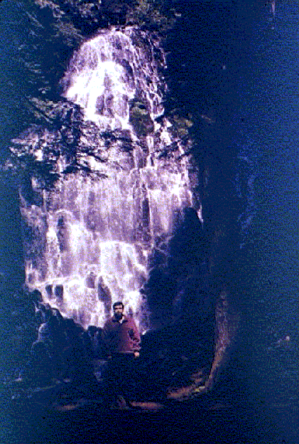
 **** Ramona Falls (Mt.
Hood, Zigzag area): An excellent hike near Mt. Hood. The trail
starts along the Sandy river and then crosses Sandy river on a little
bridge that is removed in winter. Trail later parallels Ramona Creek for
considerable distance. The bubbling creek and the carpet of moss that
covers everything around the trail are attractive enough in their own
right but the high point of the hike is Ramona Falls which is a breathtakingly
beautiful, wide terraced waterfall. The return can be via a shorter route
instead of the Ramona creek but there is a lot of horse-shit on this trail
because of the horses. I would recommend returning the same way via the
scenic creek-side route even though it will add an extra mile to the trip.
The shitty trailhead fee signs are posted here as well.(9 miles, 900 ft. ,
done 7/3/99, 5/20/00 and 5/27/03) pic,
pic, pic
**** Ramona Falls (Mt.
Hood, Zigzag area): An excellent hike near Mt. Hood. The trail
starts along the Sandy river and then crosses Sandy river on a little
bridge that is removed in winter. Trail later parallels Ramona Creek for
considerable distance. The bubbling creek and the carpet of moss that
covers everything around the trail are attractive enough in their own
right but the high point of the hike is Ramona Falls which is a breathtakingly
beautiful, wide terraced waterfall. The return can be via a shorter route
instead of the Ramona creek but there is a lot of horse-shit on this trail
because of the horses. I would recommend returning the same way via the
scenic creek-side route even though it will add an extra mile to the trip.
The shitty trailhead fee signs are posted here as well.(9 miles, 900 ft. ,
done 7/3/99, 5/20/00 and 5/27/03) pic,
pic, pic
 ***** South Climb a.k.a Hogsback (Mt.
Hood South side) : This is not strictly a hike per se, so not
advisable if you don't know anything about ice-axe and crampon usage. My
objective in this case was not the summit but the area near the crater
known as "Devils kitchen". It has volcanic fumaroles that emit
noxious gases (including sulphur dioxide, smells like rotten eggs). Started
at Timberline Lodge (elevation 6000 ft.). Started hiking at 5 am with a
balmy breeze blowing from the east and no sign of the blustery winter-like
weather of last weekend. Beginning part is along the ski slope with lots
of snow and a few exposed outcroppings of rock. Most of the going was in
mushy snow because of balmy weather which prevented the snow from freezing
overnight. The first marker is Silcox hut at the 1 mile, 1000 ft.
elevation gain. Another long 1.5 mile slog gets you to the 8500 ft. level
where Palmer ski lift ends. After that things get more interesting as you
leave the noisy skier dudes behind. The climb along the ski-lift is rather
boring but does afford some nice views. Mt. Jefferson and the three
Sisters became increasingly visible as well as the drier land east of the
Cascades. It was a long slog but not really dangerous because there were
already a lot of people who had kicked steps in the snow. Basically it was
like walking up a huge staircase with no hand railings :-) . It was really
crowded on Hogsback ( a ridge leading to summit) all morning with hundreds
of climbers strung like ants all along the ridge as they waited to come off
or go up to the summit. There was one crevasse
at the 9000 ft. level that I had to gingerly cross on a little 1-2 foot
wide shoulder on the side and a sheer drop-off to White River glacier on
the other side. This area is usually pretty devoid of snow because I don't
remember this stuff during my hikes in late summer last year. After the
crevasse there is a long fairly steep slog up to crater rock. Looking down
is quite dizzying at this point. The crater is a weird but fascinating
looking place with a lot of steaming sulfur-coated rocks (steam was really
rising off the inner side of crater rock). There is almost a constant hail
of rocks falling down the Steel Cliffs as well as Crater Rock. Some of
these were quite sizable and zinged off the boulders like bullets while
others skittered down more slowly. Extremely crumbly rock. All this rock
fall made me quite nervous because it felt like being in a minefield. I
had hiked up to Crater rock a couple of times last summer and remember seeing
several large rocks sporadically roll down the snowfield with no apparent
trigger event, as well as a thundering rock avalanche from the crumbling
Steel Cliff area. Now I know why these guys like to climb when there is
still snow there to lock the rocks in place. A helmet is a good thing to
have handy in this kind of situation. Warm weather made snow really mushy
so I did not dare to go above the widely yawning bergschrund. Since I was
pretty late in getting up there I had the whole place to myself except for
a couple of skier dudes who languished lazily on the Hogsback ridge and
smoked as they took in the scenery. It had taken me a good 8-9 hours to
climb up to the bergschrund but took only 2 fun hours to glissade (sliding
on your butt) down. On my descent I lost a crampon which was strapped to
my backpack while I glissaded down :-( I spent 45-50 minutes climbing back
up several hundred feet and backtracking on my footsteps to find the damn
thing but to no avail. Really pissed at myself for losing it since it was
a rental. I will be sure to pack a wide-brim hat next time to avoid the
overwhelming sunlight as well as the glare from snow reflection. Towards
the end I was desperate for any scrap of shade I could get from a large
boulder or a stunted tree. It was so hot I probably didn't need to carry
all the warm stuff up all that distance but warnings about the fickle
weather as well as my own wariness of the mountain contributed to my
packing several clothing layers. Oh well, better be safe than sorry. All
in all a pretty awesome experience. (9-10 miles, 4500 ft. elev. gain, done
7/10/99)
***** South Climb a.k.a Hogsback (Mt.
Hood South side) : This is not strictly a hike per se, so not
advisable if you don't know anything about ice-axe and crampon usage. My
objective in this case was not the summit but the area near the crater
known as "Devils kitchen". It has volcanic fumaroles that emit
noxious gases (including sulphur dioxide, smells like rotten eggs). Started
at Timberline Lodge (elevation 6000 ft.). Started hiking at 5 am with a
balmy breeze blowing from the east and no sign of the blustery winter-like
weather of last weekend. Beginning part is along the ski slope with lots
of snow and a few exposed outcroppings of rock. Most of the going was in
mushy snow because of balmy weather which prevented the snow from freezing
overnight. The first marker is Silcox hut at the 1 mile, 1000 ft.
elevation gain. Another long 1.5 mile slog gets you to the 8500 ft. level
where Palmer ski lift ends. After that things get more interesting as you
leave the noisy skier dudes behind. The climb along the ski-lift is rather
boring but does afford some nice views. Mt. Jefferson and the three
Sisters became increasingly visible as well as the drier land east of the
Cascades. It was a long slog but not really dangerous because there were
already a lot of people who had kicked steps in the snow. Basically it was
like walking up a huge staircase with no hand railings :-) . It was really
crowded on Hogsback ( a ridge leading to summit) all morning with hundreds
of climbers strung like ants all along the ridge as they waited to come off
or go up to the summit. There was one crevasse
at the 9000 ft. level that I had to gingerly cross on a little 1-2 foot
wide shoulder on the side and a sheer drop-off to White River glacier on
the other side. This area is usually pretty devoid of snow because I don't
remember this stuff during my hikes in late summer last year. After the
crevasse there is a long fairly steep slog up to crater rock. Looking down
is quite dizzying at this point. The crater is a weird but fascinating
looking place with a lot of steaming sulfur-coated rocks (steam was really
rising off the inner side of crater rock). There is almost a constant hail
of rocks falling down the Steel Cliffs as well as Crater Rock. Some of
these were quite sizable and zinged off the boulders like bullets while
others skittered down more slowly. Extremely crumbly rock. All this rock
fall made me quite nervous because it felt like being in a minefield. I
had hiked up to Crater rock a couple of times last summer and remember seeing
several large rocks sporadically roll down the snowfield with no apparent
trigger event, as well as a thundering rock avalanche from the crumbling
Steel Cliff area. Now I know why these guys like to climb when there is
still snow there to lock the rocks in place. A helmet is a good thing to
have handy in this kind of situation. Warm weather made snow really mushy
so I did not dare to go above the widely yawning bergschrund. Since I was
pretty late in getting up there I had the whole place to myself except for
a couple of skier dudes who languished lazily on the Hogsback ridge and
smoked as they took in the scenery. It had taken me a good 8-9 hours to
climb up to the bergschrund but took only 2 fun hours to glissade (sliding
on your butt) down. On my descent I lost a crampon which was strapped to
my backpack while I glissaded down :-( I spent 45-50 minutes climbing back
up several hundred feet and backtracking on my footsteps to find the damn
thing but to no avail. Really pissed at myself for losing it since it was
a rental. I will be sure to pack a wide-brim hat next time to avoid the
overwhelming sunlight as well as the glare from snow reflection. Towards
the end I was desperate for any scrap of shade I could get from a large
boulder or a stunted tree. It was so hot I probably didn't need to carry
all the warm stuff up all that distance but warnings about the fickle
weather as well as my own wariness of the mountain contributed to my
packing several clothing layers. Oh well, better be safe than sorry. All
in all a pretty awesome experience. (9-10 miles, 4500 ft. elev. gain, done
7/10/99) 
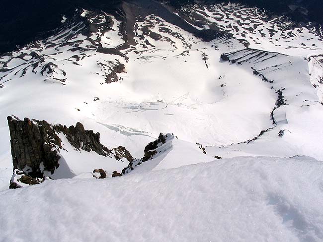
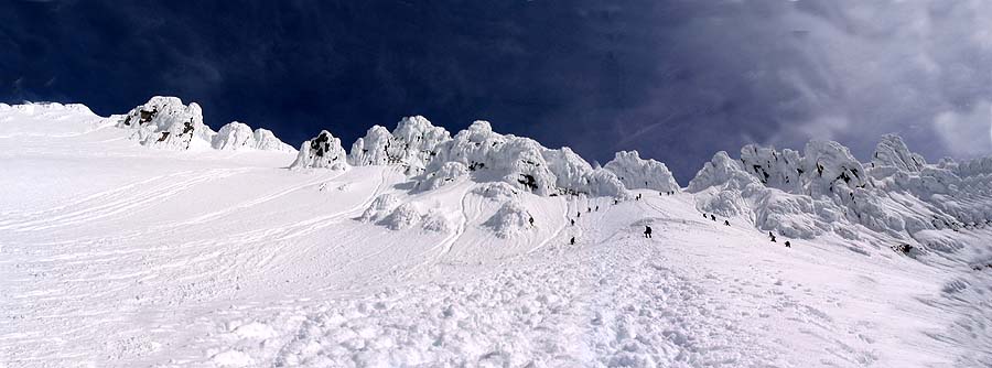
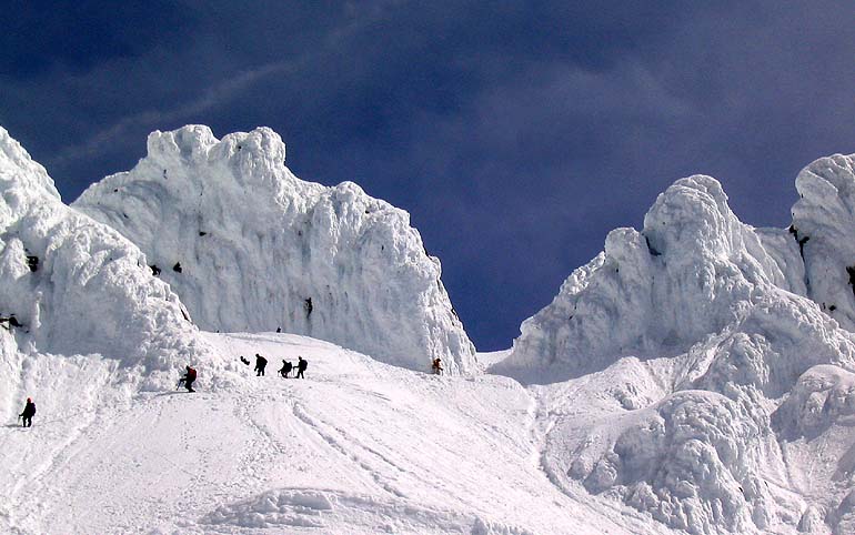
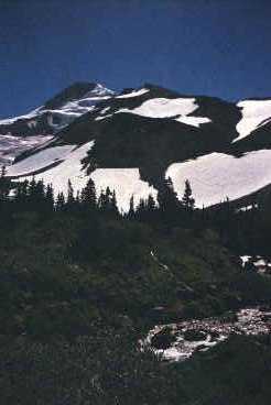
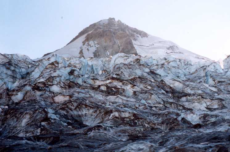
In 2005 I undertook this climb with the Mazamas. I had just completed the Mazama Basic Climb school and finally felt like it was now or never in terms of my ability to climb it. It was a standby opening and luckily someone cancelled a day before the climb so I was in. I drove up by myself and got there 11:30 PM. The weather was warm still, it had been a 90 degree day in Portland. There were a few high clouds but it was a mostly clear starry night. The ghostly outline of the Mountain was visible with a couple of snow-cats grooming the ski lift. It looked like an unearthly sight seeing those headlights meandering high up on the mountain. I was feeling a mixture of apprehension and excitement of finally climbing this mountain that had obsessed me for so long. There was a guy in the parking lot asking around to see if somebody wanted to split the midnight snow cat to the top of Palmer. Apparently it was $140 and it could carry 10-12 people so pretty reasonable cost per person if you could fill it up. I regretfully decline and from what I could tell there were not too many takers for this snow cat. I guess it would be a little like cheating. We started out at 12:45 am after completing introductions, registration and getting avalanche beacons from the climb leader. We had 12 people in our group with the youngest a 14 yr old boy and some 50+ yr olds. The weather was quite warm and a balmy breeze was blowing so I decided to leave the heavy clothing behind. I was wearing a polypro top and bottom, shorts and gaiters. I trudged along in snow with all the other team members , our head-lamps glowing in a string up the slope. Few were in a chatty mood at this hour. After 45 minutes of steady walking we reached the top of Magic Mile lift and took a 10 minute break to refuel. I had a nutrition bar. The hut housing the chair-lift was open so I went in to take shelter from the wind which felt cold once I stopped moving. Usually I do this section in an hour but this group was obviously moving faster. After this break began the most monotonous section of the climb -- the 2 hour trudge to the top of Palmer ski lift. I could see the flicker of head-lamps high above on the Hogs back even this early. They looked like fire flies that were being drawn inexorably higher up the mountain. It seems like everybody except me was using LED head-lamps. I was feeling a bit of cramp in my right leg so I started lagging behind. The slope was getting steeper and anything dropped tended to slide a long ways before stopping. I was beginning to wonder if I would be able to keep up with these guys at all as I periodically lost sight of their head lamps. Finally I caught up with the rest of the group at the top of Palmer where they were taking a break. It was about 3:45 am so we had climbed about 2500+ feet in 3 hours. It seemed that we had actually climbed a little over Palmer before breaking.I barely had time to wolf down a boiled egg before they started getting ready to move on. The climb leader asked me if I wanted to head down since another guy was also calling it quits. I politely declined to go back. I would be damned if I was going to turn around now after getting so close to Crater Rock. Surprisingly I started feeling better in this section after the break. I was able to keep up with the rest of the team. The slope was quite steep and we were kicking steps and climbing up in each other's steps and rest stepping to conserve energy. The wind had become quite cold now so I had donned my jacket over the thermal top I had worn for the first part of the climb. The moon finally broke over the clouds to the east and cast a bright glow on the snow. Crater rock and Illumination rock were quite visible in the moonlight. We took another break about midway between Palmer and Crater Rock to put on our harnesses, crampons and helmets. I had to figure out the crampon straps and also struggled with the harness. The rest of the group and the leader Jay Chambers were quite helpful and made me feel reassured that they were paying attention to the needs of the entire group. Once we had donned all the climbing paraphernalia we started the final push towards Crater Rock. Dawn was beginning to break and turn the clouds pink over Illumination Rock, I was blown away by the huge shadow the mountain was casting over the lowlands to the west so got out of the track and took a few pictures. The slope here was quite steep and one of the gals dropped a glove that slithered away and ended up in the White River canyon. The views of the Steel Cliffs, Crater rock and south to Jefferson were stupendous. We reached the base of Crater Rock at around 6 am. Devils Kitchen fumaroles were as sulphurous as ever. The stink from its fumaroles had been stinging our nostrils ever the top of Palmer but it really reached its peak in this area around Crater Rock. The whole place smelt like a sewer. We wound over way along the side of Crater Rock and ended up at the saddle below Hogsback. Here we took a fairly long break to sort out the ropes, pickets etc. and assign people to teams. It was quite cold here with strong chilly winds. There were several people descending unroped above the bergshrund and one roped party ahead of us. The leader pointed out a very scary avalanche-scoured gully named Devil's Kitchen Headwall and mentioned he had climbed it a couple of weeks ago. He also mentioned that it was going to be his ninth summit of Mt. Hood this year. Noticing my concerns about climbing above the shrund he mentioned that he was going to "sew" the route with picket anchors. It took us about half an hour to sort out the ropes and then we were ready for the final push just as the sun was beginning to break over the rim. I was part of the first team with Jay leading the rope. He was a jangling mass of pickets as he trudged up to the bregschrund. We crossed over the bregschrund around 7:30 am on a snowbridge on the left side. It was opening up to a fearful size in its widest spot and I marveled at the boldness of the climbers casually descending directly above it without ropes. Jay was good to his word about sewing the route and I felt reassured as I clipped through the protection placed at regular intervals. He also stomped good steps as he went along. The second member of the rope team was Ingrid, Jay's wife and last guy behind me was named Mike. The slope got even steeper as we rounded a curve and ascended the final chute leading to the summit. I was really scared at the thought of slipping and falling here so I tried to make sure I climbed in balance and sunk my ice-axe as deep as possible. I heaved a sigh of relief when I cleared the chute and emerged on the sunny slope leading to the summit. The section above the schrund had really sapped me emotionally and physically. I staggered up the final slope to the summit at a slow pace causing the rope to tug me frequently. I finally got to the summit at 9:10 am. The view at the summit was great but not as stunning as I had imagined. It was surprisingly calm and warm at the summit in sharp contrast to the cold and windy conditions at the saddle below. Jay allowed us to unrope but strongly cautioned against approaching the edge overlooking the Elliott glacier. There were a couple of dozen people milling around on the summit. I took the obligatory summit shots and ate half a sandwich. I discovered that I had lost a pole on the climb and one of the guys told me he had seen it lying near the bergschrund. A lot of people were calling friends and family on their cell phones to proclaim their success. I tried but couldn't get through. I was hoping to get killer views of all the glaciers cascading from the summit but that would have required a lot of walking around on the summit. This would have been fraught with danger because of overhanging cornices and whatnot. I did sneak close to the edge and held my camera out to take a picture of the north side looking down to Cooper Spur and Elliot Glacier. We spent about 45 minutes on summit before heading down at about 10 am. This was the part that scared me the most. We reversed the rope order with Mike leading and Jay at the end. The chute was just as scary as I imagined and I saw Mike downclimbing with face into the slope. I followed suit and down-climbed kicking as hard as I could to get purchase in the steep slope. Clipping through was nerve-wracking because I was unable to do it with one hand a few times. Consequently I had to relax my deathgrip on the ice-axe to do it, which made me feel very vulnerable. A further complication was the pieces of ice being kicked down by Ingrid above me. Finally it was hard to see the steps below you and the exposed view as I looked down between my legs was scary to say the least. I was fervently praying that I would get down this slope in one piece. There were also small ice chunks ands snow avalanches pouring down the slopes onto our track as the sun softened up the slopes. The guy below me was constantly pulling so I had trouble clipping through a few times and I was also scared he was going to make me lose my balance. Ingrid was also hollering down at me not to keep the rope too taut. I was somewhat reassured to see Jay downclimbing as well because I felt I had been overly timid coming down facing into the slope. Once I got below the chute I started going down faster and faced forward. The bergschrund crossing was mercifully uneventful and I was finally across. It took an hour for us to descend to below the bergschrund. I found my pole lying near the bergschrund and reclaimed it. Once all our team was past the schrund I unclipped my rope and stopped to take a few pictures before walking down to the saddle. The snow had become very soft and it was tough going as I post-holed frequenlty. We waited on the saddle between Crater Rock and Hogsback for the rest of team. The last rope team took a long time and Jay had to go back up and guide them down. Apparently the 14 yr old kid on the last rope team had some problems on the way down. I wandered up the ridge leading to Crater Rock and found several people taking bathroom breaks there. Apparently its the only spot offering some modicum of privacy in this place. After everybody was down, I took off the climbing gear and slogged through the mushy snow to the base of Crater Rock. There the glissading began. I had put on my slick green nylon rain pants and effortlessly glissaded most of the way down to the top of Palmer where we were supposed to regroup. From the top of Palmer we glissaded along the side of the ski run almost down to the Magic Mile. It was an exhilarating experience but it left me with a frozen butt and soggy clothes. After Silcox hut our group lost its cohesion and we all took different paths to Timberline. I was definitely feeling drained and the harsh sun was finally getting to me but I was too tired to apply more sunscreen. I tried to find remaining snow patches since they were easier on the feet. The clunky rented plastic boots were just a tad too tight and hurt my toes if I walked on the exposed ground. I finally reached the parking lot by 2 PM and found some of the team gathered around Jay's Subaru chugging beers. I handed in my picket and avy beacon and hung around for a while to collect my summit certificate and then headed home. The drive home was scary because I was extremely sleepy and nearly drove off the road a few times. I kept zoning out and then jerking back to life. Mercifully I made it home unscathed and collapsed after a shower and slept for 12 hours straight. All in all a very memorable experience.I have wanted to climb Mt. Hood for years and it was a huge personal goal of mine that was accomplished on that weekend. (10 miles, 5000 ft, Done 5/28/2005) Crater Rock and Hot Rocks from Hogsback,
Elliott Glacier and Cooper Spur view from summit,
Panoramic view of Pearly Gates and summit rim,
Above the Bergschrund ,
Devils Kitchen
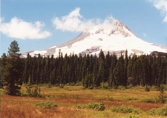
 **** Elk Cove (On Mt.
Hood's North Side): A great Hood hike but hard to reach this year
('99). The access from Cloud Cap along Timberline trail was not possible
because USFS has not placed the seasonal bridges on the steep and
treacherous Elliott and Coe rivers that gush forth from similarly named
glaciers. Instead we had to use an alternate route (Trail 631) but here
the USFS in its infinite wisdom had dug up the road to the trailhead with
30 ditches thus adding a dusty 2.5 miles to length of hike. The trailhead
marker has also been removed to further inconvenience and confuse hikers.
Trail climbs through a humdrum fir forest with bear grass and many
blood-thirsty bugs and bees. Lots of fallen trees obstructed the trail and
made things difficult for us. There was a wide stream crossing that got my
boots wet both times I crossed it. There is one great view of Mt. Hood
with Coe glacier descending steeply down the face and feeding a river that
runs far below you. Elk Cove itself is a delightful flower-strewn alpine
meadow with a small stream running through it. Avalanche lilies, Indian
paintbrush, "Old man of the mountain" are some of the flowers
visible along the hike. A little side trail near the stream takes you
closer to the Coe glacier and some snow fields. The glacier has a really
cool looking icefall. A smaller glacier to the right (Junaid glacier??) is
hanging precipitously off a rock face. Mt. Adams is clearly visible to the
North. (10 miles roundtrip, 2000 ft.). The much maligned trail park pass
sign is posted as well but there is precious little trail maintenance in
evidence. I noticed that a lot of hikers are getting pretty pissed at the
obstacles USFS is creating for them. I was also impressed by the hike leader's dedication -- she had already done the whole hike the day before just to scout it for the group hike. (done 8/23/99) pic,
pic, pic, pic, pic, pic
**** Elk Cove (On Mt.
Hood's North Side): A great Hood hike but hard to reach this year
('99). The access from Cloud Cap along Timberline trail was not possible
because USFS has not placed the seasonal bridges on the steep and
treacherous Elliott and Coe rivers that gush forth from similarly named
glaciers. Instead we had to use an alternate route (Trail 631) but here
the USFS in its infinite wisdom had dug up the road to the trailhead with
30 ditches thus adding a dusty 2.5 miles to length of hike. The trailhead
marker has also been removed to further inconvenience and confuse hikers.
Trail climbs through a humdrum fir forest with bear grass and many
blood-thirsty bugs and bees. Lots of fallen trees obstructed the trail and
made things difficult for us. There was a wide stream crossing that got my
boots wet both times I crossed it. There is one great view of Mt. Hood
with Coe glacier descending steeply down the face and feeding a river that
runs far below you. Elk Cove itself is a delightful flower-strewn alpine
meadow with a small stream running through it. Avalanche lilies, Indian
paintbrush, "Old man of the mountain" are some of the flowers
visible along the hike. A little side trail near the stream takes you
closer to the Coe glacier and some snow fields. The glacier has a really
cool looking icefall. A smaller glacier to the right (Junaid glacier??) is
hanging precipitously off a rock face. Mt. Adams is clearly visible to the
North. (10 miles roundtrip, 2000 ft.). The much maligned trail park pass
sign is posted as well but there is precious little trail maintenance in
evidence. I noticed that a lot of hikers are getting pretty pissed at the
obstacles USFS is creating for them. I was also impressed by the hike leader's dedication -- she had already done the whole hike the day before just to scout it for the group hike. (done 8/23/99) pic,
pic, pic, pic, pic, pic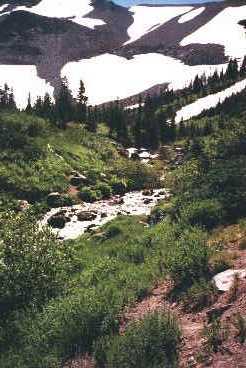
 ***** McNeil Point (On
Mt. Hood's West Side) : One of the best Mt. Hood hikes with flowers, mountain views and everything in-between. The access
is from Top Spur/Lolo Pass Road. I have done this hike in July, Aug. and Oct.
and it was good all times of the year. Summer brings wild-flowers but
murderous flies and bugs pester you in the lower parts of the trail.
Autumn is cooler and bug-free but has no wildflowers and there is rotting
vegetation in meadows. Top Spur trail is short with lots of roots across
the trail and several majestic fir and hemlock trees with lichen-encrusted trunks. It quickly leads to Timberline
trail in about 0.5 miles. This place is quite a nexus of trails and can
get confusing (see end of this account to see how confusing) . If you head right at the fork towards the viewpoint you
will be able to take in some great views and then take a shortcut over to
the main trail. The Mt. Hood view from this point is one of my favorites because the precipitous drop to the river valley below accentuates the height of the mountain and gives one the feeling of being perched in the air. There are quite a few wildflowers along the exposed ridge during this section of the trail including white bunchberry, red columbines and yellow tiger lilies. A few rhodie bushes also put out a good display of pink blooms in early summer . You need to watch out for the short side trail in the second clump of
trees about 0.5 mile after the fork. This will cross you over to the main
trail to McNeil Pt. There is long slog on this main trail before you
get to the ridge where you get some more views -- bugs (mostly flies) are particularly
bothersome in this stretch in summer. The ridge line offers gorgeous views
of Sandy and Reid Glaciers with high tall thin ribbons of several waterfalls cascading down from the glacier into the Muddy Fork valley. One seemed a
lot taller than Multnomah falls to me. Don't know why it isn't mentioned
as the highest in OR -- maybe its seasonal or something. Autumn colors
were also in evidence along the trail in Oct. as vines on exposed faces
had turned to shades of bright red and orange. The trail dips in and out
of trees as it climbs up a ridge, each opening in the trees reveals great
views and delightful close-ups of the mountain. The Muddy Fork river runs
far below you in the valley that contains Ramona Falls. Yocum ridge rises
up on the other side of the valley towards Sandy glacier headwall. The
sheer headwall is awesome with yellow and orange volcanic rock stripped bare by the glacier. Then the trail dips back into the forest and
climbs back up to emerge below McNeil Pt. At this point There are some
goat trails to Mc Neil point shelter which are quite steep and muddy and
pass through some swampy meadow-like terrain with abundant flowers in
summer and fleshy plants that had a ripe rotting vegetation smell in Oct.
In July/August however the meadows are ablaze with wildflowers and it looks
like a piece of heaven. Everything from delicate avalanche lilies to
bright red Indian paintbrush. The trail crosses several cool and refreshing
snowmelt creeks and skirts the edges of two snowmelt-fed shallow ponds
before coming to a branch shortly after its intersection with the Mazama
trail. At this point the McNeil point trail splits to the right and goes
up an extremely pretty flower strewn valley with a little brook running
along the trail. There are several nice rocks to stretch out and luxuriate
in the nice breeze among this meadow. A fairly steep but short stretch
takes you up on a ridge with nice views of Helens, Rainier and Adams. The
trail then crosses a couple of small snowfields and angles up at a more
tolerably graded trail to McNeil Point shelter. The views down the valley,
up towards Mt. Hood and north to Washington cascades are quite
spectacular. The energetic hiker can continue up the ridge to tie-in-rock
where it becomes a climbing route to summit. All in all this is probably
one of the nicest hikes on Mt. Hood and a definite repeater in all
seasons. (8-9 miles, 3000 ft., done 10/2/99, 8/6/00,7/25/02 and 7/12/03)
Captain's log supplemental: I redid this hike in July 2002. Its almost becoming an annual rite of passage now. There was plenty of snow so I kick-stepped up a snowfield to get to the plateau that leads to McNeil Pt. Then, unencumbered by any whiny companions, I continued up the trail to where it peters out and becomes a climbing route. The views in this segment were stupendous with open windswept tundra, sun-bleached krummholz and close-up views of Sandy and Glisan Glaciers (I am not sure if it was just snowfields or a glacier on the left side of Sandy Glacier). On the way back I took the steep shortcut down to the main trail from McNeil point. There was a party of three women setting up camp near the shelter and they were very nice and hospitably offered me to use the sleeping bag somebody had left hanging in the shelter and spend the night there instead of going down in the dark. They also generously offered to share some food but given the rapidly ending daylight, I declined. One of the women had taken the shortcut before and she made it sound really hairy. It was indeed pretty rough but quite manageable. I guess I have become hardened after negotiating Monitor ridge on Helens a couple of times. I turned back pretty late at 7 pm and paid the price for it on the way back. I wasted even more time filtering water and taking pictures of Mt. Hood in Alpenglow. By the time I reached the view point it had gotten pretty dark so I broke out the flashlight. At the confusing junction I took the Top Spur trail but I noticed that it was quite overgrown and also seemed to be climbing quite a bit more that I remembered. After about half an hour on this trail I became very uneasy and decided to turn back. At this point my flashlight decided to give out and its light faded to a dim glow. This put an entirely different complexion on the matter since I couldn't see a damn thing in the dark. I usually carry an extra flashlight but I had moved things around to my bigger backpack for the Wallowa trip and consequently I was SOL. It was supposed to be a full moon night but the thunder clouds took care of that. Finally I resorted to switching on the flashlight briefly to catch a glimpse of the trail and then stumble along for a few feet before repeating the process. The breaks seemed to give a little bit of time for batteries to recuperate and produce an anemic beam of light for a few seconds. There were times I was really scared because I thought I had lost the trail in the dense flowers and shrubs that were covering the trail. Luckily I always managed to backtrack a little and find the trail. Checking clean cut ends of fallen logs by feel also reassured me that I was on the trail. When the flashlight became almost totally depleted, I followed my dog whose white fur made him appear like a dim ghost leading the way. I managed to creep along in this manner to the 6 way trail junction and realized that I had missed Top Spur and had gone on towards Ramona Falls or something. After a little more cursing and groping about in the dark I was able to locate the right trail which was strewn with roots and quite broad just like I remembered it to be. I finally emerged from the forest at 11 pm. The trailhead was empty apart from a VW van with some hippy types camping in it. Thankfully drove home resolving to always carry an extra flashlight and batteries in future. This episode brought back very vividly the experience I had in the Kachina Peaks wilderness in Arizona in 1996 when my buddy Daljeet and I had barely made it down Humphery's Peak on a small flashlight with faltering batteries.
***** McNeil Point (On
Mt. Hood's West Side) : One of the best Mt. Hood hikes with flowers, mountain views and everything in-between. The access
is from Top Spur/Lolo Pass Road. I have done this hike in July, Aug. and Oct.
and it was good all times of the year. Summer brings wild-flowers but
murderous flies and bugs pester you in the lower parts of the trail.
Autumn is cooler and bug-free but has no wildflowers and there is rotting
vegetation in meadows. Top Spur trail is short with lots of roots across
the trail and several majestic fir and hemlock trees with lichen-encrusted trunks. It quickly leads to Timberline
trail in about 0.5 miles. This place is quite a nexus of trails and can
get confusing (see end of this account to see how confusing) . If you head right at the fork towards the viewpoint you
will be able to take in some great views and then take a shortcut over to
the main trail. The Mt. Hood view from this point is one of my favorites because the precipitous drop to the river valley below accentuates the height of the mountain and gives one the feeling of being perched in the air. There are quite a few wildflowers along the exposed ridge during this section of the trail including white bunchberry, red columbines and yellow tiger lilies. A few rhodie bushes also put out a good display of pink blooms in early summer . You need to watch out for the short side trail in the second clump of
trees about 0.5 mile after the fork. This will cross you over to the main
trail to McNeil Pt. There is long slog on this main trail before you
get to the ridge where you get some more views -- bugs (mostly flies) are particularly
bothersome in this stretch in summer. The ridge line offers gorgeous views
of Sandy and Reid Glaciers with high tall thin ribbons of several waterfalls cascading down from the glacier into the Muddy Fork valley. One seemed a
lot taller than Multnomah falls to me. Don't know why it isn't mentioned
as the highest in OR -- maybe its seasonal or something. Autumn colors
were also in evidence along the trail in Oct. as vines on exposed faces
had turned to shades of bright red and orange. The trail dips in and out
of trees as it climbs up a ridge, each opening in the trees reveals great
views and delightful close-ups of the mountain. The Muddy Fork river runs
far below you in the valley that contains Ramona Falls. Yocum ridge rises
up on the other side of the valley towards Sandy glacier headwall. The
sheer headwall is awesome with yellow and orange volcanic rock stripped bare by the glacier. Then the trail dips back into the forest and
climbs back up to emerge below McNeil Pt. At this point There are some
goat trails to Mc Neil point shelter which are quite steep and muddy and
pass through some swampy meadow-like terrain with abundant flowers in
summer and fleshy plants that had a ripe rotting vegetation smell in Oct.
In July/August however the meadows are ablaze with wildflowers and it looks
like a piece of heaven. Everything from delicate avalanche lilies to
bright red Indian paintbrush. The trail crosses several cool and refreshing
snowmelt creeks and skirts the edges of two snowmelt-fed shallow ponds
before coming to a branch shortly after its intersection with the Mazama
trail. At this point the McNeil point trail splits to the right and goes
up an extremely pretty flower strewn valley with a little brook running
along the trail. There are several nice rocks to stretch out and luxuriate
in the nice breeze among this meadow. A fairly steep but short stretch
takes you up on a ridge with nice views of Helens, Rainier and Adams. The
trail then crosses a couple of small snowfields and angles up at a more
tolerably graded trail to McNeil Point shelter. The views down the valley,
up towards Mt. Hood and north to Washington cascades are quite
spectacular. The energetic hiker can continue up the ridge to tie-in-rock
where it becomes a climbing route to summit. All in all this is probably
one of the nicest hikes on Mt. Hood and a definite repeater in all
seasons. (8-9 miles, 3000 ft., done 10/2/99, 8/6/00,7/25/02 and 7/12/03)
Captain's log supplemental: I redid this hike in July 2002. Its almost becoming an annual rite of passage now. There was plenty of snow so I kick-stepped up a snowfield to get to the plateau that leads to McNeil Pt. Then, unencumbered by any whiny companions, I continued up the trail to where it peters out and becomes a climbing route. The views in this segment were stupendous with open windswept tundra, sun-bleached krummholz and close-up views of Sandy and Glisan Glaciers (I am not sure if it was just snowfields or a glacier on the left side of Sandy Glacier). On the way back I took the steep shortcut down to the main trail from McNeil point. There was a party of three women setting up camp near the shelter and they were very nice and hospitably offered me to use the sleeping bag somebody had left hanging in the shelter and spend the night there instead of going down in the dark. They also generously offered to share some food but given the rapidly ending daylight, I declined. One of the women had taken the shortcut before and she made it sound really hairy. It was indeed pretty rough but quite manageable. I guess I have become hardened after negotiating Monitor ridge on Helens a couple of times. I turned back pretty late at 7 pm and paid the price for it on the way back. I wasted even more time filtering water and taking pictures of Mt. Hood in Alpenglow. By the time I reached the view point it had gotten pretty dark so I broke out the flashlight. At the confusing junction I took the Top Spur trail but I noticed that it was quite overgrown and also seemed to be climbing quite a bit more that I remembered. After about half an hour on this trail I became very uneasy and decided to turn back. At this point my flashlight decided to give out and its light faded to a dim glow. This put an entirely different complexion on the matter since I couldn't see a damn thing in the dark. I usually carry an extra flashlight but I had moved things around to my bigger backpack for the Wallowa trip and consequently I was SOL. It was supposed to be a full moon night but the thunder clouds took care of that. Finally I resorted to switching on the flashlight briefly to catch a glimpse of the trail and then stumble along for a few feet before repeating the process. The breaks seemed to give a little bit of time for batteries to recuperate and produce an anemic beam of light for a few seconds. There were times I was really scared because I thought I had lost the trail in the dense flowers and shrubs that were covering the trail. Luckily I always managed to backtrack a little and find the trail. Checking clean cut ends of fallen logs by feel also reassured me that I was on the trail. When the flashlight became almost totally depleted, I followed my dog whose white fur made him appear like a dim ghost leading the way. I managed to creep along in this manner to the 6 way trail junction and realized that I had missed Top Spur and had gone on towards Ramona Falls or something. After a little more cursing and groping about in the dark I was able to locate the right trail which was strewn with roots and quite broad just like I remembered it to be. I finally emerged from the forest at 11 pm. The trailhead was empty apart from a VW van with some hippy types camping in it. Thankfully drove home resolving to always carry an extra flashlight and batteries in future. This episode brought back very vividly the experience I had in the Kachina Peaks wilderness in Arizona in 1996 when my buddy Daljeet and I had barely made it down Humphery's Peak on a small flashlight with faltering batteries. Repeated in Aug 05, very few bugs but also very little snow. The valley with the stream is closed for revegetation but we went up it anyway. The stream was dry and the snowfield had completely melted out (the first time I have ever seen it totally out). The flowers had peaked in lower meadows but there were some nice flowers and views above the shelter. (done 7/25/02 and 8/7/05, 10 mi, 3200 ft)
McNeil point and Sandy glacier,
Close-up of Sandy glacier,
Relaxing among the wildflowers
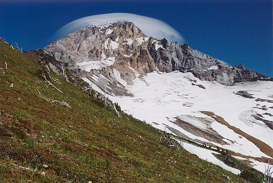
Tundra above shelter and Mt. Hood with a lenticular cloud
Alpenglow on Mt. Hood
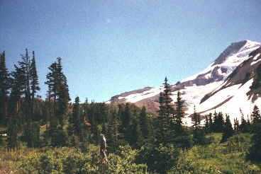
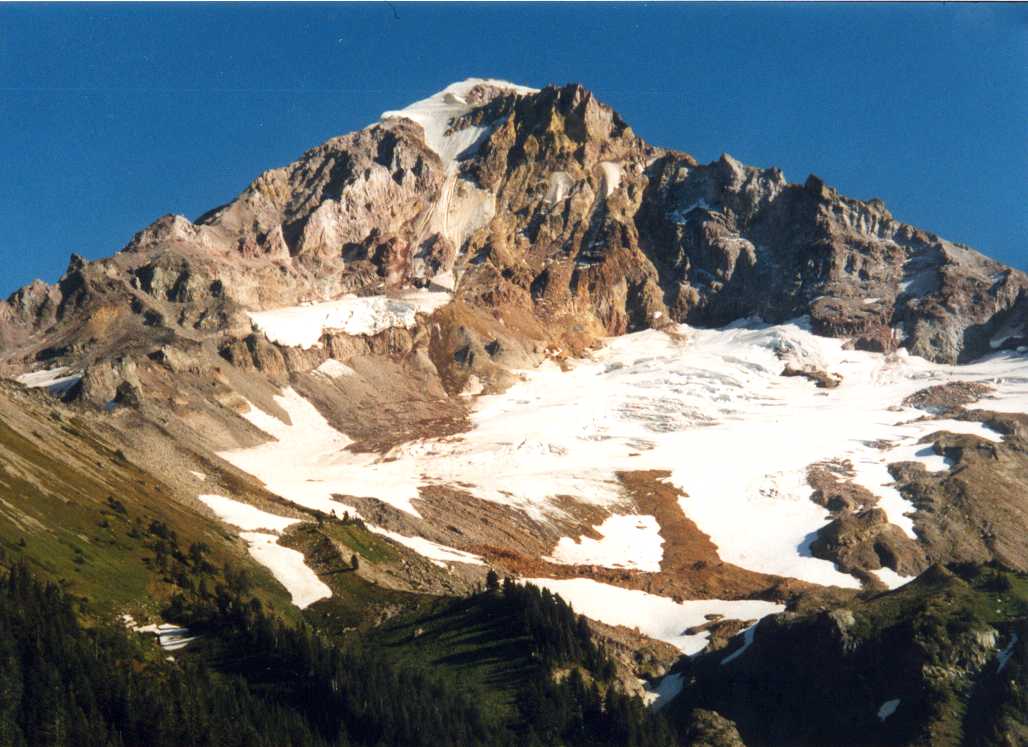
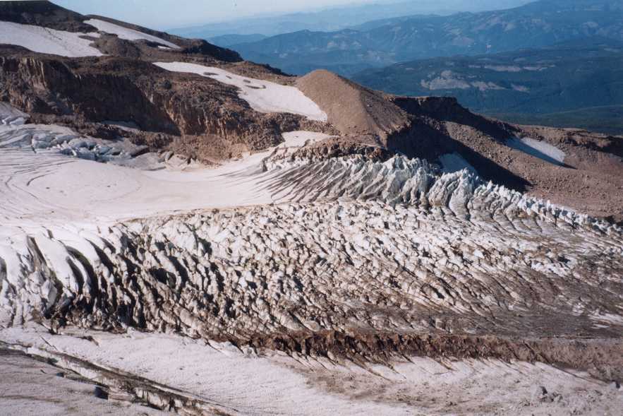
 ***** Elliot Glacier
(On Mt. Hood's North Side): Another great Hood hike. The access is
from Cloud Cap. Trail quickly leads up an ashy slope to the lateral
moraine. Gorgeous views of Elliot glacier (largest glacier on Mt. Hood).
Rocky/ashy stuff makes for tough going . Trail is above timberline so
bring a wide-brimmed hat or cap. A river springs from glacier. Lots of
dust and dirt covers lower portions of the glacier. HUGE crevasses and
other glacial features can be seen up close. The successive layers of dirt
and snow in crevasse walls tell the story of passing seasons. At the end
of the moraine a steep and exposed trail continues up to Cooper Spur. The
sheer scale of things is overwhelming and can mislead hikers. What looks
like an entirely reachable destination turns out to be several miles and
thousands of feet away. For the location of many of these Mt. Hood hikes
refer to Topographic
Map of Mt. Hood (done 10/3/99) looking down at
the crevasses, Lateral moraine -- Mt. Adams and
Helens on right and left edges of the picture, Elliot
glacier's icefall, A crevasse, Rainier and Adams
in background
***** Elliot Glacier
(On Mt. Hood's North Side): Another great Hood hike. The access is
from Cloud Cap. Trail quickly leads up an ashy slope to the lateral
moraine. Gorgeous views of Elliot glacier (largest glacier on Mt. Hood).
Rocky/ashy stuff makes for tough going . Trail is above timberline so
bring a wide-brimmed hat or cap. A river springs from glacier. Lots of
dust and dirt covers lower portions of the glacier. HUGE crevasses and
other glacial features can be seen up close. The successive layers of dirt
and snow in crevasse walls tell the story of passing seasons. At the end
of the moraine a steep and exposed trail continues up to Cooper Spur. The
sheer scale of things is overwhelming and can mislead hikers. What looks
like an entirely reachable destination turns out to be several miles and
thousands of feet away. For the location of many of these Mt. Hood hikes
refer to Topographic
Map of Mt. Hood (done 10/3/99) looking down at
the crevasses, Lateral moraine -- Mt. Adams and
Helens on right and left edges of the picture, Elliot
glacier's icefall, A crevasse, Rainier and Adams
in background
 ** Mirror Lake (Mt.
Hood, OR) : I have done this hike as a winter snowshoe as well as
a summer hike. The trail begins at a parking area right off of highway 26
above Yocum Falls -- right after the highway comes out of the curves above
Zigzag but before Gov't Camp. You cross over a narrow bridge to start the
hike. The trail switchbacks up and involves crossing one more bridge and
traversing a rockslide. The latter requires some careful stepping when
snow is hard-packed to avoid sliding down. Some people actually like to
slide on the snow-covered rockslide area instead of walking down the
switchback (its a lot of fun). Mirror lake is a shallow circular lake
(frozen in winter). Its banks have a lot of bushes with little clearings
here and there to get to the shore. Tom-Dick-Harry ridge looms on one side
and Hood is visible on the other side in clear weather. There are
backpacking campsites on west side of the lake. Numerous lunch spots dot
the lakeside. This is a very popular summer or winter trail. Consequently
snow is so well packed that snowshoes are not really required and may
actually be a hindrance on the way down since the ice under the packed
snow can be slippery. (3 mi., 600 ft., done 3/5/00 and 7/16/00 and
2/11/01 and 12/20/01). *** Salmon River I
(Near ZigZag, OR) : This was a pleasant hike on one of the first
nice weekends of Spring 2000. Take Salmon river road next to Subway. Time to dust off the old hiking boots and hit
the trail kind of days. The trail starts off along Salmon river and
continues to run along the river among old-growth Cedar and Fir forest.
Most trees are heavily encrusted with moss. Several nice backpacking
campsites exist along the river bank. This trail is somewhat similar to
Siouxon creek. Water is clean and inviting but freezing cold and the
current is swift. Presumably, it must have contained salmon at some time
but I didn't see anything. An old angler was hanging out at one place, so
I guess its not totally devoid of fish. Strictly catch & release only.
The road parallels the trail and spoils the atmosphere as you can see the
occasional car go by in the distance. Also the trail comes out on the road
for a couple of times for short distances. (5 mi., 0 ft., done 4/29/00).
** Mirror Lake (Mt.
Hood, OR) : I have done this hike as a winter snowshoe as well as
a summer hike. The trail begins at a parking area right off of highway 26
above Yocum Falls -- right after the highway comes out of the curves above
Zigzag but before Gov't Camp. You cross over a narrow bridge to start the
hike. The trail switchbacks up and involves crossing one more bridge and
traversing a rockslide. The latter requires some careful stepping when
snow is hard-packed to avoid sliding down. Some people actually like to
slide on the snow-covered rockslide area instead of walking down the
switchback (its a lot of fun). Mirror lake is a shallow circular lake
(frozen in winter). Its banks have a lot of bushes with little clearings
here and there to get to the shore. Tom-Dick-Harry ridge looms on one side
and Hood is visible on the other side in clear weather. There are
backpacking campsites on west side of the lake. Numerous lunch spots dot
the lakeside. This is a very popular summer or winter trail. Consequently
snow is so well packed that snowshoes are not really required and may
actually be a hindrance on the way down since the ice under the packed
snow can be slippery. (3 mi., 600 ft., done 3/5/00 and 7/16/00 and
2/11/01 and 12/20/01). *** Salmon River I
(Near ZigZag, OR) : This was a pleasant hike on one of the first
nice weekends of Spring 2000. Take Salmon river road next to Subway. Time to dust off the old hiking boots and hit
the trail kind of days. The trail starts off along Salmon river and
continues to run along the river among old-growth Cedar and Fir forest.
Most trees are heavily encrusted with moss. Several nice backpacking
campsites exist along the river bank. This trail is somewhat similar to
Siouxon creek. Water is clean and inviting but freezing cold and the
current is swift. Presumably, it must have contained salmon at some time
but I didn't see anything. An old angler was hanging out at one place, so
I guess its not totally devoid of fish. Strictly catch & release only.
The road parallels the trail and spoils the atmosphere as you can see the
occasional car go by in the distance. Also the trail comes out on the road
for a couple of times for short distances. (5 mi., 0 ft., done 4/29/00). *** Salmon River II
(Near ZigZag, OR) : This trail starts where the lower Salmon River
trail (#742A) ends. Just before the afore-mentioned road crosses a bridge
over the river. This is a little more strenuous hike. Trail starts level
along the river for the first 2 miles to the wilderness boundary. There
are several side trails leading to idyllic campsites by the river. Trail
stays close to the river except from some small twists to get cross stream
beds. Shortly after crossing the wilderness boundary, it climbs a fairly
steep section onto a ridge to a nice lunch spot. There are nice views of
heavily forested Salmon-Huckleberry wilderness and the river running far
below. For once, no clear cuts mar the landscape. This makes a nice turn-around
spot but if you are the energetic sort of hiker (if you are reading this
drivel, you probably are), you can continue up to a junction, left branch
loops back to the lunch spot and the right branch continues up for a short
distance and then levels off. Then it goes downhill, crosses a small
stream and heads up to another nice view point. There is a FS sign asking
people to camp under tress and not in the meadow. The day was cloudy
initially but clouds broke up in late afternoon offering delightful views.
I turned back at this point. The trail continues on for several miles
after this. (7.5 mi., 1000 ft., done 5/99, 7/21/01, 5/2002, 2/12/2006). ** Little Crater Lake to Timothy Lake
(Near Mt. Hood, OR) : This hike starts at the Little Crater Lake
campground and passes through some marshy meadow-like terrain before
hopping a turn-stile to reach the lake. The lake is more accurately a 50 ft
deep artesian well with deep aquamarine blue water which is clear enough
that you can see the bottom. The trail continue past this lake and enters
a forest of fairly mature fir trees, with a few big ones still surviving.
A couple of bridges later you come to Timothy lake. This was the
destination and turnaround point for me. The trail can be taken all the
way around the lake but its pretty long 12 miles or so. Lake is quite
popular with fishermen and horses. (Done 5/21/00 4 mile, 0 ft) **** Elk Meadows (Mt.
Hood, SE side) : This hike is another pretty one. Trailhead is
located near Clark Sno-park. Trail started out flat among abundant
huckleberry bushes. There was a large number of ripe berries on these in
late August so I munched on the juicy tangy berries as I hiked. The trail
crossed a bridge over Clark Creek and then soon thereafter came to a
fairly fast flowing stream (newton creek) which was crossed in a fairly
adventurous manner on a couple of rickety logs.The hike leader got us lost a couple of times. After this the trail
ramped up a fairly steep series of 8 switchbacks and then leveled out the
rest of the way to Elk Meadows. The meadows are a delightful place with
great views of the flowery meadows and up at the Newton-Clark glacier on
Mt. Hood. We lunched at the rustic shelter where camp-robber jays did
their best to steal our food. They were so bold that several of them
landed on my hand to feed on the sunflower seeds in my palm. The whole group spread out in the meadow and we spent a delightful hour just sprawled out and drowsily taking in the beautiful scenery. Mt. Hood loomed over the meadow with the crevassed Newton & Clark glaciers visible from this side. This could be
a great backpacking destination as well. The trail circles the meadows and
then heads back down. All in all a very nice hike. Late July / Early
August may provide good wildflower displays here. (8 miles, 1200 ft, done
8/27/00). ***** Paradise Park
(Mt. Hood South side) One of the last hikes which doesn't require
a trail park pass. Start out at Timberline lodge and go left at the sign
for Pacific Crest/timberline trail 600. The trail quickly passes under the
lifts and heads on out of the tourist madhouse. The views of Jefferson and
Sisters and up towards Zigzag glacier are very pretty. Trail dips in and
out of trees and goes up and down a few small valleys which contain
seasonal snowmelt streams. On the whole you are losing elevation so going
is pretty easy. Little Zigzag canyon is the biggest one of these little
valleys. Near this you cross the wilderness boundary. The trail comes out
on a magnificent view of the zigzag canyon at about 2 miles and then
plunges along the side of the canyon in a series of switchbacks about 800
ft down to the river. This section can be pretty muddy. The river can be
easily crossed on rocks when water is low but could be tough early in the
season. There is a nice waterfall visible from the river crossing and a
few helpful cairns point out possible crossing points. Then the trail
climbs up on the other side of the canyon until it comes to the junction
with Paradise park loop. At this point you head right up this loop trail
to get to the grassy meadows with views of Zigzag glacier and
surroundings. I decided to head back at this point but you can make this
hike much longer by doing the entire loop. The way back is pretty tough
because you have to negotiate the canyon again and then labor uphill all
the way to Timberline lodge.
*** Salmon River II
(Near ZigZag, OR) : This trail starts where the lower Salmon River
trail (#742A) ends. Just before the afore-mentioned road crosses a bridge
over the river. This is a little more strenuous hike. Trail starts level
along the river for the first 2 miles to the wilderness boundary. There
are several side trails leading to idyllic campsites by the river. Trail
stays close to the river except from some small twists to get cross stream
beds. Shortly after crossing the wilderness boundary, it climbs a fairly
steep section onto a ridge to a nice lunch spot. There are nice views of
heavily forested Salmon-Huckleberry wilderness and the river running far
below. For once, no clear cuts mar the landscape. This makes a nice turn-around
spot but if you are the energetic sort of hiker (if you are reading this
drivel, you probably are), you can continue up to a junction, left branch
loops back to the lunch spot and the right branch continues up for a short
distance and then levels off. Then it goes downhill, crosses a small
stream and heads up to another nice view point. There is a FS sign asking
people to camp under tress and not in the meadow. The day was cloudy
initially but clouds broke up in late afternoon offering delightful views.
I turned back at this point. The trail continues on for several miles
after this. (7.5 mi., 1000 ft., done 5/99, 7/21/01, 5/2002, 2/12/2006). ** Little Crater Lake to Timothy Lake
(Near Mt. Hood, OR) : This hike starts at the Little Crater Lake
campground and passes through some marshy meadow-like terrain before
hopping a turn-stile to reach the lake. The lake is more accurately a 50 ft
deep artesian well with deep aquamarine blue water which is clear enough
that you can see the bottom. The trail continue past this lake and enters
a forest of fairly mature fir trees, with a few big ones still surviving.
A couple of bridges later you come to Timothy lake. This was the
destination and turnaround point for me. The trail can be taken all the
way around the lake but its pretty long 12 miles or so. Lake is quite
popular with fishermen and horses. (Done 5/21/00 4 mile, 0 ft) **** Elk Meadows (Mt.
Hood, SE side) : This hike is another pretty one. Trailhead is
located near Clark Sno-park. Trail started out flat among abundant
huckleberry bushes. There was a large number of ripe berries on these in
late August so I munched on the juicy tangy berries as I hiked. The trail
crossed a bridge over Clark Creek and then soon thereafter came to a
fairly fast flowing stream (newton creek) which was crossed in a fairly
adventurous manner on a couple of rickety logs.The hike leader got us lost a couple of times. After this the trail
ramped up a fairly steep series of 8 switchbacks and then leveled out the
rest of the way to Elk Meadows. The meadows are a delightful place with
great views of the flowery meadows and up at the Newton-Clark glacier on
Mt. Hood. We lunched at the rustic shelter where camp-robber jays did
their best to steal our food. They were so bold that several of them
landed on my hand to feed on the sunflower seeds in my palm. The whole group spread out in the meadow and we spent a delightful hour just sprawled out and drowsily taking in the beautiful scenery. Mt. Hood loomed over the meadow with the crevassed Newton & Clark glaciers visible from this side. This could be
a great backpacking destination as well. The trail circles the meadows and
then heads back down. All in all a very nice hike. Late July / Early
August may provide good wildflower displays here. (8 miles, 1200 ft, done
8/27/00). ***** Paradise Park
(Mt. Hood South side) One of the last hikes which doesn't require
a trail park pass. Start out at Timberline lodge and go left at the sign
for Pacific Crest/timberline trail 600. The trail quickly passes under the
lifts and heads on out of the tourist madhouse. The views of Jefferson and
Sisters and up towards Zigzag glacier are very pretty. Trail dips in and
out of trees and goes up and down a few small valleys which contain
seasonal snowmelt streams. On the whole you are losing elevation so going
is pretty easy. Little Zigzag canyon is the biggest one of these little
valleys. Near this you cross the wilderness boundary. The trail comes out
on a magnificent view of the zigzag canyon at about 2 miles and then
plunges along the side of the canyon in a series of switchbacks about 800
ft down to the river. This section can be pretty muddy. The river can be
easily crossed on rocks when water is low but could be tough early in the
season. There is a nice waterfall visible from the river crossing and a
few helpful cairns point out possible crossing points. Then the trail
climbs up on the other side of the canyon until it comes to the junction
with Paradise park loop. At this point you head right up this loop trail
to get to the grassy meadows with views of Zigzag glacier and
surroundings. I decided to head back at this point but you can make this
hike much longer by doing the entire loop. The way back is pretty tough
because you have to negotiate the canyon again and then labor uphill all
the way to Timberline lodge.Second time around I decided to do this as a backpack. Being a habitual procrastinator I started out late and hit the trail at 6 pm. The initial part of the trail is described above. After the Paradise Loop/PCT junction, the loop trail ascends steadily up a forested ridge and then comes to an open spot overlooking the ZigZag canyon. Then it prescribes a couple of long switchbacks and clears the trees to enter the meadows. At this point, I reached a trail junction with Paradise Park trail which somewhat confused me since this was supposed to be a loop but appeared to be a 3-way junction. I had made it to the Paradise Park area by 8:30 pm, it was getting dark and I didn't know how far I was from the designated campsite area. It was only later that I realized that the Paradise Park trail is a 3rd connector between PCT and the Loop trail. The flowers really hit saturation density around this junction. The air was thick and heady with their scent. I decided to take the Paradise Park trail up for a while then found a clump of trees off to the side and pitched my tent. After I finished setting up the tent, I looked around for the dog since he was carrying all my cooking and food supplies in his doggie pack. At this point I had a rude and unpleasant surprise. My dog was cavorting around the meadow without his pack. Obviously he had managed to squeeze out of it, however I couldn't remember the last time I had noticed it on him. Whether it was near the tent or along the trail. I spent a futile 30 minutes with a flashlight looking around in knee high flowers for the pack and then gave up. Needless to say I was royally pissed. I was seriously entertaining thoughts of returning this irresponsible hound to the animal shelter. I had heard the Perseus meteor shower was going to happen that night. I no longer had any cooking to do and was in an ideal location to watch the skies free from light pollution. So I plopped down on the meadow under the stars and watched the meteors zip across the sky for an hour. It was a very rewarding and liberating experience. I also noticed quite a few satellites criss-crossing across the skies. Finally I hit the sack around midnight and spent an uncomfortable night tossing and turning on the lumpy ground. The dog didn't seem to mind the lack of food and I could hear him messing around in the meadow all night.
Next morning I got up bright and early at 6 am and looked around for the dog pack. Much to my surprise I found it very quickly. It was only 50 ft away from the tent. Reinvigorated from this discovery, I decided to hike up the Paradise Park trail. The trail ascends a steep section to reach an upper meadow. The flowers quickly petered out and a brushy juniper ground cover took over. I looked over at the next ridge and saw several occupied campsites there. I had been very close to the designated camping area last night and might have made it there before dark if I had stayed on the loop trail instead of heading up. Oh well, live and learn. Towards the left Mt. St. Helens became visible for a short while before disappearing behind the ridge. On the right side was a pretty waterfall and V-shaped canyon. The cliff of Mississippi Head were very close and didn't look quite so formidable from this point. I kept going up till the trail disappeared and the surface changed to the ashy crumbly mix of stones and big boulders that characterize upper slopes of Cascade volcanoes. Finally I sat on a big boulder and watched the sunrise on Mt. Hood. Wisps of volcanic gasses were emanating from the fumaroles behind Crater Rock and catching the first rays of sun as they wafted off. I also noticed 4 deer silhouetted on the next ridge looking at me and the dog. On all my years of hiking on the mountain, this is the first time I have seen any large animal. Looking down the mountain I could see the Mirror Lake basin and Tom/Dick/Harry ridge directly across from me. On the way down I noticed some hoof prints in the ash so apparently this area has some deer population. I packed up my tent after coming down from this morning walk and headed towards the camping area. The trail meandered through some meadows, crossed a nice stream and came to the campsites in short order. I found several nice campsites and repitched my tent and set about cooking up some food. This was mixed success since my rice were still crunchy after an hour in the boiling water. I am pretty sure it was the rice's fault and not the elevation. I rested up till 2 p.m. and then continued on the loop trail. The path is more or less level as it goes through some more meadows and crosses a couple of streams. Delightful views of Hood with flowered meadows abound. The trail heads down to PCT in about 1 mile. The 2.4 miles of PCT back to the original junction with loop trail are not as pretty as the upper trail but certainly not lacking in interest. There is an exposed section through a very dramatic canyon with a waterfall. Also several scenic stream crossings and some flowers. Also millions of flies. Obstreperous, obnoxious motherfucking flies. They sit on your legs and arms the second you stop moving. 100% deet does not repel them and they do sting. I strongly suspect a connection between the flies and the horses that frequent this trail. On the way back on PCT there is some elevation gain and then after the lower Paradise Park trail junction, the trail loses it all in switchbacks that quickly brought me down to ZigZag canyon. The climb up on the other side was tough but doable. A thunderstorm came up just as I reached the rim of the canyon. The mountain was creating its own weather since all the ridges nearby were in bright sunlight. The last 2 miles back to Timberline lodge were pretty miserable. I was all out of water and all I could think of was how nice an ice-cold can of Pepsi would taste once I got back to the lodge. The trail just kept going up monotonously without any sign of ending. Its only 400 ft elev. gain in this last section but it seemed like a heck of a lot more than that. Finally the ski lifts came into view and it was over. It is certainly one of the better hikes on Mt. Hood, the flowers are outstanding and so are the views. ( 6 miles, 1600 ft, done 9/17/2000; 15 mi, 3000 ft, 8/10-11/2001, out and back done 6/19/05). Zigzag canyon viewpoint, South side of Mt. Hood, ZigZag Canyon and Mississippi Head cliffs. , Bottom of Zigzag canyon
**** Burnt Lake and East ZigZag Mountain (Mt.
Hood South side) This hike can be considered a bigger(and less
crowded) brother of Mirror Lake. The trailhead is a small parking lot at
the end of a forest road that goes past Lost Creek and McNeil CG. The
trail starts out level and parallels a creek. There were plentiful
huckleberry bushes along the way although the berries had become somewhat
tart by this time of the year. At 2 miles the trail crosses a small stream (lost creek)
and starts climbing up the side of a mountain. There are some nice views
of Mt. Hood if you look back occasionally. Also many huge burnt out trees
are encountered along the trail (hence the name Burnt Lake). After 1.5
miles you come to scenic Burnt lake which has nice views of Mt. Hood with
full frontal shots of Reid Glacier. There were fish in the lake which
would periodically make a splash as they lunged up for some hapless bug hovering
above. I personally observed two lobster-like critters called crawdads
skittering around on the lake bed near where I ate my lunch. There is a
short, and sometimes muddy, loop trail around the lake. Several nice
backpacking campsites are located around the lake. The USFS is at its anal best numbering campsites with numbers and day use sites with letters. The best lunch spot is a fallen log at site "D" and best reflection shots can be had from "C". Personally I can think of a lot better places to backpack to than this lake. The backpacking sites have no views and are just flat spots hacked out in the brush and trees. Some people had lugged floating tubes up here and were lazing in the middle of the lake.
The second time I did this hike I continued to East Zig Zag mountain after eating lunch at the lake. It was a hot and muggy day with thunderheads building on the eastern slopes of the mountain. The trail climbed among bear grass and rhodies and then switchbacked steeply to a junction. It then climbed straight up the ridge at a fairly steep angle before toppping out in open slopes of ZigZag Mountain. The panoramic views of Mt. Hood and Burnt Lake nestled far below are great. Even though the day was hazy I could still see Mt. Adams in the distance. Yocum Ridge and Bald Mountain are clearly visible and you can even see the trail that goes to McNeil Point. Lupine, penstemons and other wildflowers were plentiful on the open slopes of zig zag. ( 7-8 miles, 1700 ft to lake, 10 miles 2400 ft to East ZigZag done 9/24/2000 , 7/17/04). At the lake , Mt. Hood from the trail, Reid Glacier is visible
Paying ransom to camp robber jays
Elk Meadow and Mt. Hood
 ***** White River Moraine
(Snowshoe, SE side of Mt. Hood):This is a great winter
snowshoe. It begins at the White River sno-park on the west side of the
river. Trail takes off along the side of the river and continues to ascend
at a gradual pace among the trees. The river is never really close to the
trail. After about 2 miles you come to a point where you can either
cross over the river on a snow bridge and continue on the medial moraine
of White River Gl., or go to the left and climb a steep 200-300 ft
slope to get on to the lateral moraine. Since this was a low snow pack
year(Jan 2001) , the bridge was not safe and the hike leader opted for the
latter choice. The ascent up this was indubitably the hardest snowshoeing
I have done yet. To avoid avalanche danger we avoided the exposed obvious
slope and headed a little bit to the left of it among the trees. It was
steep going, and even though we were creating little switchbacks it was
still pretty tough. Towards the end my legs felt like jelly and I couldn’t
kick with enough force to get a perch in the snow. Finally resorted to
some "vegetable belays" by holding on to trees to haul myself up
the last bit. After a brief rest we continued up a more moderate slope to
the lunch point. Timberline lodge looked pretty close from where we
stopped for lunch. The return was along the top of the moraine so we were
mercifully spared the steep descent down the way we came. This is the fun
part where you take big strides and let the snow absorb the impact. The
leader was not sure of the route so we had to backtrack a bit a couple of
times. All in all a very nice snowshoe with nice views of the mountain and
the river winding its way through deep snow. We also came across a couple
of snow campers who had dug deep pits in the snow to get a campfire going.
When we started there was hardly a car in the lot , on our return it had a
circus atmosphere with hordes of revelers tubing and sledding down the
slopes by the parking lot.
***** White River Moraine
(Snowshoe, SE side of Mt. Hood):This is a great winter
snowshoe. It begins at the White River sno-park on the west side of the
river. Trail takes off along the side of the river and continues to ascend
at a gradual pace among the trees. The river is never really close to the
trail. After about 2 miles you come to a point where you can either
cross over the river on a snow bridge and continue on the medial moraine
of White River Gl., or go to the left and climb a steep 200-300 ft
slope to get on to the lateral moraine. Since this was a low snow pack
year(Jan 2001) , the bridge was not safe and the hike leader opted for the
latter choice. The ascent up this was indubitably the hardest snowshoeing
I have done yet. To avoid avalanche danger we avoided the exposed obvious
slope and headed a little bit to the left of it among the trees. It was
steep going, and even though we were creating little switchbacks it was
still pretty tough. Towards the end my legs felt like jelly and I couldn’t
kick with enough force to get a perch in the snow. Finally resorted to
some "vegetable belays" by holding on to trees to haul myself up
the last bit. After a brief rest we continued up a more moderate slope to
the lunch point. Timberline lodge looked pretty close from where we
stopped for lunch. The return was along the top of the moraine so we were
mercifully spared the steep descent down the way we came. This is the fun
part where you take big strides and let the snow absorb the impact. The
leader was not sure of the route so we had to backtrack a bit a couple of
times. All in all a very nice snowshoe with nice views of the mountain and
the river winding its way through deep snow. We also came across a couple
of snow campers who had dug deep pits in the snow to get a campfire going.
When we started there was hardly a car in the lot , on our return it had a
circus atmosphere with hordes of revelers tubing and sledding down the
slopes by the parking lot. ; Captain's log Supplemental; Redid this in Jan 2002 when the snow pack was much better. We crossed onto the medial moraine without any difficulty this time. The snow on top of the moraine was firmly packed, windswept and icy in places. The trail continued ascending at a fairly steep rate with a few relatively level stretches giving some breathing respite. There were a few exposed patches with some ground cover vegetation still trying to grow in these harsh winter conditions. We were lucky enough to do this on a clear and calm day with great visibility and the views of the Mt. Hood and the White River canyon (on both sides of the moraine) were excellent. One could even see Mt. Jefferson and Three Sisters from near the top. The moraine curved to the right as it rose and finally we came to a big dip. This was the lunch and turn-around point. I sat too close to the edge and lost the lid to my Tupperware lunchbox. It slid off on the packed ice like a rocket and was lost from view immediately. Definitely a slope you don't want to venture on except with an ice-axe. Chastised, I moved away from the edge. Return was rapid and a delight. This was a much better snowshoe than last year. There was even a Home Depot sponsored snowshoe run going on and we passed numerous runners on our way up.
A view on the way down (6 miles. 1500 ft, Done 2/18/01, 1/13/02, 2/20/06).
 ***** Ghost Ridge
(Snowshoe, SE side of Mt. Hood) This is an excellent winter
snowshoe and a nice summer hike . It begins at the Barlow Pass Sno-park on
highway 35 , 2 miles north of the 35/26 junction. Trail takes off along
the same route as the summer Barlow pass trail that leads to Twin lakes
and Frog Lake sno-park. I have done this trail in summer, in August there
is a profusion of huckleberries. However at this time of the year the only
evidence of huckleberry bushes is a few naked sticks poking out of the
snow. The Ghost ridge trail branches to the right off the main trail after
about a mile of moderate uphill hiking. Then the trail heads up the ridge
at a somewhat steeper angle. It levels off a bit and then there is a
second steep section where excellent views of Mt. Hood make for a nice
lunch spot. We continued up the ridge after lunch. The trail ascends at an
erratic pace, interspersing level stretches with modestly steep sections.
Final turn around point was an open area with rocks a few sun-bleached
tree trunks. Great close-up view of Mt. Hood's SE face is ample reward for
this hike. Nice powdery snow made for an easy descent. The steep downhill sections can be tricky and I took a few falls which didn't hurt much but dislodged the lenses from frame of my glasses. (6 miles. 800 ft, Done 3/3/01 and 12/7/03).
***** Ghost Ridge
(Snowshoe, SE side of Mt. Hood) This is an excellent winter
snowshoe and a nice summer hike . It begins at the Barlow Pass Sno-park on
highway 35 , 2 miles north of the 35/26 junction. Trail takes off along
the same route as the summer Barlow pass trail that leads to Twin lakes
and Frog Lake sno-park. I have done this trail in summer, in August there
is a profusion of huckleberries. However at this time of the year the only
evidence of huckleberry bushes is a few naked sticks poking out of the
snow. The Ghost ridge trail branches to the right off the main trail after
about a mile of moderate uphill hiking. Then the trail heads up the ridge
at a somewhat steeper angle. It levels off a bit and then there is a
second steep section where excellent views of Mt. Hood make for a nice
lunch spot. We continued up the ridge after lunch. The trail ascends at an
erratic pace, interspersing level stretches with modestly steep sections.
Final turn around point was an open area with rocks a few sun-bleached
tree trunks. Great close-up view of Mt. Hood's SE face is ample reward for
this hike. Nice powdery snow made for an easy descent. The steep downhill sections can be tricky and I took a few falls which didn't hurt much but dislodged the lenses from frame of my glasses. (6 miles. 800 ft, Done 3/3/01 and 12/7/03).
View of Mt. Hood from our lunch spot
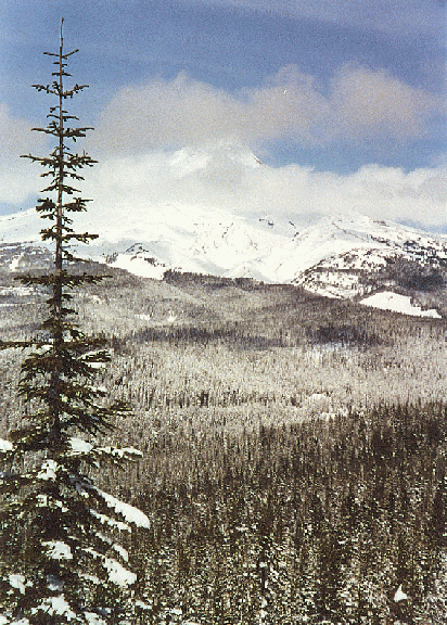
Another view of Mt. Hood from same spot
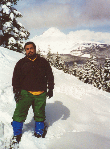 *** Bennet Ridge
(Snowshoe, SE side of Mt. Hood) This is a good snowshoe with nice
views of Mt. Hood, Jefferson and the neighboring river valleys. Trail
started off at a small sno-park on Bennet Pass right past a bridge over
Hwy 35. There is a very gradual ascent along a snow-covered forest road
with good views back towards Hood. Take a right at the blue arrow and keep
going as trail loses a little bit of elevation and comes to an opening in
the forest with nice views. This was my dogs first snow shoe and he was
somewhat aggressive towards the first cross-country skiers he encountered,
but he rapidly came to regard them as non-threatening after a couple more
encounters. The trail angled sharply up to the right and came to a saddle
with nice views of Mt Jefferson. I stopped at this point for a lunch
break. Shortly after this I came to the "Terrible Traverse".
This is a steep 60+ Degree slope that offers ample opportunity to slip and
tumble down a ways. I crossed very carefully kicking steps into the slope
and testing the foothold before stepping forward. There was a layer of
packed ice under the top layer of snow thus making it a fairly dicey
venture that made the heart go pitter-patter. Looking down was somewhat
unnerving but there was no room to turn around so I pushed across. The dog
apparently had no problem crossing because of his 4 limb advantage. After
crossing the traverse the trail rounded a bend and came to a pass between two stricking rock outcroppings. This is know as Gunsight Notch. After this trail entered woods and continued on towards
Bonney Junction. I decided to call it a day here. Recrossing the traverse
was a little less harrowing since I was more confident of my ability to
negotiate it. Return trip was uneventful. In 2006 the crossing was a lot less steep. (6 miles. 600 ft, Done 4/7/01 and 1/15/2006).
*** Bennet Ridge
(Snowshoe, SE side of Mt. Hood) This is a good snowshoe with nice
views of Mt. Hood, Jefferson and the neighboring river valleys. Trail
started off at a small sno-park on Bennet Pass right past a bridge over
Hwy 35. There is a very gradual ascent along a snow-covered forest road
with good views back towards Hood. Take a right at the blue arrow and keep
going as trail loses a little bit of elevation and comes to an opening in
the forest with nice views. This was my dogs first snow shoe and he was
somewhat aggressive towards the first cross-country skiers he encountered,
but he rapidly came to regard them as non-threatening after a couple more
encounters. The trail angled sharply up to the right and came to a saddle
with nice views of Mt Jefferson. I stopped at this point for a lunch
break. Shortly after this I came to the "Terrible Traverse".
This is a steep 60+ Degree slope that offers ample opportunity to slip and
tumble down a ways. I crossed very carefully kicking steps into the slope
and testing the foothold before stepping forward. There was a layer of
packed ice under the top layer of snow thus making it a fairly dicey
venture that made the heart go pitter-patter. Looking down was somewhat
unnerving but there was no room to turn around so I pushed across. The dog
apparently had no problem crossing because of his 4 limb advantage. After
crossing the traverse the trail rounded a bend and came to a pass between two stricking rock outcroppings. This is know as Gunsight Notch. After this trail entered woods and continued on towards
Bonney Junction. I decided to call it a day here. Recrossing the traverse
was a little less harrowing since I was more confident of my ability to
negotiate it. Return trip was uneventful. In 2006 the crossing was a lot less steep. (6 miles. 600 ft, Done 4/7/01 and 1/15/2006).
View of valley after crossing the Terrible Traverse.
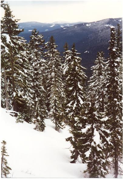
Diamir the dog on Terrible Traverse.
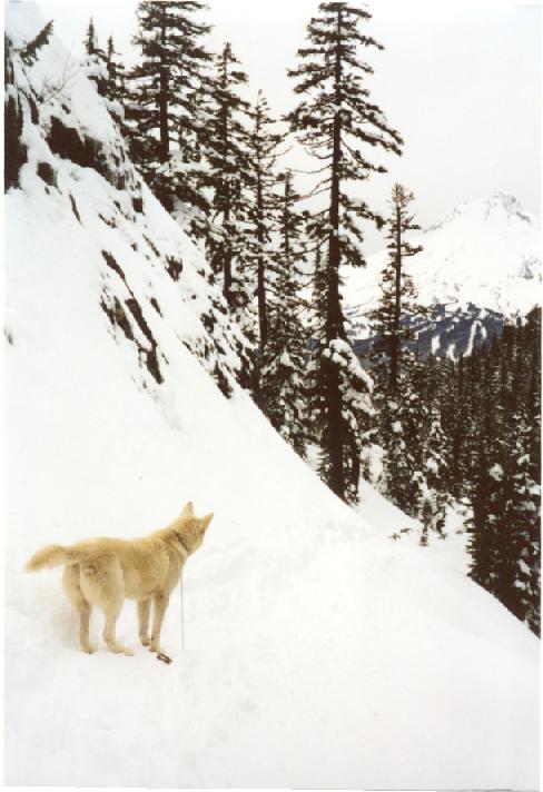 ** Mazama Trail 625 (10
miles north Zig Zag, OR) A pretty steep trail with very little
bang for the buck. To get to the trailhead you need to go North on Lolo
Pass Road. The road peters out at a yellow gate and there are 3 choices at
this point. The first left takes you towards Top Spur and McNeil Point
trailhead. The 2nd left is the best option. I however chose to go straight
and took the rough forest road that passes through some clear cuts and
under some high tension power lines. It is supposed to be the
"scenic" route. Anyway once you reach pavement, take a right and
follow signs for Mazama trailhead along Road 1810. The trail starts out at
a dramatic note with great view of Mt. Hood from trail head and McGee
creek rushing far below you in a steep canyon. The trail soon crosses the
wilderness boundary and in about 1/2 hr you come to a series of
switchbacks across a talus slope. After that the trail continues to
switchback steeply with each turn revealing increasing portions of Adams,
Rainier and Helens. The path then straightens and continues up the ridge
at a steep angle, coming tantalizingly close to the edge of the ridge but
never going all the way to the edge. No expansive views. Some nice
displays of avalanche lilies and bear grass though. The trail continues
its relentless uphill pace, slacking off only in a couple of places. Bugs
and roots and the occasional fallen tree make it a pretty miserable
experience. Finally towards the end the trail comes to some nice views of
Hood as it goes up the side of a boulder field. It soon thereafter
intersects Timberline trail and the good stuff begins. However it was
getting late so this became the snack and turnaround point. In conclusion,
if you want a good workout as an end in itself then do this trail. If you
want quick access to the high country use the Vista Ridge trail.(7.5 mi.,
1500 ft, Done 7/7/01). ***** Vista Ridge Trail
626 to Wy'East Basin and Eden Park (15 miles north Zig Zag, OR) This
is the kinder gentler cousin of the Mazama Trail. It started out at the
end of FS Road 1650. Initial part was somewhat rocky but the trail became
smooth near the wilderness boundary. A couple of switchbacks and then a
long gentle uphill trudge to Timberline trail. Purple-tinged avalanche
lilies abounded in this section and unfortunately so did the bugs. At 2.5
miles Vista ridge intersected Timberline 600 trail. Going left for 0.3 mi
brings one to Wy'East basin. A pretty place with streams and views of Coe
Glacier. There was considerable snow when I went there and the trail
traversed a few snow slopes but nothing dangerous. After Wy'East basin the
trail climbed another steep snow slope (with steps kicked in) and
continued on to Elk Cove. Another set of footprints in the snow indicated
the loop trail to Cairn Basin. However, I backtracked towards Eden Park
instead of trying for a loop. The trail to Eden Park descended rapidly and
crosses a couple of streams to reach Eden Park. There were some flowers
beginning to show up but nothing like the full display that happens in
late July/Aug. Lots of mushy meadows were beginning to appear here and
there with a few Indian Paintbrush, Avalanche Lilies and "Old Man of
the Mountain" flowers. On both this and the Mazama trailheads I
noticed Forest Rangers but little effort was being made to enforce the
Forest Pass. Maybe the demise of Clinton/Babbit spells the death of this
shitty system. (7 mi., 1500 ft, Done 7/8/01).
** Mazama Trail 625 (10
miles north Zig Zag, OR) A pretty steep trail with very little
bang for the buck. To get to the trailhead you need to go North on Lolo
Pass Road. The road peters out at a yellow gate and there are 3 choices at
this point. The first left takes you towards Top Spur and McNeil Point
trailhead. The 2nd left is the best option. I however chose to go straight
and took the rough forest road that passes through some clear cuts and
under some high tension power lines. It is supposed to be the
"scenic" route. Anyway once you reach pavement, take a right and
follow signs for Mazama trailhead along Road 1810. The trail starts out at
a dramatic note with great view of Mt. Hood from trail head and McGee
creek rushing far below you in a steep canyon. The trail soon crosses the
wilderness boundary and in about 1/2 hr you come to a series of
switchbacks across a talus slope. After that the trail continues to
switchback steeply with each turn revealing increasing portions of Adams,
Rainier and Helens. The path then straightens and continues up the ridge
at a steep angle, coming tantalizingly close to the edge of the ridge but
never going all the way to the edge. No expansive views. Some nice
displays of avalanche lilies and bear grass though. The trail continues
its relentless uphill pace, slacking off only in a couple of places. Bugs
and roots and the occasional fallen tree make it a pretty miserable
experience. Finally towards the end the trail comes to some nice views of
Hood as it goes up the side of a boulder field. It soon thereafter
intersects Timberline trail and the good stuff begins. However it was
getting late so this became the snack and turnaround point. In conclusion,
if you want a good workout as an end in itself then do this trail. If you
want quick access to the high country use the Vista Ridge trail.(7.5 mi.,
1500 ft, Done 7/7/01). ***** Vista Ridge Trail
626 to Wy'East Basin and Eden Park (15 miles north Zig Zag, OR) This
is the kinder gentler cousin of the Mazama Trail. It started out at the
end of FS Road 1650. Initial part was somewhat rocky but the trail became
smooth near the wilderness boundary. A couple of switchbacks and then a
long gentle uphill trudge to Timberline trail. Purple-tinged avalanche
lilies abounded in this section and unfortunately so did the bugs. At 2.5
miles Vista ridge intersected Timberline 600 trail. Going left for 0.3 mi
brings one to Wy'East basin. A pretty place with streams and views of Coe
Glacier. There was considerable snow when I went there and the trail
traversed a few snow slopes but nothing dangerous. After Wy'East basin the
trail climbed another steep snow slope (with steps kicked in) and
continued on to Elk Cove. Another set of footprints in the snow indicated
the loop trail to Cairn Basin. However, I backtracked towards Eden Park
instead of trying for a loop. The trail to Eden Park descended rapidly and
crosses a couple of streams to reach Eden Park. There were some flowers
beginning to show up but nothing like the full display that happens in
late July/Aug. Lots of mushy meadows were beginning to appear here and
there with a few Indian Paintbrush, Avalanche Lilies and "Old Man of
the Mountain" flowers. On both this and the Mazama trailheads I
noticed Forest Rangers but little effort was being made to enforce the
Forest Pass. Maybe the demise of Clinton/Babbit spells the death of this
shitty system. (7 mi., 1500 ft, Done 7/8/01).
Redid this hike in Sep 2002 with a group, Oregon Nordic Club I think. It was a dog hike so we had 4 dogs rough housing and humping each other throughout the hike. It was one of those perfect fall days with not a cloud in the sky. All the snow was gone and the glaciers lay exposed waiting for winter snows to replenish them. I always get a bitter-sweet feeling on these fall hikes knowing that these meadows will be soon be covered with snow and high-country hiking will be over till next year. The meadows of the loop were ablaze with huckleberry bushes and vine maple turning red, yellow and orange. Surprisingly we found a few huckleberries bushes still loaded with berries in shady spots. Also some last remnants of lupine were still hanging on to life along streams. We lunched in WyEast Basin with nice views off to the 3 volcanoes in Washington. The bugs were mostly gone but a few pesky flies persisted. After WyEast, the trail climbed over a ridge and then dropped into Cairn Basin after crossing Ladd Creek. Then it wound past a stone shelter and dropped further into Eden Park. Nice views of Hood presented themselves periodically through breaks in the trees. The trail then crossed Ladd Creek once again before climbing up to the junction with Vista Ridge. The creek crossings were fairly easy despite the lack of bridges. I was quite pleased with my new Casio Pathfinder altimeter wrist watch which closely matched the elevations given in the trail description. (8 mi., 1700 ft, Done 9/22/02).
**** Tamanawas Falls
(Mt. Hood SE side) : A very nice short hike. The trail started
next to Hwy 35 and crossed a bridge across Hood River. Then it climbed
parallel to the highway for a short distance before veering away from the
noisy highway. Soon I entered a quiet forest with a noisy creek rushing
along the trail. The creek is very scenic as it rushes down in a series
of small waterfalls and pools. The water in this creek looked very clean
and formed clear blue pools periodically that would be great for wading
and playing around. In the last stretch the trail crosses a rock slide
that obviously wiped out the earlier trail. The fall itself is an
impressive affair. The valley dead ends here and the water cascades over a
lip of volcanic rock and thunders down. ( 4 miles, 100 ft, done 9/15/01) ** Twin Lakes Snowshoe
(Near Mt Hood) : A mediocre short snowshoe. The trail started next
to Hwy26 at Frog Lake sno-park. The parking lot was a zoo with
snow-mobilers and dog sledders hogging almost all the lot. The trail
started out in fairly mature second-growth forest. The crowds soon fell
behind. Trail climbed steadily up the side of a ridge. About 1.5 miles
into the hike the side-trail for twin lakes branched off to the right.
Soon it crested at 4230 ft (a small marker on a tree) and started heading
downhill. Shortly thereafter it reached the frozen lower twin lake. I
walked out onto the lake with some trepidation about breaking through. At
the time I thought it was only 4 feet deep but it later turned out that it
was 18 feet deep and the other twin was the shallow one. The ice was
covered by about 6 inches of snow. The trees around it were laden with
fresh snow presenting a very pretty sight. I headed back after a quick
snack and a couple of photos since daylight was fading fast. Last part of
the trip was in the dark with the help of my headlamp. The parking lot was
just as crowded on my return with all the snowmobilers running noisy
generators to make up for any lack of noise that had escaped the buzz of
their snowmoblies. No good seems to come from the recreators who use
2-stroke engine based monstrosities on public land. ( 5 miles, 800 ft,
done 12/29/01)Diamir and I sit on thin ice.
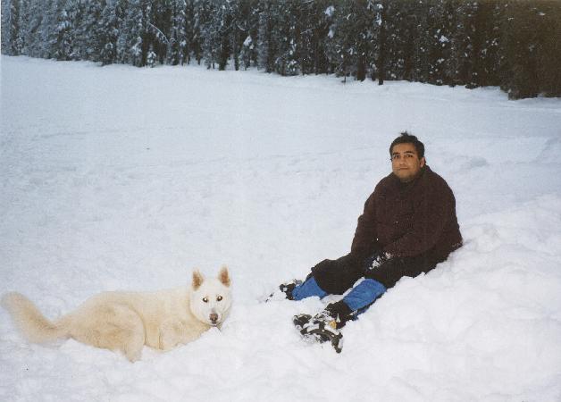 *** Trillium Lake Loop
(Gov’t Camp, Mt. Hood) :
A very popular snowshoe trail
near Mt. Hood. The parking lot and trailhead area was crowded with people
engaged in snow-play. However the crowds dropped off quickly once I got on
the trail. I ran into a ranger at the very beginning who informed me with
glum satisfaction that dogs are not allowed on the trail without leash. I temporarily
leashed the dog to please this sourpuss. However I saw no other dogs on
this trail who were leashed. I unleashed the dog soon thereafter. The trail descended a little bit
and came to a big widely traveled area. Evidence suggested that snow-mobilers
might be using this area. I took the right and followed the loop towards
the old airstrip and beyond. The trail was pretty enough but power lines
marred the view and reminded that civilization was not too far away. I was
further disappointed to find cabins inhabited by boisterous revelers along
the way. Not exactly a wilderness experience. On return I cut across a
wide open space that might have been a meadow or a covered lake. It was
probably the best part of this hike which was otherwise a pretty
lackluster experience. ( 4 miles, 500 ft, done 3/2002)
*** Trillium Lake Loop
(Gov’t Camp, Mt. Hood) :
A very popular snowshoe trail
near Mt. Hood. The parking lot and trailhead area was crowded with people
engaged in snow-play. However the crowds dropped off quickly once I got on
the trail. I ran into a ranger at the very beginning who informed me with
glum satisfaction that dogs are not allowed on the trail without leash. I temporarily
leashed the dog to please this sourpuss. However I saw no other dogs on
this trail who were leashed. I unleashed the dog soon thereafter. The trail descended a little bit
and came to a big widely traveled area. Evidence suggested that snow-mobilers
might be using this area. I took the right and followed the loop towards
the old airstrip and beyond. The trail was pretty enough but power lines
marred the view and reminded that civilization was not too far away. I was
further disappointed to find cabins inhabited by boisterous revelers along
the way. Not exactly a wilderness experience. On return I cut across a
wide open space that might have been a meadow or a covered lake. It was
probably the best part of this hike which was otherwise a pretty
lackluster experience. ( 4 miles, 500 ft, done 3/2002)
Redid as xc ski trip, the first time I tried xc. This time we went directly left and ended up at the lake after negotiating a few small hills. I fell repeatedly. (1/2004)
***** Elk cove via Timberline Trail (Mt. Hood) : I have been trying to do this hike for a couple of years now but something or the other always seemed to thwart my plans. Last year the first attempt in July failed because weather was shitty (it snowed in July). On the second attempt some neurotic females in the hiking group revolted and refused to cross Elliot Creek. This year I resolved to finally do this hike even if it meant fording the creek. I started out from Tilly Jane campground where I had spent Saturday night. There is a short connector trail from here to Cloud Cap. The Forest Service had put up signs all over the place advising that bridge on Elliott Creek is out. This pissed me off quite a bit and I was about to scribble something on the sign to the effect "Why don't you stop charging the fucking trailhead fees until you improve the fucking trail" but then realized the futility of this endeavour and continued up to the moraine and then down to the raging creek. I was fuming all the way about the perfidy of the USFS who weasel their way out of putting a bridge there every year. I was somewhat mollified when I observed two punky-looking youths actually engaged in building a bridge across the creek. They had created a couple of platforms and layed out two planks across the creek. Presumably they would add some wood slats afterwards. I continued up to where the water gushed out of the dirt-covered glacier and managed to cross the creek after some fairly dicey boulder-hopping. My dog, Diamir, demonstrated commendable agility and resourcefulness in choosing his own path in boulder-hopping across the creek. This dog is a born hiker if ever there was one and I was damn lucky to pick him out at the shelter. After the crossing the trail crossed over to the true left morine and dropped sharply to meet the Timberline trail. From here on the trail descended at a gentle rate, crossing several streams and providing nice views of Hood River valley as well as many wildflower covered hillsides. Most stream banks had very nice pink and yellow monkeyflowers. The lupine flowers seemed to have shot their load and gone into the pod phase. Just as I was thinking that I was going to cruise to Elk Cove in record time, the trail suddenly abandoned its mild manner and plunged down the ridge in a series of switchbacks. The reason for this abrupt change in character was the raging torrent coming out of Coe Glacier. The trail finally met the creek after losing several hundred feet. There was a makeshift bridge made out of three shaky looking logs. I managed to cross on them and the dog impressed me even more in fording the stream just above the logs. After this the trail switchbacked up regain the lost elevation. There were a few huckleberry bushes along this section with some berries beginning to ripen. I had noticed several people picking berries along the highway on my way to the hike but at this higher elevation the berries take longer to ripen. Soon after this I reached the enchanting meadow of Elk Cove. The palce was as beautiful as I remembered it from last time. After a brief snack on a granola bar I decided to explore a little bit and headed up towards an obvious opening that seemed to lead towards Coe Glacier. The trail soon petered out and I did a little cross-country jaunt to the base of the huge talus slopes ringing Elk Cove. From here on it got really rocky and I chose the relatively smooth surface of 3 remaining snowfields to ascend. This was relatively risky since the snowpack was thinning out and there were holes with water rushing underneath. Just how risky was brought home to me when the dog ventured too close to one of these holes. He suddenly broke through the snow and fell into the water. For a few seconds all I could see was the tip of his tail poking out above the hole he had created. Before I could rush to the rescue, he vanished and emerged a few moments later from the tunnel opening where water was entering the snowfield. He looked a little sheepish and chastised but none the worse for wear! After this we progressed, albeit more cautiously, to the top of the last snowfield and then scrambled up the bouders to the top of the moraine of Coe Glacier. The view from here was quite stunning and I felt positively drunk with all the beauty and solitude surrounding me. After a brief snack and the obligatory photos I headed back the way I came. The return was uneventful except that both Coe and Elliott Creeks were more swollen now than they were earlier in the day. However we manged to cross them without incident. Clouds had been building up all day but seemed to be lined up as if an invisble wall was stopping them near Cascade Locks. On my way back they suddenly surged forward like an army that had been waiting for the generals order to advance. This worried me since I did not want to get caught in a thunderstorm. However the clouds stayed well below us and channelled through the gorge. It took about the same time to go back as it did to reach Elk Cove (about 3 and a half hours each way). The last section where trail detours up the true left moraine of Elliott Glacier was a real killer, coming at the end of the long hike. This was an awesome hike and I was glad I had finally done it. The last section down from the other moraine is a piece of cake in gaiters as one can just take huge strides in the soft ash and practically run down to Cloud Cap. I quickly packed up at the now deserted Tilly Jane campground and then drove very carefully down the dirt road. This road is quite smooth in places but heavily washboarded in others. Also in an effort to "improve" the road every switchback has been liberally sprinkled with jagged rocks the size of tennis balls. After the recent flat on the Jeff Park hike, I was wincing at each one of these switchbacks and hoping I wouldn't have to get out and change a flat in the dark. Mercifully I made it down without any problems. (13 miles, 2000 ft, done 8/25/2002)
Topo Map of Elk Cove
*** Elk Meadows via Newton Creek (Mt. Hood Meadows): A variation on the Elk Meadows hike. We started from the Meadows Ski area and proceeded half a mile to the footbridge with a big trail junction. The trail was very dusty and the hot day made it feel even dustier and hotter. The trail was plagues with millions of flies who missed no opportunity to alight on your body and inflict painful stings. After crossing a few small streams we took the Newton Creek trail just before the trail crossed the turbulent glacial torrent. The Newton Creek trail wound its way up a dusty and exposed ridge with a few nice views of Hood -- all too infrequent in my opinion. My Montrail boots started causing blisters within the first two miles as usual. These damned things were a total waste of $110. Fortunately I had brought the trusty old boots along and changed into them. We reached the top of the ridge after two hot and dusty miles and hit the junction with Timberline trail. The views opened up here nicely and from the moraine-like top we could see Newton Creek, Lamberson Butte and Hood. Now we headed down Timberline trail to cross the creek on a dicey looking crossing consisting of two skinny logs and some rock hopping. It would have been very hard to do it without poles. We stopped for lunch here since it was the only place in the entire wilderness where flies seemed to be absent. The trail ascended Gnarl Ridge on the other side and soon reached a junction with the Elk Meadows trail. Here I was somewhat disappointed since I wanted to see some gnarly trees but we were well below timberline. I continues up the trail in the vain hope of reaching timeberline but gave up after 10 minutes. The heat and flies just seemed to sap all my energy. I did come across a couple of nice lupine meadows in this part of the trail. After this it was all downhill and we quickly descended to Elk Meadows and the shelter. Here I polished off th rest of my lunch and we spent some time taking pictures and soaking in the views. The meadow is huge but had very few showy flowers. Mostly it was small white flowers that dominated the vegetation. We cut across the meadow on a faint trail and had to thrash around a bit to find the main trail. The descent down a series of switchbacks went very fast and we were soon back at our nemesis -- the Newton Creek crossing. The creek seemed even more swollen and dangerous here compared to the upper crossing. We had to scout upstream quite a ways before reaching a big fallen log with branches radiating out like spokes. This provided a reasonable crossing point but then we had to bushwahch back to the trail on the other side. All this took more exertion that anything else on the rest of the trail. I was mentally cursing and fuming at the forest service throughout this needless and dangerous detour. It seems like if they would get off their lazy asses and put a bridge on this crossing it would at least make me feel like they are using these fucking trailhead fees for some good purpose. Instead the motherfuckers spend their time policing the trailheads for permits and god knows what happens to the money they are extorting from hikers. The rest of the trail went by pretty quickly and we were soon out. This was definiely one of the less enjoyable hikes I have done on Hood. The weather, flies and bridgeless creek crossings all conspired to make this more of a slog and less of an enjoyable hike. (8 miles, 2000 ft, Done 7/27/2003). ***** Cloud Cap to Gnarl Ridge (Lamberson Butte): Another stupendous section of the Timberline Trail. Made the mistake of hiking to Cloud Cap and then getting on the TimberLine trail instead of just taking the Tilly Jane Connector. Things were pretty dry and dusty till getting to the Cooper Spur shelter but from there onwards it was just a cornucopia of big mountain scenery. The trail is remarkably well-behaved and stays more or less level with numerous stream crossing where a few snow fields were still lingering into late August. The wind was almost calm today in sharp contrast to yesterday. I hiked upto a small plateau when the trail started heading down rapidly towards Gnarl Ridge and Elk Meadow. This plateau had a stupendous close-up view of the entire Newton-Clark glacier and the numerous waterfalls cascading down from it into the immense chasm carved by the Newton and Clark creeks. Hood looks like totally different mountain from this side. It presents a fairly symmetrical and pointy profile from just about every other side but looks broad and unsymmetric from this vantage point. Mt. Jefferson was visible from here but its entire east side was obscured by a huge cloud of smoke. I knew the B&B complex fire burning near Bend was big but this brought home to me the true magnitude of this fire. Sad but still awe-inspiring. This was to be my last hike with my dog and faithful hiking buddy Diamir. He died in October suddenly from what appears to be a case of rodenticide poisoning. In retrospect I have to say that this dog I adopted form the shelter rewarded and enriched my life in more ways that I can count. He was a major pain in the ass in the beginning and still had some annoying traits but he and I had finally learnt to get along. I had toyed with the idea of returning him to the shelter or giving him away many times but never followed through on it. He would soon make up for his latest transgression by his good behaviour, enjoyment of nature and cheerful disposition. He had improved and matured remarkably in the 2.5 years I had him. I was looking forward to many more hikes and backpacks with him but fate had other plans. Diamir, my friend, I will miss you. If you have a soul I hope it finds its way to doggie heaven. (8 miles, 2000 ft, Done 8/28/2003).
Redid this hike with Oregon Nordic Club in August 2005. We hiked farther down the ridge to a saddle below Lamberson Butte where the group took a leisurely lunch. I climbed up the butte while the group lazed around. Great hike in beautiful weather. It was a considerably drier year and there were hardly any snowfields left. Lots of scenic views of the mountain with stunted, gnarly sun-bleached trees in the foreground. (Done 8/21/05)
***** Teacup Lake XC Ski: My 2nd xcountry ski trip. We started out from the Teacup lake sno-park on a bitterly cold day when temps in Portland were hovering in the low 20s. The snow was the driest and powderiest I have ever seen around Mt. Hood. The trails were being groomed by a snowcat and this made it very easy to glide along in the grooves. There was one rather tame downhill and I was pleasantly surprised when I made it down without falling even once. No doubt I have learnt some snow plowing from last time, also I am finally learning to lean forward instead of leaning backwards and flailing my arms as I fall on downhill. The weather showed some signs of clearing and there were times when blue skies framed the snow-laden trees very prettily. We had lunch at the junction with Rabbit Ears trail. The trail went by pretty quickly and we were done by early afternoon. We stopped at Trillium Lake on the way back and tried going down the hill. This quickly evaporated my confidence as I fell repeatdly on the way down. Oh well (3 miles, 500 ft, Done 1/4/2004). ***** Heather Canyon XC: My 3rd xcountry ski trip. We started in rain at the Mt. Hood Meadows parking lot. The trail was uphill all the way for 2 miles until terminating at a chairlift. It seemed to follow a road, crossing a stream several times along the way. The snow was atleast 10-15 ft deep along the stream and made for some scenic pictures. I was using Randonee skis which are heavier but proved pretty stable on the way down. I still fell 5-6 times on the way back but feel like my snowplow experience increased. Hurt my left knee pretty badly on the last fall so I doubt if I will be trying this again any time soon. (4 miles, 500 ft, Done 1/18/2004). **** Coe East Moraine< : Very similar to Elk Cove except that when the trail headed down to cross Coe Creek, we headed uphill and cross-country. We had go over a couple of small ridges before hitting the moraine. Its pretty narrow in places but nothing dangerous. We followed it all the way up to where it transitioned into a cliff near the ice fall. We debated crossing the glacier over to Elk Cove but decided against it. It was windy day with clouds forming over Hood and then blowing away. On the way down we hiked in the ablation valley below the morinae and came across evidence that people camp here. We also picked up a boot track that took us down to Timberline trail. (5 miles, 1000 ft, Done Sat 8/21/2004). ***** Barrett Spur : This was the Labor Day 200 backpack. We started out at the Elk Cove trailhead near Laurence Lake. It was about 11 am. My car was the only one parked at the TH on Labor Day weekend which speaks volumes for the low use this trail gets. The weather was nice with some clouds and a cool breeze helping to keep us from overheating. The initial part of the "trail" is the road that the FS chose to close for some reason. See my comments from previous hike. The huge ditches I observed on this trail-cum-road were still there and still looked pretty raw after 6 years. The first mile along this section was quite boring and unscenic. Then things improved somewaht as we left the abandoned road and started on the trail. The grade was good and trail surface smooth so we made very good time and made it up to Elk Cove in about 4 hours. The only notable event along the way was Denise's headlong dive off the trail but she mercifully had a soft landing and was unhurt. We were quite pleased with our achievement (5 miles in 4 hours with heavy packs) and set about selecting camp sites and pitching tents. There was only one other party of 3 and a dog that arrived from Cloud Cap about the same time as we showed up. I selected a somewhat secluded spot with a nice view of Hood. The meadow was definitely past its prime, even the fuzzy egg-shaped pasque flowers were beginning to fall apart. All the snowfields were gone in the Elk Cove basin except for a huge ice cave with a stream running through it. The water in the stream near our camps was quite silty so we walked along it in the hope of finding a clear tributary. This was the first time I had seen silty water in this stream. Sure enough we found a clear tributary a few minutes up from where the Timberline trail crossed the stream. We decided to head up and investigate the ice cave. Barrett Spur forms the West side of the basin and looms above it. It looked like a heck of a long hike to its top. Anyway we hiked cross-country through meadows and morainal rubble to the snowfield. The silty stream was running right through the middle of the ice cave. The cave itself was large and semi-circular with a diameter of about 50 feet. I hiked up to it first and took a few pictures. I could see large chunks of ice had fallen from its ceiling. The temptation to enter was too strong so I threw caution to th winds and walked right in. It was a very cool place with scalloped walls and blue light filtering through the ceiling. There were some arches in the back where the ceiling had collapsed. I spent a few minutes in there but it felt like being in a mine field. A big chunk of ice could fall any minute so I only stopped long enough for a few pics and then went back. We quickly descended to our campsite, filtering some clear water en route. I took my stove over to Mark's camp and cooked dinner there. There was still plenty of light left so we took a little walk along the timberline trail after dinner. The temperature dropped quickly once the sun went down and I retired to my tent around 7:30 pm. The wind howled all night long but it was nice and cosy in my tent. Around 2am there was a loud noise that woke me up and caused the neighbors' dog to bark. It sounded like a tree limb must have fallen.
Up around 7:30 am. I took longer than usual to get ready, what with cooking and stuff. I hit the trail around 10 am and quickly caught up with Mark and Denise. We had some trouble finding the trail up Barrett -- mostly because hikers coming from the other side mislead us. We hike cross country but soon located the trail that lead us to Dollar Lake. The lake hadn't been too big to begin with and had shrunk to small shallow puddle in September. There were tons of interesting hoof and paw prints around it. We climbed up to Barrett Spur along the gentle ridge. The trail was faint in places but easy enough to follow. I discovered somewhere along the way that the dress ring on my Canon A70 had fallen off. The views got impressive with every step with more of Hood revelaing itself. The trail ended at the base of Barrett Spur with a kick-ass panorama of Coe and Ladd glaciers. The wind was quite strong up here so I backtracked a little to find a calm spot and made short work of the trail mix "lunch". Mark and Denise arrived soon and had lunch as well. The spur looked pretty daunting and I could see why Mazamas had it listed in the climbs instead of hikes. Denise opted to stay at the saddle but Mark and I started up it and it went a lot faster than I thought. The footing was fairly stable and we cruised up to the top following the occasional cairn or boot track. However we were rudely surprised to find out that it was a false summit and there was a ridge leading to a boulder field on the other side of it. We made our way along the ridge the best we could. There was a big boulder blocking the path (gendarme?). We made the mistake of skirting around the left which forced us onto some tricky terrain with loose footing and considerable exposure down towards Coe Glacier. I quickly scrambled back onto the ridge and followed the occasional cairn up the boulders. The boulders were large and mostly stable but there were a few that would tilt unnervingly when stepped upon. I was beginning to wonder if this was more than we could handle when I got to the last cairn and stepped onto firm gound on the other side. The vista was stupendous with Hood looming above and the vast glacial expanse of Coe and Ladd Glaciers fully exposed. The ice fall on Coe looked most impressive and gave the whole scene a very Himalayan flavor. I continued along the now gentle ridge past a couple of humps. Really spectacular, probably the best hike I have done on Hood. We descended quickly to the saddle and then down to Dollar Lake. We took a little break there and then were down at the camp by about 4:45 pm. I was ravenously hungry and had some ramen noodles before packing up and leaving by 6pm. We really hauled ass on the way down and hiked the 5 miles in 2 hours to emerge at the darkening TH at 8 pm. (Done 9/3-94/2005, 15 miles, 5000 ft)
Junaid Omar Last modified: Tue Feb 21 10:57:28 PST 2006