This settlement came to an end approximately one year later when open warfare erupted between the colonists and the Native Americans on the Island. The colonists returned to England and safety on one of Francis Drake's ships.
| FIRST EXPEDITION AND SETTLEMENT | ||||||||||||
| 1585-1586 | ||||||||||||
|
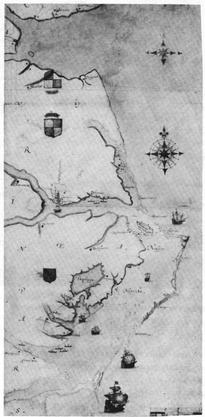
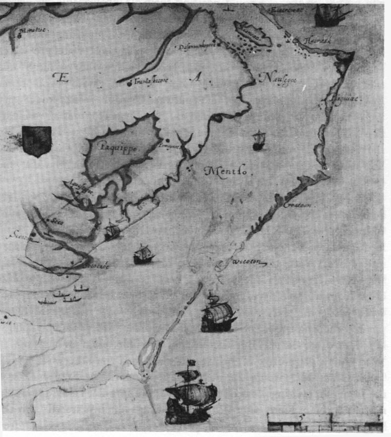
The map to the left, drawn by John White in 1585, depicts the explored coastline of Greenville's expedition. It was named Virginia by the English and, currently, represents the southern coastline of Virginia and the Northern Coastline of North Carolina, past Cape Hatteras. The map below, is an enlargement of the section of the coast where Roanoke Island is located and where the English explored most heavily on the expedition. | |||||||||||
|
||||||||||||
| The very First expedition was carried out by Amidas and Barlow who were sent by Walter Raleigh in 1584 to coast the area, carrying out a largely reconissance mission. The First settlement of Roanoke actually occured during the second expedition that was set out. The group, led by Richard Greenville, reached the coastline of what is now Virginia and Northern North Carolina, in June 1585, and after informing the Native Americans that they had arrive, set up a settlement on Roanoke Island. This settlement came to an end approximately one year later when open warfare erupted between the colonists and the Native Americans on the Island. The colonists returned to England and safety on one of Francis Drake's ships. |
||||||||||||