|
73.50 miles. Maximum 29 mph, rating: 7
Patched the tube from yesterday’s flat tire and sorted mail. Ate doughnuts and cereal at motel, then went for muffins at South of the Border café.
We wanted to mail all our stuff in the US to avoid the semi-infinite delays historically associated with Canada Post. Waiting for the post office to open got us off to a late start, though Jacky rode ahead while I mailed things. She set a good pace all day.
Little wind, wide shoulder, light traffic. Lots of bays this morning. At 10 AM, we rendezvous-ed at Magney state park, then rode together to Grand Portage lodge. Got there right at noon, 35 miles. We had lunch at the lodge. It’s a nice place, with good food (wild rice and chicken soup). The service was slow, but we passed the time watching the hummingbirds around the feeders and enjoying the view of the Raspberry trail, which disappeared into the forest on its way to the lakeshore.
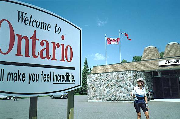
Minnesota bade us goodbye with cool weather, good road, mostly flat country. There was one little grunt, Mt Josephine. It’s been the best state.
Canada immigration was no hassle, about thirty seconds. There is a good tourist information stand just beyond the border, where we got maps and information.
Canada bade us hello with Eastern time, steep grades, headwinds, transversely cracked roads, and no paved shoulders. I hope this isn’t a way of life [but it was, until we got to southeastern Ontario]. The sleaze factor in Canada is away up from Minnesota. We had a bad snack at a country store, and the waitress didn’t give a damn. We naturally saw no reason to leave a tip.
At 70 miles, we met two cycle tourists, a big guy from Minneapolis on the circle tour of Superior, and a young girl with braces from Thunder Bay. It wasn’t clear whether she was just going home, or going on around. They were lightly loaded, and disappeared in the distance, her tiny form swallowed in his draft.
Thunder Bay is in a ring of mountains. Some of them are completely vertical – rock cliffs. Once we got into the basin and headed east, the wind helped us.
Stopped at a motel before Thunder Bay. Turned out to be almost as dirty as the Seaway hotel, but had a laundromat. There was a restaurant nearby, where we cooked our own fish hot pot. It had good dry wine, and we shared a serving of carrot cake.
83.72 miles. Maximum 30 mph, rating: 8
Rode about nine miles into Thunder Bay. Breakfasted on cinnamon rolls and muffins at the Victoriaville mall, got some Canadian money. Found a bike shop for a patch kit and a discussion on routes. According to the fellow at the bike shop, the northern route is flat, boring, has no paved shoulders anywhere, and every truck in the world uses it. I think we’ll take the southern route!
Decided to skip the “huge” International mall, because it was anchored by Sears and Zellers. Not much class there. Not easy riding out of Thunder Bay. Traffic, parked cars, confusing signs, and a hill just as 17B merged with 17. Then we turned east and rode a couple of fast hours.
Stopped at a gas station/restaurant. I had lunch – Dave had breakfast. I rode on before he finished, but he caught me on the first hill. The road was mixed, sometimes smooth with a good shoulder, other times narrow and lumpy. Fair amount of traffic.
I think Canadian highway engineers consider a 7% grade okay, while the US standard for major roads seems to be in the 5% range. I was beginning to think my super granny was superfluous until we got to Canada.
It was a long day to Nipigon. There was paved shoulder for about 50% of the total distance, and moderate traffic. But even moderate traffic density on the 50% without paved shoulders stressed me more than a month of normal riding. There was no time to enjoy the scenery. I hope life will improve when the southern route diverges tomorrow. We met a fully loaded tourist going west. Just a wave and hi, no conversation.
As I recall the story from the days when we lived in Canada, Terry Fox was in his 20s, dying of cancer. He had already lost one leg to the disease. As the climax of his life, he wanted to run across Canada – one natural leg, one artificial. He started on the east coast, got as far the stretch of Trans-Canada highway between Thunder Bay and Nipigon, but had to give up (give up?!) near Thunder Bay. The cancer had returned, and he died within a year. Today, that piece of road is called the Terry Fox Courage Highway.
Got to Nipigon about 6, a pretty little tourist town with nice views of the lake and mountains. Skipped several motels and rode off the highway down into the town. The three hotels didn’t look too good, so we settled for just eating in town, cabbage rolls at the Hotel Normandie. A man with a German accent came up and offered us accommodation at his cottage on the lake, but it was 24 km further along, and we didn’t want to go that far tonight. Rode back out, tried two motels, found a vacancy at the third.
We napped and showered, then walked back down to the town to see the lakeshore (nice) and have a draft Renegade (good) and watch people. Bought muffins, grapefruit juice, and chocolate almonds at Mike’s Mart.
Today’s milestone: we are as far north as we’ll go on this trip.
82.80 miles. Maximum 33 mph, rating: 9
12 noon, Rossport
It was a chilly morning, and we made good time. We had muffins at the motel, and second breakfast at Gravel River, about 25 miles out.
After the routes diverged, traffic became noticeably lighter. The road has probably 75% paved shoulder with adequate surface quality. The country is very hilly and scenic – it looks like the Sierra. Lots of wildflowers. Occasional views of Superior and other lakes.
We stopped at a reasonable little gas station/motel/café for breakfast at 10 AM, after almost three hours and thirty miles. There we got in some more people watching. Four fishermen who had done well, two other couples, three employees.
Dave rode ahead fourteen miles while I slowly climbed two mountains. He was basking in the sun on some rocks when I found him. The weather was foggy and chilly at times – warmer, but never hot, at others. We saw several ex-porcupines along the road.
My butt still hurts where the cyst was. To reduce my time in the saddle, I have been riding more on my own. This leg was about twenty miles from the previous rendezvous. At my own pace, I put more weight on the pedals and lean further forward, often riding on the drops. As well as easing butt pain, this seems to have solved the chronic hand pain I have had since the beginning of the trip.
I’m working on climbing out of the saddle, something I’ve never been comfortable with. As well as filling out my cycling skills, this is another way to rest my butt and hands. And it feels great to really push it once in a while. There was some knee pain today, and I may have pulled a groin muscle. Take it easy!
When do the winds start prevailing from the west again? – he asked plaintively.
Coming down today’s steepest hill, I met two unloaded cyclists, walking up. Waves. Yesterday, we got a wave from a fast-moving freight train in a tight, densely wooded canyon. The driver blew his whistle for no reason other than to get our attention so he could wave. Starting in Minnesota, and almost completely in Ontario, you don’t get many waves from [auto] drivers. There are still a few, though.
We saw our first wild raspberries of the trip. I passed some people near the road picking something; when I yelled to ask them what, they said, “blueberries!” We heard a loon at the lake.
There’s fresh paint on the road (another smell). Your tires pick up tiny glass beads, and glisten in the light! I adjusted my front derailleur again. I thought it was generating iron filings on the chain in super-granny. Later I decided it was just white dust.
Chose Schreiber for lunch at 2:30. Thought we had picked an Italian restaurant, but the only Italian offering was wine, so we ate sandwiches. Schreiber was a pretty little town, and we hoped Terrace Bay would be the same.
It wasn’t. Terrace Bay is a community planned and built by the paper mill, and God obviously hates it. The fog was thick and the town dull. We put on our jackets until we got out of the fog, which happened as soon as we got out of town. Stopped at the one bright spot, the library, curling rink, squash courts, A&W, and tourist information. Booked at the Red Coach motel 15 km east. Got there about 5:30 (more hills).
Nice sandy beach at Jackfish lake. Nice room, with curtains, lace bedspread. Because there are no restaurants around, the motel offers its own limited menu with room service. We ate chili and pie in the room.
Our motel neighbors say there’s a stretch of road under construction east of Marathon. They also say Quebec roads are bad (even worse than this?). They’re from Nova Scotia, and think we should go there. We’d like to, but not this trip. Maybe we’ll omit Quebec altogether, and re-enter the US from Ontario.
Concerned about the remaining time and distance, we debated route alternatives. We talked about going through Sault Ste Marie (inevitable in any case), Manitoulin island, and down the Bruce peninsula, to get off the Trans-Canada highway. We tentatively agreed to omit Quebec.
99.14 miles. Maximum 37 mph, rating: 5
Motel had bran and molasses muffins, which we ate with coffee in the motel room. I left a bit ahead of Dave so he wouldn’t have to spend so much time waiting for me in the fog and cold. At 7:40, I needed glove liners, tights, and jacket. Of course these came off after we climbed out of Jackfish. It’s a good road from Jackfish.
Dave passed me and waited across from Neys provincial park. We bought V8, cheese and crackers, peanuts, and raisins, and snacked on a picnic bench. The little house really did have a crescent moon cut into its door.
Rode with a couple of real bikies from Marathon. Helped a guy steer his dead car off the road. Saw a rabbit, thought we heard a loon.
When people talking about moving house here, they really mean it. Houses have been going by on trucks, two or three per day, since Thunder Bay – local construction too expensive? Also trucks with very long logs.
My front derailleur cable broke on the next leg, after I pulled off to let a house roll by. Jacky came into Marathon in granny, with a broken front shifter cable. Didn’t take long to replace with one of the spares I’m carrying.
Trucks in Canada
Trucks here aren’t as ærodynamic as the ones we encountered in the western US. There’s lots more wind blast when they pass. Speculating about reasons: perhaps recalcitrant loads (eg logs) are more common. Maybe the tax laws don’t encourage the replacement of technologically obsolete capital. Maybe the Canadian operators can’t be bothered about something as trivial.
They run wide (really wide) loads on these roads, and really fast! Several times, we’ve seen loads that extended from the centre line out to the edge of the gravel shoulder. They act like they own the road, too.
I’ve seen standard width axles, with two more wheels outboard on either side. It’s common to see triple rear axles on trailers, or one or more retractable mid-body axles. We see a few double trailers, but no triples such as we saw in the US.
We had lunch at Marathon. The guy at tourist information said there are fewer hills (he didn’t say flat) between here and Wawa, and there is 20 km of road construction. The day warmed up and gave us a tailwind. The riding was great until we got to the construction.
It started with 1 km of absolutely soaked road. They apparently had enough water to damp down the dust for all 20 km, and used all of it on km #1. We were drenched with yellow mud, and the bikes, especially wheels and brakes, built up a thick coat. Then we got 19 km of unpaved surface covering the full range of possibilities from thick fine dust to broken rock. The good news was that the drivers were considerate and neither of us fell! Project manager should be shot!
Map accuracy
In the US, we found that we could add up mileages from the map and arrive at a good estimate of the total distance from A to B. Canada, however, has not been metric long enough to get the maps rationalized. We found estimates on road signs and billboards that disagreed by as much as 8 miles in 60! In a few cases, I think the word miles had been replaced with km, without changing the number!
Dave did not really want to camp at White Lake provincial park (70 miles), so we rode into White River, almost a century. Both motels full, hotel out of business, cabins full, illegal to camp at the (nice) lake. Should have stayed at the park.
After chasing some wild geese, we spent the evening cleaning the mud off the bikes and lubing them. At dusk, we pitched the tent at the grassy picnic area in the major intersection of town, right next to the A&W. A bit noisy, and we had no way to clean up, but no one bothered us, and we survived yet another night.
Wildlife: 1" caterpillars, yellow and fuzzy, with a black band at each end, and a thin black line down the back. I think I’ve seen some without end bands and others without the longitudinal stripe, but that could be an error in instantaneous perception. Flies have been replaced by mosquitoes.
Winnie the Pooh is Canadian!
Doris told us the Pooh story later, in Ottawa, but this is where it fits.
A Canadian soldier from Winnipeg (hence Winnie) bought a bear cub at White River, and left it at the London zoo when he went on to fight in France. Christopher Robin Milne, the son of A A, fell in love with it at the zoo, and thus inspired the Pooh story.
The town of White River wanted to erect a Pooh bear statue, but Walt Disney corporation, which now owns the rights, wouldn’t agree.
White River does, however, have a monument to the coldest temperature ever recorded in Canada, -72°F.