 |
Contents
Spring Lake
Spring
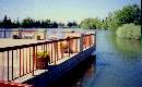
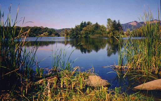
Lake Regional Park is a 320-acre Sonoma County park in the foothills
on the eastern edge of the city of Santa Rosa. Its main feature is 72-acre
Spring Lake. The lake is a popular spot for fishing and boating. It is
stocked with trout in the cooler months and has warmwater fishing year
round. Around the lake are shady picnic areas and hiking and biking trails.
Canoes, paddleboats, and mountain bikes are available for rent. All around
the lake are picnic areas, some in oak groves. There is an educational
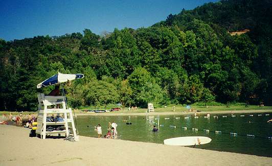
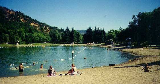
visitors center in the park. Next to the lake is a 3-acre swimming lagoon,
with lifeguards, a sandy beach, a concession stand, and showers. On the
west shore of the lake is an oak-shaded campground. The campground has
27 reservable individual sites and 1 reservable group site. It has paved
parking, picnic tables, barbecue pits, flush toilets, and hot showers.
See here for Camping
Information.
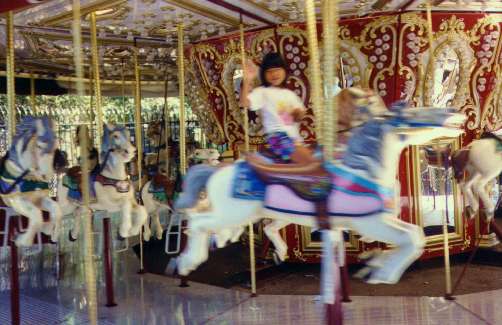
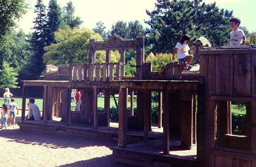
Next to Spring Lake Park is the city of Santa Rosa's Howarth Park to
the west and Annadel State Park to the east. Howarth Park is a highly-developed
city park, with a carousel, train rides, petting zoo, play areas, tennis
courts, ball fields, picnic areas, and Lake Ralphine, which offers
sailing, paddleboating, and fishing. Annadel
State Park is a huge undeveloped wildland park, with 5000 acres of
rolling hills, woods, and meadows. Elevations range from 380 to 1880 feet.
The park has 35 miles of trails. It contains Lake Ilsanjo, which is a hike-in
warmwater fishing lake. The three adjoining parks are connected by paths
and trails so it is possible to walk from the city streets of Santa Rosa,
around the park lakes, and climb the hills up into the wilderness.
Spring Lake Regional Park phone: (707) 539-8092, picnic reservations:
(707) 565-2267, camping reservations: (707) 565-CAMP (2267)
Park address: 5390 Montgomery Drive, Santa Rosa, California 95409
Campground and boat ramp: 5585 Newanga Avenue, Santa Rosa
Spring Lake Park Pictures:
(click on the thumbnails for a bigger picture, hit the Back button on your
browser to return)
 |
 |
 |
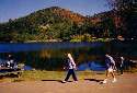
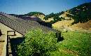
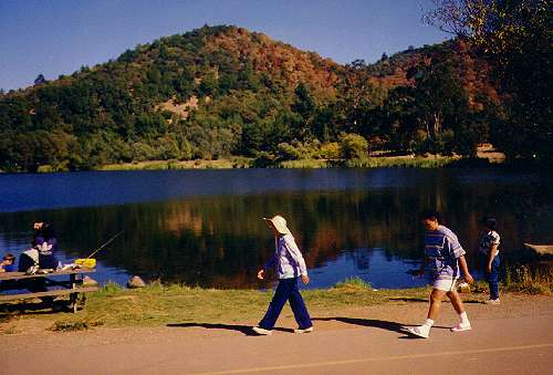
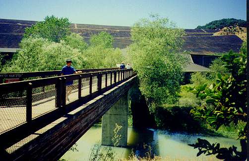
| Walking and biking path along west shore of Spring Lake (8/90) |
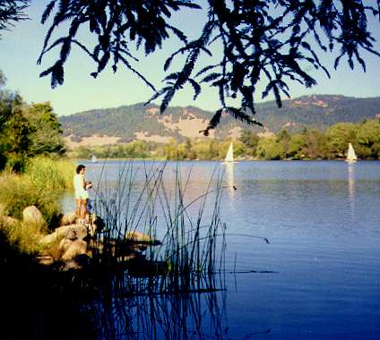
Fishing at Spring Lake (8/90) |
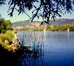
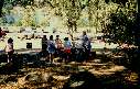
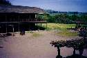
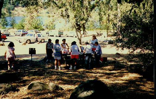
Picnic area, southeast end of Spring Lake |
 |
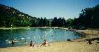 |
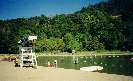
| Spring Lake Swim Lagoon (8/95) |
Looking towards south end of Swim Lagoon (8/95) |
Warnings
-
Keep an eye on small children around the lakes and ponds. Never let them
near the water alone.
-
Always wear life jackets while boating.
-
As with all hillside parks, watch out for rattlesnakes, ticks, poison oak,
and mountain lions in the hills.
-
It can get hot in the hills in the summer, so bring plenty of water when
taking long excursion on the hillside trails.
-
This is yellowjacket country, so bring yellowjacket traps when picnicking
or camping.
Howarth Park Pictures
These pictures of Howarth Park were taken in 1991. They show the features
of the park, but they may have changed in the interim: (click on
the thumbnails for a bigger picture)
 |
 |
 |
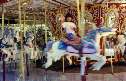
| Merry-Go-Round |
Playground |
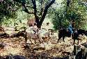
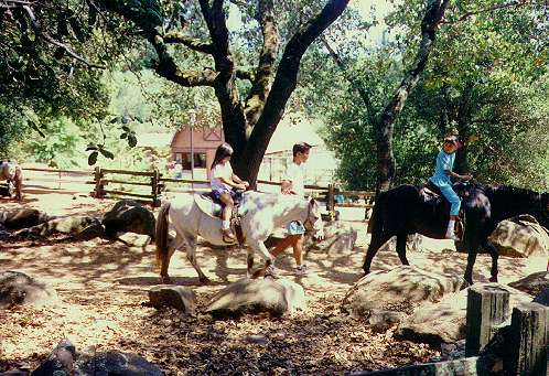
Pony Rides |
 |
 |
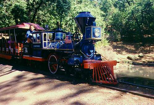
| Train Ride |
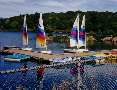
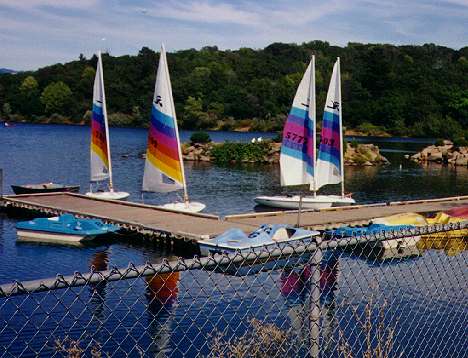
Lake Ralphine with sail and paddleboats |
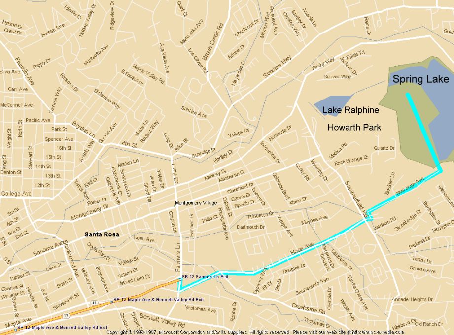
Map and Directions
Click here for a map of the area around Spring
Lake.
Directions to the Spring Lake Campground:
-
Take US 101 north to Santa Rosa
-
Take CA-12 exit towards Sebastopol/Sonoma - 0.2 miles
-
Keep right at the fork in the ramp - 0.2 miles
-
Merge on CA-12 East. 1.1 miles.
-
Take the exit - 0.2 miles.
-
Turn LEFT onto FARMERS LN/CA-12 - 0.3 miles.
-
Turn RIGHT onto HOEN AVE - 1.5 miles.
-
Turn LEFT onto NEWANGA AVE - 0.5 miles
To get to Spring Lake Park:
-
Take US 101 north to Santa Rosa
-
Take CA-12 exit towards Sebastopol/Sonoma - 0.2 miles
-
Keep right at the fork in the ramp - 0.2 miles
-
Merge on CA-12 East. 1.1 miles.
-
Take the exit - 0.2 miles.
-
Turn LEFT onto FARMERS LN/CA-12 - 1.0 miles.
-
Turn RIGHT onto SONOMA HWY/CA-12 W - 3.5 miles.
-
Turn SLIGHT RIGHT onto LOS ALAMOS RD - 0.1 miles.
-
Turn RIGHT onto MELITA RD - 0.1 miles.
-
Turn SLIGHT LEFT onto MONTGOMERY DR. 0.4 miles.
Santa Rosa and Vicinity
The city of Santa Rosa is the largest city in Sonoma County, with some
164,000 people. It is the county seat for Sonoma County. It has had
several famous residents. One was the famous horticulturist Luther Burbank,
whose home and gardens are a city park. Cartoonist Robert L. Ripley, of
Ripley's
Believe It or Not, was born in Santa Rosa. The Robert L. Ripley Memorial
Museum is housed in the "Church Built from One Tree," built from the wood
of one huge redwood tree and which was featured in one of Ripley's cartoons.
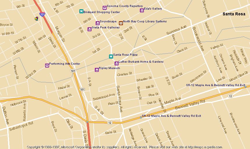
It is located downtown. (See here for a map
of downtown Santa Rosa.) Santa Rosa was also the home of the most famous
cartoonist of all, Charles Schulz, who owned the Redwood Empire Ice Arena
on Steele Lane and the neighboring Snoopy's Gallery and Gift Shop. Nearby,
the Charles M. Schulz Museum is under construction. (See here for a map
and directions.)
Santa Rosa Information:
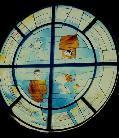
Pictures of Snoopy's Gallery (taken 1991):
 |
 |
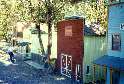
| Snoopy's Gift Shop (8/91) |
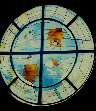
Stainglass window at Snoopy's Gift Shop (8/91) |
Sonoma County
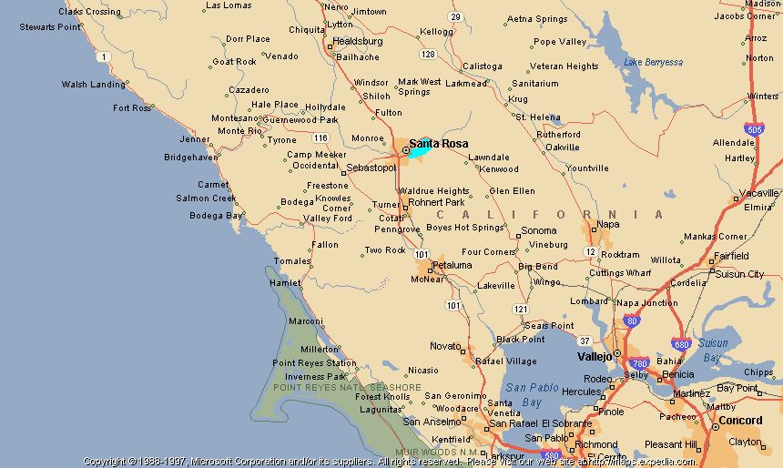
Santa Rosa is located in the heart of Sonoma
County. The county is large, covering 1604 square miles. It is most
famous as a premier wine-growing area, but it also has a scenic coastline,
redwood forests, Russian River resorts, museums, antique shops, spas, farms,
and cultural centers. (Click here for a map
of the region around Santa Rosa.) Here are some things to see in Sonoma
County, listed roughly from south to north:
-
Petaluma - The city of Petaluma
is located along the Petaluma River, which is navigable down to San Francisco
Bay. It is known for its historic downtown, with iron-front buildings,
antique shops, art galleries, restaurants and Victorians along the river.
Kayaks can be rented for paddling up the river.
-
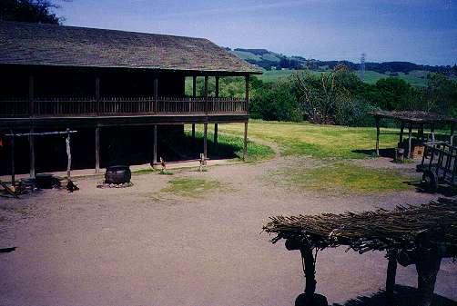
Petaluma Adobe State Historic
Park - This park east of Petaluma contains the preserved adobe
home of General Mariano Vallejo, who was at one time the commandant of
the presidio of San Francisco. The large adobe ranch building dates back
to the 1830's. Exhibits in the building and grounds give an authentic look
at the time period.
-
Bodega Bay - This scenic bay is
north of Tomales Bay, straddling the Marin-Sonoma County border. At the
north end of Bodega Bay is south-facing protected Bodega Harbor and the
small town of Bodega Bay. The calm waters of the large harbor area are
ideal for kayakking. Ocean breezes also make it good for windsurfing. The
harbor has a fleet of boats for deep-sea sportfishing and whale-watching.
The Bodega Marine Laboratory, located on Westside Road, is open to the
public on Fridays from 2 to 4 pm. It has aquariums and touch tanks.
-
Sonoma - The beautiful historic
Wine Country town of Sonoma is located in farm country at the southeast
corner of the county that shares its name. The town grew up around Mission
San Francisco de Solano de Sonoma, the last and northernmost of the
California missions, founded in 1823. The mission still remains, as does
the town's 8-acre central plaza. These together, along with other historic
buildings downtown, form Sonoma
State Historic Park. A popular place for kids, located just south of
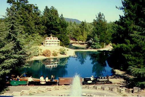
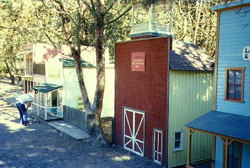
downtown, is Sonoma Traintown.
Here a miniature steam train takes visitors through a landscape of miniature
lakes, mountains, and waterfalls, crossing over bridges and running through
tunnels. It stops halfway at a miniature town and petting zoo. It has a
merry-go-round and three real cabooses that you can walk through.
-
Sonoma Mission Inn
& Spa - For those looking for the ultimate in luxurious escapes,
head two miles north of Sonoma to the town of Boyes Hot Springs. There
you'll find the historic, world-famous Sonoma Mission Inn & Spa. It
has hot mineral springs, plush rooms, and an 18-hole golf course. It offers
exotic baths, massages, facials, and body care. Rooms range from $319 to
$1200 a night. It is a romantic destination for honeymooning couples.
-
Rohnert Park - The suburban planned
community of Rohnert Park is located halfway between Petaluma and
Santa Rosa. It is known for its surrounding wineries and for Sonoma
State University. The university provides a lively cultural life for
the city.
-
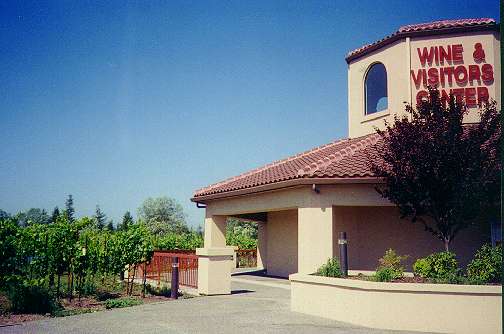
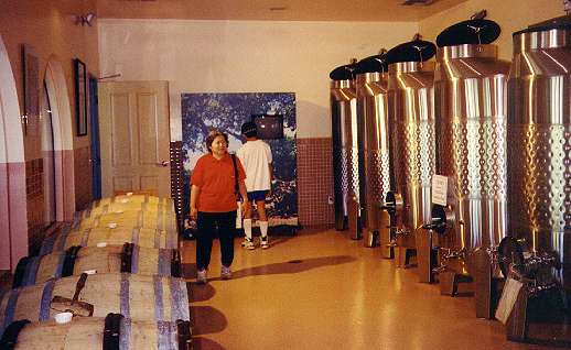
California Welcome Center
- Located at 5000 Roberts Lake Road in Rohnert Park, this visitors center
is a great place for wine lovers, but it also has educational exhibits
for kids and tourist information for visitors. It has interactive displays
on wine-making, a demonstration vineyard, a demonstration mini-winery,
a wine-tasting bar, and a wine shop featuring Sonoma County wines. It also
has maps, travel, lodging, and dining information for Sonoma County visitors.
To get there from the south, take 101N, exit at Golf Course Drive and bear
left. At first stop sign, turn right on Golf Course Drive, proceed to first
stop sign and turn left on Roberts Lake Road; turn right into the first
parking lot.
-
Sebastopol - The farm town
of Sebastopol is located on the Gravenstein Highway (116) between Rohnert
Park and Guerneville. It is a popular shopping location. The downtown area
has a colorful mix of specialty shops and bookstores. The Sebastopol
Antique Mall has 50 antique dealers. Outside of town are apple orchards,
vineyards, nurseries, Christmas tree farms, and pumpkin farms. Two annual
fairs are dedicated to its apple-growing heritage: the Gravenstein Apple
Fair and the Apple Blossom Festival.
-
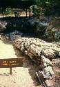
Petrified Forest - Located
30 minutes northeast of Santa Rosa, in the hills just west of Calistoga
on Petrified Forest Road, is a forest of stone redwood trees. The trees
were petrified over millions of years after they were covered by volcanic
ash from the eruption of Mt. St. Helena. The fallen stone redwood trees
range up to 8 fet in diameter. The largest is 105 feet in length, the largest
petrified tree in the world. To get here from Santa Rosa, "Drive South
on Highway 12. Just before the Saint Francis Shopping Center, make a left
turn onto Calistoga Road. Continue on Calistoga Road until it becomes Petrified
Forest Road. Continue on Petrified Forest Road. You will see the entrance
to the Petrified Forest 1/2 mile down the road on your left. The drive
from Santa Rosa to the Petrified Forest will take approximately 30 minutes."
Petrified Forest Road can be used to access the Napa Valley at Calistoga
(see below).
-
Valley of the Moon - Hwy 12 runs from Santa Rosa south through the Sonoma
Valley, romantically called the Valley of the Moon, after a Jack
London novel of the same name. The name comes from the Indian legend
that Sonoma means "many moons." The valley runs through scenic, hilly wine
country through the small towns of Kenwood, Glen Ellen, Boyes Hot Springs,
and ends at Sonoma.
-
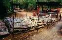
Jack London
State Historic Park - This 800-acre park preserves part of the estate
of writer Jack London. It is located in Glen Ellen, 20 minutes north of
Sonoma. It contains the "House of Happy Walls," set in a redwwod
forest and now a museum dedicated to the memory of Jack London. A short
hike leads to Jack London's grave and the huge ghostly stone ruins of Wolf
House, the author's dream house that burned down shortly after it was built.
Other trails lead to a dam, lake, and bathouse.
-
Sugarloaf Ridge
State Park - This state park, located 7 miles east of Santa Rosa, includes
2700 acres of oak woodland and chaparral, with 25 miles of trails. The
park contains th eheadwaters of Sonoma Creek, which runs through lush canyons
and meadows covered with ferns and redwoods. 2,729-foot Bald Mountain provides
panoramic views. The park also contains the Ferguson
Observatory which features telescopes, including a huge 40-inch reflector,
open to public viewing.
-
Healdsburg - The town of Healdsburg
is located along the Russian River. Hwy 101 crosses the Russian River in
Healdsburg. The town is known for its inns, antique shops, historic homes,
and river-related recreation. Veterans Memorial Beach on the river has
a long sandy swimming beach with a wading area for small children. It also
has shady picnic areas, volleyball courts, and a snack bar. Canoes and
kayaks can be rented nearby.
-
Russian River - The Russian River
passes through or near the Sonoma County towns of Cloverdale, Geyserville,
Healdsburg, Rio Nido, Guerneville, Monte Rio, Duncan Mills, and enters
the Pacific Ocean at Jenner. At its upper end, it runs through broad agricultural
valleys in the heart of wine country. As it turns towards the ocean, it
runs through narrower, steeper valleys covered with redwood forests. The
Russian River area is popular for canoeing, hiking, swimming, and fishing.
Armstrong
Redwoods State Reserve has giant redwood trees.
-
Sonoma Coast
State Beach - This is a series of small beaches that stretch along
the coast for 17 miles from Bodega Head to 4 miles north of the Russian
River. Hwy 1 runs right along the coast for this stretch, providing easy
access to the beaches. The rugged, rocky, scenic beaches are popular places
for fishing, beachcombing, sunbathing, picnicking, and surfing, but
not swimming.
-
Fort Ross
State Historic Park - This state park, located on a beautiful coastal
bluff 12 miles north of the Russian River, features a restored Russian
fort. The site dates back to 1812, when Russian fur trappers and traders
established an outpost here. The Russians occupied the site until 1841,
leaving after sea otters became scarce. The fort and its buildings were
made of redwood, but the buildings seen today are all reconstructions.
There is a chapel, stockade, and other buildings, including a visitor center
and bookstore. The parks docents provide guided tours, demonstrations,
and talks on the fort's history. Nearby are sandy beaches and tide pools.
Inland is an historic orchard.
-
Salt Point
State Park, Kruse
Rhododendron State Reserve - These two parks are located 20 miles north
of the Russian River on Hwy 1. Salt Point State Park runs for 6 miles along
the rocky coast. It is a popular place for abalone hunting, diving, fishing,
mushroom hunting, hiking, mountain biking, and horseback riding. Kruse
Rhododendron is a 317-acre reserve with 5 miles of hiking trails through
beautiful rhododendron groves and redwood forests. The rhododendrons bloom
in May.
-
Lake Sonoma and
the Warm Springs Dam Hatchery - Warm Springs Dam was built in 1983 in the
hills behind Geyserville, west of Hwy 101. The dam created Lake Sonoma,
which has a capacity of 380,000 acre-feet, 2,700 surface acres, and extends
for 9 miles on Dry Creek and 4 miles on Warm Springs Creek. The lake offers
camping, boating, fishing, water skiing, picnicking, hiking, and mountain
biking. At the base of Warm Springs Dam is the visitors center and fish
hatchery. The visitors center has exhibits on the dam and the history of
the valley. The hatchery has exhibits on salmon and steelhead, which are
raised in the hatchery.
Napa Valley
While the Napa Valley is in Napa County, it is a short drive away from
Santa Rosa. The Napa Valley is the most famous wine-growing area in America
and produces some of the best wines in the world. Wine-tasting at its many
wineries is its most popular tourist attraction. However, the Napa Valley
as other things to offer:
-
Calistoga - If you're travelling
from Santa Rosa to visit the Petrified Forest, continue east for 6 miles
on Petrified Forest Road to the resort town of Calistoga. It is famous
for its hot springs and spas.
-
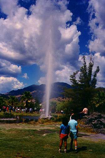
Just north of Calistoga, in the shadow of volcanic Mt. St. Helena, is an
example of the area's geothermal activity: the Old
Faithful Geyser. The geyser shoots a jet of 350-degree water 6 stories
into the air at regular intervals, averaging 30 minutes. It is located
at 1299 Tubbs Lane, east off Hwy 128.
-
Sharpsteen Museum and Brannan
Cottage - In the town of Calistoga is a museum that was started by
Ben Sharpsteen, one of the chief animators for Disney's early cartoons.
While the museum has memorabilia and cartoons from the Disney days, its
main focus is a series of meticulously-detailed 3-dimensional dioramas
depicting life around Calistoga and the Napa Valley in the 1860's. The
Sam Brannan Cottage is a remnant of the elegant cottages that were present
in Sam Brannan's Calistoga Hot Springs Resort in the 1860's. It is opulently
furnished with antiques from that era. Robert Louis Stevenson and his wife
stayed in the cabin in 1880.
-
Robert Louis
Stevenson State Park - Located 7 miles north of Calistoga on winding
Hwy 29 this rugged, mountainous state park is where the famous author and
poet spent his honeymoon. Trails lead through cool evergreen forests and
hot chaparral-covered slopes. A trail leads to the top of volcanic Mt.
St. Helena, which has views that can go all the way to Mt. Shasta.
-
Bothe-Napa Valley
State Park - located 4 miles south of Calistoga on Hwy 128, this state
park is a good place to go to cool off. It has a swimming pool and trails
through shady forests. The park covers 1800 acres, with elevations ranging
from 300 to 2000 feet. In the cooler valleys are stands of redwoods, the
inland-most coast redwoods in California. The park has over 10 miles of
trails for hiking and horseback riding. (See here for trail
descriptions.) It has picnic areas and a campground.
-
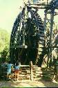
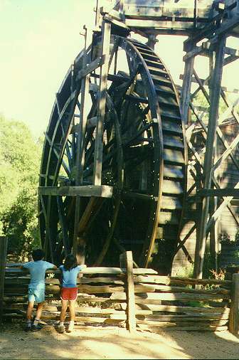
Bale Grist Mill
State Historic Park - Located just south of Bothe-Napa Valley State
Park, this historic site features a working water-powered grist mill. The
mill is powered by a 36-foot high wooden waterwheel. Water is carried from
nearby Mill Creek on a flume to the top of the waterwheel. Inside the mill
building are huge grinding stones used to grind grain into flour.
Pictures of Sonoma and Napa County Attractions
Pictures from South Sonoma County and the Sonoma Valley:
 |
 |
 |
| Petaluma Adobe (4/93) |
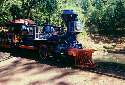
Train and lakes at Traintown Sonoma (8/89) |
Little town at Traintown Sonoma (8/89) |
 |
 |
| House of Happy Walls, Jack London State Park (4/93) |
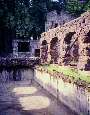
Wolf House, Jack London SP (4/93) |
Pictures of the Russian River Area:
 |
 |
 |
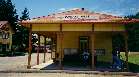
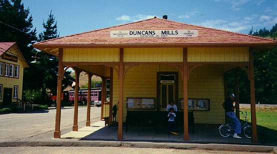
| Duncans Mills Station (8/90) |
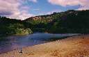
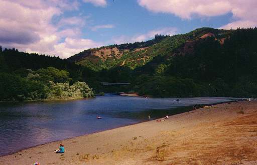
Beach at Casini Ranch campground (8/90) |
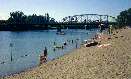
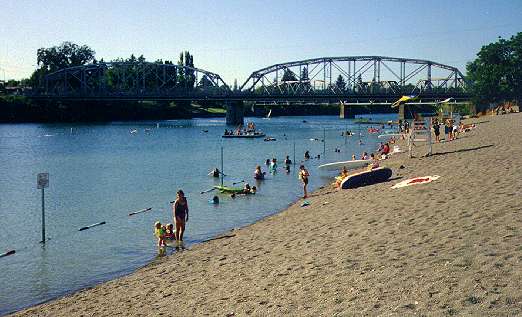
Veterans Memorial Beach, Healdsburg (7/92) |
Pictures of Lake Sonoma:
 |
 |
 |
 |
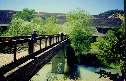
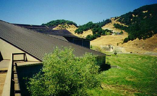
| Walkway to Warm Springs Dam Hatchery (8/95) |
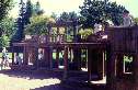
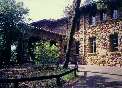
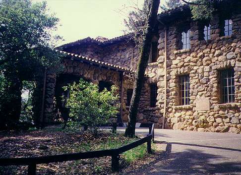
Warm Springs Dam Hatchery and Visitors Center building |
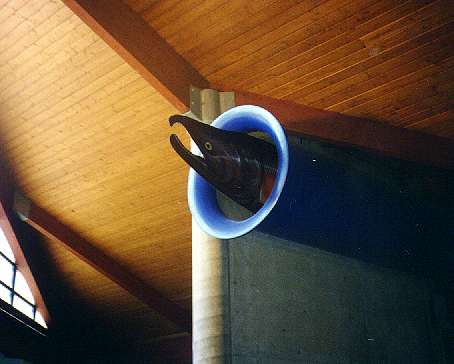
Giant salmon model in visitors center |
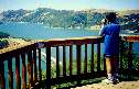
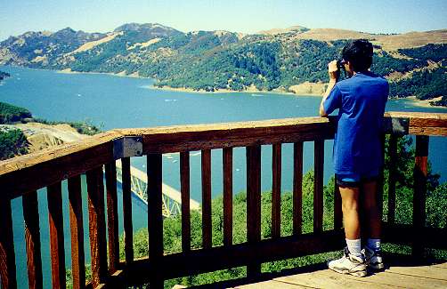
View of Lake Sonoma from overlook |
Pictures of the California Welcome Center, Rhonert Park:
 |
 |
 |
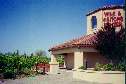
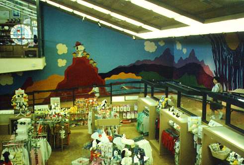
| Wine & Visitors Center (now the California Welcome Center) (8/95) |
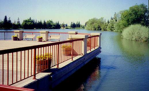
Deck and pond behind the center |
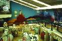
Display on winemaking in center |
Pictures from the Calistoga Area:
 |
 |
 |
 |
| The Giant Tree at the Petrified Forest |
Another huge petrified giant redwood |
The Old Faithful Geyser of California in Calistoga |
The Bale Grist Mill, near St. Helena |
Links
Bay Area Backroads Stories
and Videos on Santa Rosa and Vicinity:
Regional Information:
Other Travel and Recreation Links:
Created 5/23/2001 by Ronald
Horii
|


