Links:
Guadalupe River Park and Gardens:
Part 1: Central - Coleman Road to the Arena Green
Part 2: South - Santa Clara Street to I-280
Part 3: North - Guadalupe Gardens to I-880
The Guadalupe River Trail: I-880 to Hwy 101
The Guadalupe River Trail: Hwy 101 to Alviso
Los Alamitos Creek Trail
San Jose Parks
Guadalupe River Trail
Guadalupe Creek Trail
Bay Area Biking
Bay Trail
Bay Area Parks
Bay Area Back Pages
SF Bay Rec & Travel
The Guadalupe River Trail
Hwy 101 to Alviso
North of 101, both banks of the Guadalupe River Trail are open to public access all the way to Alviso. After 101, the trail passes under 4 bridges: Trimble Road, Montague Expressway, Tasman Drive, and Highway 237. It ends at the Gold Street bridge in Alviso. From Trimble Road to Highway 237, the west bank river trail is in the city of Santa Clara. The east bank is entirely in San Jose, including Alviso, which is part of San Jose. The bridges provide access points to the trail and ways to get from one bank to the other. (See maps: Lower Guadalupe River Trail South: Montague Expressway to Hwy 880, Lower Guadalupe River Trail North: Gold Street to Montague Expressway.) Here are the approximate mileages:
- 1.7 miles: Hwy 101 to Montague Expressway.
- 1.6 miles: Montague Expressway to Tasman Drive.
- 0.7 miles: Tasman Drive to Hwy 237.
- 0.6 miles: Hwy 237 to
Gold Street
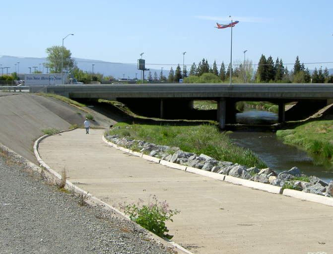
This
is the north side of the Highway 101 under-crossing from the Guadalupe
River Trail, looking south towards Mineta San Jose International
Airport. The undercrossing and trail south on the east bank is now
open, all the way to the Guadalupe River Park and Gardens (see Guadalupe River Trail: I-880 to Hwy 101).
There is no undercrossing on the west bank.
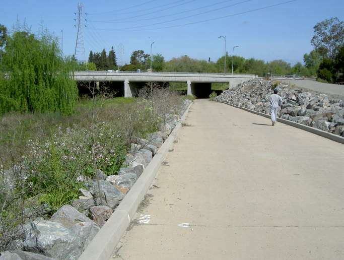
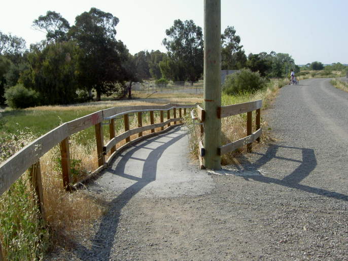
This
is the east bank trail at Trimble Road. There are trail entrances on
the road. You can use the bridge to reach the trail on the opposite
bank of the river. A paved ramp goes under the bridge.
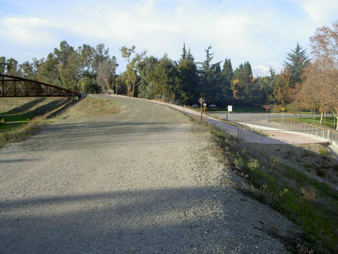
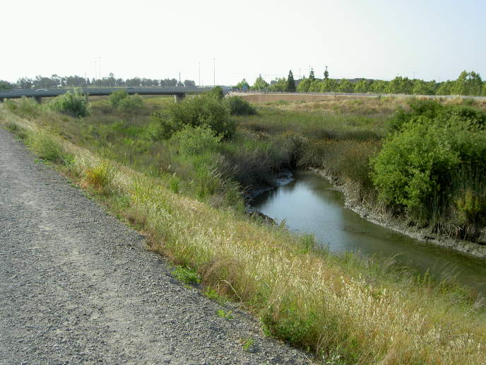
North of Trimble, the trail splits. The
wider gravel levee trail runs on top of the levee. A lower trail runs
close to the river. (Note: new signs now warn to stay on the upper
levee trail, implying that the lower trails are closed.) A line of
trees blocks the view of the west bank.
Ahead is the Montague Expressway. You can go under the bridge or cross
over to reach the west bank.
This
is a view of the Montague Expressway Bridge, looking south from the
west bank trail. The undercrossings on both sides of the river are
paved.
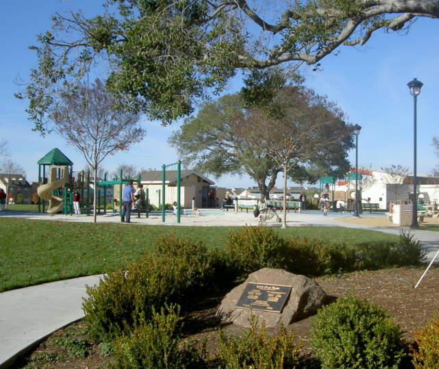
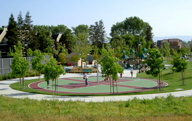
Two
blocks west at Montague and
Rivermark Plaza is the Rivermark
Village shopping center and Live
Oak Park (above). The shopping center has restaurants and
stores. The park has playing fields, a playground, restroom, water, and
picnic tables.

A
short distance up the trail is the long River Oaks pedestrian bridge.
The area west
of the river, which is in Santa Clara, is residential. The area east of
the river, in San Jose, is industrial.
The
bridge on the east side leads to
a pedestrian ramp to River Oaks Place next to VTA headquarters. The VTA Light Rail
runs
along N. 1st Street, which is a block east of the trail at this point.
The River Oaks station is here.
This is a view at the east end of the bridge, looking north along the unpaved east bank of the trail.

At the east end of the bridge, the trail is paved for a short distance, where it runs behind residences.
The west bank trail turns back into gravel, and a ramp leads down to a lower trail at river level.
The
trail passes by Santa Clara's Thamien
Park on Lick Mill Blvd. The
park has a tennis court, basketball courts, playgrounds, and lawn areas.
A large open space area appears, with a
ramp leading down to it. This is Santa Clara's Ulistac
Natural Area.
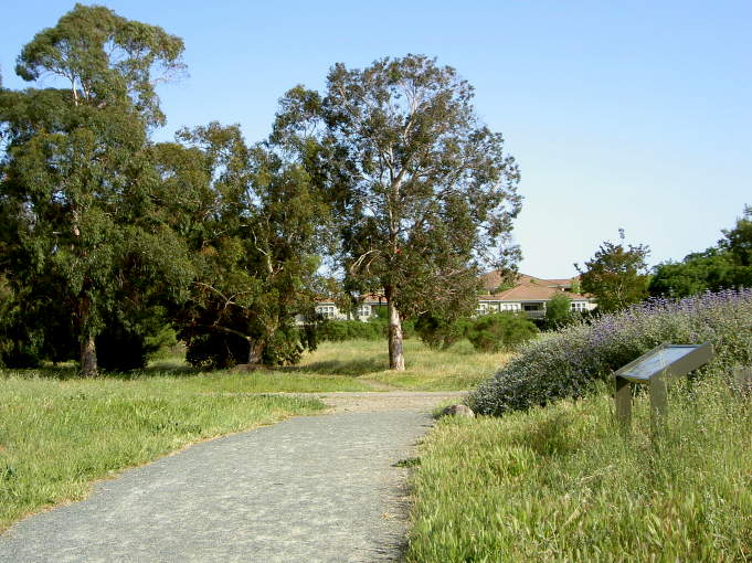
Named
after an Ohlone Indian chief, Ulistac is a 40-acre open space preserve
consisting of grasslands, woodlands, wetlands, and a butterly and
hummingbird garden (on the right above).
The
Ulistac site was used as a campsite by the Ohlone Indians. Later, it
was used for grazing and farming. From 1961 to 1988, it was part of a
golf course. Now it is being restored to a natural state.
A
ramp near the north end of Ulistac leads back up to the Guadalupe River
Trail. The trail goes up to and under the Tasman Drive Bridge. Tasman
Drive can be taken west to the Santa Clara Golf and Tennis
Club, the
Santa
Clara Youth Soccer Park, the San Francisco 49'ers
Headquarters and practice
fields, the Great
America theme park, the Santa
Clara Convention Center, and the San
Tomas Aquino Creek Trail. Tasman Drive can be taken east to reach
the Coyote
Creek Trail. The VTA
Light Rail runs on Tasman Drive. The nearest station to the
west is Lick Mill. The nearest station to the east is Champion. Tasman
goes high over Lafayette on a bridge. From the bridge, stairs lead down
to the Santa Clara/Great America Amtrak/ACE
Train station below.
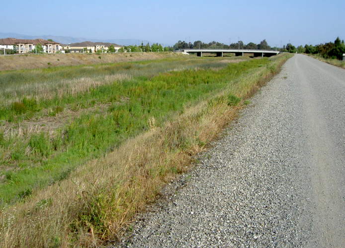
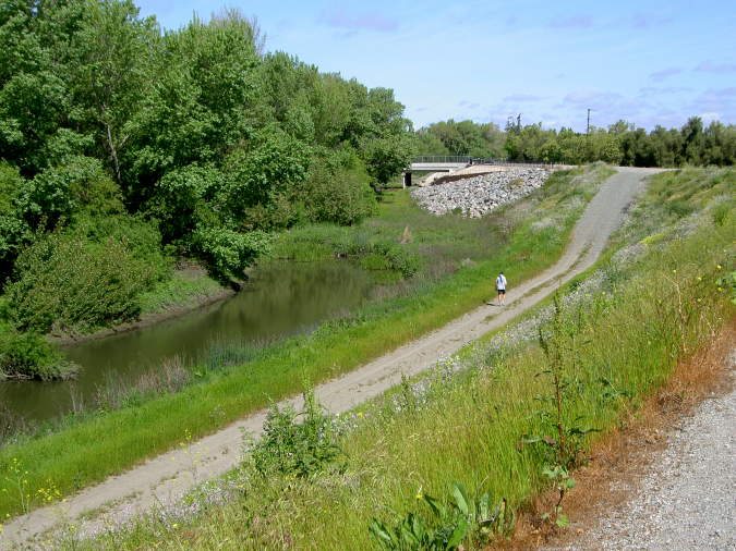
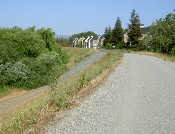
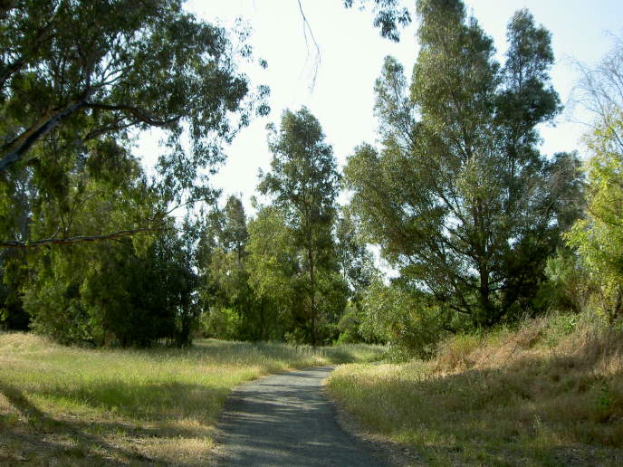
Between
Tasman Drive and Hwy 237, the trail is a long, wide straightaway. On
the east side, it runs above residences. On the west side, it run below
the Santa Clara Golf and Tennis Club golf course. Above is the west
side trail, looking back towards Tasman Drive.
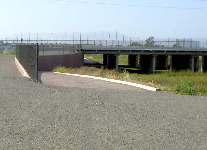
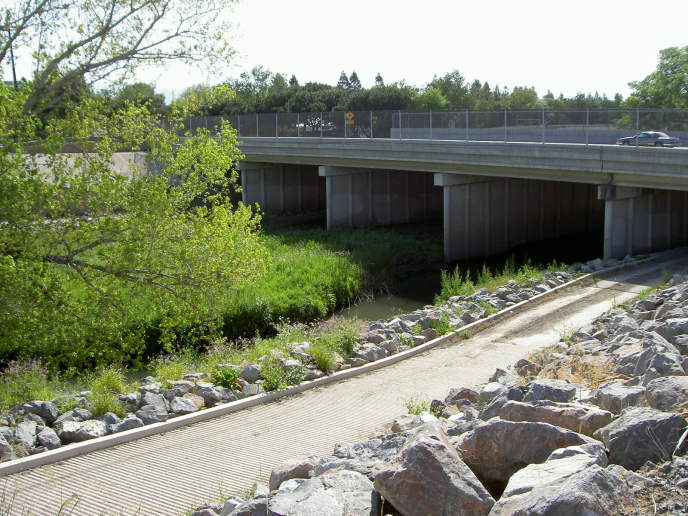
At
the Hwy 237 bridge, you can either continue on the trail under the
highway, or take the Hwy 237 bikeway. The bikeway leads west to Lafayette
Street or east to N. 1st Street. Lafayette Street can be taken to reach
the Bay Trail or Alviso.
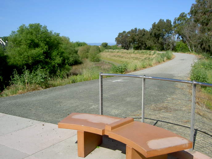
This is the west bank trailhead at the Gold Street Bridge in Alviso. There is a similar trailhead on the east bank.
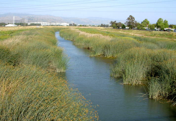
This
is a view of the river from the Gold Street Bridge. Note the driving
range on the east side.

On
the other side of the bridge, a
trail leads up to the railroad tracks, but there is no rail crossing as
of yet. You can walk across the tracks or carry your bike over it, but
beware. These are busy tracks. Freight and Passenger trains, including
the ACE Train, use them all day long. Do not walk along the railroad
bridge, as trains can appear suddenly. There are plans to provide a
safe railroad crossing. Past here, the Guadalupe River becomes the
Alviso Slough. Orignally, the Guadalupe River flowed into the Guadalupe
Slough, which is west of here in the Sunnyvale Baylands. Around the
turn of the century, the river was re-routed to the Alviso Slough, then
called Steamboat Slough.
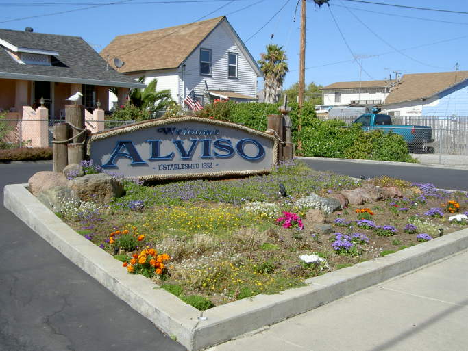
You
can take Gold Street to reach the historic community of Alviso. It was
once a small town and a bustling seaport, but it became part of San
Jose.in 1968. It is San Jose's only access to the Bay.
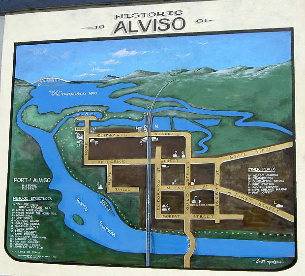
Painted on one
of the buildings on Gold and Taylor Streets is a map showing some
of the historic structures in Alviso and other points of interest.
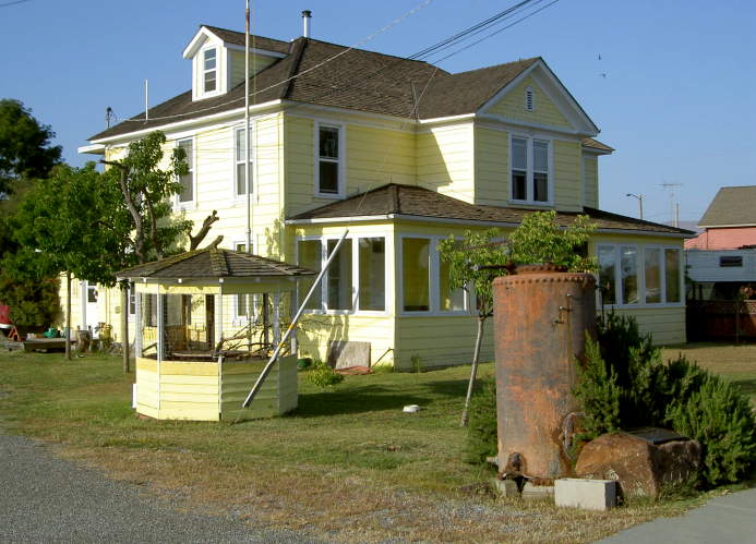
Alviso
is known for its
historic buildings. Above is the La
Montagne Boarding House, originally
built in the 1890's.
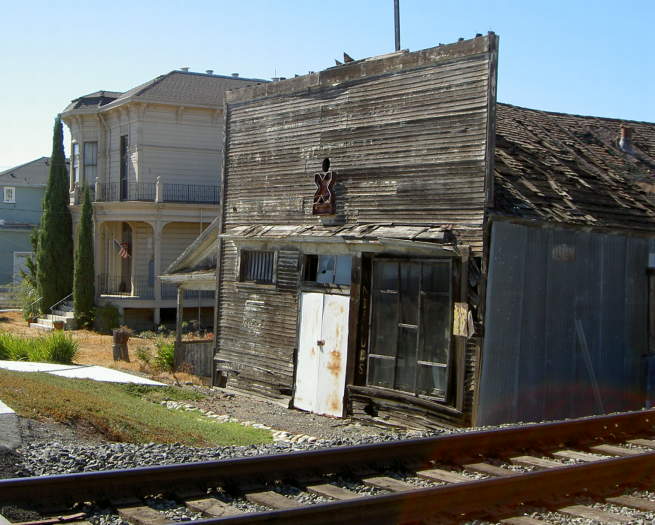
Above is the Laine Residence (left) and Laine Grocery Store (right)
There
is a path on the Alviso
Slough Levee, with benches and signs. The building above is the South
Bay Yacht Club.

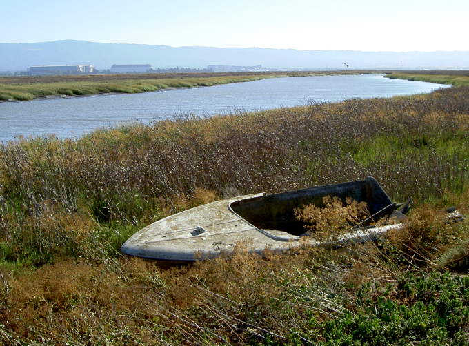
The Alviso Slough is an active port, though some boats have been adandoned.
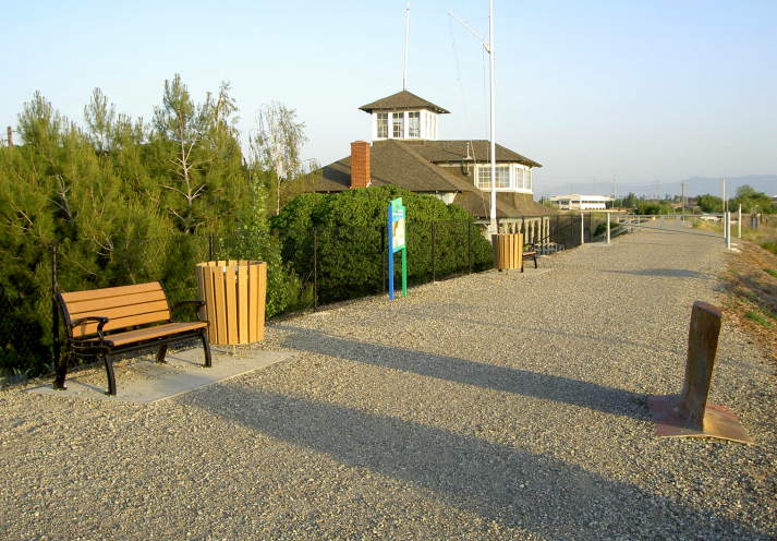
Alviso
Marina County Park is at the end of Hope Street. The marina was
originally built by the county in 1968, but it became too expensive to
keep it clear of sediment. In the 1980's, it was abandoned and allowed
to be filled with sediment and bulrushes. The marina has been
tranformed into a staging and interpretive area. The marina's docks
have recently been turned into boardwalks and viewing platforms, with
interpretive signs. There is a large parking lot, restroom, drinking
fountain, benches, and picnic tables here, making it a good staging
area for exploring the trails.
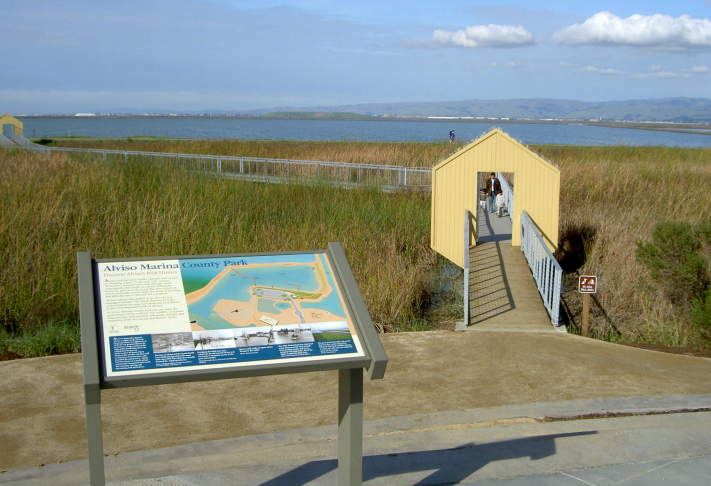
Outside
the Marina, the Alviso Slough Loop Trail begins. The trails are open to
hikers and bikers. Dogs and horses are not allowed. This is part of the
Don Edwards San Francisco
Bay National Wildlife Refuge and is
administered by the US Fish & Wildlife Service. The slough trails
are part of the Bay
Trail and the De Anza National
Trail. To follow the
Alviso Slough, take the trail to the left.
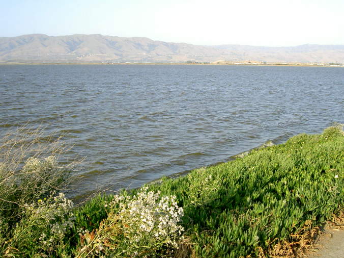
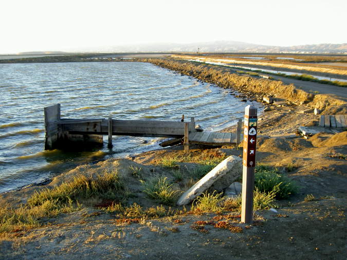
The salt ponds here are enormous. The outer trail around the periphery of the salt ponds is 9 miles long.
The
trail follows the Alviso Slough. In the distance, you can see the
hangars at Moffett Field. Abandoned boats can be seen along the banks.
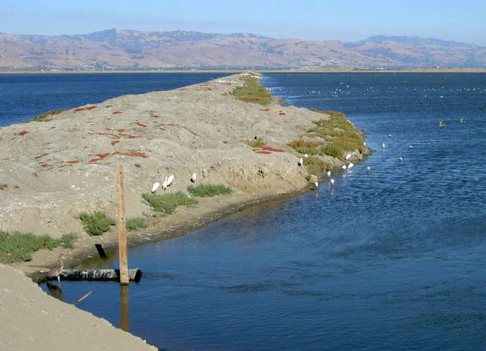
The
salt ponds, sloughs, and marshes are havens for wildlife, particularly
waterfowl. There are several rough levees that are closed to public
access, as well as small islands. These become favorite nesting and
resting spots for birds.

After
4 miles from the marina, just past a salt pond inlet structure, the
Alviso Slough ends as it joins up with the Coyote River. At that point,
the trail turns to the right and follows the Coyote River. You can
backtrack to the marina or continue around the loop for another 5
miles. Partway down the east side of the loop, a train crossing
leads to the 5.5 mile Mallard Slough Loop, which follows Coyote Creek,
Mallard Slough, and New Chicago Marsh. It also leads to the Alviso
Environmental Education Center.
For more information on the trails in Alviso, see the Bay Trail guided photo tours for Alviso: Town and Slough and Alviso: Mallard Slough and Environmental Education Center.
From the end of the Guadalupe River Trail at Gold Street, if you turn left and follow Gold Street south, you'll come to the entrance of the Bay Trail, next to the Hwy 237 on-ramp. This leads to the Sunnyvale Baylands. The Bay Trail in Sunnyvale runs along the salt ponds and water treatment ponds all the way to the edge of Moffett Field. Future plans call for connecting the trail to the Stevens Creek Trail in Mountain View. From here the Bay Trail runs to Shoreline Park, the Palo Alto Baylands, and Ravenswood Open Space Preserve. So the Guadalupe River Trail can take trail users from downtown San Jose into the enormous Bay Trail network, which when completed, will run for 400 miles around the Bay.
Created by Ronald Horii, 8/13/07, updated 1/21/08