|
No sé cuando comencé a coleccionar MAPAS, simplemente los juntaba. Un día por 1992 decidí especializarme en mapas oficiales de carreteras de EU y Canadá, pues cada estado y provincia edita el suyo cada año junto con su guía turística. Así comencé 2 colecciones al mismo tiempo: mapas oficiales de carreteras y guías turísticas oficiales. Pocos estados de México editan guías turísticas y ninguno tiene su mapa oficial. Al igual que con las placas, descubrí en Internet otros fanáticos y coleccionistas. Incluso encontré sitios relacionados muy interesantes: 1- Boundary Point, Punto Fronterizo. Club de gente interesada en fronteras. Coleccionan información y fotos de fronteras políticas, mojoneras, de ellos mismos parados con un pie a cada lado de alguna frontera, y de puntos múltiples (donde convergen tres o más estados o países). Incluso hay fotos de un hotel construido sobre la frontera franco-suiza con camas puestas en la línea divisoria, así que tú puedes dormir en Francia mientras tu esposa duerme en Suiza! 2- Degree Confluence Project, Proyecto Confluencia de Grados. ¿Cómo es el lugar donde se cruzan meridianos y paralelos? Aquí está la respuesta. Sé el primero en ir a donde se cruzan un paralelo y un meridiano, toma fotos y descríbelo. Prueba que estuviste ahí con un aparato GPS (Sistema de Posicionamiento Global) y tómale una foto cuando indique que estás en el cruce elegido. Muchos puntos de convergencia están en lugares deshabitados y aún no explorados. Hay uno en México que está en una cancha rural de fútbol! 3- Flags of the World, Banderas del Mundo. Imágenes, historia y descripción de banderas de todas las naciones, estados, provincias y otras subdivisiones. También enseñas navales, de fuerzas aéreas y escudos de armas. Hay muchos sitios sobre mapas, tantos que resulta largo ennumerarlos. Si también coleccionas mapas quizá podamos hacer algún intercambio. Tú dices...
Hasta la vista! |
|
I don't know when I started to collect MAPS, I just gathered them. Someday in 1992 I decided to specialize in official highway maps of the US and Canada as every state and province issues its own with its tourist guide. So I started 2 collections at the same time: official highway maps and official tourist guides. Few states in Mexico issue tourist guides and none has its official highway map. As with plates, I discovered in Internet other fans and collectors. I even found very interesting related sites: 1- Boundary Point. Club with people interested in borders. They collect information and pictures on political borders, markers, themselves standing with one foot at each side on some boundary, and on multiple points (where 3 or more states or countries meet). There also is a picture of a hotel in the French-Suisse boundary with beds over the dividing line, so you can sleep in France while your wife sleeps in Switzerland! 2- Degree Confluence Project. How is the place where meridians and the parallels meet? Here is the answer. Be the first to go where a parallel and a meridian meet, take pictures and describe it. Prove you were there with a GPS (Global Positioning System) device and take pictures of it when it shows you are in the chosen place. Most of all points of convergence are in uninhabited places and are not yet explored. There is one in Mexico that is in a rural soccer field! 3- Flags ot the World. Images, history and description of flags from all nations, states, provinces and other subdivisions. Also naval and air force ensigns and coats of arms. There are lots of sites about maps, so many it is very long to ennumerate them all. If you collect maps too, maybe we could do a trade. It's up to you...
So long! |
|
|
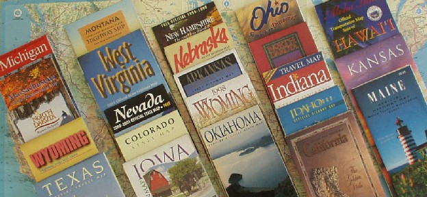
Algunos
mapas de EU de mi colección (81 Kbs) Some US maps from my collection (81 Kbs) |
|
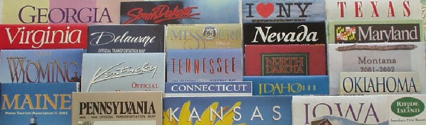
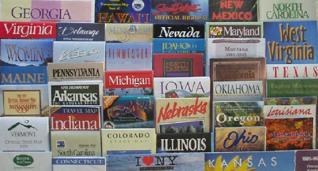
Más
mapas (91 Kbs) More maps (91 Kbs) |
|
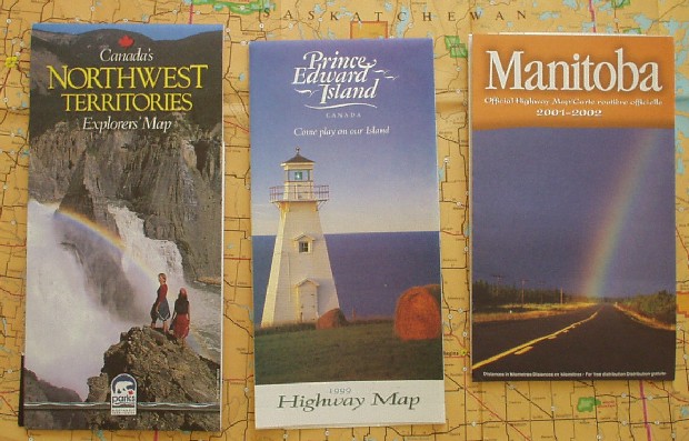
Mapas
de Canadá (83 Kbs) Canada maps (83 Kbs)
|
|
|
Ciudad
de Querétaro, GIF hecho por mi (25 Kbs),
© 2000 Raúl Conde Queretaro City, GIF made by me (25 Kbs), © 2000 Raúl Conde |
|
|
|
© 2002 Raúl Conde |
Actualizado
/ Updated 21 August 2002 |
Óptimo
con / Best with |