 Looking back, it was exactly 4:26 p.m. on Monday, 16 July 1990, that a killer earthquake
unexpectedly hit and extensively devastated the City of Baguio. As reported, the powerful
temblor measured 7.7 in the open-ended Richter scale and lasted for 45 seconds. It was said
to be the most destructive earthquake on record within the Cordillera Region. There were
numerous aftershocks that followed and the strongest, which occured at 3:15 a.m. of July 18,
lasted for eight seconds ... and measured 5.3 on the Richer scale.
Looking back, it was exactly 4:26 p.m. on Monday, 16 July 1990, that a killer earthquake
unexpectedly hit and extensively devastated the City of Baguio. As reported, the powerful
temblor measured 7.7 in the open-ended Richter scale and lasted for 45 seconds. It was said
to be the most destructive earthquake on record within the Cordillera Region. There were
numerous aftershocks that followed and the strongest, which occured at 3:15 a.m. of July 18,
lasted for eight seconds ... and measured 5.3 on the Richer scale.
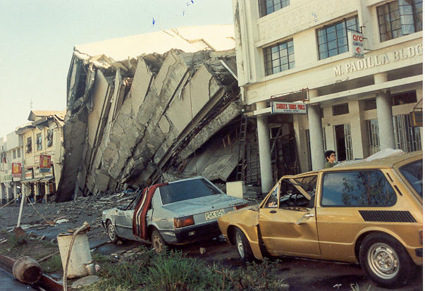
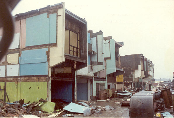
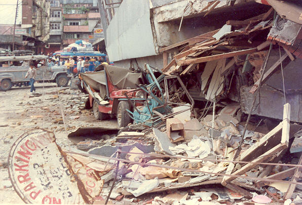
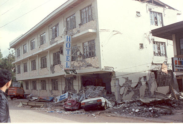
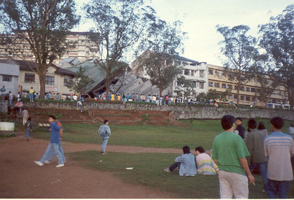
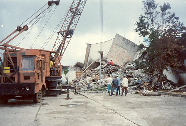
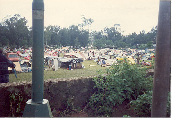
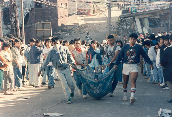
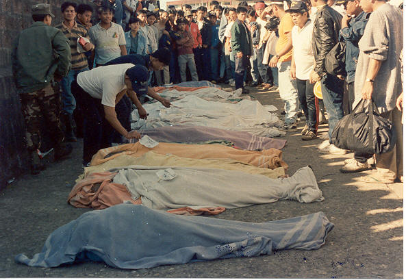
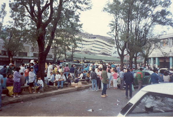
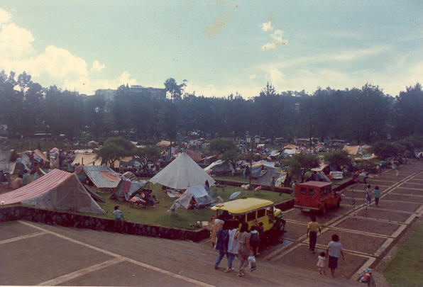
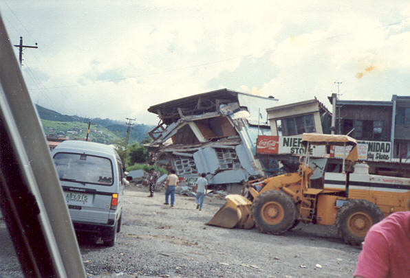
Fearing for their lives, many of Baguio's 120,000 people slept outdoors on Monday night. The city suffered the most in terms of destruction to properties and numerous deaths. Many commercial and government buildings, hotels, inns, and residences were heavily damaged. The death toll continued to rise as rescuers pulled more bodies from the rubbles. It was estimated that as many as 1,000 people were trapped and killed in damaged buildings.
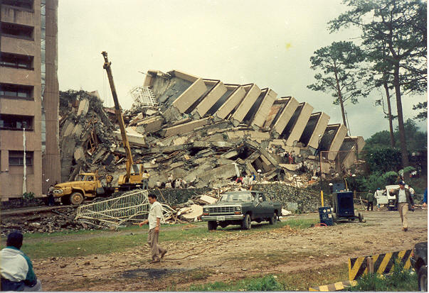
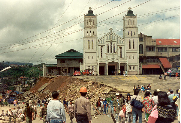
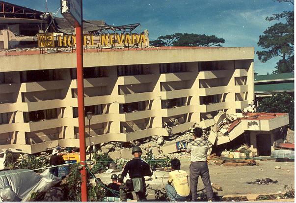
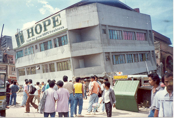
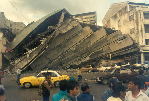
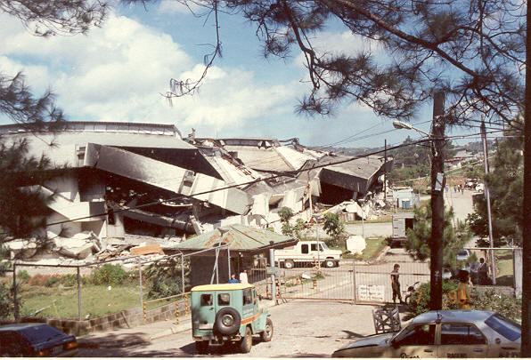
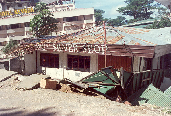
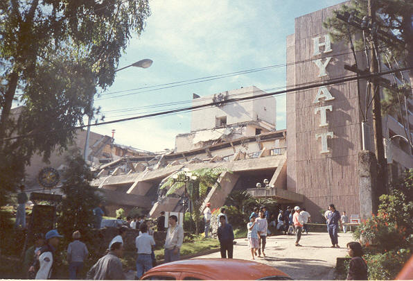
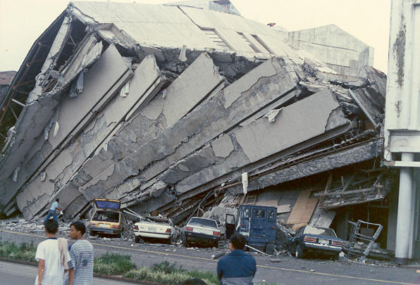
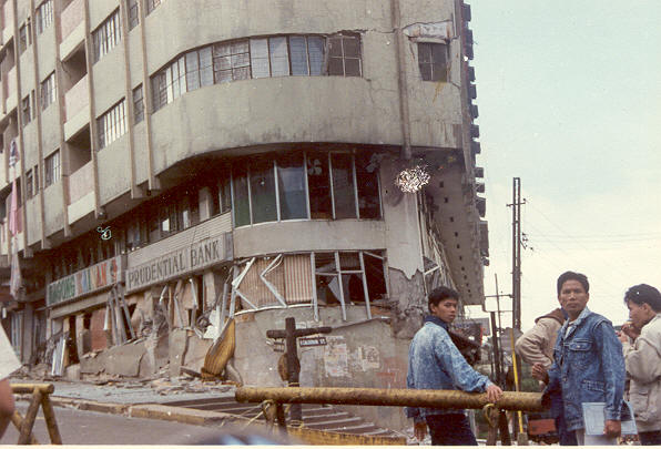
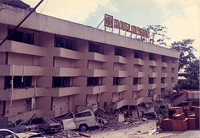
The five-star Hyatt Terraces Plaza sustained the worst damage when its terraced front collapsed onto the lobby area, killing about 50 people. The Baguio Park Hotel along Harrison Road was a total wreck. The luxurious Nevada Hotel which is located right across from the main gate of Camp John Hay was ripped in half by the quake, leaving a huge gash in the middle of the structure. The Saint Vincent Catholic Church along Naguilian Road was spared by the strong quake, however a portion of its retaining wall and parking area was damaged and collapsed to the road below. The church, which has withstood typhoons, bombings during the 2nd World War, and other disasters, suffered only minor damage.
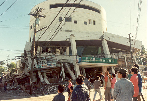
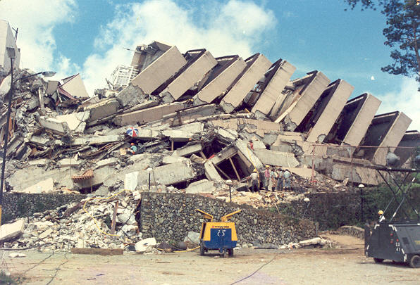
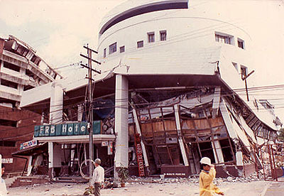
At the University of Baguio (UB), it was initially reported that 23 people, mostly students,
were killed when the supporting structure of the commerce building gave way. Nearby the FRB
Building also crumbled to the ground. The FRB building and UB are both owned by Fernando
Bautista, Sr. and his family. The Philippine Military Academy at Fort Del Pilar was also one of
the worst hit portions in the city. The parade ground mushroomed into a tent city where cadets
pitched tents after their barracks was destroyed. There were many other buildings and familiar
landmarks of Baguio which were damaged and classified as hazards.
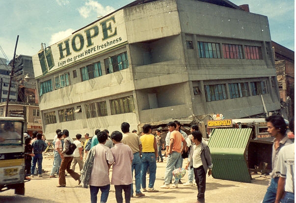
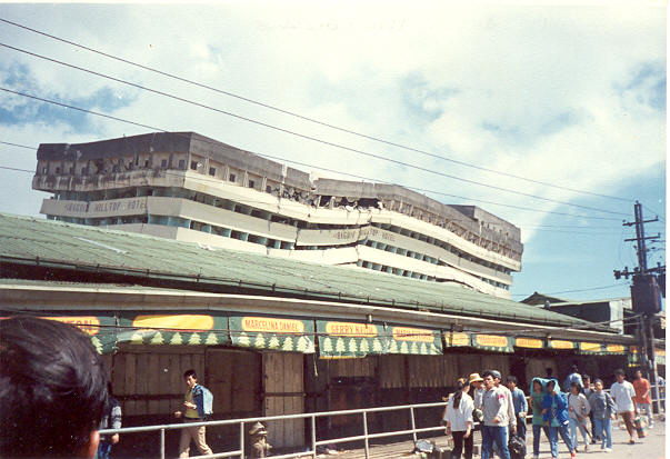
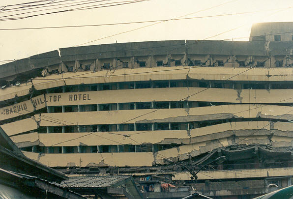
 These included the Skyworld Condominium and Commercial Center along Session Road, The Royal
Inn at Magsaysay Avenue, and the controversial Baguio Hilltop Hotel which was constructed on
a hill behind the Baguio Public Market. Because of the extensive devastation, Baguio City was
described to be a virtual "war zone." Also, it was running low on water, fuel, food, and other
miscellaneous basic necessities to include much-needed medicines for the injured and sick people.
These included the Skyworld Condominium and Commercial Center along Session Road, The Royal
Inn at Magsaysay Avenue, and the controversial Baguio Hilltop Hotel which was constructed on
a hill behind the Baguio Public Market. Because of the extensive devastation, Baguio City was
described to be a virtual "war zone." Also, it was running low on water, fuel, food, and other
miscellaneous basic necessities to include much-needed medicines for the injured and sick people.
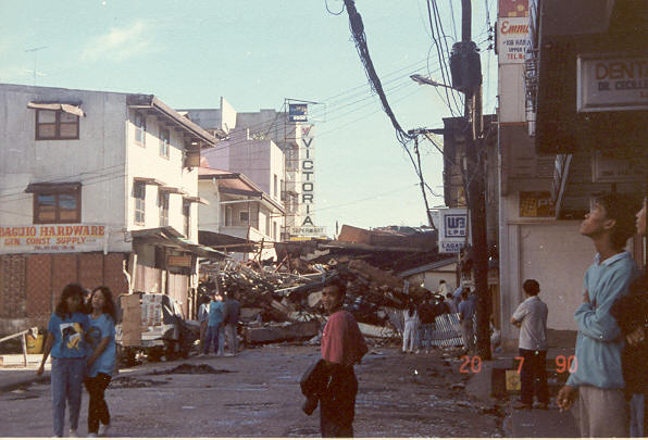
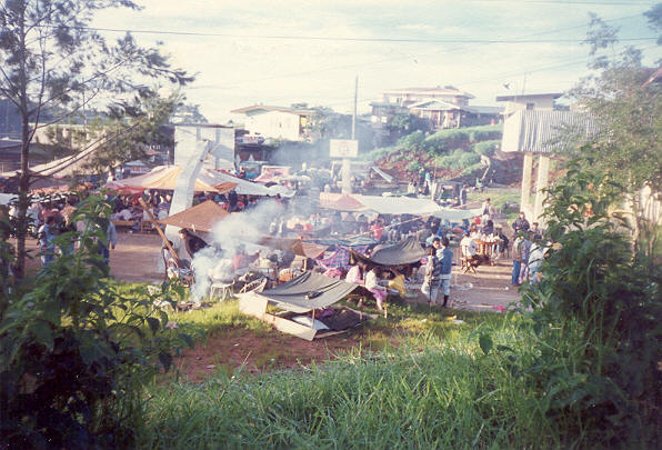
Rescue crews and relief supplies began to trickle into Baguio as hope faded for hundreds of people believed trapped under collapsed buildings as a result of Monday's earthquake. Thousands of residents of the city huddled in tattered tents and makeshift shelters in parks and streets. Drenched by daily rains, many complained that they had no food, water or medicine. Doctors working under umbrellas and sheets of plastic had treated nearly 800 of the injured. The city's three hospitals were all damaged and without power. Aftershocks continued throughout the day. Without electric power, rescue work at the Hyatt Terraces and Nevada hotels stopped as daylight faded. Almost no rescue operations were evident at the 20 other hotels and at schools, office buildings and factories.
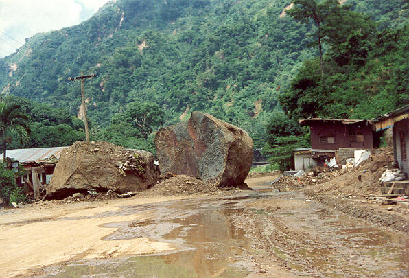
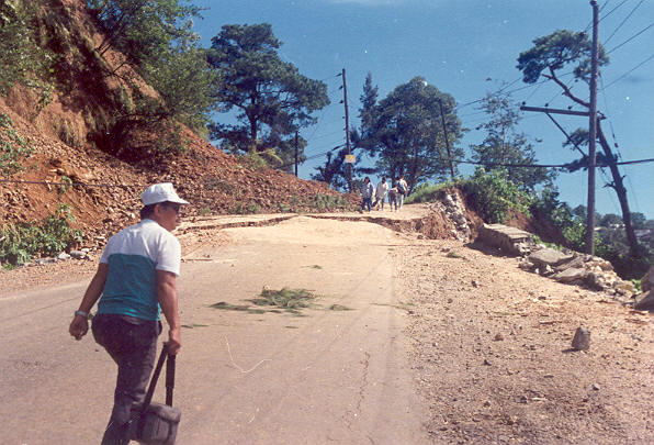
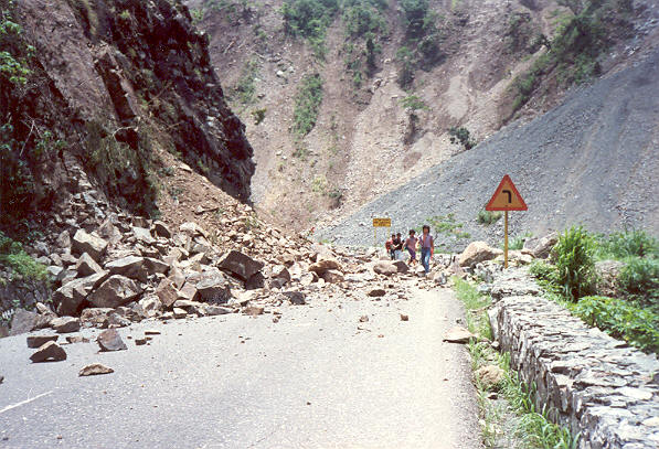
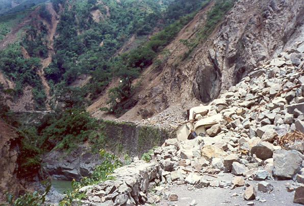
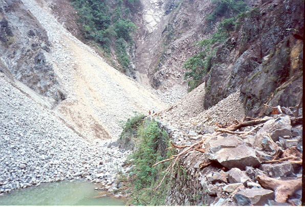
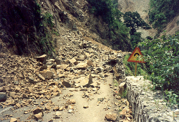
The three main access roads to Baguio were blocked by landslides that hundreds of motorists were stuck along the highways. The roads were totally impassable to vehicular traffic. People desiring to leave the city had no other alternative but to hike down Kennon Road, Marcos Highway, or Naguilian Road. Different portions of Kennon Road were blocked by landslides. This condition also made the delivery of critically needed aid to the city impossible. Loakan airport had to be temporarily closed to commercial flights to allow food, supplies, equipment, and rescue personnel to be transported by air using military and some privately-owned aircraft.
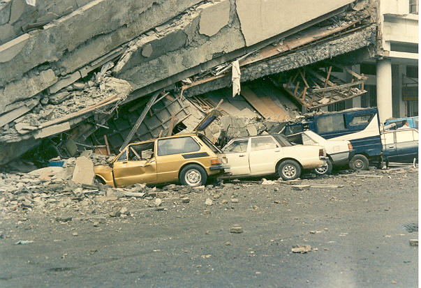
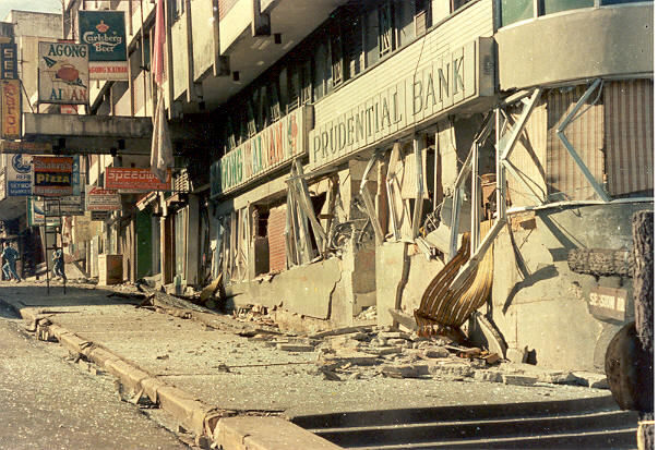
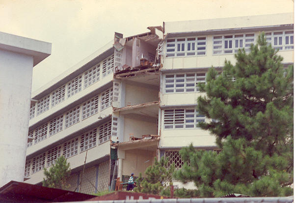
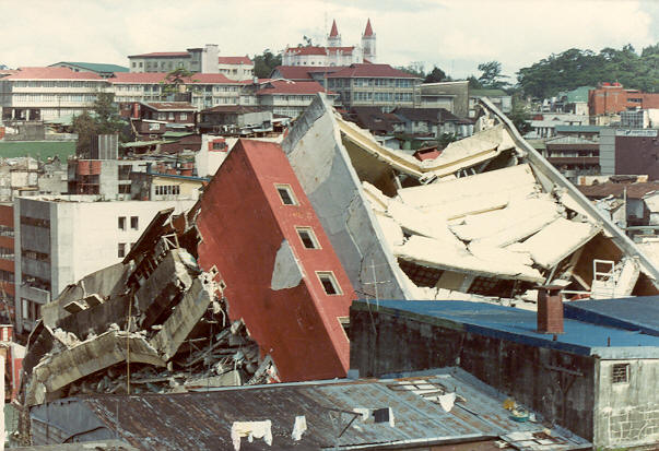
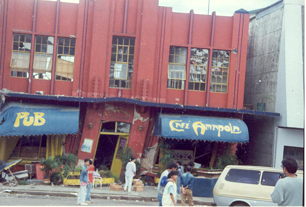
The following 40 photographs show the extensive damage on buildings, structures, facilities, and roads as a result of this killer earthquake that hit Baguio City which the residents hope and pray will never ever happen again (Note: Click on any "thumbnail image" to view the photo in a larger format, then use the BACK button of your browser to return to this page).