| 7 |
| The megalithic tombs of the Netherlands, Province of Drenthe |
| The megalithic tombs of the Netherlands, Province of Drenthe |
| �2001 Wim Dekker, Haren |
 |
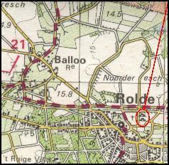
| Map of the megalithic tomb Drenthe 18 near Rolde (Noorder es, the more southern of the two), municipality of Rolde, cadastral section G nr. 1443. Owner: State of the Netherlands, acquired from H. Eggen c.s. at Rolde on 7th of October 1873; 27 stones, deviation 74�30�, condition July 2001. |
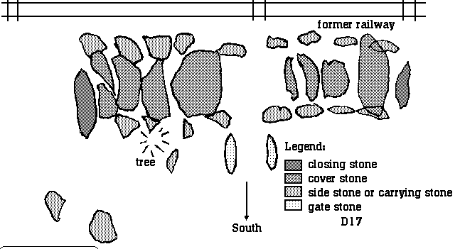 |
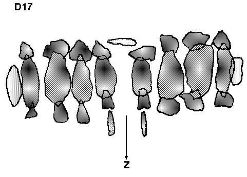
| Map of the megalithic tomb Drenthe 17 near Rolde (Noorder es, the more northern of the two), municipality of Rolde, cadastral section G nr. 1442. Owner: State of the Netherlands, acquired from H. Eggen c.s. on 13th of November 1872; 35 stones, deviation 97�30�, condition July 2001. (picture on top of page). |
| 8 |
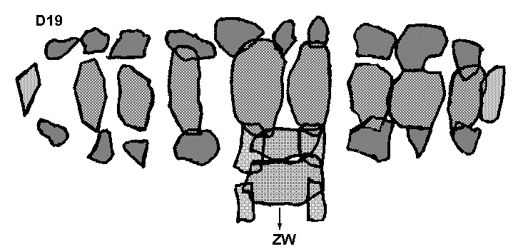 |
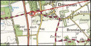
| Map of the megalithic tomb Drenthe 19 near Drouwen (Steenhopenweg, the more western of the two), municipality of Borger, cadastral section G nr. 1569. Owner: State of the Netherlands, acquired from J. Meursing c.s. at Nieuw-Buinen, K. Dilling and W.S. Dilling at Bronneger on 29th of March 1871; 36 stones, deviation 63�30�, condition July 2001. |
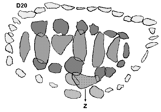 |
| Map of the megalithic tomb Drenthe 20 near Drouwen (Steenhopenweg, the more eastern of the two), municipality of Borger, cadastral section G nr. 1569. Owner: State of the Netherlands, acquired from J. Meursing c.s. at Nieuw-Buinen, K. Dilling and W.S. Dilling at Bronneger on 29th of March 1871; 38+2 stones, deviation 84�30�, condition July 2001. |
| 7 |
 |
 |
| kerbstone roofstone orthostat entrance stone |
 |
 |
 |
 |
|
|
|
|
| Drenthe |