
- Milne Enterprises, Inc.
- 2292 Durham Dr
- Saginaw MI 49609-9234
- Phone: 989-781-1046
- [email protected]
Welcome to the gallery of maps; I hope you see something interesting. Milne Enterprises, Inc. can help create maps for you covering any area and any subjects. I would love to talk to you about your mapping needs, so if you have any questions, just call me today. I've helped others, drawing maps and working with the underlying data for over 30 years: I think I can help you.
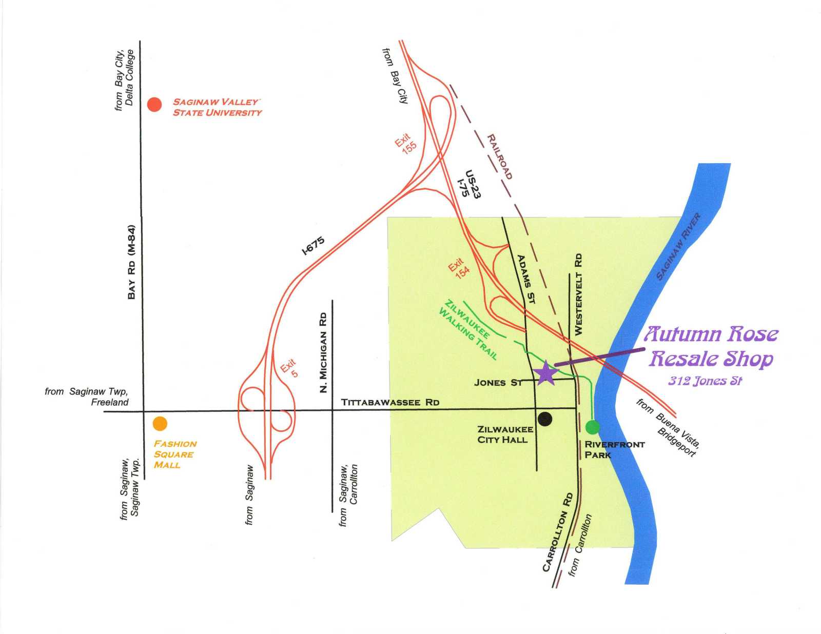
This is an example of a map for a retail store, showing its location in the community and routes from other places to the store. It was intended to be part of a tri-fold brochure, perhaps in black-and-white.
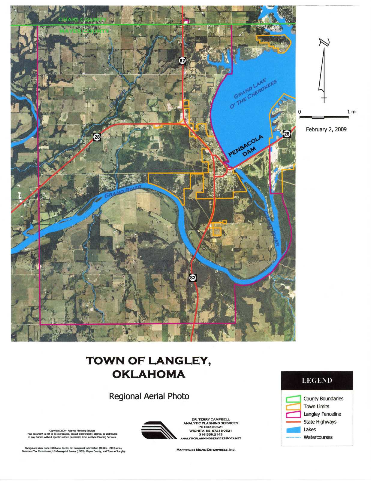
This is one of a series of maps for a community master plan. This map shows a recent aerial photo, while others in the series show zoning, transportation plans, utilities, etc. This map is suitable both for inclusion in the plan document and for printing at a large scale for a wall map, for use in meetings.
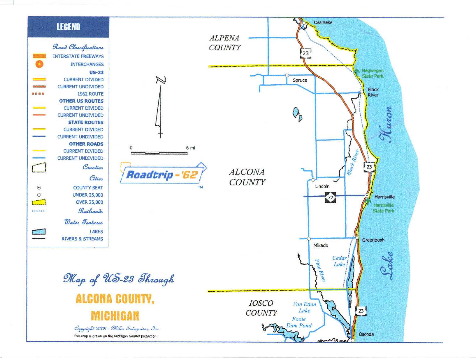
This is one of a series of county maps, rendered in the style of a 1962 gas station highway map. It is intended for use on various printed materials and on a website.
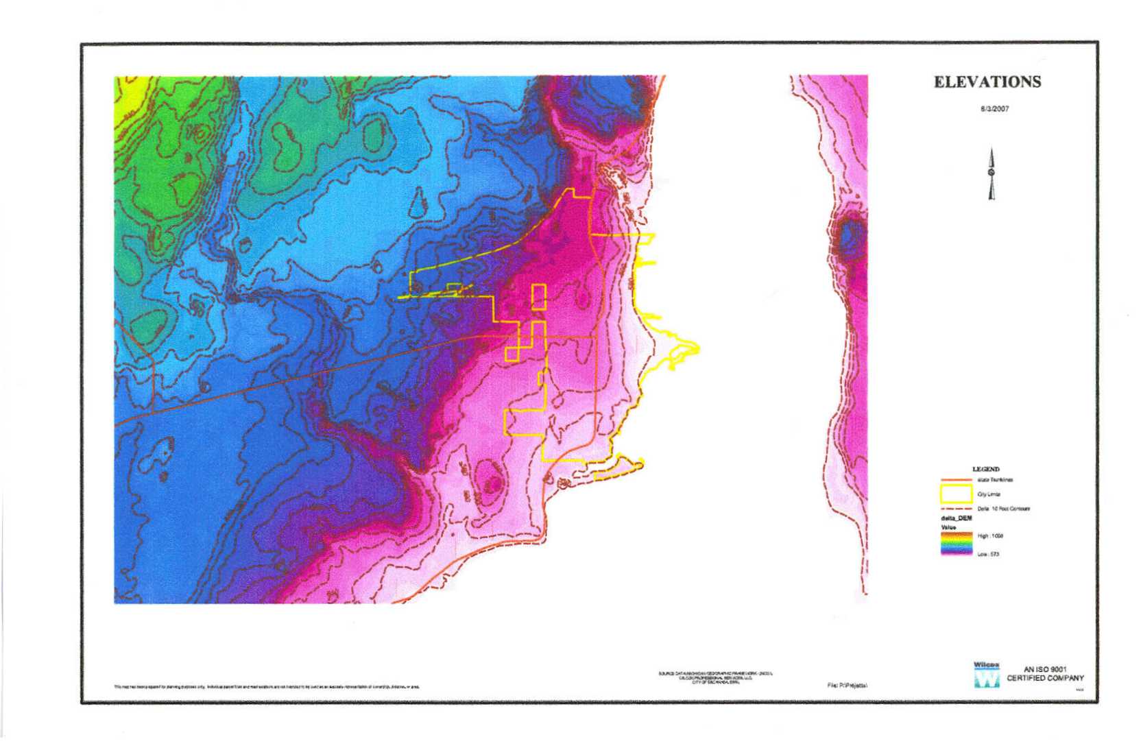
This is a map of land elevation information for a county. It was part of a series of maps in a wetlands delineation report, where the relative height of areas to other areas was of concern. It shows elevations both in a graded color scheme and with discrete lines at intervals.
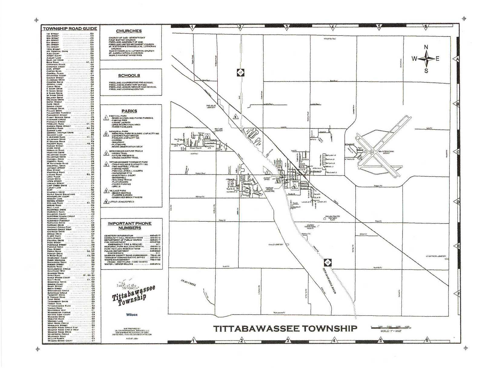
This is a map of the streets in a community and was intended to be for free distribution to residents and businesses. The portion shown here is the black portion only, with registration marks to allow proper alignment of other colors in a four-color printing process.