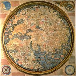
Fra Mauro (1459) (Mappamundi)
(Monk in Venice)
-----------------------------------
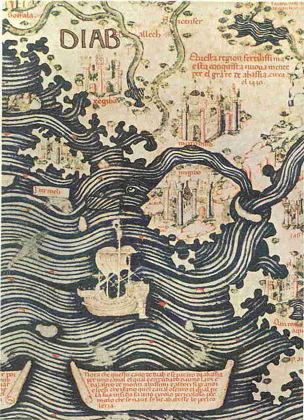
Nota che questo cauo de diab e separato da abassia per uno canal, el qual e circundado da uno ladi e da l'altro de monti altissimi e albori si grandi e spesi che i fano quel canal oscuro, el qual ne la sua insidia fa uno cirolo pericoloso per modo che se naue se ne abatesse le pericoleria
Philip Snow: The Star raft.
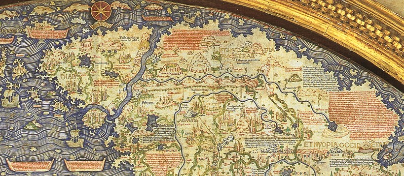
The East African part of the Map of Fra Mauro exists of roughly the following countries. Egypt, Ethiopia, Abassia, and the island of Diab. (Abassia is the kingdom of Prester John) (he painted his big map in the days that the Portuguese were looking for the Kingdom of Prester John) (the Island of DIAB must be of what he had heard of the Island of Madagascar through Marco Polo, who in general had a great influence on his work.). In his Map we clearly recognize the general outline of the map of Marino Sanudo.
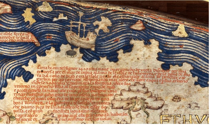
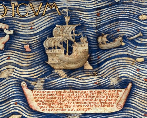
About the year of Our Lord 1420 a ship, what is called an Indian junk (Zoncho de India) on a crossing of the sea of India towards the island of Men and Women, was driven by a storm beyond the Cape of Diap (Cavo de Diab) (the most southern point on the map), through the green Islands, (in Arab literature this is Zanzibar and Pemba), out into the Sea of Darkness on their way west and southwest, in the direction of Algarve. Nothing but air and water was seen for forty days and by they reckoning they ran 2,000 miles and fortune deserted them. When the stress of the weather had subsided they made the return to the said Cavo de Diab in seventy days and drawing near to the shore to supply their wants the sailors saw the egg of a bird called roc, the egg being as big as a seven gallon cask, and the size of a bird is such that from the point of one wing to another was sixty paces and it can quite easily lift an elephant or any other animal. It does great damage to the inhabitants and is very fast in its flight.
Note: others see in this an allusion to the voyages of Zheng He because above this text on the extreme southern tip of Africa is drawn a junk and the date 1420 would also fit. As well as the description that a storm drove them back (see Mao-kun map)
In the south of Africa is written: Fronteira de Africa
Elsewhere he writes that he had spoken to people who had been driven forty days beyond the Cavo de Soffala. Moreover I have had speech with a person worthy of belief who affirmed that he had passed in a ship of the Indies through a raging storm 40 days out of the Indian Ocean beyond the Cape of Sofala and the green Islands more or less south west and west. And according to the calculations of her astronomers, his guides, this person sailed 2000 miles. Whence assuredly we may take him as sincere as those who say that they sailed 4000 miles (The Portuguese sailing down the west coast and back)
Other mentions on his map concerning east Africa are: Xengibar, Soffala, Chelue (Kilwa), Maabasa, Baraua, Mogodisso, all are on the island of DIAB. Far into the ocean is still the island of Changibar. And in the borderlands of Abassia are the rivers Galla and Hilla. The name of the island Negila (Isola nebila) off the coast of Soffala means beautiful in Sanskrit.
His account of east Africa is not accurate, but of Ethiopia it is, even rivers in the deep south of that country are accurately mentioned. For this he got most probably his information from the Ethiopian mission to Florence in 1441.
The name Diab for the Island he might have gotten from a document at Murano that states: Diab is a great province in parts of which there is an abundance of good things, its principal town being called Mogadis.
Taken from; JSTOR Some Medieval theories about the Nile
The range of mountains in which are the sources of the Nile is called Ciebelchamir, and in his remark inserted close by Fra Mauro states specifically that: The Nile rises in the provinces of Marora and Salgu, and flows by the side (costiera) of a very high mountain called Marora or Chamir. (Is mount Maraua south of lake Ashangi) Ciebelchamir is the Jebel Gamr or Mountains of the Moon of the Arabs.