General Trout Lake Information
By Resident/Association Member Don Heltemes
Trout Lake is located in Itasca County, just south of the City of Coleraine, with its northern end in the city. The DNR DOW (Department of Waters) lake number is 31-0216, and the lake is classified as a recreational lake; there are no resorts on it. Trout Lake has three public accesses: one is on the north end in Coleraine, another on the east side next to Kom-On-In-Beach, [owned by Greenway Lions off Co Rd 10] and a third on a southwest corner [maintained by Trout Lake Township off Crooked Road].
Trout Lake is a large 1890 acre mesotrophic lake with a maximum depth of 135 feet. It is a Class 22 ecological lake, 1287.3 feet above sea level. It is about 4.5 miles long, approximately NNW to SSE, and about 1.5 miles across at its widest spot. It has 438 littoral acres (no more than 15 feet deep) and a shoreline of 13.54 miles. It has a watershed area about 4.5 times the size of the lake. Water inflow is by precipitation, runoff and ground water (springs). Trout Creek is the only outlet and the creek flows to Swan River, and eventually into the Mississippi River.
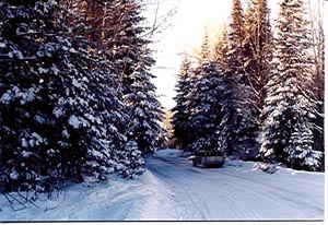
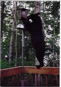
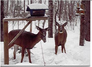
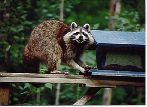
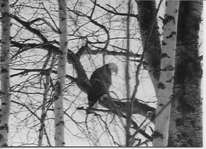
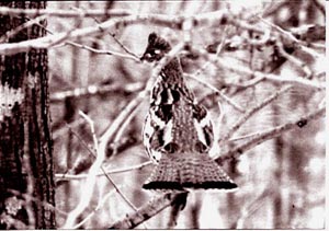
Trout Lake is beautiful, surrounded by an attractive mixture of young and old growth forests and farm land. There is an abundance of nature to be seen in the area. See Don’s photos: Rural road adjacent to Trout Lake…Bear…Deer…Raccoon…Eagle…Grouse.
The lake has been stocked with various species of fish since 1940, but has been heavily stocked with walleyes and northerns since 1960. [See Fishing Section] Although it has also been stocked with lake trout (the last time being in 1942) no recorded catch of lake trout has occurred since 1956. The DNR has indicated that if the phosphorus levels could be reduced below 15 ug/l and the chlorophyll A (algae) could be reduced below 4 ug/l (micrograms per liter) restocking of lake trout could occur. [See Canisteo Mine Pit Issue for fish habitat recovery]
~More~
Background Information
Lake Assessment Program 1987 Trout Lake
MN Pollution Control Agency Division of Water Quality
By Steve Heiskary
Pgs. 5-6
Trout Lake is located in north central Minnesota in Itasca County. It is about 1900 acres in size, placing it in the upper ten percent of the lakes in the state in terms of size (MDNR, 1968) and is one of 171 lake basins of 150 acres or more in Itasca County (Borchert et al., 1970). It is a deep lake with a maximum depth of 135 feet. Compared to lakes in this part of the state it would rank in the upper 10 percent in terms of maximum depth. The littoral zone (the zone characterized by rooted vegetation) covers approximately 23 percent of the basin.
Trout Lake is an ice-block basin in till deposits (Zumberge, 1952). Soils in the watershed are classified as Nebish-Rockwood, which are light colored medium textured forest soils overlying noncalcareous sand and gravel.
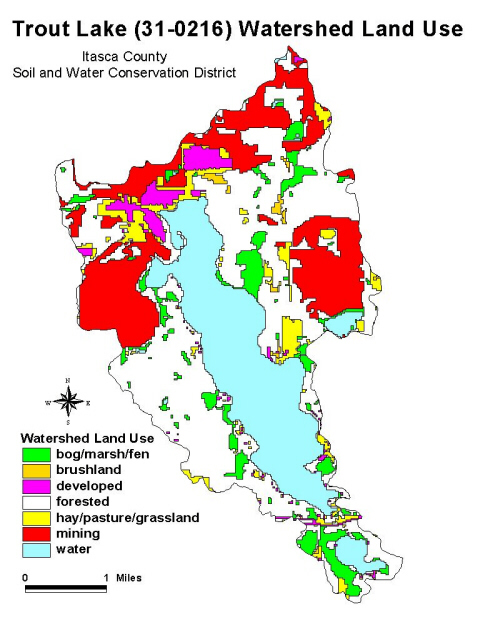
As land use affects water quality, it can be useful to divide the state into regions where the land use and water resources are similar. For Minnesota, this results in seven regions, referred to as "ecoregions," as defined by soils, land surface form, natural vegetation, and current land use. Trout Lake is located in the Northern Lakes and Forests Ecoregion ((Figure 1). Land use in the watershed of Trout Lake is dominated by forest (48%) and water/marsh (46%) The predominately forest and water/marsh land use composition is typical for lakes in this part of the state…. The somewhat high percentage of water/marsh land use is a function of Trout Lake’s rather small watershed area relative to the lake’s surface area, in fact, the surface area of Trout Lake accounts for about 42 percent of the total watershed of the lake.
The water quality, ecology and basin morphometry of Trout Lake has been impacted by human disturbances in the watershed. An historical summary of some of these activities is included in Table 4 [or read Historical Use & Misuse section]. The activities which had the biggest impact on the lake would include the discharge of fine ore tailings into the lake from about 1907-1940 and the discharge of wastewater from the cities of Coleraine and Bovey from about 1910-1987. In the summer of 1987, the discharge was diverted downstream of Trout lake into the Swan River.
FYI:
Littoral- Shallow nearshore water area, usually defined as the area from the shore to the outer edge where rooted aquatic vegetation grows.
Mesotrophic- middle aged lake
Morphometry- form
Noncalcareous- No lime
Do you know that a copy of Landscaping for Wildlife and Water Quality is available to borrow from TLC Center? No due date/no fines. We trust you.