I've been climbing with Scott H. for about 5, maybe 6 years, and together we've done 16 or 17 mountains (mostly things on his tick list). That's not a lot, I know, but it's pretty decent if you consider he has lived in SLC, Atlanta, and now Columbia SC and we generally have a long weekend each year to kill ourselves in. Scott's now 2 mountains away from completing his CO 14ers, so we have one more trip to do (they would have been done this week, but that's why this TR has the theme).
 This year he decided he wanted to finish his list off - and of course, he'd left some difficult ones until last. Silly boy. Our roadtrip would take us all through the Sangres, Sawatch, Elks, and north Front. Lots and lots of driving, and our schedule was quite tight. Only with good weather and sucking up the lack of recovery time in between treks could we hope to get this done.
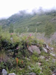
We started out Friday night after dinner with his folks; his dad, a retired 2-star, let us borrow his pretty new Durango so we could get higher than my capable-but-without-ground-clearance Accord would take us. We had a great dinner and took grilled chicken and fresh homemade elk sausage with us from there that would sustain us, we hoped, with all the calories and electrolytes we'd need. We stopped briefly at REI to pick up Scott a bivy sack and headlamp, and then we were off. Driving south from Colorado Springs, we eventually arrived at the Lake Como road leading to Blanca, Ellingwood, and Little Bear (vicinity the Great Sand Dunes). We rock-crawled up a mile past the lower parking lot, until I was too tired to see the road anymore, and found a small pullout for the truck. It was midnight. Ellingwood Peak (14042) would be a long hike later in the morning. I wished Scott had finished it off either of the last two times he'd made this desert hike.
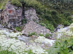
 We slept (although that word implies sleeping occurred) under the stars behind the truck, next to a small creek. The skeeters didn't show until we were just getting into our sacks, and then they didn't leave. We lay there with our bodies and heads completely covered, suffering in the 60 degree heat, in 20 degree bags, and with wool balaclavas completely covering our heads, faces closed. Absolutely miserably, we each got maybe an hour of sleep before the alarm went off at 4 (an hour plus before BMNT). We hiked in darkness for 2:15 to Como Lake at 11,760', where the temperature was about 35; quite a drastic change from 60 lower, and we were frozen and zombie-like. A couple of granola bars and some nice salty elk sausage (say, which parts did he make this from, anyway?) revived us after 20 minutes.
 Scott was climbing more slowly with each section I forced, but still making progress; another 2000' up I reached the saddle ridge between Ellingwood and Blanca and sat, enjoying the sun and light breeze, and admired the views of the Huerfano valley and all the other peaks around. Scott had made a couple of hundred feet of progress to my 600 or so, so I had a little wait; I was considering running the ridge nekkid, but 20 minutes of waiting and eating and generally milling about convinced me it wasn't quite warm enough that morning. The last 250 vertical feet of the ridge, in a half-mile or so, is best run right on the edge of the ridge. Taking the cairned 'trail' just below the ridgeline is an ankle-twister, plus you miss the fabulous views and exposure of being on overhanging (cornice-like) ridge blocks. We reached the summit and enjoyed being the only ones there for 20 or 30 minutes before heading down. I had considered running the ridge to Blanca (I'd have had plenty of time with Scotty's current climbing speed), but decided the heck with it. These were all repeats anyway, so I wandered down and sat in the sun at Blue Lakes waiting. The largest wild trout I'd ever seen, up to 15", took off when they saw me at the upper Blue Lake.
 As always, the worst part of the trek was the long, long nasty road back down to the vehicle. We made it down to Como Lake as dark clouds floated over the high peaks behind us, and we were happy we'd made an alpine climbing decision. Too bad for those still heading up� Como Lake road is arguably the most difficult 4x4 road in the state, with 4 major obstacles (Jaws I-IV) and babyheads (that's big round talus to climbers) to 2' diameter covering the entire road. Within half a mile of the lake we came to a convoy whose second vehicle suffered, as I walked up to it, a fan-through-the-radiator accident (whoops), and then lower a 3-vehicle jeepvoy with one destroyed tie rod - folded completely over itself. It's a heck of a long hike in desert conditions, but better than killing your vehicle! The final toll was 11 hours car-to-car and 5000'.
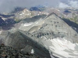
 We drove to Aspen via Buena Vista (I felt I'd earned a mondo combo burrito at Pancho's), and headed up the Pearl Pass road to its junction with Montezuma Basin at 11,200'. Arriving just at 9pm, we packed up our rucks for the next morning and settled under a breezy, partly cloudy night sky into our bivy sacks and slept well. 0500 came early, but we were refreshed and ready to climb. The target for the first part of the day was Castle Peak (14265) and subpeak Conundrum (14022), via a new route (NW Ridge), which would hopefully keep us out of mushy snow climbing conditions.
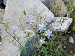
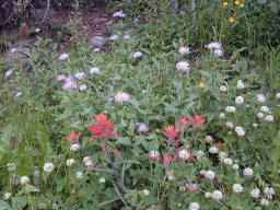 The Montezuma Basin road heads to a high parking lot (4x4 only past about 10,200') at 12,500', but driving there just wouldn't have been sporting. The basin is filled with old collapsed mines and tailings piles, talus from the crumbling mountains ringing it, and wildflowers growing wherever soil can be found. I'd been up the standard route diagonal up the NW ridge before with an ex-girlfriend, and remembered how nasty it had been; rolley nastly scree and dirt trail through talus. Almost dangerously nasty. My plan for the day was to do the entire NW ridge, staying on the crest as much as possible to try for more solid rock and a better climb. The first several hundred feet were a rising traverse on lingering snowfields, mostly still solid enough to walk across (posthole, retreat a few feet, try a new direction), to big rolling alpine meadows with rock-hops and wildflowers, to the beginning of the talus ridge. As we left the parking lot area, we saw a group of 4 about 600 feet up the first snow headwall, apparently climbing with skiis. I aimed to beat them to the summit. They had only climbed 600 feet to my 1750 so far; no prob, their route is shorter but steeper.
Only about 200m of the entire route I took was nasty or even unpleasant, and I could have avoided that by staying more in line with the ridge proper instead of venturing north into the next basin and it's snowfield. Several small crags on the ridge were perfect for 5.5-5.6 20-30 foot playing; I had some extra time as Scott came up behind me, so I played. The last mile of the ridge is absolutely fantastic, one of the best ridge runs (non-technical) I've ever had the pleasure of. It corkscrews around and over small blocky pinnacles with great exposure, cool views, and looks down at the roughly stacked blocks that make up the entire mountain. It's amazing the mountain doesn't just blow over the way the rocks look. I smoked the last subpeaks and notches and hit the top 10 minutes before the other group topped out. I had 8 minutes alone on the top, dead quiet, in perfect sunny weather, just to enjoy being alone and up high. Beautiful.
 Scott arrived just before the other group, two couples in their mid to late twenties. We signed in and decided to pretty much keep moving, as we had plans later in the day; before we left they asked us to take their picture with a nifty little digital handicam, and then we got to film the group doing the hokey-pokey on the summit. Apparently the girls were a little lightheaded from the altitude. Good group of people, anyway.
We descended the NE ridge towards Conundrum, a subpeak I needed to tick, and I ran up the 250' to the top; Scott was only at the saddle when I hit the top, so I decided to run over another half mile and hit another subpeak that looked like it was about the same height. Just past Conundrum Couloir a little knob sticks up from the ridgeline that is maybe 2 feet lower than the main Conundrum summit; you couldn't see that until you were on the lower one, though, and I felt I needed to make sure. I ran back over to the summit cairn after my exploration and arrived just as Scott pulled over the top.
 Two fellas were sitting at the cairn snacking when I arrived, and the four of us talked for a bit about the climb and climbing in general. The leader/guide of the other party was a first grade teacher in Grand Junction who had just climbed summers for the past 10 or so years, and was over 600 peaks but only a few 14ers. Said he'd had a six-year stretch of climbing 13ers and 12ers where he hadn't ever seen another person on the summit. We talked about the peaks around Castle, Capitol (where we were planning to climb tomorrow), and discussion led us to discuss Clark Peak. My boss has been harping on me for 3 years to go recon climb it for him. He's been fascinated with it for probably 20 years but isn't a technical climber and didn't want to try it without having some good beta (and no, he doesn't use words like beta or reconnoiter). There are apparently routes, lower fifth class but rope-free, from both the K2 ridge and from the Pierre Lakes that are superb. I'll check it out when I hit Capitol for sure now.
Well, time to go down, after a few hours at 14k. We descended back to the Castle-Conundrum saddle where the snowfield (which used to be the US Ski Team's primary summer training area) came to the ridge. With a battle cry of 'I am King of the Lemmings, Follow Me!' I hopped onto the steep upper field. The grade starts at about 80 degrees and quickly lowers to 50 and then 30 degrees, but I was already flying, catching air off my butt 40 feet into the 400 vertical foot ride. Scotty followed me with Ye-haws and yells from our climbing acquaintances on the ridges above following him down. About halfway down the slide snow pluming over Scott knocked off his ballcap. We climbed back up to get it. Well, heck. It was only another 300 or so feet up and I can do the whole ride again.
 A new couple actually waited at the top of the climb for me, about 5 minutes, just to say hi, and the girls from the first group we'd met wandered over as I was topping out as well. They were going to slide down too, while their boyfriends tele'd. This time, without the battle cry, I took a running leap off the edge for maximum airtime. It was just as good or better the second time down, and totally worth the climb back up. Scott and I watched the guys tele down the upper pitch and then wandered over to the lower, 600' headwall for a second rocket glissade. We tried racing, and decided in a non-scientific experiment that plastic pants are much faster than vinyl. I lost. We walked down the road at a pleasant gait, arriving at the truck just as big black clouds looked like they were again threatening being high on several sides. This was a fun, near-perfect climb, 7 hours (we took our time and enjoyed the ridges and summits) car-to-car.
Well, Scott was in the middle of closing on a house and his wife Portia is doing the negotiating at home; we spent some more time at the Basalt grocery trying to fax signatures and paperwork back and forth to South Carolina. Mostly I sat in the truck. Three short and one really, really long cell phone conversations later, we'd had to come to a decision. As we were approaching the third peak's trailhead in the Durango, Portia kept going in and out on the phone; I stopped, backed up to the last point of coverage, and waited. Scott got out to talk for a bit. Just minutes from the trailhead! We're there!
A long story short, there were life and living and paperwork complications and we both felt the right thing to do was for him to go home to make things right all around. We'd have more chances to climb. We drove back to CoSpgs, and cut short a terrific vacation. We missed his last two, Capitol and Longs, and I still have the Weminuche 3; hopefully he'll get back out here for a week later in the summer and we can finish all of them up together.