Page updated April 2, 2009
Weather
QuickLinks
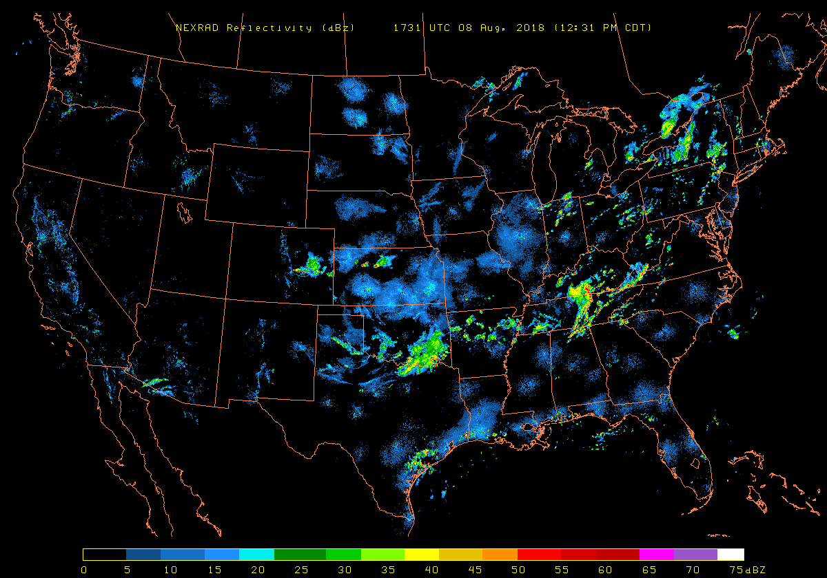
Weather Radar
US
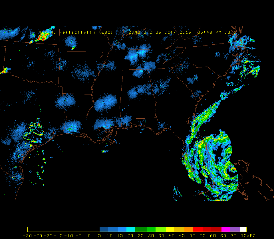
loop - US no loop - Coastal Radars for Hurricanes
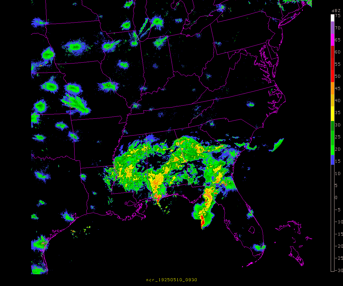
Southeast
and Florida
Jacksonville,
FL - Valdosta, GA - Tampa, FL
-
Accumulated
Precip. (my local) -
Radar Status (NWS
WSR-88D)
_
http://www.roc.noaa.gov/ Radar Operations Center
http://weather.noaa.gov/monitor/radar/ Auto-Refresh 1
min.
Radar Nationwide loop
_
http://radar.weather.gov/Conus/index_loop.php *
http://www.srh.noaa.gov/ridge/lite/ or http://www.crh.noaa.gov/ridge/lite/
http://www.spc.noaa.gov/
http://www.spc.noaa.gov/products/activity_loop.gif
http://www.spc.noaa.gov/exper/mesoanalysis/ java/javascript
http://www.spc.noaa.gov/exper/mesoanalysis/s4/activity_loop.gif
http://www.spc.noaa.gov/exper/mesoanalysis/sectorloop.gif
http://www.spc.noaa.gov/exper/mesoanalysis/s4/s4_loops/rgnlrad/rgnlrad_10.gif (rgnlrad_1.gif to rgnlrad_10.gif)
http://aviationweather.gov/obs/radar/loop.shtml java loops
http://aviationweather.gov/data/obs/radar/frame_5_rcm_sm_tops.gif (frame_0_rcm_sm_tops.gif to frame_5_rcm_sm_tops.gif)
http://aviationweather.gov/products/ncwf/ javascript loops only shows strong
echos
http://www.ncdc.noaa.gov/oa/radar/jnx/ java Java NEXRAD
Viewer/Exporter
https://avweb.weather.navy.mil/cgi-bin/radar/radar_loop.cgi?SYS/BREF/
https://avweb.weather.navy.mil/cgi-bin/radar/radar_loop.cgi?EAn/BREF/&13
https://afweather.afwa.af.mil/weather/radar.html
http://www.intellicast.com/IcastPage/LoadPage.aspx?loc=usa&seg=LocalWeather&prodgrp=RadarImagery&product=RadarLoop *(cookie)
? http://radar.accuweather.com/adcbin/public/radar_index_large.asp?getArea=US_REG&type=loop&nxtype=re
http://sirocco.accuweather.com/nx_mosaic_640x480c/re/inmareus_.gif
http://www.accuweather.com/radar-large.asp?partner=accuweather&traveler=0&site=US_&type=SIR&anim=1&level=regional&large=1
http://sirocco.accuweather.com/nx_mosaic_640x480c/sir/inmasirus_.gif
? http://www.accuweather.com/adcbin/public/sat_index_large?getarea=US_REG&type=loop&sattype=rs
http://sirocco.accuweather.com/sat_mosaic_640x480_public/rs/isarun.gif
http://wxweb.meteostar.com/radar/site/SYS.shtml?SYS
http://weather.unisys.com/radar/rad_us_loop.html *Auto-Refresh 30
min.
http://www.weather.com/maps/maptype/dopplerradarusnational/index_large_animated.html java loops
http://image.weather.com/looper/archive/us_radar_plus_usen/5L.jpg [1L.jpg to 5L.jpg]
http://www.wunderground.com/US/Region/US/Radar.html
http://icons.wunderground.com/data/640x480/2xus_rd_anim.gif *
http://www.weatherforyou.com/cgi-bin/hw3/hw3.cgi?forecast=pass&pass=radar_us_loop
http://www.weatherforyou.com/radar/radarmaps/usnextype_640x480.gif *
http://www.geostrophy.weather.net/cgi-bin/interrad_nat_us
http://vortex.plymouth.edu/
http://vortex.plymouth.edu/psc_usrad.mpg *
http://vortex.plymouth.edu/psc_satrad.mpg *
http://vortex.plymouth.edu/psc_usrad_an12.gif *
http://vortex.plymouth.edu/psc_satrad_an12.gif *
http://vortex.plymouth.edu/psc_usrad_an24.gif *
http://vortex.plymouth.edu/psc_satrad_an24.gif *
http://vortex.plymouth.edu/psc_usrad_an.html java loops
http://vortex.plymouth.edu/psc_satrad_an.html java loops
http://vortex.plymouth.edu/nids.html java loops Select your own radar
http://vortex.plymouth.edu/rcm.html java loops
http://vortex.plymouth.edu/rad.html java loops
http://vortex.plymouth.edu/usrcm_an.gif *
http://www.nlmoc.navy.mil/cgi-bin/movie.pl?radar+GIF+12tttt+480+976+nrm+ushf
http://www.rap.ucar.edu/weather/radar/ javascript loops
http://www.atmo.arizona.edu/products/radar/ java loops
http://www.atmo.arizona.edu/gifs/USRADCOMP.GIF *long download
http://twister.sbs.ohio-state.edu/nexrad.php
http://twister.sbs.ohio-state.edu/loopsh.php?based=archive/radar/national&loopid=National+Mosaic javascript loops
http://wx.erau.edu/data/
http://www.ametsoc.org/dstreme/images/smrad_sum_loop.gif
Backup commercial radar
http://html.ibsys.com/sh/weather/radarsites.html
Radar Nationwide
_
http://radar.weather.gov/Conus/full_lite.php
http://www.srh.noaa.gov/ridge/lite/ or http://www.crh.noaa.gov/ridge/lite/
http://www.spc.noaa.gov/exper/mesoanalysis/s4/index2.html
http://www.spc.noaa.gov/exper/mesoanalysis/s4/rgnlrad.html
http://wdssii.nssl.noaa.gov/web/wdss2/products/radar/conus.shtml WDSS-II 2D Multi-Radar CONUS
http://aviationweather.gov/obs/radar/
http://aviationweather.gov/data/obs/radar/rcm_sm_tops.gif
http://aviationweather.gov/data/iffdp/2080.gif
http://weather.noaa.gov/fax/radar.shtml (alternative)
http://weather.noaa.gov/pub/fax/QAUA00.TIF
http://aviationweather.gov/products/ncwf/
http://aviationweather.gov/data/products/ncwf/nat/23_nat_fcst_ncwf.gif (00 to 23) only
shows strong echos
http://aviationweather.gov/data/products/ncwf/nat/23_nat_detect_ncwf.gif (00 to 23) only
shows strong echos
http://www.hpc.ncep.noaa.gov/html/sfc2.shtml 00Z 03Z 06Z 09Z 12Z 15Z 18Z 21Z
http://www.hpc.ncep.noaa.gov/sfc/radsfcus.gif
https://avweb.weather.navy.mil/radar/radar_link.shtml?map=SYS_BREF
http://www.nlmoc.navy.mil/cgi-bin/latest.pl?radar+nrm+ushf
http://vortex.plymouth.edu/
http://vortex.plymouth.edu/lnids_conus.html
http://vortex.plymouth.edu/usrcm.gif
http://vortex.plymouth.edu/rcm.html
http://vortex.plymouth.edu/cgi-bin/gen_rcm.cgi?re=us&var=all&cu=la
http://vortex.plymouth.edu/cgi-bin/gen_rcm.cgi?re=us&var=comp&cu=la
http://vortex.plymouth.edu/rad.html
http://vortex.plymouth.edu/cgi-bin/gen_rad.cgi?re=us&var=all&cu=la
http://vortex.plymouth.edu/usrad.gif
http://tao.atmos.washington.edu/images/extra/radar_us/
http://tao.atmos.washington.edu/images/extra/radar_us_full/
http://www.atmo.arizona.edu/products/wximagery/
http://www.atmo.arizona.edu/products/wximagery/usradar/r23.GIF
http://www.atmo.arizona.edu/gifs/USRADWX.GIF
http://www.rap.ucar.edu/weather/radar/
http://motherlode.ucar.edu/unidata/images/nids/radar_mosaic.gif
http://motherlode.ucar.edu/unidata/images/nids/
http://www.unidata.ucar.edu/software/gempak/examples/redbook/radar_summary.gif
http://whirlwind.meteor.wisc.edu/~wxp/nids/nids.html
http://tempest.aos.wisc.edu/radar/uscomp.gif
http://weather.cod.edu/mcnexrad/USA.gif
http://weather.cod.edu/mcnexrad/USA/
http://weather.bgsu.edu/rads/conus.php?prod=dem
http://wx.erau.edu/data/
http://fltwx.db.erau.edu/images/Radar_mosaics/National/N0R/latest.gif
http://fltwx.db.erau.edu/images/Radar_mosaics/National/NCR/latest.gif
http://mesonet.tamu.edu/LevelII/
http://fltwx.db.erau.edu/images/NIDS/
http://weather.admin.niu.edu/cgi-bin/getnowrad?re=us
http://weather.admin.niu.edu/machine/radar.html
http://twister.sbs.ohio-state.edu/archive/radar/national/
http://hoot.metr.ou.edu/new_radar_page.htm
http://www.intellicast.com/IcastPage/LoadPage.aspx?loc=usa&seg=LocalWeather&prodgrp=RadarImagery&product=Radar (cookie)
http://www.intellicast.com/IcastPage/LoadPage.aspx?loc=usa&seg=LocalWeather&prodgrp=SevereWeather&product=RadarSummary (cookie)
? http://radar.accuweather.com/adcbin/public/radar_index_large.asp?getArea=US_REG&type=still&nxtype=re
http://sirocco.accuweather.com/nx_mosaic_640x480c/re/inmreus_.gif
http://www.accuweather.com/radar-large.asp?partner=accuweather&traveler=0&site=US_&type=SIR&anim=0&level=regional&large=1
http://sirocco.accuweather.com/nx_mosaic_640x480c/sir/inmsirus_.gif
http://www.accuweather.com/radar-large.asp?partner=accuweather&traveler=0&site=UN&type=RS&anim=0&level=regional&large=1
http://sirocco.accuweather.com/sat_mosaic_640x480_public/rs/isrun.jpg
http://wxweb.meteostar.com/radar/radar_link.shtml?map=SYS_BASE_REFL.gif
http://weather.unisys.com/radar/rad_us.html
http://www.wunderground.com/US/Region/US/Radar.html
http://icons.wunderground.com/data/640x480/2xus_rd.gif
http://www.weather.com/maps/maptype/dopplerradarusnational/index_large.html
http://image.weather.com/web/radar/us_radar_large_usen.jpg
http://www.weather.com/maps/maptype/dopplerradarusnational/uswinterradar_large.html
http://image.weather.com/web/radar/us_winterradar_large_usen.jpg
http://www.weatherforyou.com/cgi-bin/hw3/hw3.cgi?forecast=pass&pass=radar_us_latest
http://www.weatherforyou.com/radar/radarmaps/usnextype_640x480.png
http://www.awis.com/samples/us_radar.gif
http://www.agriculture.com/data/agol/fnw/free/radar20.gif
http://www.atmos.washington.edu/cgi-bin/latest.cgi?sfc includes isobars
and plots
http://cheget.msrc.sunysb.edu/products/sfc/0_HrsAgo.gif includes plots
http://www.atmos.albany.edu/gopher-local/surface/us/00latest.gif includes plots
http://windfall.evsc.virginia.edu/~mcuser/webpage/radar/radpres.gif includes isobars
and plots
http://www.comet.ucar.edu/dstreme/images/sfc_map.gif includes isobars
and plots
Backup commercial radar
http://html.ibsys.com/sh/weather/radarsites.html
http://weatheroffice.ec.gc.ca/radar/index_e.html Canada
Radar [Florida and SE US]
.gov .mil - .edu - .net - .com
_
http://radar.weather.gov/index_lite.htm
http://radar.weather.gov/Conus/southeast_lite_loop.php
http://aviationweather.gov/products/ncwf/
http://aviationweather.gov/data/products/ncwf/se/23_se_fcst_ncwf.gif (00 to 23) only
shows strong echoes
http://aviationweather.gov/data/products/ncwf/se/23_se_detect_ncwf.gif (00 to 23) only
shows strong echoes
http://aviationweather.gov/data/products/ncwf/zjx/23_zjx_fcst_ncwf.gif (00 to 23) only
shows strong echoes
http://aviationweather.gov/data/products/ncwf/zjx/23_zjx_detect_ncwf.gif (00 to 23) only
shows strong echoes
http://aviationweather.gov/data/products/ncwf/zma/23_zma_fcst_ncwf.gif (00 to 23) only
shows strong echoes
http://aviationweather.gov/data/products/ncwf/zma/23_zma_detect_ncwf.gif (00 to 23) only
shows strong echoes
http://www.sfwmd.gov/curre/3_radar.html
https://avweb.weather.navy.mil/radar/radar_link.shtml?map=SER_BREF
https://afweather.afwa.af.mil/cgi-bin/radar_loop.cgi?RDSE2D
_
http://weather.cod.edu/analysis/analysis.radar.html
http://weather.cod.edu/mcnexrad/Florida/?M=D
http://vortex.plymouth.edu/
http://vortex.plymouth.edu/lnids_conus.html
http://vortex.plymouth.edu/rcm.html
http://vortex.plymouth.edu/cgi-bin/gen_rcm.cgi?re=se&var=all&cu=la
http://vortex.plymouth.edu/rad.html
http://vortex.plymouth.edu/cgi-bin/gen_rad.cgi?re=se&var=all&cu=la
http://www.rap.ucar.edu/weather/radar/
http://www.rap.ucar.edu/weather/radar/displayRad.php?icao=KTBW&prod=n0r
http://www.rap.ucar.edu/weather/radar/displayRad.php?icao=KTBW&prod=n0r&duration=1 [java loop]
http://www.atmo.arizona.edu/gifs/
http://www.atmo.arizona.edu/gifs/RADAR_SE.GIF
http://whirlwind.meteor.wisc.edu/~wxp/nids/nids.html
http://tempest.aos.wisc.edu/radar/secomp.gif
http://twister.sbs.ohio-state.edu/loopsh.php?based=archive/radar/south&loopid=South+Regional+Mosaic
http://twister.sbs.ohio-state.edu/archive/radar/south/
http://wx.erau.edu/data/
http://fltwx.db.erau.edu/images/Radar_mosaics/Florida/N0R/latest.gif
http://fltwx.db.erau.edu/images/Radar_mosaics/Florida/NCR/latest.gif
http://weather2.admin.niu.edu/niurad/NIUFL_36.GIF [1.GIF to 36.GIF]
http://weather.niu.edu/niufl.html javascript loop
http://weather.admin.niu.edu/cgi-bin/getnowrad?re=fl
http://weather2.admin.niu.edu/niurad/NIUSE_36.GIF [1.GIF to 36.GIF]
http://weather.niu.edu/niuse.html javascript loop
http://weather.admin.niu.edu/cgi-bin/getnowrad?re=se
http://www.anemometer.weather.net/cgi-bin/freesenotisinterrad?zipcode=32801 anim
_
http://wwwa.accuweather.com/radar-large.asp?level=state&site=FL_&type=RE&anim=loop
http://sirocco.accuweather.com/nx_mosaic_640x480c/RE/inmaREFL_.gif
http://wwwa.accuweather.com/radar-large.asp?level=state&site=FL_&type=SIR&anim=loop
http://sirocco.accuweather.com/nx_mosaic_640x480c/SIR/inmaSIRFL_.gif
http://wwwa.accuweather.com/radar-large.asp?level=state&site=FL_&type=RS&anim=loop
http://sirocco.accuweather.com/sat_mosaic_640x480_public/rs/isarFL_.gif
http://wwwa.accuweather.com/radar-large.asp?level=regional&site=SE&type=RE&anim=loop
http://sirocco.accuweather.com/nx_mosaic_640x480c/RE/inmaRESE.gif
http://wwwa.accuweather.com/radar-large.asp?level=regional&site=SE&type=SIR&anim=loop
http://sirocco.accuweather.com/nx_mosaic_640x480c/SIR/inmaSIRSE.gif
http://wwwa.accuweather.com/radar-large.asp?level=regional&site=SE&type=RS&anim=loop
http://sirocco.accuweather.com/sat_mosaic_640x480_public/rs/isarSE.gif
http://www.intellicast.com/IcastPage/LoadPage.aspx?loc=kmco&seg=LocalWeather&prodgrp=RadarImagery&product=Radar (cookie)
http://www.intellicast.com/IcastPage/LoadPage.aspx?loc=kmco&seg=LocalWeather&prodgrp=SevereWeather&product=RadarSummary (cookie)
http://www.intellicast.com/IcastPage/LoadPage.aspx?loc=kmco&seg=LocalWeather&prodgrp=RadarImagery&product=RadarLoopLoop (cookie)
http://wxweb.meteostar.com/radar/radar_link.shtml?map=SER_BASE_REFL.gif
http://wxweb.meteostar.com/radar/nav/
http://weather.unisys.com/radar/rad_se_loop.html Auto-Refresh 30
min.
http://www.weather.com/maps/maptype/dopplerradarusnational/southeastradar2100mile_large_animated.html
http://image.weather.com/looper/archive/us_se_4regradar_plus_usen/5L.jpg [1L to 5L.jpg overwrite se: umw ne we]
http://image.weather.com/web/radar/us_se_4regwinterradar_large_usen.jpg [overwrite se: mw ne we]
http://www.weather.com/maps/maptype/dopplerradarusnational/southeastdopplerradar1800_large_animated.html
http://image.weather.com/looper/archive/us_se_9regradar_plus_usen/5L.jpg [1L to 5L.jpg overwrite se: cn ec nc ne nw sc sw wc
alaska hawaii]
http://www.wunderground.com/US/Region/Southeast/2xpxRadar.html
http://icons.wunderground.com/data/640x480/2xse_rd_anim.gif
http://icons.wunderground.com/data/640x480/2xradard5_anim.gif
http://icons.wunderground.com/data/640x480/2xradard4_anim.gif
http://icons.wunderground.com/data/640x480/2xradarc5_anim.gif
http://www.weatherforyou.com/cgi-bin/hw3/hw3.cgi?forecast=pass&pass=radar_region_loop&state=southeast
http://www.weatherforyou.com/radar/radarmaps/ussoutheastnextype_anim_640x480.gif
http://wwc.stormdisplay.com/images/AWSRadars/bugradar_enlarge/28/radar1.jpg [1.jpg to 8.jpg]
http://wwc.stormdisplay.com/images/AWSRadars/bugradar_enlarge/22/radar1.jpg [1.jpg to 8.jpg]
http://static.worldnow.com/images/wci_nxrd_fl.jpg
http://static.worldnow.com/worldnow/images/wc_serad.jpg
Radar sites for
tracking hurricanes or storms
_
US Radar south of 35 Degrees North
Scroll down further for backup
links to .gov radar
JUA JUA TJUA JUA TJUA TJUA JUA JUA [only IntellicastImg=## San Juan, PR then radar]
BYX BYX KBYX BYX KBYX KEYW BYX BYX Key West, FL Intellicast enable cookies
AMX AMX KAMX AMX KAMX KMIA AMX AMX Miami, FL
TBW TBW KTBW TBW KTBW KTPA TBW TBW Tampa, FL
MLB MLB KMLB MLB KMLB KMLB MLB MLB Melbourne, FL
TLH TLH KTLH TLH KTLH KTLH TLH TLH Tallahassee, FL
EVX EVX KEVX EVX KEVX KVPS EVX EVX Eglin AFB, FL
JAX JAX KJAX JAX KJAX KJAX JAX JAX Jacksonville,FL
MOB MOB KMOB MOB KMOB KMOB MOB MOB Mobile, AL
LIX LIX KLIX LIX KLIX KNEW LIX LIX New Orleans, LA
LCH LCH KLCH LCH KLCH KLCH LCH LCH Lake Charles, LA
HGX HGX KHGX HGX KHGX KHOU HGX HGX Houston, TX
CRP CRP KCRP CRP KCRP KCRP CRP CRP Corpus Christi, TX
BRO BRO KBRO BRO KBRO KBRO BRO BRO Brownsville, TX
CLX CLX KCLX CLX KCLX KCHS CLX CLX Charlestown, SC
LTX LTX KLTX LTX KLTX KILM LTX LTX Wilmington, NC
MHX MHX KMHX MHX KMHX KMRH MHX MHX Morehead City, NC
javascript click-on map for regional radar maps:
http://www.intellicast.com/IcastPage/LoadPage.aspx?loc=usa&seg=StormCenter&prodgrp=RadarImagery&product=RadarLoop
Brownsville, TX (kbro) - San Antonio, TX (ksat) - New Orleans, LA (kmsy) - St. Petersburg, FL (kpie) - Key West, FL (keyw) - Columbus, GA (kcsg) - Charlotte, NC (kclt) - Staunton, VA (kshd) - Binghamton, NY (kbgm) - Berlin, NH (kbml)
http://weather.cod.edu/analysis/radar.main.html *
http://weather.cod.edu/analysis/analysis.1km.html
http://weather.cod.edu/analysis/ goto Radar Images
http://mesonet.tamu.edu/products/radar/LevelII.html ?
http://mesonet.tamu.edu/products/radar/srhLII.html ?
http://www.rsmas.miami.edu/e/metar.cgi?s=KMLB
http://weather.noaa.gov/radar/national.html
http://www.nlmoc.navy.mil/cgi-bin/main.pl?radar Coastal NEXRAD Radar Sites
Radar outside of the US
_
Antilles
http://www.meteo.fr/temps/domtom/antilles/pack-public/princ.htm
http://www.meteo.fr/temps/domtom/antilles/pack-public/animation/animMOSAIC2.html
http://www.meteo.fr/temps/domtom/antilles/pack-public/animation/liste400mosaic.js
http://www.meteo.fr/temps/domtom/antilles/pack-public/MOSAIQUE/yyyymmddhhmm-Mosaique.gif
[hh = UTC mm = 00 15 30 45]
Puerto Rico
JUA JUA TJUA JUA TJUA TJUA JUA JUA [only IntellicastImg=## San Juan, PR then radar]
Bahamas
http://www.bahamasweather.org.bs/radar/local/
https://ows.dm.af.mil/BY_SCALE/MESO/index.cfm?fuseaction=auto_loop&look_id=38&BW=L&UF=M&AOR=1 [USAF public restricted]
Jamaica
http://www.metservice.gov.jm/radarpage1.asp
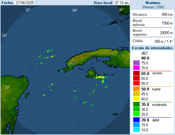
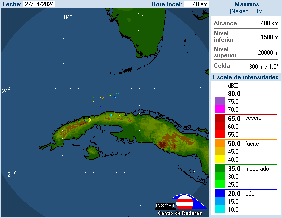
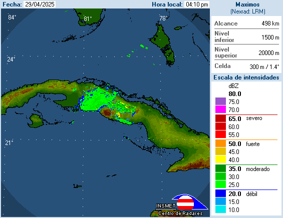
Cuba
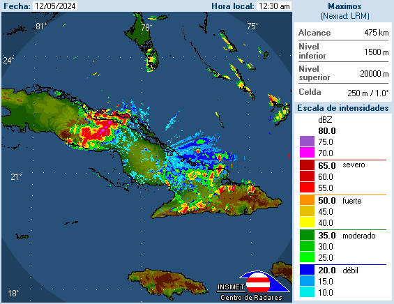
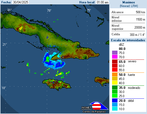
http://www.insmet.cu/asp/genesis.asp?TB0=PLANTILLAS&TB1=RADARES [150.188.4.189./Radar/activos=/name=]
http://www.insmet.cu/Radar/NacComp200Km.gif mosiac
http://www.insmet.cu/Radar/00Pinar%20del%20Rio/lbjMAXw01a.gif La Bajada
http://www.insmet.cu/Radar/01Casablanca/csbMAXw01a.gif Casablanca
http://www.insmet.cu/Radar/02I.Juventud/pdeMAXw01a.gif Punta del Este
http://www.insmet.cu/Radar/03Cienfuegos/psjMAXw01a.gif Pico San Juan
http://www.insmet.cu/Radar/04Camaguey/cmwMAXw01a.gif Camagüey
http://www.insmet.cu/Radar/05Pilon/plnMAXw01a.gif Pilon
http://www.insmet.cu/Radar/06Gran%20Piedra/gpdMAXw01a.gif Gran Piedra
http://www.insmet.cu/Radar/07Holguin/hlgMAXw01a.gif ? Holguin
Guantanamo Bay, Cuba
https://detweb.weather.navy.mil/gtmo/radar.htm [restricted in 2007]
http://www.weather.navy.mil/products/animate/radar.jsp?prod=radar&id=mugm&type=cmax&frames=12>ype=JPG [javascript ? last updated April 2007]
http://www.weather.navy.mil/products/animate/radar.jsp?prod=radar&id=mugm&type=base&frames=12>ype=JPG
http://www.weather.navy.mil/products/animate/radar.jsp?prod=radar&id=mugm&type=etops&frames=12>ype=JPG
http://www.weather.navy.mil/products/animate/radar.jsp?prod=radar&id=mugm&type=cappi&frames=12>ype=JPG
http://radar.weather.gov/ridge/radar_lite.php?rid=gmo&product=N0R&loop=yes
Mexico
http://smn.cna.gob.mx/
http://smn.cna.gob.mx/radares/radares.html
http://smn.cna.gob.mx/radares/rad-canc.jpg Cancún
http://smn.cna.gob.mx/radares/rad-tamp.jpg Tampico
http://smn.cna.gob.mx/radares/rad-alva.gif ? Alvarado
http://smn.cna.gob.mx/radares/rad-saba.jpg ? Sabancuy
Panama
http://www.pancanal.com/eng/eie/radar/radar.html
http://www.pancanal.com/eng/eie/radar/movie.gif
http://www.pancanal.com/eng/eie/radar/current_image.gif
_
This requires conversion software to view, download from http://www.ncdc.noaa.gov/oa/radar/jnx/
http://weather.noaa.gov/pub/SL.us008001/DF.of/DC.radar/
Radar [Jacksonville, FL (JAX) for Gainesville and
Ocala, FL]
Note: You can overwrite letters in the link
for your radar area. JAX to TLH or kjax to ktlh, etc.
_
http://radar.weather.gov/radar_lite.php?product=N0Z&rid=JAX&loop=yes
http://www.srh.noaa.gov/ridge/lite/N0R/JAX_loop.gif or http://www.crh.noaa.gov/ridge/lite/N0R/JAX_loop.gif
http://www.srh.noaa.gov/ridge/lite/N0R/JAX_0.png or http://www.crh.noaa.gov/ridge/lite/N0R/JAX_0.png (7.png to 0.png)
http://www.srh.noaa.gov/ridge/lite/N0R/JAX_1.png or http://www.crh.noaa.gov/ridge/lite/N0R/JAX_1.png (7.png to 0.png)
http://vortex.plymouth.edu/gen_lnids.cgi?pl=n0r&cu=1&loop=no&ident=jax
http://vortex.plymouth.edu/nids.html Enter Station Identifier: jax
http://weather.cod.edu/analysis/paulradar.pl?JAX
http://weather.cod.edu/nexrad/brefs/JAX/BREF1_loops/JAX.BREF1.24.gif 1.gif to 24.gif
http://www.rap.ucar.edu/weather/radar/displayRad.php?icao=KJAX&prod=bref1&bkgr=black
http://www.rap.ucar.edu/weather/radar/displayRad.php?icao=KJAX&prod=bref1&bkgr=black&duration=1 [java loop]
http://www.rap.ucar.edu/weather/radar/displayRad.php?icao=KJAX&prod=vel1&bkgr=black
http://www.rap.ucar.edu/weather/radar/displayRad.php?icao=KJAX&prod=vel1&bkgr=black&duration=1 [java loop]
? http://motherlode.ucar.edu/cgi-bin/ldm/radargif?JAX
http://fltwx.db.erau.edu/images/NIDS/JAX/
http://fltwx.db.erau.edu/images/NIDS/JAX/N0Z/?C=M&O=D - http://fltwx.db.erau.edu/images/NIDS/JAX/N0Z/latest.gif
http://fltwx.db.erau.edu/images/NIDS/JAX/N0R/?C=M&O=D - http://fltwx.db.erau.edu/images/NIDS/JAX/N0R/latest.gif
http://fltwx.db.erau.edu/images/NIDS/JAX/NCR/?C=M&O=D - http://fltwx.db.erau.edu/images/NIDS/JAX/NCR/latest.gif
http://fltwx.db.erau.edu/images/NIDS/JAX/N0S/?C=M&O=D - http://fltwx.db.erau.edu/images/NIDS/JAX/N0S/latest.gif
http://fltwx.db.erau.edu/images/NIDS/JAX/N0V/?C=M&O=D - http://fltwx.db.erau.edu/images/NIDS/JAX/N0V/latest.gif
http://fltwx.db.erau.edu/images/NIDS/JAX/NET/?C=M&O=D - http://fltwx.db.erau.edu/images/NIDS/JAX/NET/latest.gif
http://fltwx.db.erau.edu/images/NIDS/JAX/NTP/?C=M&O=D - http://fltwx.db.erau.edu/images/NIDS/JAX/NTP/latest.gif
http://fltwx.db.erau.edu/images/NIDS/JAX/N1P/?C=M&O=D - http://fltwx.db.erau.edu/images/NIDS/JAX/N1P/latest.gif
http://fltwx.db.erau.edu/images/NIDS/JAX/NVL/?C=M&O=D - http://fltwx.db.erau.edu/images/NIDS/JAX/NVL/latest.gif
? http://mesonet.tamu.edu/LevelII/KJAX/dz/ and http://mesonet.tamu.edu/LevelII/KJAX/dz_white/
01-05-KJAX.gif
? http://mesonet.tamu.edu/LevelII/KJAX/sw/ and http://mesonet.tamu.edu/LevelII/KJAX/sw_white/
? http://mesonet.tamu.edu/LevelII/KJAX/vr/ and http://mesonet.tamu.edu/LevelII/KJAX/vr_white/
http://www.aprsfl.net/radar/index.php?site=KJAX&mode=dz&animated=no&SubmitButton=Submit
http://www.aprsfl.net/radar/images/KJAX/dz/01-05-KJAX.gif 24-05 to 01-05
https://afweather.afwa.af.mil/cgi-bin/radar_zoom.cgi?KJAX
https://afweather.afwa.af.mil/nexrad/radar/KJAX/KJAX23.GIF [01 to 23]
https://avweb.weather.navy.mil/radar/site/JAX_PCP.shtml?JAX&20
https://avweb.weather.navy.mil/cgi-bin/radar/radar_loop.cgi?JAX/BREF/&13
http://www.nlmoc.navy.mil/cgi-bin/latest.pl?radar+kjax+crp
http://www.nlmoc.navy.mil/products/animate/radar.jsp?prod=radar&id=kjax&type=crp&frames=12>ype=gif
http://www.nlmoc.navy.mil/cgi-bin/latest.pl?radar+kjax+vel
http://www.nlmoc.navy.mil/products/animate/radar.jsp?prod=radar&id=kjax&type=vel&frames=12>ype=gif
_
? http://wwwa.accuweather.com/adcbin/local_radar.asp?nav=home&nxtype=r1&nxsite=kjax
http://sirocco.accuweather.com/nxss_R1_640x480d/R1/inxR1kjaxs.gif
? http://wwwa.accuweather.com/adcbin/local_radar.asp?nav=home&nxtype=r1&nxsite=kjax&type=loop
http://sirocco.accuweather.com/nxssa_R1_640x480d/R1/inxR1kjaxa.gif
? http://wwwa.accuweather.com/adcbin/local_radar.asp?nav=home&nxtype=re&nxsite=kjax
http://sirocco.accuweather.com/nxss_RE_640x480d/RE/inxREkjaxs.gif
? http://wwwa.accuweather.com/adcbin/local_radar.asp?nav=home&nxtype=re&nxsite=kjax&type=loop
http://sirocco.accuweather.com/nxssa_RE_640x480d/RE/inxREkjaxa.gif
? http://wwwa.accuweather.com/adcbin/local_radar.asp?nav=home&nxtype=cr&nxsite=kjax
http://sirocco.accuweather.com/nxss_CR_640x480d/CR/inxCRkjaxs.gif
http://wwwa.accuweather.com/radar-local.asp?level=local&type=re&site=kjax
http://sirocco.accuweather.com/nxss_r1_h_500x620d/r1h/inxr1KJAXs_h.gif
http://wwwa.accuweather.com/radar-local.asp?level=local&site=KJAX&type=R1&anim=loop
http://sirocco.accuweather.com/nxssa_r1_h_500x620d/r1h/inxr1KJAXa_h.gif
? http://www.wx.com/wxmaps/radar/wxradarSS.cfm?submenu=maps&radar=JAX
? http://www.wx.com/wxmaps/radar/ss2.cfm?radar=JAX
? http://www.wx.com/wxmaps/radar/wxradarSSanim.cfm?submenu=maps&radar=JAX
? http://www.wx.com/wxmaps/radar/ssanim2.cfm?radar=JAX
? http://www.wx.com/radar.cfm?zip=34470&TYPE=jpeg
http://www.intellicast.com/IcastPage/LoadPage.aspx?loc=kjax&seg=LocalWeather&prodgrp=NEXRADimagery&product=BaseReflectivity (cookie)
http://www.intellicast.com/IcastPage/LoadPage.aspx?loc=kjax&seg=LocalWeather&prodgrp=NEXRADimagery&product=RadialVelocity (cookie)
http://www.intellicast.com/IcastPage/LoadPage.aspx?loc=kjax&seg=LocalWeather&prodgrp=NEXRADimagery&product=BaseReflectivityLoop (cookie)
http://wxweb.meteostar.com/radar/site/JAX.shtml?JAX
http://www.wunderground.com/radar/radblast.asp?ID=JAX&lat=0&lon=0&label=you&type=N0Z&zoommode=pan&map.x=400&map.y=240¢erx=400¢ery=240&prevzoom=pan&num=6&delay=5&scale=1&noclutter=0&showstorms=1&showlabels=0&rainsnow=1&lightning=1
http://www.wunderground.com/radar/station.asp?ID=JAX19&type=loop&clutter=
http://icons.wunderground.com/data/nids/JAX19_anim_t.gif
http://www.weather.com/weather/map/34470
http://image.weather.com/looper/archive/us_tlh_closeradar_plus_usen/5L.jpg [1L.jpg to 5L.jpg]
Radar [Moody AFB - Valdosta, Georgia (VAX)]
Note: You can overwrite letters in the link
for your radar area. VAX to TLH or kvax to ktlh, etc.
_
http://radar.weather.gov/radar_lite.php?product=N0Z&rid=VAX&loop=yes
http://www.srh.noaa.gov/ridge/lite/N0R/VAX_loop.gif or http://www.crh.noaa.gov/ridge/lite/N0R/VAX_loop.gif
http://www.srh.noaa.gov/ridge/lite/N0R/VAX_0.png or http://www.crh.noaa.gov/ridge/lite/N0R/VAX_0.png (7.png to 0.png)
http://www.srh.noaa.gov/ridge/lite/N0R/VAX_1.png or http://www.crh.noaa.gov/ridge/lite/N0R/VAX_1.png (7.png to 0.png
http://vortex.plymouth.edu/gen_lnids.cgi?pl=n0r&cu=1&loop=no&ident=vax
http://vortex.plymouth.edu/nids.html Enter Station Identifier: vax
http://weather.cod.edu/analysis/paulradar.pl?VAX
http://weather.cod.edu/nexrad/brefs/VAX/BREF1_loops/VAX.BREF1.24.gif 1.gif to 24.gif
http://www.rap.ucar.edu/weather/radar/displayRad.php?icao=KVAX&prod=bref1&bkgr=black
http://www.rap.ucar.edu/weather/radar/displayRad.php?icao=KVAX&prod=bref1&bkgr=black&duration=1 [java loop]
http://www.rap.ucar.edu/weather/radar/displayRad.php?icao=KVAX&prod=vel1&bkgr=black
http://www.rap.ucar.edu/weather/radar/displayRad.php?icao=KVAX&prod=vel1&bkgr=black&duration=1 [java loop]
? http://motherlode.ucar.edu/cgi-bin/ldm/radargif?VAX
http://fltwx.db.erau.edu/images/NIDS/VAX/
http://fltwx.db.erau.edu/images/NIDS/VAX/N0Z/?C=M&O=D - http://fltwx.db.erau.edu/images/NIDS/VAX/N0Z/latest.gif
http://fltwx.db.erau.edu/images/NIDS/VAX/N0R/?C=M&O=D - http://fltwx.db.erau.edu/images/NIDS/VAX/N0R/latest.gif
http://fltwx.db.erau.edu/images/NIDS/VAX/NCR/?C=M&O=D - http://fltwx.db.erau.edu/images/NIDS/VAX/NCR/latest.gif
http://fltwx.db.erau.edu/images/NIDS/VAX/N0S/?C=M&O=D - http://fltwx.db.erau.edu/images/NIDS/VAX/N0S/latest.gif
http://fltwx.db.erau.edu/images/NIDS/VAX/N0V/?C=M&O=D - http://fltwx.db.erau.edu/images/NIDS/VAX/N0V/latest.gif
http://fltwx.db.erau.edu/images/NIDS/VAX/NET/?C=M&O=D - http://fltwx.db.erau.edu/images/NIDS/VAX/NET/latest.gif
http://fltwx.db.erau.edu/images/NIDS/VAX/NTP/?C=M&O=D - http://fltwx.db.erau.edu/images/NIDS/VAX/NTP/latest.gif
http://fltwx.db.erau.edu/images/NIDS/VAX/N1P/?C=M&O=D - http://fltwx.db.erau.edu/images/NIDS/VAX/N1P/latest.gif
http://fltwx.db.erau.edu/images/NIDS/VAX/NVL/?C=M&O=D - http://fltwx.db.erau.edu/images/NIDS/VAX/NVL/latest.gif
? http://mesonet.tamu.edu/LevelII/KVAX/dz/ and http://mesonet.tamu.edu/LevelII/KVAX/dz_white/
01-05-KVAX.gif
? http://mesonet.tamu.edu/LevelII/KVAX/sw/ and http://mesonet.tamu.edu/LevelII/KVAX/sw_white/
? http://mesonet.tamu.edu/LevelII/KVAX/vr/ and http://mesonet.tamu.edu/LevelII/KVAX/vr_white/
https://afweather.afwa.af.mil/cgi-bin/radar_zoom.cgi?KVAX
https://afweather.afwa.af.mil/nexrad/radar/KVAX/KVAX23.GIF [01 to 23]
https://avweb.weather.navy.mil/radar/site/VAX_PCP.shtml?VAX&20
https://avweb.weather.navy.mil/cgi-bin/radar/radar_loop.cgi?VAX/BREF/&13
_
? http://wwwa.accuweather.com/adcbin/local_radar.asp?nav=home&nxtype=r1&nxsite=kvad
http://sirocco.accuweather.com/nxss_R1_640x480d/R1/inxR1kvads.gif
? http://wwwa.accuweather.com/adcbin/local_radar.asp?nav=home&nxtype=r1&nxsite=kvad&type=loop
http://sirocco.accuweather.com/nxssa_R1_640x480d/R1/inxR1kvada.gif
? http://wwwa.accuweather.com/adcbin/local_radar.asp?nav=home&nxtype=re&nxsite=kvad
http://sirocco.accuweather.com/nxss_RE_640x480d/RE/inxREkvads.gif
? http://wwwa.accuweather.com/adcbin/local_radar.asp?nav=home&nxtype=re&nxsite=kvad&type=loop
http://sirocco.accuweather.com/nxssa_RE_640x480d/RE/inxREkvada.gif
? http://wwwa.accuweather.com/adcbin/local_radar.asp?nav=home&nxtype=cr&nxsite=kvad
http://sirocco.accuweather.com/nxss_CR_640x480d/CR/inxCRkvads.gif
http://wwwa.accuweather.com/radar-local.asp?level=local&type=re&site=kvad
http://sirocco.accuweather.com/nxss_r1_h_500x620d/r1h/inxr1KVADs_h.gif
http://wwwa.accuweather.com/radar-local.asp?level=local&site=KVAD&type=R1&anim=loop
http://sirocco.accuweather.com/nxssa_r1_h_500x620d/r1h/inxr1KVADa_h.gif
? http://www.wx.com/wxmaps/radar/wxradarSS.cfm?submenu=maps&radar=VAX
? http://www.wx.com/wxmaps/radar/ss2.cfm?radar=VAX
? http://www.wx.com/wxmaps/radar/wxradarSSanim.cfm?submenu=maps&radar=VAX
? http://www.wx.com/wxmaps/radar/ssanim2.cfm?radar=VAX
http://www.intellicast.com/IcastPage/LoadPage.aspx?loc=kvax&seg=LocalWeather&prodgrp=NEXRADimagery&product=BaseReflectivity
http://www.intellicast.com/IcastPage/LoadPage.aspx?loc=kvax&seg=LocalWeather&prodgrp=NEXRADimagery&product=RadialVelocity
http://www.intellicast.com/IcastPage/LoadPage.aspx?loc=kvax&seg=LocalWeather&prodgrp=NEXRADimagery&product=BaseReflectivityLoop
http://wxweb.meteostar.com/radar/site/VAX.shtml?VAX
http://www.wunderground.com/radar/radblast.asp?ID=VAX&lat=0&lon=0&label=you&type=N0Z&zoommode=pan&map.x=400&map.y=240¢erx=400¢ery=240&prevzoom=pan&num=6&delay=5&scale=1&noclutter=0&showstorms=1&showlabels=0&rainsnow=1&lightning=1
http://www.wunderground.com/radar/station.asp?ID=VAX19&type=loop&clutter=
http://icons.wunderground.com/data/nids/VAX19_anim_t.gif
Radar [Tampa, FL (TBW)]
Note: You can overwrite letters in the link
for your radar area. TBW to JAX or ktbw to kjax, etc.
_
http://radar.weather.gov/radar_lite.php?product=N0Z&rid=TBW&loop=yes [javascript]
http://www.srh.noaa.gov/ridge/lite/N0R/TBW_loop.gif or http://www.crh.noaa.gov/ridge/lite/N0R/TBW_loop.gif
http://www.srh.noaa.gov/ridge/lite/N0R/TBW_0.png or http://www.crh.noaa.gov/ridge/lite/N0R/TBW_0.png (7.png to 0.png)
http://www.srh.noaa.gov/ridge/lite/N0R/TBW_1.png or http://www.crh.noaa.gov/ridge/lite/N0R/TBW_1.png (7.png to 0.png
http://vortex.plymouth.edu/gen_lnids.cgi?pl=n0r&cu=1&loop=no&ident=tbw
http://vortex.plymouth.edu/nids.html Enter Station Identifier: tbw
http://weather.cod.edu/analysis/paulradar.pl?TBW
http://weather.cod.edu/nexrad/brefs/TBW/BREF1_loops/TBW.BREF1.24.gif 1.gif to 24.gif
http://www.rap.ucar.edu/weather/radar/displayRad.php?icao=KTBW&prod=bref1&bkgr=black
http://www.rap.ucar.edu/weather/radar/displayRad.php?icao=KTBW&prod=bref1&bkgr=black&duration=1 [java loop]
http://www.rap.ucar.edu/weather/radar/displayRad.php?icao=KTBW&prod=vel1&bkgr=black
http://www.rap.ucar.edu/weather/radar/displayRad.php?icao=KTBW&prod=vel1&bkgr=black&duration=1 [java loop]
? http://motherlode.ucar.edu/cgi-bin/ldm/radargif?TBW
http://fltwx.db.erau.edu/images/NIDS/TBW/
http://fltwx.db.erau.edu/images/NIDS/TBW/N0Z/?C=M&O=D - http://fltwx.db.erau.edu/images/NIDS/TBW/N0Z/latest.gif
http://fltwx.db.erau.edu/images/NIDS/TBW/N0R/?C=M&O=D - http://fltwx.db.erau.edu/images/NIDS/TBW/N0R/latest.gif
http://fltwx.db.erau.edu/images/NIDS/TBW/NCR/?C=M&O=D - http://fltwx.db.erau.edu/images/NIDS/TBW/NCR/latest.gif
http://fltwx.db.erau.edu/images/NIDS/TBW/N0S/?C=M&O=D - http://fltwx.db.erau.edu/images/NIDS/TBW/N0S/latest.gif
http://fltwx.db.erau.edu/images/NIDS/TBW/N0V/?C=M&O=D - http://fltwx.db.erau.edu/images/NIDS/TBW/N0V/latest.gif
http://fltwx.db.erau.edu/images/NIDS/TBW/NET/?C=M&O=D - http://fltwx.db.erau.edu/images/NIDS/TBW/NET/latest.gif
http://fltwx.db.erau.edu/images/NIDS/TBW/NTP/?C=M&O=D - http://fltwx.db.erau.edu/images/NIDS/TBW/NTP/latest.gif
http://fltwx.db.erau.edu/images/NIDS/TBW/N1P/?C=M&O=D - http://fltwx.db.erau.edu/images/NIDS/TBW/N1P/latest.gif
http://fltwx.db.erau.edu/images/NIDS/TBW/NVL/?C=M&O=D - http://fltwx.db.erau.edu/images/NIDS/TBW/NVL/latest.gif
? http://mesonet.tamu.edu/LevelII/KTBW/dz/ and http://mesonet.tamu.edu/LevelII/KTBW/dz_white/
01-05-KTBW.gif
? http://mesonet.tamu.edu/LevelII/KTBW/sw/ and http://mesonet.tamu.edu/LevelII/KTBW/sw_white/
? http://mesonet.tamu.edu/LevelII/KTBW/vr/ and http://mesonet.tamu.edu/LevelII/KTBW/vr_white/
http://weather2.admin.niu.edu/niurad/NIUTB_24.GIF [1.GIF to 24.GIF]
http://weather.niu.edu/niutb.html javascript loop
http://weather.admin.niu.edu/cgi-bin/getnowrad2?re=ts
http://metlab.cas.usf.edu/cgi-bin/gen_mcidas_radar.cgi?type=RTNEXRAD/N0R
http://www.aprsfl.net/radar/index.php?site=KTBW&mode=dz&animated=no&SubmitButton=Submit
http://www.aprsfl.net/radar/images/KTBW/dz/01-05-KTBW.gif 24-05 to 01-05
https://afweather.afwa.af.mil/cgi-bin/radar_zoom.cgi?KTBW
https://afweather.afwa.af.mil/nexrad/radar/KTBW/KTBW23.GIF [01 to 23]
https://avweb.weather.navy.mil/radar/site/TBW_PCP.shtml?TBW&20
https://avweb.weather.navy.mil/cgi-bin/radar/radar_loop.cgi?TBW/BREF/&13
http://www.nlmoc.navy.mil/cgi-bin/latest.pl?radar+ktbw+crp
http://www.nlmoc.navy.mil/products/animate/radar.jsp?prod=radar&id=ktbw&type=crp&frames=12>ype=gif
http://www.nlmoc.navy.mil/cgi-bin/latest.pl?radar+ktbw+vel
http://www.nlmoc.navy.mil/products/animate/radar.jsp?prod=radar&id=ktbw&type=vel&frames=12>ype=gif
_
? http://wwwa.accuweather.com/adcbin/local_radar.asp?nav=home&nxtype=r1&nxsite=ktpa
http://sirocco.accuweather.com/nxss_R1_640x480d/R1/inxR1ktpas.gif
? http://wwwa.accuweather.com/adcbin/local_radar.asp?nav=home&nxtype=r1&nxsite=ktpa&type=loop
http://sirocco.accuweather.com/nxssa_R1_640x480d/R1/inxR1ktpaa.gif
? http://wwwa.accuweather.com/adcbin/local_radar.asp?nav=home&nxtype=re&nxsite=ktpa
http://sirocco.accuweather.com/nxss_RE_640x480d/RE/inxREktpas.gif
? http://wwwa.accuweather.com/adcbin/local_radar.asp?nav=home&nxtype=re&nxsite=ktpa&type=loop
http://sirocco.accuweather.com/nxssa_RE_640x480d/RE/inxREktpaa.gif
? http://wwwa.accuweather.com/adcbin/local_radar.asp?nav=home&nxtype=cr&nxsite=ktpa
http://sirocco.accuweather.com/nxss_CR_640x480d/CR/inxCRktpas.gif
http://wwwa.accuweather.com/radar-local.asp?level=local&anim=STILL&site=ktpa
http://sirocco.accuweather.com/nxss_r1_h_500x620d/r1h/inxr1KTPAs_h.gif
http://wwwa.accuweather.com/radar-local.asp?level=local&site=KTPA&type=R1&anim=loop
http://sirocco.accuweather.com/nxssa_r1_h_500x620d/r1h/inxr1KTPAa_h.gif
? http://www.wx.com/wxmaps/radar/wxradarSS.cfm?submenu=maps&radar=TBW
? http://www.wx.com/wxmaps/radar/ss2.cfm?radar=TBW
? http://www.wx.com/wxmaps/radar/wxradarSSanim.cfm?submenu=maps&radar=TBW
? http://www.wx.com/wxmaps/radar/ssanim2.cfm?radar=TBW
? http://www.wx.com/radar.cfm?zip=33601&TYPE=jpeg
http://www.intellicast.com/IcastPage/LoadPage.aspx?loc=ktpa&seg=LocalWeather&prodgrp=NEXRADimagery&product=BaseReflectivity (cookie)
http://www.intellicast.com/IcastPage/LoadPage.aspx?loc=ktpa&seg=LocalWeather&prodgrp=NEXRADimagery&product=RadialVelocity (cookie)
http://www.intellicast.com/IcastPage/LoadPage.aspx?loc=ktpa&seg=LocalWeather&prodgrp=NEXRADimagery&product=BaseReflectivityLoop> (cookie)
http://wxweb.meteostar.com/radar/site/TBW.shtml?TBW
http://wxweb.meteostar.com/search/getweather.php?locid=26441
http://www.wunderground.com/radar/radblast.asp?ID=TBW&lat=0&lon=0&label=you&type=N0Z&zoommode=pan&map.x=400&map.y=240¢erx=400¢ery=240&prevzoom=pan&num=6&delay=5&scale=1&noclutter=0&showstorms=1&showlabels=0&rainsnow=1&lightning=1
http://www.wunderground.com/radar/station.asp?ID=TBW19&type=loop&clutter=
http://icons.wunderground.com/data/nids/TBW19_anim_t.gif
_
Backup radar if Nexrad radar above
is out of service
http://www.myfoxtampabay.com/subindex/weather
http://weather.myfoxtampabay.com/maps/WTVT/baron/b_xm0.jpg [0.jpg to 9.jpg]
http://weather.myfoxtampabay.com/maps/WTVT/baron/c_xm0.jpg [0.jpg to 9.jpg]
http://weather.myfoxtampabay.com/maps/WTVT/metro/radar/d640x480/b_xm0.jpg [0.jpg to 9.jpg]
http://weather.myfoxtampabay.com/maps/WTVT/regional/radar/d640x480/a_xm0.jpg
http://weather.myfoxtampabay.com/maps/sector/us-southeast/radar/d640x480/m0.jpeg
http://weather.myfoxtampabay.com/maps/sector/us-national/radar/d640x480/m0.jpeg
http://weather.myfoxtampabay.com/maps/sector/us-national/infrared/d640x480/m0.jpeg
http://weather.myfoxtampabay.com/maps/sector/us-southeast/infrared/d640x480/m0.jpeg
http://weather.myfoxtampabay.com/maps/sector/us-national/visible/d640x480/m0.jpeg
http://weather.myfoxtampabay.com/maps/sector/hurricane/infrared/d640x480/m0.jpeg
http://www2.tbo.com/weather/
http://www2.tbo.com/weather/local/animated-radar/
http://www.tbo.com/weather//radar/75basest_image.htm
http://doppler.tbo.com/75base1.jpg [1.jpg 3.jpg 5.jpg 7.jpg]
http://doppler.tbo.com/polk1.jpg [1.jpg to 10.jpg]
http://doppler.tbo.com/citrushernando1.jpg
http://doppler.tbo.com/pasco1.jpg
http://doppler.tbo.com/nwhillsb1.jpg
http://doppler.tbo.com/brandon1.jpg
http://doppler.tbo.com/newtampa1.jpg
http://doppler.tbo.com/centraltampa1.jpg
http://doppler.tbo.com/stampa1.jpg
http://doppler.tbo.com/npinellas1.jpg
http://doppler.tbo.com/spinellas1.jpg
http://doppler.tbo.com/shore1.jpg
http://doppler.tbo.com/heartland1.jpg
http://doppler.tbo.com/sarasota1.jpg
http://doppler.tbo.com/manatee1.jpg
http://www2.tbo.com/weather/local/doppler/
http://doppler.tbo.com/wfla_nowrad_fl.jpg
http://doppler.tbo.com/wfla_nowrad_se.jpg
http://doppler.tbo.com/wfla_nowrad_us.jpg
http://doppler.tbo.com/wfla_satir_fl.jpg
http://doppler.tbo.com/wfla_satir_us.jpg
http://www.baynews9.com/Weather.html
http://www.baynews9.com/Klystron9Radar.html
http://www.baynews9.com/images/wx/BayAreaDoppler.jpg
http://media2.www.baynews9.com/images/wx/BayAreaDoppler.jpg
http://www.baynews9.com/images/wx/FloridaDoppler.jpg
http://media2.www.baynews9.com/images/wx/FloridaDoppler.jpg
http://www.baynews9.com/images/wx/CitrusDoppler.jpg
http://www.baynews9.com/content/Doppler.xml [overwrite # below from this list]
http://www.baynews9.com/images/wx/doppler/barons/#.jpg
http://www.baynews9.com/images/wx/doppler/State/#.jpg
http://www.baynews9.com/content/CountyDoppler.xml [overwrite # below from this list]
http://www.baynews9.com/images/wx/doppler/Citrus/#.jpg
http://www.baynews9.com/images/wx/doppler/Hernando/#.jpg
http://www.baynews9.com/images/wx/doppler/Hillsborough/#.jpg
http://www.baynews9.com/images/wx/doppler/Manatee/#.jpg
http://www.baynews9.com/images/wx/doppler/Pasco/#.jpg
http://www.baynews9.com/images/wx/doppler/Pinellas/#.jpg
http://www.baynews9.com/images/wx/doppler/Polk/#.jpg
http://www.baynews9.com/content/Tropical.xml [overwrite # below from this list]
http://www.baynews9.com/images/wx/doppler/Gulf/#.jpg
http://www.baynews9.com/images/wx/doppler/Caribbean/#.jpg
http://www.baynews9.com/images/wx/doppler/Atlantic/#.jpg
http://www.baynews9.com/StateDoppler.html
http://www.baynews9.com/PolkDoppler.html
http://www.baynews9.com/images/wx/RAIN.JPG
http://www.baynews9.com/images/wx/TROPICAL1.JPG
http://www.baynews9.com/images/wx/TROPICAL2.JPG
http://www.baynews9.com/images/wx/TROPICAL3.JPG
http://www.wtsp.com/weather/
http://www.wtsp.com/video/weather/radar/
http://www.wtsp.com/weather/wx_images/bigdoppler1.jpg
http://www.wtsp.com/weather/radar/local_loop/
http://www.wtsp.com/weather/wx_images/doppler01.jpg [01.jpg to 20.jpg]
http://www.wtsp.com/video/weather/radar/
http://www.wtsp.com/video/weather/radar/doppler.asx
http://www.abcactionnews.com/weather/
http://www.abcactionnews.com/weather/maps.aspx
Radar [Melbourne, FL (MLB) and Orlando, FL]
Note: You can overwrite letters in the link
for your radar area. MLB to JAX or kmlb to kjax, etc.
_
http://radar.weather.gov/radar_lite.php?product=N0Z&rid=MLB&loop=yes
http://www.srh.noaa.gov/ridge/lite/N0R/MLB_loop.gif or http://www.crh.noaa.gov/ridge/lite/N0R/MLB_loop.gif
http://www.srh.noaa.gov/ridge/lite/N0R/MLB_0.png or http://www.crh.noaa.gov/ridge/lite/N0R/MLB_0.png (7.png to 0.png)
http://www.srh.noaa.gov/ridge/lite/N0R/MLB_1.png or http://www.crh.noaa.gov/ridge/lite/N0R/MLB_1.png (7.png to 0.png
http://vortex.plymouth.edu/gen_lnids.cgi?pl=n0r&cu=1&loop=no&ident=mlb
http://vortex.plymouth.edu/nids.html Enter Station Identifier: mlb
http://weather.cod.edu/analysis/paulradar.pl?MLB
http://weather.cod.edu/nexrad/brefs/MLB/BREF1_loops/MLB.BREF1.24.gif 1.gif to 24.gif
http://www.rap.ucar.edu/weather/radar/displayRad.php?icao=KMLB&prod=bref1&bkgr=black
http://www.rap.ucar.edu/weather/radar/displayRad.php?icao=KMLB&prod=bref1&bkgr=black&duration=1 [java loop]
http://www.rap.ucar.edu/weather/radar/displayRad.php?icao=KMLB&prod=vel1&bkgr=black
http://www.rap.ucar.edu/weather/radar/displayRad.php?icao=KMLB&prod=vel1&bkgr=black&duration=1 [java loop]
? http://motherlode.ucar.edu/cgi-bin/ldm/radargif?MLB
http://fltwx.db.erau.edu/images/NIDS/MLB/
http://fltwx.db.erau.edu/images/NIDS/MLB/N0Z/?C=M&O=D - http://fltwx.db.erau.edu/images/NIDS/MLB/N0Z/latest.gif
http://fltwx.db.erau.edu/images/NIDS/MLB/N0R/?C=M&O=D - http://fltwx.db.erau.edu/images/NIDS/MLB/N0R/latest.gif
http://fltwx.db.erau.edu/images/NIDS/MLB/NCR/?C=M&O=D - http://fltwx.db.erau.edu/images/NIDS/MLB/NCR/latest.gif
http://fltwx.db.erau.edu/images/NIDS/MLB/N0S/?C=M&O=D - http://fltwx.db.erau.edu/images/NIDS/MLB/N0S/latest.gif
http://fltwx.db.erau.edu/images/NIDS/MLB/N0V/?C=M&O=D - http://fltwx.db.erau.edu/images/NIDS/MLB/N0V/latest.gif
http://fltwx.db.erau.edu/images/NIDS/MLB/NET/?C=M&O=D - http://fltwx.db.erau.edu/images/NIDS/MLB/NET/latest.gif
http://fltwx.db.erau.edu/images/NIDS/MLB/NTP/?C=M&O=D - http://fltwx.db.erau.edu/images/NIDS/MLB/NTP/latest.gif
http://fltwx.db.erau.edu/images/NIDS/MLB/N1P/?C=M&O=D - http://fltwx.db.erau.edu/images/NIDS/MLB/N1P/latest.gif
http://fltwx.db.erau.edu/images/NIDS/MLB/NVL/?C=M&O=D - http://fltwx.db.erau.edu/images/NIDS/MLB/NVL/latest.gif
? http://mesonet.tamu.edu/LevelII/KMLB/dz/ and http://mesonet.tamu.edu/LevelII/KMLB/dz_white/
01-05-KMLB.gif
? http://mesonet.tamu.edu/LevelII/KMLB/sw/ and http://mesonet.tamu.edu/LevelII/KMLB/sw_white/
? http://mesonet.tamu.edu/LevelII/KMLB/vr/ and http://mesonet.tamu.edu/LevelII/KMLB/vr_white/
http://www.aprsfl.net/radar/index.php?site=KMLB&mode=dz&animated=no&SubmitButton=Submit
http://www.aprsfl.net/radar/images/KMLB/dz/01-05-KMLB.gif 24-05 to 01-05
https://afweather.afwa.af.mil/cgi-bin/radar_zoom.cgi?KMLB
https://afweather.afwa.af.mil/nexrad/radar/KMLB/KMLB23.GIF [01 to 23]
https://avweb.weather.navy.mil/radar/site/MLB_PCP.shtml?MLB&20
https://avweb.weather.navy.mil/cgi-bin/radar/radar_loop.cgi?MLB/BREF/&13
_
? http://wwwa.accuweather.com/adcbin/local_radar.asp?nav=home&nxtype=r1&nxsite=kmlb
http://sirocco.accuweather.com/nxss_R1_640x480d/R1/inxR1kmlbs.gif
? http://wwwa.accuweather.com/adcbin/local_radar.asp?nav=home&nxtype=r1&nxsite=kmlb&type=loop
http://sirocco.accuweather.com/nxssa_R1_640x480d/R1/inxR1kmlba.gif
? http://wwwa.accuweather.com/adcbin/local_radar.asp?nav=home&nxtype=re&nxsite=kmlb
http://sirocco.accuweather.com/nxss_RE_640x480d/RE/inxREkmlbs.gif
? http://wwwa.accuweather.com/adcbin/local_radar.asp?nav=home&nxtype=re&nxsite=kmlb&type=loop
http://sirocco.accuweather.com/nxssa_RE_640x480d/RE/inxREkmlba.gif
? http://wwwa.accuweather.com/adcbin/local_radar.asp?nav=home&nxtype=cr&nxsite=kmlb
http://sirocco.accuweather.com/nxss_CR_640x480d/CR/inxCRkmlbs.gif
http://wwwa.accuweather.com/radar-local.asp?level=local&type=re&site=kmlb
http://sirocco.accuweather.com/nxss_r1_h_500x620d/r1h/inxr1KMLBs_h.gif
http://wwwa.accuweather.com/radar-local.asp?level=local&site=KMLB&type=R1&anim=loop
http://sirocco.accuweather.com/nxssa_r1_h_500x620d/r1h/inxr1KMLBa_h.gif
? http://www.wx.com/wxmaps/radar/wxradarSS.cfm?submenu=maps&radar=MLB
? http://www.wx.com/wxmaps/radar/ss2.cfm?radar=MLB
? http://www.wx.com/wxmaps/radar/wxradarSSanim.cfm?submenu=maps&radar=MLB
? http://www.wx.com/wxmaps/radar/ssanim2.cfm?radar=MLB
? http://www.wx.com/radar.cfm?zip=32801&TYPE=jpeg
http://www.intellicast.com/IcastPage/LoadPage.aspx?loc=kmco&seg=LocalWeather&prodgrp=NEXRADimagery&product=BaseReflectivity (cookie)
http://www.intellicast.com/IcastPage/LoadPage.aspx?loc=kmco&seg=LocalWeather&prodgrp=NEXRADimagery&product=RadialVelocity (cookie)
http://www.intellicast.com/IcastPage/LoadPage.aspx?loc=kmco&seg=LocalWeather&prodgrp=NEXRADimagery&product=BaseReflectivityLoop (cookie)
http://www.intellicast.com/IcastPage/LoadPage.aspx?loc=kmco&seg=LocalWeather&prodgrp=SevereWeather&product=MetroStormWatchLoop (cookie)
http://www.intellicast.com/IcastPage/LoadPage.aspx?loc=kmco&seg=LocalWeather&prodgrp=SevereWeather&product=1kmStormWatchLoop(cookie)
http://wxweb.meteostar.com/radar/site/MLB.shtml?MLB
http://wxweb.meteostar.com/search/getweather.php?locid=25715
http://www.wunderground.com/radar/radblast.asp?ID=MLB&lat=0&lon=0&label=you&type=N0Z&zoommode=pan&map.x=400&map.y=240¢erx=400¢ery=240&prevzoom=pan&num=6&delay=5&scale=1&noclutter=0&showstorms=1&showlabels=0&rainsnow=1&lightning=1
http://www.wunderground.com/radar/station.asp?ID=MLB19&type=loop&clutter=
http://icons.wunderground.com/data/nids/MLB19_anim_t.gif
http://www.weather.com/weather/map/32801
http://image.weather.com/looper/archive/us_tpa_closeradar_plus_usen/5L.jpg [1L.jpg to 5L.jpg]
http://image.weather.com/looper/archive/us_orl_ultraradar_plus_usen/5L.jpg
http://image.weather.com/looper/archive/us_orl_metroradar_plus_usen/5L.jpg
http://weather.yahoo.com/images/us_orl_metroradar_medium_usen.jpg
_
Backup radar if Nexrad radar above
is out of service
http://www.wftv.com/weather/
http://www.wftv.com/local-radar/1877642/detail.html
http://images.ibsys.com/orlc/images/weather/auto/doppler_640x480.jpg
http://images.ibsys.com/orlc/images/weather/auto/doppler_loop_640x480.xml
http://images.ibsys.com/orlc/images/weather/auto/iris1_640x480.jpg
http://images.ibsys.com/orlc/images/weather/auto/iris2_640x480.jpg
http://images.ibsys.com/orlc/images/weather/auto/iris3_640x480.jpg
http://images.ibsys.com/sh/images/weather/auto/radar_gulf_640x480.jpg
http://images.ibsys.com/sh/images/weather/auto/radar_gulf_loop_640x480.xml
http://images.ibsys.com/sh/images/weather/auto/radar_us_640x480.jpg
http://images.ibsys.com/sh/images/weather/auto/radar_us_loop_640x480.xml
http://images.ibsys.com/sh/images/weather/auto/ir_atl_640x480.jpg
http://images.ibsys.com/sh/images/weather/auto/ir_at_640x480.jpg
http://images.ibsys.com/sh/images/weather/auto/ir_at_loop_640x480.xml
http://images.ibsys.com/sh/images/weather/auto/vis_atl_640x480.jpg
http://images.ibsys.com/sh/images/weather/auto/ir_g4_640x480.jpg
http://images.ibsys.com/sh/images/weather/auto/vis_g4_640x480.jpg
http://images.ibsys.com/sh/images/weather/auto/ir_gulf_640x480.jpg
http://images.ibsys.com/sh/images/weather/auto/ir_gulf_loop_640x480.xml
http://images.ibsys.com/sh/images/weather/auto/sat_us_640x480.jpg
http://images.ibsys.com/sh/images/weather/auto/sat_us_loop_640x480.xml
http://www.wesh.com/weather/
http://www.wesh.com/mapsandradar/
http://images.ibsys.com/orl/images/weather/auto/radar_640x480.jpg
http://images.ibsys.com/orl/images/weather/auto/radar_loop_640x480.xml
http://images.ibsys.com/orl/images/weather/auto/marion_radar_640x480.jpg
http://images.ibsys.com/orl/images/weather/auto/marion_radar_loop_640x480.xml
http://images.ibsys.com/orl/images/weather/auto/volusia_radar_640x480.jpg
http://images.ibsys.com/orl/images/weather/auto/volusia_radar_loop_640x480.xml
http://images.ibsys.com/orl/images/weather/auto/flagler_radar_640x480.jpg
http://images.ibsys.com/orl/images/weather/auto/flagler_radar_loop_640x480.xml
http://images.ibsys.com/orl/images/weather/auto/lake_radar_640x480.jpg
http://images.ibsys.com/orl/images/weather/auto/lake_radar_loop_640x480.xml
http://images.ibsys.com/orl/images/weather/auto/sumter_radar_640x480.jpg
http://images.ibsys.com/orl/images/weather/auto/sumter_radar_loop_640x480.xml
http://images.ibsys.com/orl/images/weather/auto/seminole_radar_640x480.jpg
http://images.ibsys.com/orl/images/weather/auto/seminole_radar_loop_640x480.xml
http://images.ibsys.com/orl/images/weather/auto/orange_radar_640x480.jpg
http://images.ibsys.com/orl/images/weather/auto/orange_radar_loop_640x480.xml
http://images.ibsys.com/orl/images/weather/auto/brevard_radar_640x480.jpg
http://images.ibsys.com/orl/images/weather/auto/brevard_radar_loop_640x480.xml
http://images.ibsys.com/orl/images/weather/auto/polk_radar_640x480.jpg
http://images.ibsys.com/orl/images/weather/auto/polk_radar_loop_640x480.xml
http://images.ibsys.com/orl/images/weather/auto/oceola_radar_640x480.jpg
http://images.ibsys.com/orl/images/weather/auto/oceola_radar_loop_640x480.xml
http://images.ibsys.com/orl/images/weather/auto/wxplus_radar_fl_640x480.jpg
http://images.ibsys.com/orl/images/weather/auto/fl_doppler_640x480.gif
http://images.ibsys.com/orl/images/weather/auto/wxplus_radar_orlando_640x480.jpg
http://images.ibsys.com/orl/images/weather/auto/wxplus_ir_orlando_640x480.jpg
http://images.ibsys.com/orl/images/weather/auto/wxplus_radar_us_640x480.jpg
http://images.ibsys.com/orl/images/weather/auto/wxplus_ir_nat_640x480.jpg
http://images.ibsys.com/orl/images/weather/auto/wxplus_ir_atlantic_640x480.jpg
http://www.myfoxorlando.com/subindex/weather
http://weather.myfoxorlando.com/maps/WOFL/radar/seminole/seminole.jpg [seminole_9.jpg to seminole_1.jpg to seminole.jpg]
http://weather.myfoxorlando.com/maps/WOFL/radar/ocala/ocala.jpg [ocala_9.jpg to ocala_1.jpg to ocala.jpg]
http://weather.myfoxorlando.com/maps/WOFL/radar/orange/orange.jpg
http://weather.myfoxorlando.com/maps/WOFL/radar/osceola/osceola.jpg
http://weather.myfoxorlando.com/maps/WOFL/radar/daytona/daytona.jpg
http://weather.myfoxorlando.com/maps/WOFL/radar/melbourne/melb.jpg
http://www.cfnews13.com/Weather/Default.aspx
http://www.cfnews13.com/Weather/Radar/Default.aspx
http://www.cfnews13.com/images/weather/loop/WEB_RADAR_CF//image12.jpg 0 to 12.jpg
http://www.cfnews13.com/images/weather/loop/WEB_RADAR_FULLSTATE//image12.jpg 0 to 12.jpg
http://www.cfnews13.com/images/weather/loop/WEB_RADAR_MARION//image12.jpg 0 to 12.jpg
http://www.cfnews13.com/images/weather/loop/WEB_RADAR_LAKE//image12.jpg 0 to 12.jpg
http://www.cfnews13.com/images/weather/loop/WEB_RADAR_SUMTER//image12.jpg 0 to 12.jpg
http://www.cfnews13.com/images/weather/loop/WEB_RADAR_SEMINOLE//image12.jpg 0 to 12.jpg
http://www.cfnews13.com/images/weather/loop/WEB_RADAR_VOLUSIA//image12.jpg 0 to 12.jpg
http://www.cfnews13.com/images/weather/loop/WEB_RADAR_FLAGLER//image12.jpg 0 to 12.jpg
http://www.cfnews13.com/images/weather/loop/WEB_RADAR_ORANGE//image12.jpg 0 to 12.jpg
http://www.cfnews13.com/images/weather/loop/WEB_RADAR_BREVARD//image12.jpg 0 to 12.jpg
http://www.cfnews13.com/images/weather/loop/WEB_RADAR_OSCEOLA//image12.jpg 0 to 12.jpg
http://www.cfnews13.com/images/weather/loop/WEB_RADAR_POLK//image12.jpg 0 to 12.jpg
http://orlando.justweather.com/
http://orlando.justweather.com/radar/
overwrite
470_268_yymmddhhmmss.jpeg to 728_410_yymmddhhmmss.jpeg for larger
image
http://images.ibsys.com/orlpn/images/weather/auto/radar_640x480.jpg
http://images.ibsys.com/orlpn/images/weather/auto/radar_loop_640x480.xml
http://images.ibsys.com/jax/images/weather/auto/radar_640x480.jpg
http://images.ibsys.com/mia/images/weather/auto/radar_640x480.jpg
Radar Accumulated
Precipitation [TBW, MLB, FL, SE US]
Note: You can overwrite letters in the
link for your radar area. MLB to JAX or kmlb to kjax, etc.
_
http://radar.weather.gov/radar_lite.php?product=NTP&rid=JAX&loop=yes Storm total rainfall JAX
http://radar.weather.gov/radar_lite.php?rid=jax&product=N1P&loop=yes 1-Hour Total JAX
http://radar.weather.gov/radar_lite.php?product=NTP&rid=VAX&loop=yes Storm total rainfall VAX
http://radar.weather.gov/radar_lite.php?rid=vax&product=N1P&loop=yes 1-Hour Total VAX
http://radar.weather.gov/radar_lite.php?product=NTP&rid=TBW&loop=yes Storm total rainfall TBW
http://radar.weather.gov/radar_lite.php?rid=tbw&product=N1P&loop=yes 1-Hour Total TBW
http://radar.weather.gov/radar_lite.php?product=NTP&rid=MLB&loop=yes Storm total rainfall MLB
http://radar.weather.gov/radar_lite.php?rid=mlb&product=N1P&loop=yes 1-Hour Total MLB
_
http://www.wunderground.com/radar/radblast.asp?ID=JAX&lat=0&lon=0&label=you&type=N0Z&zoommode=pan&map.x=400&map.y=240¢erx=400¢ery=240&prevzoom=pan&num=6&delay=5&scale=1&noclutter=0&showstorms=1&showlabels=0&rainsnow=1&lightning=1
http://www.wunderground.com/radar/radblast.asp?zoommode=pan&prevzoom=pan&num=6&frame=0&delay=5&scale=1.000&noclutter=0&ID=JAX&type=N1P&showstorms=1&lat=0&lon=0&label=you&map.x=400&map.y=240&scale=1.000¢erx=400¢ery=240&showlabels=0&rainsnow=1&lightning=1&lerror=20&num_stns_min=2&num_stns_max=9999&avg_off=9999
http://www.wunderground.com/radar/radblast.asp?ID=VAX&lat=0&lon=0&label=you&type=N0Z&zoommode=pan&map.x=400&map.y=240¢erx=400¢ery=240&prevzoom=pan&num=6&delay=5&scale=1&noclutter=0&showstorms=1&showlabels=0&rainsnow=1&lightning=1
http://www.wunderground.com/radar/radblast.asp?zoommode=pan&prevzoom=pan&num=6&frame=0&delay=5&scale=1.000&noclutter=0&ID=VAX&type=N1P&showstorms=1&lat=0&lon=0&label=you&map.x=400&map.y=240&scale=1.000¢erx=400¢ery=240&showlabels=0&rainsnow=1&lightning=1&lerror=20&num_stns_min=2&num_stns_max=9999&avg_off=9999
http://www.wunderground.com/radar/radblast.asp?ID=TBW&lat=0&lon=0&label=you&type=N0Z&zoommode=pan&map.x=400&map.y=240¢erx=400¢ery=240&prevzoom=pan&num=6&delay=5&scale=1&noclutter=0&showstorms=1&showlabels=0&rainsnow=1&lightning=1
http://www.wunderground.com/radar/radblast.asp?zoommode=pan&prevzoom=pan&num=6&frame=0&delay=5&scale=1.000&noclutter=0&ID=TBW&type=N1P&showstorms=1&lat=0&lon=0&label=you&map.x=400&map.y=240&scale=1.000¢erx=400¢ery=240&showlabels=0&rainsnow=1&lightning=1&lerror=20&num_stns_min=2&num_stns_max=9999&avg_off=9999
http://www.wunderground.com/radar/radblast.asp?ID=MLB&lat=0&lon=0&label=you&type=N0Z&zoommode=pan&map.x=400&map.y=240¢erx=400¢ery=240&prevzoom=pan&num=6&delay=5&scale=1&noclutter=0&showstorms=1&showlabels=0&rainsnow=1&lightning=1
http://www.wunderground.com/radar/radblast.asp?zoommode=pan&prevzoom=pan&num=6&frame=0&delay=5&scale=1.000&noclutter=0&ID=MLB&type=N1P&showstorms=1&lat=0&lon=0&label=you&map.x=400&map.y=240&scale=1.000¢erx=400¢ery=240&showlabels=0&rainsnow=1&lightning=1&lerror=20&num_stns_min=2&num_stns_max=9999&avg_off=9999
http://www.intellicast.com/IcastPage/LoadPage.aspx?loc=kmco&seg=LocalWeather&prodgrp=HistoricWeather&product=Precipitation 24 hr from 12Z (cookie)
http://www.intellicast.com/IcastPage/LoadPage.aspx?loc=kmco&seg=LocalWeather&prodgrp=HistoricWeather&product=WeeklyPrecipitation weekly from 12Z (cookie)
http://vortex.plymouth.edu/nids.html Enter Station Identifier: tbw or mlb then select
Precipitation
http://weather.cod.edu/analysis/analysis.radar.html
http://wxweb.meteostar.com/leads_images/radar/JAX/PRECIP/
http://wxweb.meteostar.com/leads_images/radar/VAX/PRECIP/
http://wxweb.meteostar.com/leads_images/radar/TBW/PRECIP/
http://wxweb.meteostar.com/leads_images/radar/MLB/PRECIP/
http://wxweb.meteostar.com/leads_images/radar/SER/PRECIP/
? http://wwwa.accuweather.com/adcbin/local_radar.asp?nav=home&nxtype=op&nxsite=kjax
1hr JAX
http://sirocco.accuweather.com/nxss_OP_640x480d/OP/inxOPkjaxs.gif
? http://wwwa.accuweather.com/adcbin/local_radar.asp?nav=home&nxtype=op&nxsite=ktpa
1hr TBW
http://sirocco.accuweather.com/nxss_OP_640x480d/OP/inxOPktpas.gif
? http://wwwa.accuweather.com/adcbin/local_radar.asp?nav=home&nxtype=op&nxsite=kmlb
1hr MLB
http://sirocco.accuweather.com/nxss_OP_640x480d/OP/inxOPkmlbs.gif
? http://wwwa.accuweather.com/adcbin/mosaic_radar.asp?nav=meteo&type=op&loop=&getarea=FL_
1hr
http://sirocco.accuweather.com/nx_mosaic_640x480c/OP/inmOPFL_.gif
? http://wwwa.accuweather.com/adcbin/mosaic_radar.asp?nav=meteo&type=tp&loop=&getarea=FL_
3 hr
http://sirocco.accuweather.com/nx_mosaic_640x480c/TP/inmTPFL_.gif
? http://wwwa.accuweather.com/adcbin/mosaic_radar.asp?nav=meteo&type=24hr&loop=&getarea=FL_
24 hr
http://sirocco.accuweather.com/nx_mosaic_640x480c/24HR/inm24HRFL_.gif
? http://wwwa.accuweather.com/adcbin/mosaic_radar.asp?nav=meteo&type=op&loop=&getarea=SE_REG
1hr
http://sirocco.accuweather.com/nx_mosaic_640x480c/OP/inmOPSE.gif
? http://wwwa.accuweather.com/adcbin/mosaic_radar.asp?nav=meteo&type=tp&loop=&getarea=SE_REG
3 hr
http://sirocco.accuweather.com/nx_mosaic_640x480c/TP/inmTPSE.gif
http://wwwa.accuweather.com/radar-large.asp?level=regional&site=SE&anim=STILL&type=24HR 24 hr
http://sirocco.accuweather.com/nx_mosaic_640x480c/24HR/inm24HRSE.gif
http://wwwa.accuweather.com/radar-large.asp?level=regional&site=SE&type=24HR&anim=loop