Weather in the western portions of Cascadia (British Columbia, Oregon, and
Washington) west of the Cascade mountain crest follows a distinctive annual
pattern. Three-quarters of the precipitation falls in the six wettest months of
the year, from the month of October through the month of March. Most of the
time, proximity to the Pacific Ocean and the barrier of the Cascades shield
Cascadia from frigid winter temperatures. Precipitation falls as rain in the
lowlands and as snow above 3,000 feet elevation. Summers in Cascadia are very
dry, matching the time when days are longest. Winters are exceptionally dark
here much of the time as a consequence of heavy cloud cover and short daylight
of the northern latitude, with briefing clearings marked by angular light. The
tradoff of living in Cascadia is the very dry summer of long beautiful
days.
An excellent illustrated survey explaining the weather of Cascadia is
The Weather of the Pacific Northwest (University of Washington Press,
2008) by Cliff Mass, professor of atmospheric sciences at the University of
Washington and a frequent guest on local public radio station KUOW.
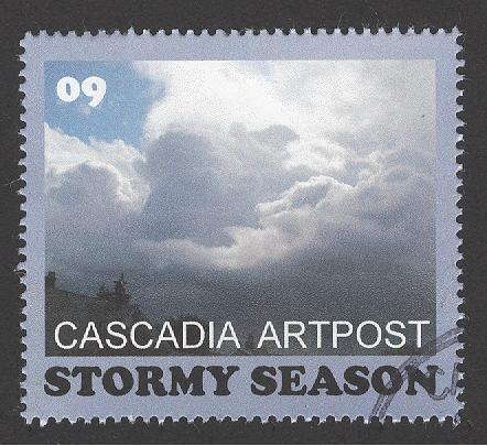
The break from summer is usually marked by an early storm, which can occur
any time between early September and early October. This year, such a stormy
period occurred on September 6-7. Cascadia Artpost tried to capture the essence
of what we call the "Stormy Season" through a photo of stormy afternoon cumulus
clouds boiling over Seattle, Washington.

0 comments:
Post a Comment