|
|
 |
|
|
Snapshot: SRSAC, Jodhpur
|
|
Remote Sensing is an emerging technology which contemplates of spatial, spectral and temporal data of earth surface using air and space craft. Remote Sensing technology is powerful tool for evaluation of Natural Resources, both renewable and non-renewable, with speed, accuracy and economy. In conjunction with ground survey, it offers an efficient time saving and cost effective method for assessment of Natural Resources on repetitive basis for planning the development activities of the state.
|
|
The technology comprises
application of Satellite data, Air borne and Ground truth data. The data products from satellite are in Black & White imagery, false color composites and computer compatible tapes, aerial photographs are variable scale can be
analyzed visually and digitally.
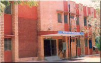
SRSAC, Jodhpur
In Rajasthan Remote Sensing activities started with the establishment of
Aerial Photo Interpretation Laboratory
(APIL)
in 1979 as a part of centrally sponsored Desert Development programme, to assist soil and water conservation planning in the State under the State Agriculture Department. Later on in 1985 looking to the multi-disciplinary utility of Remote Sensing technology, the laboratory was
transferred to State Department of Science and Technology and renamed as
State Remote Sensing Application Centre (SRSAC)
|
|
|
|
|