Hiking into "die gat" after the burn
The Donkey Trail
I dont know where I first heard the story that the De Kok family who lived at Silverstream used to commute on foot down Wolfieskloof to the village of Villiersdorp with pack donkeys to collect their provisions.
Knowing the kloof to be difficult, this story intrigued me.
About a year previously I had "discovered" Silverstream after I had come to live in Villiersdorp. Walking trails have always been a passion with me.
I had seen from a map that there was a building on Silverstream. A track was shown meandering from it heading away from Villiersdorp to a place I knew not where as it was off my particular map. Obviously it must go somewhere.
My plan was to take the shortest route to the building i.e. hike up the kloof, find the building and then follow the track out.
There are two kloofs from Villiersdorp village leading up to Silverstream. One a very steep and deep ravine (Wolfieskloof) and the other a parallel and more gentle valley but with steep sides rising from the valley floor to a neck.
Over a period of two or three years I was to get to know these kloofs very well.
Initially I set off with a companion to explore the kloof. We first took a route leading up the shallow kloof. Very quickly the initial path petered out.The valley floor was choked with thick vegetation. After struggling for a couple of hours following the stream bed, battling through the undergrowth we gave up and returned emerging cut, torn and bleeding.
A few weeks later we tried again. This time our route took us high up one side of the valley. The terrain was somewhat easier as the vegetation was not as dense but led higher and higher towards some other valleys that we would have to cross over. We returned yet again . This route, we decided, was also unsuitable.
By this time I had acquired another map and found out where the track from the building went. If access to the building was not feasible up the kloof; then we would try from the track side.
We set off to look for the track. We found it with some difficulty. It was overgrown and obviously had not been used in years. The track made an easy walk, meandering along a contour route and eventually stopping at a stream. Nearby a few low stones was all that appeared to be left of a building.
Later it was found that the main building, a simple stone cottage, now an overgrown ruin, was located in the next valley and the track did not link to it. The route to this building was a disused cart track; not marked on the map, coming from the opposite side of the mountain.
Thus my interest in Silverstream began. I obtained permission from the owners to walk there and eventually it became a passionate hobby.
I was told that the occupiers of the house in the 1940s had used a donkey trail down the kloof to get to the village. This must have been an easy route, but where was it? Perhaps I should try looking for the trail down from the top rather than up from the bottom.
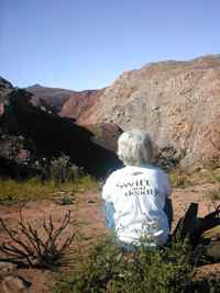
Initially the route down was easy going across gentle mountain slopes. As the kloof steepened it became more difficult and overgrown. I descended to a spot where I could see the neck at the head of the shallow valley mentioned previously. Before the neck the kloof split into two with precipitous sides. I christened this area "die gat" (the hole)
|
Hiking into "die gat" after the burn |
|
I sat and pondered over a route through that could possibly have been used by donkeys. It seemed impossible whichever way I looked at it.
Later when I met Elizabeth, who had been born in the little house at Silverstream in 1930; she told me that she and her little brothers walked down the kloof when they were small children to go to boarding school in the village. This was many years ago. She could not remember much detail of the route. What she could tell me did not fit the picture of the kloof as I knew it. The mystery of where exactly the track went remained a mystery.
|
I undertook several excursions and viewed "die gat" from all angles. I finally decided on where a route might have been . The route was, however, no longer possible due to the heavy undergrowth. I came to the conclusion that in the 30s it may have been cleaned out by fire . It might have been very different to what I was experiencing now. However it niggled me that I had not managed to find the slightest trace of the track. I even obtained aerial photos taken in the 40s and spent hours poring over them without success. The elusive donkey trail had become an obsession! |
|
In Feb 2004 I returned from a holiday in the Southern Cape to find that there had been a fire on the mountain. It had started in the village. Fanned by a strong wind, it had swept up the two kloofs out of control and engulfed the entire mountain.
My first thought was for the now partly restored house, which stood right in the path of the fire. I had not cleared much of a firebreak around it. A hurried trip to check revealed a scene of blackened devastation around the house. Thank goodness the timbers of the building had suffered no damage.
My thoughts then turned to my fixation on the donkey trail. Perhaps now with the vegetation completely burnt away up the kloof some evidence of the trail might present itself. I could not wait to mount an expedition to find out.
|
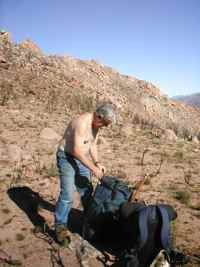
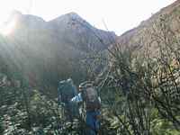
In due course I set off with a companion from the house down to the kloof. We followed a route into "die gat" where I thought the donkey trail might have gone. The route was easy going now that the vegetation had burnt away. The natural route was to skirt along the side of "die gat" towards the lower valley neck. There could only be one way to go here . From my vantage point I could clearly see what appeared to be a narrow track. We headed towards this. It was unmistakable. The donkey trail, unused since the 1940s, had been found. I was elated. |
|
On one of my previous expeditions I had stood at this very spot on the track without realizing it, as the bush was so thick and impenetrable.
We followed the track along a contour to the neck. The ground to our left shelved away steeply into the ravine. Now some of the comment made by Elizabeth made sense as she had told me that part of the track fell away steeply to one side and she was frightened to cross it.
We continued from the neck down the shallow valley now denuded of vegetation
and an easy walk following the stream bed. At the bottom of the valley the two
kloofs meet. At this spot used to stand a small power station, which supplied
Villiersdorp with some electricity in the 1930s. It was here that according
to Elizabeth, the donkey trail started.
Final proof came on a later excursion up the trail when I found a horseshoe. It
was small and could only have been made for a donkey.
Ken Thomas Sept 2005