Edwards Plateau Microbox
Edwards Plateau Microbox
| Placed By: | Silver Eagle |
|---|---|
| Date: | 01/17/09 |
| Nearest Town: | Rocksprings, TX |
| County: | Edwards |
| Terrain Difficulty: | Easy (flat, 50 yards RT) |
| Recommended Ink: | brown |
| Status: | alive (01/17/09) |
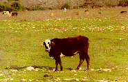
The Edwards Plateau is a region of west-central Texas which is bounded by the Balcones Fault to the south and east, the Llano Uplift and the Great Plains region to the north, and the Pecos River and Chihuahuan Desert to the west. It mostly lacks deep soil suitable for farming and the rough terrain areas are primarily grazing regions, with cattle, sheep and Angora goats predominant. Edwards County is part of this area and this box can be found in Rocksprings Cemetery.
NOTE: Always take adequate precautions (such as prodding with a stick and/or wearing gloves) before reaching into dark crevasses and holes in the wild. Before you set out read the waiver of responsibility and disclaimer.
Return to Silver Eagle's Texas Letterboxes Page
Return to Silver Eagle's Letterboxing Aerie
Last updated on 01/20/2009