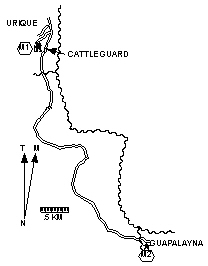
Guapalayna |
|
Length = 5.6 km. Exertion index = 175 going 125 returning. Maximum elevation = 585 m.
|
Guapalyana is a little village with a dirt street and nothing that distinguishes it from other little villages. The road there is dusty and gets enough traffic to annoy walkers but it's short not steep and has good views of the Urique River and the overhanging cliffs. 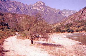
|
|