|
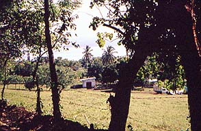
There's a small lake in a volcanic crater near Catemaco. The hike that
goes there takes you through some pretty farm country on little-used
roads.
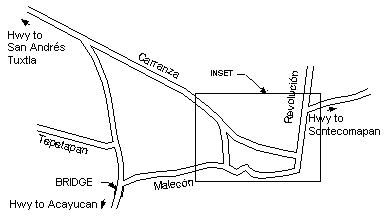
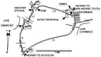
The trailhead is at the end of the street the Hotel Tepetapan is on.
That street connects with the Highway 180 bypass around Catemaco 200
meters south (toward Acayucan) from the Pemex at Km 146. It almost
lines up with Moctezuma Street coming from the center of town. When you
reach a dam at the other end
go around to the other side of of the
dam. At this point you may elect to follow the canal downstream for
whatever distance suits you to see birds in natural jungle foliage who
feed on fish in the canal.
From the dam
go past the small unmanned weather station and follow
the foot trail past the little lake to the highway and back into town.
Thanks to Dave Kloosterman for this delightful excursion.
|