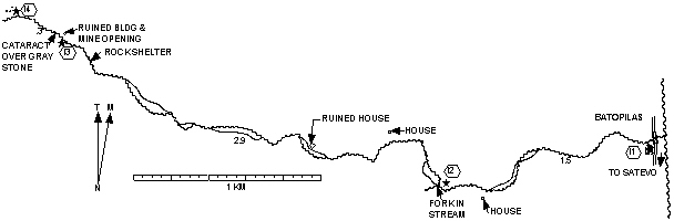
 The hike to Camuchín
an abandoned mine
starts out badly. Just after
you leave the
central plaza in the direction of Satevó you cross a little bridge. For
Camuchín
duck under
the bridge and follow the stream bed. The stream meanders about on the
flat gravel bed
splitting and rejoining
so you have to keep jumping streamlets to keep
your feet dry. Fortunately
this is the worst part of the hike
so
you'll know right away whether there's too
much water for you to make it. Once you reach the stream's fork things
get better. You take a foot trail that goes between the branches and
then follow the stream on the right up a pretty
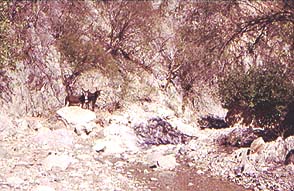
leafy canyon with many
cascades and cataracts. At the end
there's some scrambling over boulders to be done
and then you reach
the old mine. Before going inside check the floor of the mine to see if
it's flooded. There are the remains
of some ore-processing equipment a little further on.
The hike to Camuchín
an abandoned mine
starts out badly. Just after
you leave the
central plaza in the direction of Satevó you cross a little bridge. For
Camuchín
duck under
the bridge and follow the stream bed. The stream meanders about on the
flat gravel bed
splitting and rejoining
so you have to keep jumping streamlets to keep
your feet dry. Fortunately
this is the worst part of the hike
so
you'll know right away whether there's too
much water for you to make it. Once you reach the stream's fork things
get better. You take a foot trail that goes between the branches and
then follow the stream on the right up a pretty
leafy canyon with many
cascades and cataracts. At the end
there's some scrambling over boulders to be done
and then you reach
the old mine. Before going inside check the floor of the mine to see if
it's flooded. There are the remains
of some ore-processing equipment a little further on.
On the way back
there's nothing to stop you from going up some of the other canyons.
You can't get lost because you just have to follow the water downstream back to Batopilas.
|