 |
| I left the frontage road off I-49, above Sunset.
I knew I wanted to head into the prairie just because it is the most relaxed riding around. There is no traffic. There is a breeze and there's just a lot of open pretty space. Starting to sound boring to some? Maybe so. We all know the cure for boredom on a trip is a game, or a puzzle if you are a Baronet. I looked down at the GPS as I went north on Boudin Road just after leaving 357, and what do I see? Bayou Plaquemine Brule. It seems that, according to the GPS, I was very close to its source. It had to be the same bayou that flowed to Mermentau and became a contributor to the mighty Mermentau River. |
 |
 |
 |
 |
 |
 |
| I would follow it, photograph its progress as it grew and see where it meandered.. Now I had a game, and yes, a puzzle. It was a beautiful mid-Spring day, I was riding the repaired DL 650 and I was assured by multiple recently read motorcycle magazines that I was on the best motocycle in the world for getting this done. With all that praise, I figured I could just release the handlebars and tell it where to go. There was a wobble and I was slapped back into reality. The DL still requires "bars holding". |
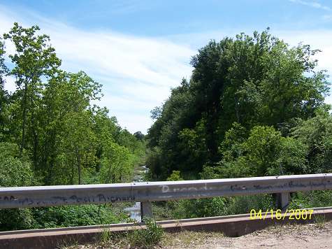
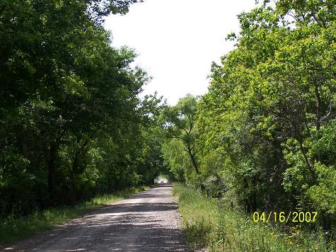
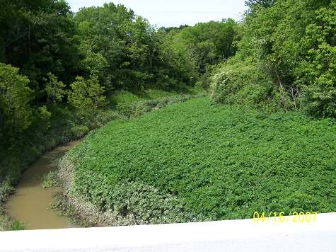
| The bayou would be illusive. Road selection would be a chess game. I had to choose roads that offered the most chances to see the bayou. The bayou hides back in the fields and in low lands that no roads traverse. I went miles without a chance to monitor it. To start with, PB starts as a fork, each bearing its name. The second time I crossed it, where the picture was taken, it had been a stream since Bayou Belleview and Carron near Washington. So it seems I was late to the show. But, look, how much smaller can a bayou get? |
| I headed south hitting La.35, crossing Brule after it had consolidated.
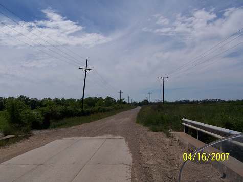
By the way, the altitude along the PB valley is a high 49 feet. It would give away some of those feet before it was all over. I saw a road that branched off 35 and took it to meet PB, then backtracked after seeing that it would have not improved my positioning for further shots. Chess. Next stop south was La 95 and a ride into Church Point. and I'll be, that deep ditch there is Bayou PB. I hit Roxi Hwy, La 370, and crossed PB again. |
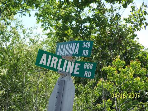
| I read all the road signs and many are funny. Many are historical. Many are functional, and many just make me wonder. Acadiana I get, that's the nickname for this Acadian area. Airline, I don't. I've run across other "Airline Roads" in the middle of nowhere and they have been equally ponderous. If it had been "Airline 666", it would have been troubling. |
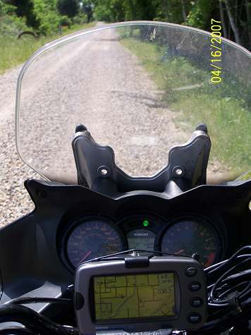
| I post these pictures and then come back and try to write something under or over them. I tried just putting up the pictures one time and Fred sent me three mauve stationery complaint notes about how uninteresting the whole article was and that I could forget about him being a reader if I didn't correct that presentation in the next one. I pondered on that one, too. Fred is like a bothersome relative. Back to the above picture. That's the DL's dashboard and the GPS. Ok, why did I use up valuable picture space with that? One reason is that this website is totally about you joining me on these outings, well, except for the research ones. Looking at the dashboard is part of the ride, a big part, maybe too big a part, as taking your eye off the road is a no-no. I no-no a lot So as not to leave you out of the full experience, I showed you this picture. Now Fred is going to complain about too much dialogue over a cocpit shot. There are a few bike riders that read this thing, Fred. They might be interested in the layout. I know you're not. |
| Had I made a wrong turn? Was I in South America? I have dreams like that. |