|
|
Survey of McGowan Camp
In the spring of 2002 one of the four regimental camps occupied by McGowan’s 1500
troops underwent a program of survey. The features within this camp were identified through
surface reconnaissance, with individual features being mapped using a Global Positioning
Station. In all, 125 depressions were mapped.
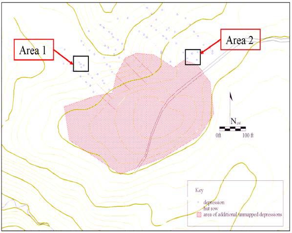
Figure 3. Map showing layout of McGowan Encampment with excavation areas indicated by boxes.
The encampment covers a 5 acre area and was carefully located to allow for access to
water and drainage. The camp is situated at the end of a south-westward trending ridge bordered
to the southwest by a stream. This camp is separated from its sister camps to the north by
shallow ravines which allowed woodlots to be carefully rationed between individual regiments.
All the camps are located on slopes— likely positioned to take advantage of drainage on the
poorly drained Piedmont soils.
Survey of the southernmost camp allowed the layout to be deciphered. Based on the
position of mapped features, the hut sites were arrayed along a set of 8 to 10 streets set parallel to
each other. This arrangement of huts along streets is very similar to what other surveys have