| CRISP - Centre for Remote Imaging, Sensing and Processing, Singapore |
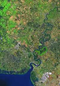 |
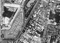
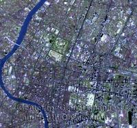
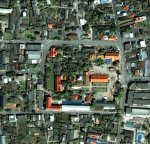
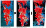
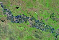
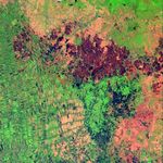
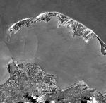
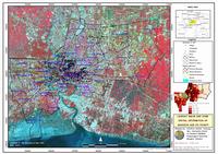
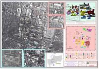
| Area: |
| Chachoengsao |
| Satellite: |
| SPOT 4 |
| Date: |
| Feb 20, 2002 |
|
|
|
| File name: |
| Feb01_o.jpg |
| Pixel: |
| 682 x 976 |
| Size: |
| 188 KB |
| Also available on the download page are:
- A higher-resolution image (200%) of a central section.
- A wider-coverage image and a location map
|
 |
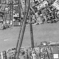
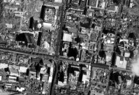
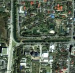
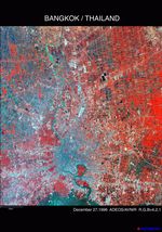
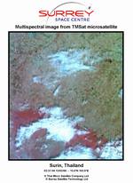
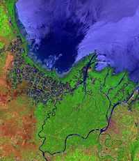
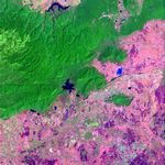
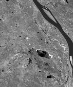
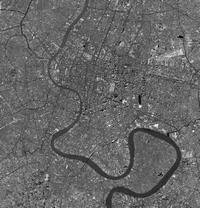
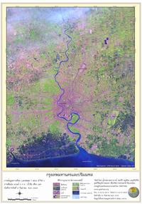
| Area: |
| Mun River |
| Satellite: |
| SPOT 4 |
| Date: |
| Dec 5, 2001 |
|
|
|
| File name: |
| Dec01_o.jpg |
| Pixel: |
| 1052 x 711 |
| Size: |
| 190 KB |
| Also available on the download page are:
- A higher-resolution image (200%) of a central section.
- A wider-coverage image and a location map
|
 |
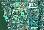
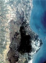
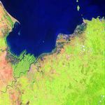
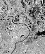
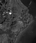
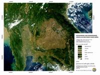
| Area: |
| Surat Thani |
| Satellite: |
| SPOT 4 |
| Date: |
| Apr 6, 2003 |
|
|
|
| File name: |
| Apr03_o.jpg |
| Pixel: |
| 542 x 627 |
| Size: |
| 183 KB |
| Also available on the download page are:
- Two higher-resolution images (200%) of central sections.
- A wider-coverage image and a location map
|
Other Images on this Site
| Satellite: SPOT 5 |
|
|
|
|
Ao Ban Don |
Thale Luang Lake |

Dong Phaya Yen |
East of Bangkok |
Phanom Dong Rak |
| |
|
|
|
| Satellite: IKONOS |
|
|
|
|
Ao Ban Don |
Thale Luang Lake |
Cape Pho |
Nakhon Panom |
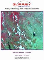
Nakhon Sawan |
|
|
|
|
|
Phu Not |
|
|
|
|
|
| Digital Globe, Inc. |
 |
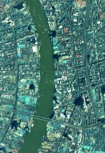
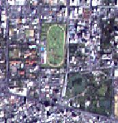
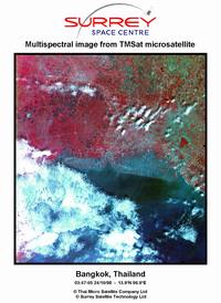
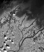
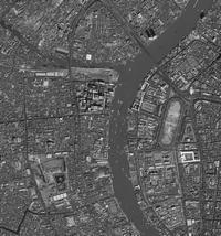
| Area: |
| Bangkok |
| Satellite: |
| QuickBird |
| Date: |
| Dec 10, 2001 |
|
|
|
| File name: |
| qb_bangkok2.jpg |
| Pixel: |
| 2100 x 2180 |
| Size: |
| 2,547 KB |
|
These images are no longer available on the Digital Globe website, but can still be downloaded from the website of the Ball Aerospace & Technologies - the manufacturer of the QuickBird satellite.
Their original file names were, respectively:
- bangkok_pan_full_scene.jpg
- bangkok_downtown.jpg
- bangkok_grand_palace_full_view.jpg
- bangkok_grand_palace_enlargement.jpg
These images were also available in the tif format on the Digital Globe website, but not anymore. |
 |
| Area: |
| Bangkok |
| Satellite: |
| QuickBird |
| Date: |
| Dec 10, 2001 |
|
|
|
| File name: |
| qb_bangkok1.jpg |
| Pixel: |
| 2241 x 2400 |
| Size: |
| 4,049 KB |
|
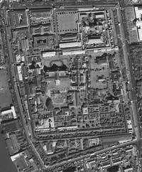 |
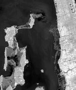
| Area: |
| Grand Palace |
| Satellite: |
| QuickBird |
| Date: |
| Dec 10, 2001 |
|
|
|
| File name: |
| qb_palace2.jpg |
| Pixel: |
| 1929 x 2334 |
| Size: |
| 1,822 KB |
|
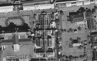 |
| Area: |
| Grand Palace |
| Satellite: |
| QuickBird |
| Date: |
| Dec 10, 2001 |
|
|
|
| File name: |
| qb_palace1.jpg |
| Pixel: |
| 1800 x 1135 |
| Size: |
| 746 KB |
|
| GIS Thai - Geo-Informatics Center for Thailand |
 |
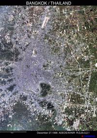
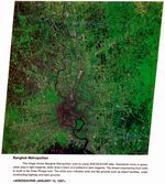
| Area: |
| Bangkok |
| Satellite: |
| Landsat |
| Date: |
| Nov, 1997 |
|
|
|
| File name: |
| satellite-bangkok.jpg |
| Pixel: |
| 1500 x 1061 |
| Size: |
| 449 KB |
|
This image is split into 120 (= 12 x 10) sections. With a proper graphic editor, you should be able to stitch them in a few minutes.
Administrative boundary lines are imprinted on the image. |
 |
| Area: |
| Bangkok |
| Satellite: |
| Landsat |
| Date: |
| Sep 2, 2002 |
|
|
|
| File name: |
| bangkokimage.jpg |
| Pixel: |
| 1024 x 1462 |
| Size: |
| 333 KB |
| This image is split into 80 (= 8 x 10) sections. |
 |
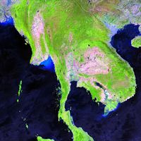
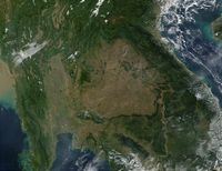
| Area: |
| Thailand |
| Satellite: |
| Terra |
| Date: |
| Mar 25, 2001 |
|
|
|
| File name: |
| modis.jpg |
| Pixel: |
| 967 x 723 |
| Size: |
| 139 KB |
|
This image is split into (= 8 x 8) sections.
This is a reduced and annotated version of the original image from NASA (listed below). |
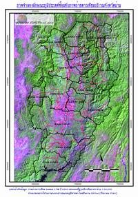 |
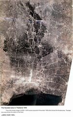
| Area: |
| Nan |
| Satellite: |
| Landsat |
| Date: |
| 1997 |
|
|
|
| File name: |
| landsat-nan.gif |
| Pixel: |
| 595 x 850 |
| Size: |
| 394 KB |
| Administrative boundary lines and major roads are imprinted on the image. |
 |
| Area: |
| Chulalongkorn University |
| Satellite: |
| aerial ? |
| Date: |
| 2000 |
|
|
|
| File name: |
| chulamap.jpg |
| Pixel: |
| 2000 x 1410 |
| Size: |
| 569 KB |
| This image is split into 140 (= 10 x 14) sections. |
| NASA - National Aeronautics and Space Administration |
 |
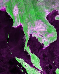
| Area: |
| Burma, Thailand, Laos, Cambodia, Vietnam |
| Satellite: |
| Terra |
| Date: |
| Nov 30, 2001 |
|
|
|
| File name: |
| ev11008_Thailand.A2001334.0350.250m.jpg |
| Pixel: |
| 5200 x 4000 |
| Size: |
| 3,164 KB |
|
International border lines are imprinted on the image.
Smaller images are available on the download site. |
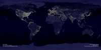 |
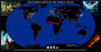
| Area: |
| Earth |
| Satellite: |
| DMSP |
| Date: |
| Nov 27, 2000 |
|
|
|
| File name: |
| ev5826_land_lights_16384f.tiff |
| Pixel: |
| 16384 x 8192 |
| Size: |
| 39.6 MB |
|
This is a huge file. Not only its downloading is a challenge for modem connection, but viewing/editing this image can be troublesome.
Smaller images are available on the download site. The jpg file (2400 x 1200 - 534 KB) is interesting enough.
The raw data for this image was provided by the NOAA (listed below). |
| Space Imaging, Inc. |
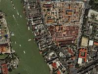 |
| Area: |
| Wat Pho, Bangkok |
| Satellite: |
| IKONOS |
| Date: |
| May 8, 2000 |
|
|
|
| File name: |
| bangkok_palace_1280.jpg |
| Pixel: |
| 1280 x 960 |
| Size: |
| 450 KB |
|
Contrary to what its file name suggests, they have effectively panned out the Grand Palace, showing only Wat Pho (political considerations?).
Furthermore, their image is upside-down, the upside being the south (corrected in the thumbnail on the left).
Reduced images are also available for wall papers as follows:
| bangkok_palace_1024.jpg |
| 327 KB |
| bangkok_palace_800.jpg |
| 225 KB |
| bangkok_palace_640.jpg |
| 156 KB |
|
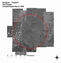 |
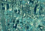
| Area: |
| Bangkok |
| Satellite: |
| IKONOS |
| Date: |
| Sep 5, 2003 |
|
|
|
| File name: |
| geo_Thailand_Bangkok_big.jpg |
| Pixel: |
| 3250 x 3333 |
| Size: |
| 1,657 KB |
| Also available on this download page are 36 segments which were used to make this mosaic (larger scale and no red circle). |