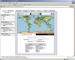
Satellite Exploration of Thailand > Satellite Image Resources
|
| Landsat MSS | Landsat TM | Landsat ETM+ |
 |  |  |
[Update: Both their MSS and ETM+ image archives now cover whole Thailand.]
Data Set Example
If you search their archive for Path 128 / Row 50 (roughly covering the Dangrek Mountain Range and the Thai-Cambodian border north of Aranya Prathet), you will find one data set as follows:
| ID | Status | WRS | P/R | Acq. Date | Description | Location |
| 13210 | Online | 2 | 123/50 | 1990-01-08 | TM, EarthSat, Orthorectified | Cambodia; Thailand |
By clicking on this data set, you will see a thumbnail image which can be somewhat enlarged:
And details of the data set:
| Filename | Download Size | Actual Size |
|---|---|---|
| p128r50_5t19900108.browse.jpg | 60 KB | 60 KB |
| p128r50_5t19900108.hdr | 1 KB | 1 KB |
| p128r50_5t19900108.met | 28 KB | 28 KB |
| p128r50_5t19900108.preview.jpg | 6 KB | 6 KB |
| p128r50_5t19900108.tar.742.jpg | 65 KB | 65 KB |
| p128r50_5t19900108.tar.jpg | 60 KB | 60 KB |
| p128r50_5t19900108_nn1.tif.gz | 21414 KB | 57591 KB |
| p128r50_5t19900108_nn2.tif.gz | 18770 KB | 57591 KB |
| p128r50_5t19900108_nn3.tif.gz | 24216 KB | 57591 KB |
| p128r50_5t19900108_nn4.tif.gz | 25536 KB | 57591 KB |
| p128r50_5t19900108_nn5.tif.gz | 30956 KB | 57591 KB |
| p128r50_5t19900108_nn6.tif.gz | 9811 KB | 57591 KB |
| p128r50_5t19900108_nn7.tif.gz | 26493 KB | 57591 KB |
| TOTAL | 157422 KB | 403366 KB |
Suppose you want to compose a RGB=742 image of this frame. You need to download following three files:
| Filename | Download Size | Actual Size |
|---|---|---|
| p128r50_5t19900108_nn2.tif.gz | 18770 KB | 57591 KB |
| p128r50_5t19900108_nn4.tif.gz | 25536 KB | 57591 KB |
| p128r50_5t19900108_nn7.tif.gz | 26493 KB | 57591 KB |
If you have a stable 56k modem connection, this can be done in about 6 - 10 hours. This is a long wait, and the download process may sometimes fail (!), but if you want a full-reslution image of a full frame, it is much easier - and often faster - than downloading hundreds of GeoZoom images and stitching them together. Also, the quality of images you get seems better than those by the GeoZoom.
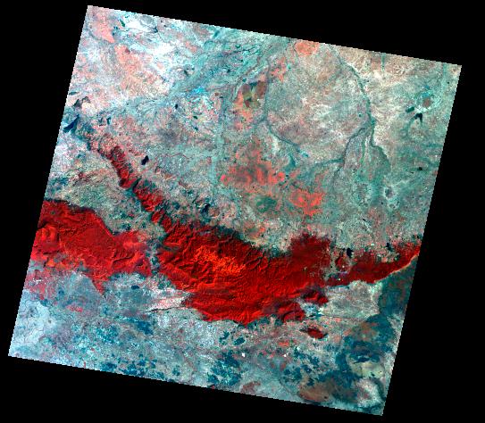
|
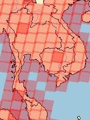
ESDI Sample Resolution - R348, Lam Nang Rong Dam TM, RGB=742 (brightness adjusted), png format, Jan 8, 1990 |
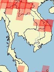
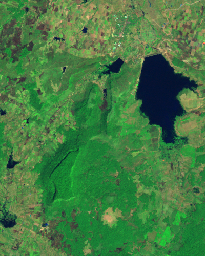
Corresponding Image from the GeoZoom ETM+, RGB=742 (contrast stretched), jpg format, Feb 12, 2002 |
 |  |