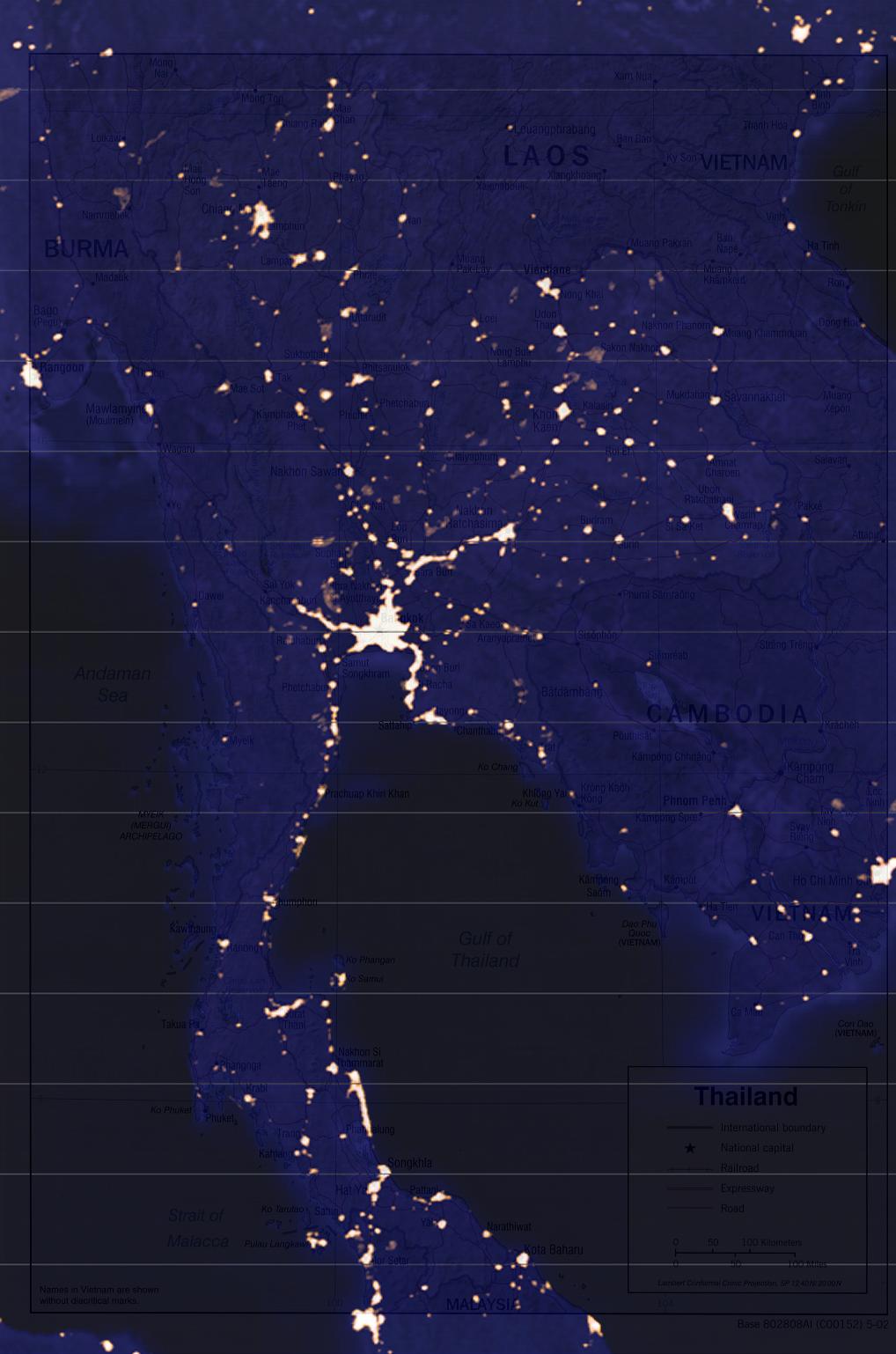
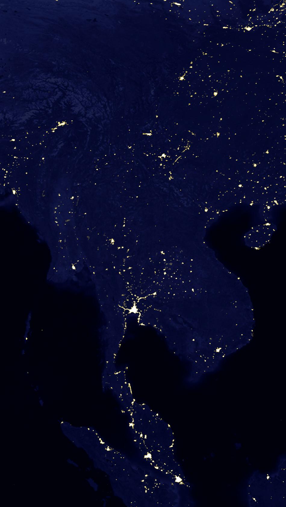
Image-1: ev5826_land_lights_16384.tiff
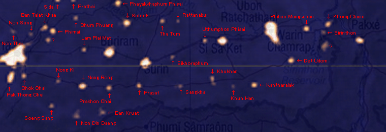
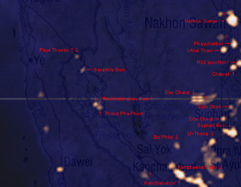
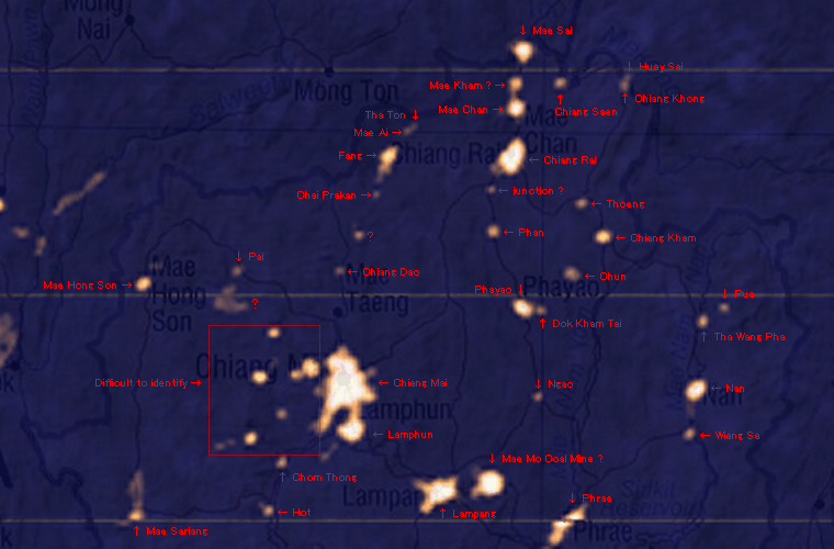
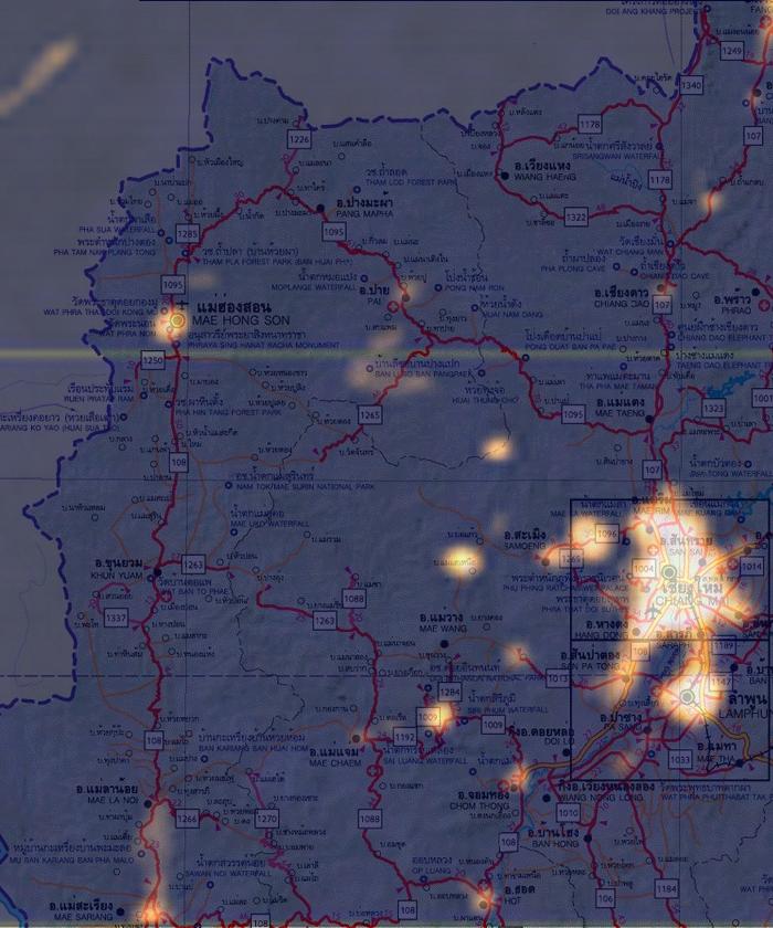
Image-2: The CIA Map of Thailand (Base 802808AI)
Image-3: Image-1 cropped around Thailand
Image Acquisition
Image-1 is a huge file [16384 x 8192, 39.6 MB] and it took me three hours to download it by 56k modem connection. I tried several graphic editors to crop the area around Thailand, but all of them failed in one way or another. Finally, with the Microsoft Paint, I managed to copy three rectangular areas by scrolling the image, and stitched them to produce Image-3. Incidentally, the Microsoft Paint failed to terminate.
Image Processing
Image-3 projects a smaller image of Thailand than Image-2 (about 50%). To reduce Image-2 to match Image-3 would hamper readability of Image-2, so I enlarged Image-3 to match Image-2.
Obviously, Image-3 is a Mercator projection. Image-2 also looks like a Mercator projection but, during the matching process, I noticed that the lower part of Image-3 must be enlarged more than its upper part. As I didn't have a graphic editor with trapezoidal transformation capacity, I cut Image-3 into 15 sections and applied different horizontal magnifications on a linear increment basis.
I overlayed these 15 images with 90% opacity on Image-2 and made horizontal fine adjustments.
Luminous Dot Identification
To identify each luminous dot, the product image should be enlarged 200%.