Western Samoa to the Marshall Island
Introduction
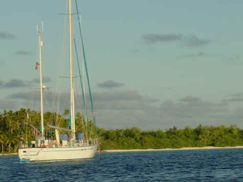
This was my 3rd trip aboard Karmaladen, a custom 62' ketch. The owner, Rixzene flew me out to help move the boat from Western Samoa to the Marshall Islands to avoid the tropical cyclone season in the southern Pacific. The other crew member was Ash, a fellow from England who had joined Rixzene in Tahiti for the trip north.
This is mostly a collection of emails written by Rixzene, Ash, and myself and combined into a story about the trip. Made a great video of the trip and discovered some wonderful people and islands out in the middle of nowhere.
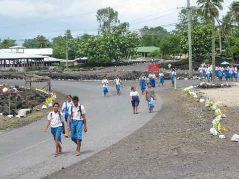
Savaii, Western Samoa
October 7, 2002 I flew to Pago Pago in American Samoa and spent the night. The following day, I caught a flight to Savaii in Western Samoa to met Karmaladen for a sailing trip to the Marshall Islands.
The weather has been raining everyday, with big seas and winds offshore. As soon as thing clear up a little we will be off to Wallis Island. If the weather remains bad for another 3 or 4 days we may just bypass Wallis and head directly for Tuvalu Island.
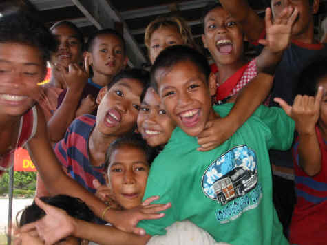
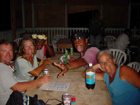
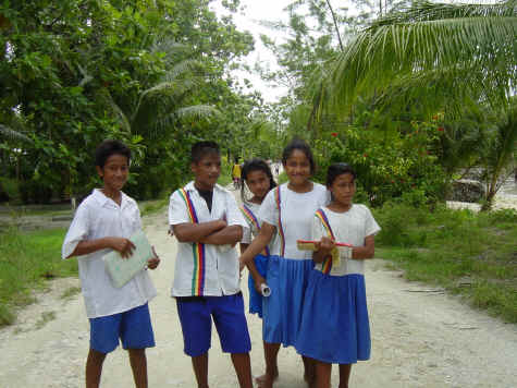
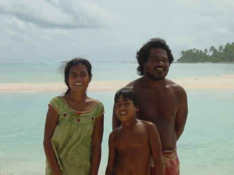
Staying in Savaii is a real treat. The people are so friendly and curious about us. Everyone asks "Where are you going?", it's like saying hello or maybe they just don't know what to say and that is what comes out. On a 5 minute walk to the post office we were stopped about 7 or 8 times by people along the road with the same question. There are only 3 very small stores in the village of Asau, where we are anchored. Each evening we go to one nearest the anchorage and have a beer. Every kid in the village shows up and wants us to take their pictures. Ash usually has 5 or 6 kids hanging on him every minute.
After the beer, we
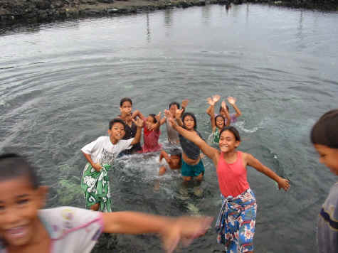
head to the village bathing pools. One is for men and one for women, both are spring fed and very cold. As you would expect, the men's pool is up stream. We usually stay in the pool until we hear the 1st bell for curfew. At the 2nd bell for curfew, everyone must be indoors someplace for 10 minutes of pray. After the 10 minutes, the 3rd bells gives the all clear. On 1st bell, we usually head for the dinghy and go back to the boat for the evening.
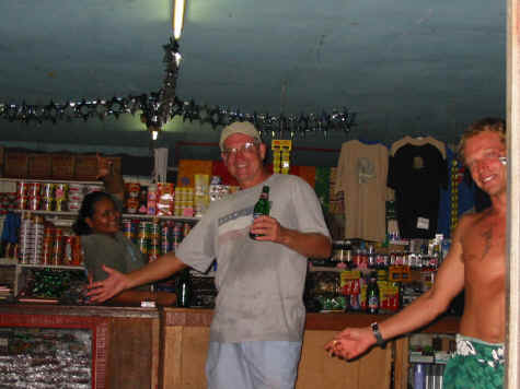
Last night Ducie, she runs the small store for her father, closed the doors and let us stay there during the
prayer time. We could hear her dad in the back praying as we were having another beer. Yesterday, we were walking by a church and decided to stop in. Chris, a local guy at the church, stopped the singing and practice for White Sunday and started it all over again, so I could tape it. Just great! Chris came out to the boat today with local fruits and presents, just unbelievable how nice everyone is. The local clothing is Lava-Lavas. Both men and women wear them and it is a skirt your wrap around yourself from the waist down. Men usually wear there a little high than the women, with underwear optional. I've bought 2 and
Dulcie gave me one. They are very comfortable.
The village boundaries are lined by rocks by the side of the road. Depending upon the village, the rocks might be either white or yellow in color. It is common to see tombs or headstones in the front yards of the homes in the village. The family buries their ancestors there to keep them close to the home. Many of the men have the typical Samoan tatoo which is applied from the bottom of the rib cage down to the knees. Everything, and I mean everything, in between is tatooed. Belly buttons, genitals, scrotum and anus are included. The women have a less painful tatoo as they are commonly tatooed only behind the knees or on the front of the upper thigh.
Wallis, Wallis Group
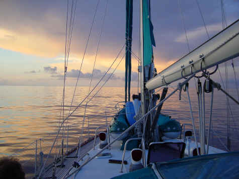
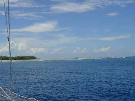
The weather finally improved from blustery to dead calm to a bit of wind and we finally and headed out for Wallis(as known as Uvea) atoll, one of the smallest French protected areas in the world. Wallis was about 215 nautical miles away and we planned to sail the entire distance with or without wind. We made an early departure planning on little or no wind but of course two hours off shore winds built to a steady 15 to 20 knots. Karmaladen picked up speed to 7 to 8 knots on a broad reach which threw our timing completely off.
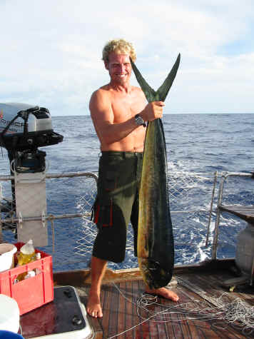
Just before dark we landed a tuna and two dorados. We sailed overnight hauling ass and would have arrived early evening but decided to slow down, sail off with a staysail and mizzen, to arrive in daylight hours just after low tide. The pass is Passe Honikulu on the south side of the Wallis. It is the only pass one can use to enter or leave Wallis and can generate 6 to 7 knots of outflowing current depending on sea conditions. A large sea can build inside the pass on an outgoing tide with large swells from the prevailing trade winds. This is one pass we felt we needed to be very cautious transitting!
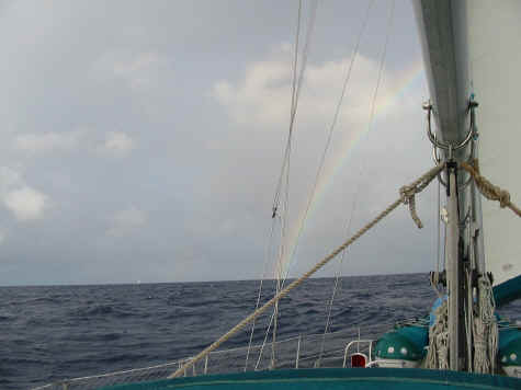
We stood off for about twelve hours. Morning greeted us with rain showers and the most perfect rainbow any of us has ever seen. The start of the rainbow was just off the port side of the boat forming a perfect arch towards Wallis Island. Wallis Island was at the end of the rainbow. Just as we started into the pass we had a small squall with 25 knots of wind but no problems entering. After entering the atoll we sailed around the east side of Uvea and anchored at Gahi village. That evening we had a dinner party with the other boats in the bay and ate the tuna and dorado.in
Wallis is a coral atoll, surrounded by a coral reef and has the main island of Uvea and five smaller islands surrounding it in the atoll. The outer edges of
the reef are nine miles by twelve nautical miles. The main island of Uvea is three by seven miles. Uvea's transportation consisted of our thumb and lots of
friendly islanders. Gahi is a small residential village and we had to travel to
Matau Utu,three miles away, for check in and any services. After our 48 hour passage captain and crew were ready for pizza and beer. And beer.
The next day we decided to tour the island by rental car but found no cars available. This island is so remote that there are only two hotels with a total
of ten rooms. The people are unbelieveably friendly. The woman in the travel agency tried to give us her car to use for the afternoon when no rentals were
found. The main group of people visiting the island are French businessmen and
not many tourists. We started off with our thumbs and had the good fortune to catch a ride with a Wallisian teach named Napoli. Napoli studied in France and
is one of five teachers on the entire island who is native to Wallis. The majority of teachers and other professionals come from France. As incredible as
this sounds, the French here are paid a higher salary for "hardship" duty.
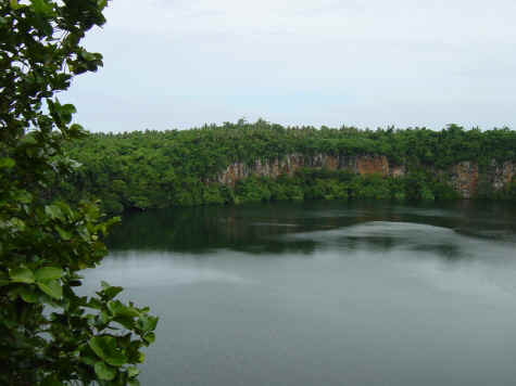
The trip with Napoli started with him planning to drop us at a crater lake. Once we got there he started telling us about the "big" crater lake and off we
went. The larger lake had high, inaccessable walls with crystal clear, emerald green water. This lake had been used by the U.S. military to dispose of WWII
surplus equipment. The trouble with paradise is the mosquitos!! And we gave
plenty that day.
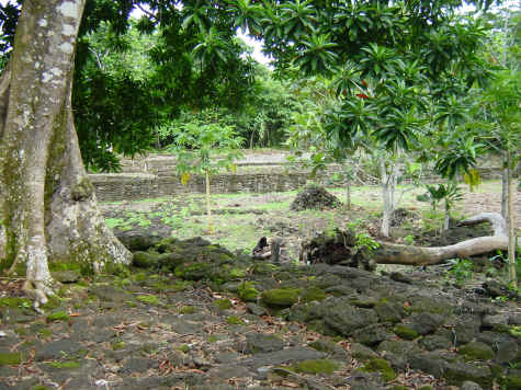
After the crater lake Napoli told us about an ancient Tongan Village which was a forward base for the Tongan takeover of the natives of
Wallis. The village was full of old stone ruins in pretty good shape. The Wallisians won't go here at night as they feel it is full of spirits then. The
pits still existed where human sacrifice took place (We're standing just in
front of one!). The natives believed that if they did a sacrifice while the chiefs daughter was giving birth that it would
make it a great warrior. We sacrificed some more blood to the mosquitos and headed to Napolis house where we met his children. Napoli dropped us at sunset
at the boat ramp. Just think - this was someone we had met only hours before
while hitchhiking.
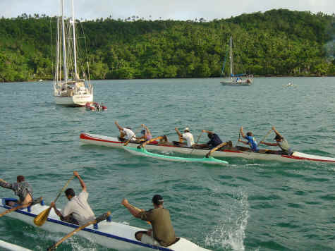
Sunday's entertainment was Polynesian canoe races. Just by chance we anchored right in the middle of their race course. We had front row seats for the eight
man polynesian canoes paddling within feet of the boat. The dogs had an exciting day cheering them on!
Tuesday we moved the boat to I'e Faioa to wait for our next weather window. The
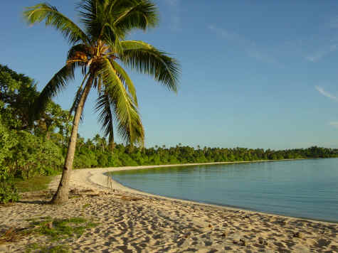
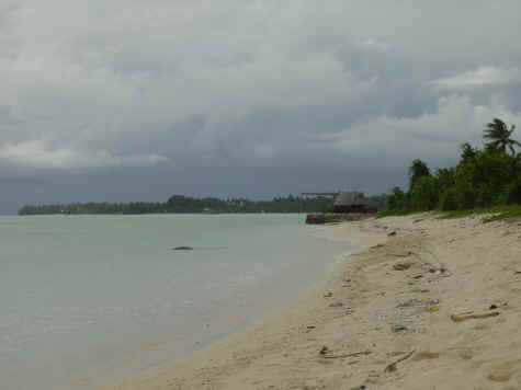
island is a deserted South Pacific island on the edge of the atoll which is picture postcard perfect.
Sofie is ready to go check out those postcard perfect beaches! The snorkeling was incredible. One of our favorites
was a tan fingerlike coral with clouds of small, bright blue fish. They would duck down into the coral when we got too close. Then again, there are the
bright little green fish! Every color you can imagine can be found in these reefs.
We played volleyball on the beach and had several great evenings with friends from the four other vessels in the atoll. One of the yachts was named Hetairos.
This 146 foot, privately owned luxury sailing/racing yacht had a crew of five, plus a nanny and two school teachers for the owner, his wife and two kids.
Being the poor kids on the block in our 62 foot custom ketch, we were just dying
to get on board to take a look around. They dropped by and asked us for 'sun downers' which consisted of champagne in fluted crystal glasses. Amazingly
enough they invited themselves on board Karmaladen a few days later. We gave them orange squash in chipped plastic mugs. Otto and his wife are really nice
people and not bad volley ball players!
Across the International Dateline
After three wonderful days at I'e Faioa, we left the pass in a dead calm to start our four hundred mile passage to the Tuvalu Group and sailed towards the international dateline which we crossed at 4:54 a.m. on Oct. 15, which immediately became 4:54 a.m. Oct. 16th.
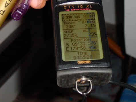
We are also pleased to announce that out Garman GPS correctly switched the W to E at 179 deg. 59.999 sec.
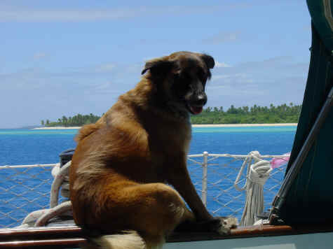
We looked for the stripe in the ocean - sorry, not there! Had a few slugs of rum and kept on looking. Now just like the picture, everything is a little fuzzy looking after a bottle of Rum at 5am on the International Dateline! This was our third day at sea and we decided take a day stop at Nukulealea in the Tuvalu Group of islands to rest for our overnight passage to Funifuti Atoll. We had had another sucessful day of fishing with both dorado and tuna in the fridge. The dolphin was easily four foot in length and Bob landed it with the help of all the crew (both dogs). We had to anchor outside the reef as there is no pass into the lagoon. Only a few people live on this island. After a little rest we snorkeled in the afternoon and saw several sharks - both black tip and grey reef. Snorkeling was great and we didn't lose any toes. We left that evening in light air under the South Pacific convergence zone.
This is an area of
unsettled weather that moves between the northern and southern hemispheres and usually has light winds mixed with squalls and
thunderstorms. Just after dark the lightning show started. With no place to hide we carried on through the
night.
Funafuti, Tuvalu Group
The Funafuti atoll has several large passes which caused no problems getting in. There were many coral heads that we needed to avoid in the lagoon. We entered Tu Puapua pass and anchored off Fongafale village. Funafuti island is a narrow strip of land on the eastern side of the atoll which is six miles long and two hundred yards wide. This is one of the most heavily populated islands per acre in the south pacific. The island houses 4100 people.
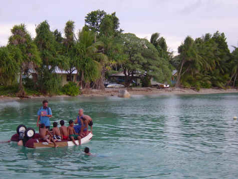
Les and Ann get boarded by the locals when we were heading into customs. The kids were sure happy to see us! This island is so far removed that only twenty to thirty yachts visit each year, and even fewer tourists. There are two flights that fly in and out of the island each week, both on the same day as connectors from Fiji. Our buddies on Hetarios, living the high life, planned to get their food flown in here but it was bumped off the plane because it was full. Customs in Fiji must have had a few good meals as the next possible flight was a week later.
The runway is right in the center of town and is used for games, bicyle riding, stolling as well as the weekly flight. One place on the island allegedly rents scooters. After two days of being promised scooters, the only available turned out to be broken so we went in search of an automobile. We tried to rent a taxi without the driver.
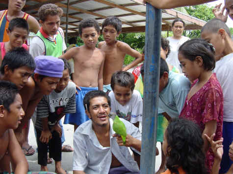
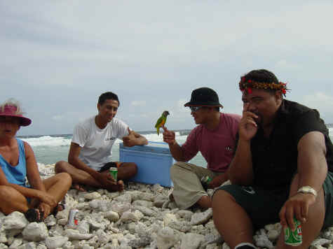
Luckily, we finally met the village idiot, a nice slow witted fellow, who knew everyone and found us a private car to rent. He was just fascinated by Les and Ann's parrot.
On our six mile journey around the
island we met some fellows on the south tip of the island on the beach with a large cooler of beer. We joined in the celebration of one of the fellows
(Guess which one!) separation from his wife. We had a great time with this group including a
physician (another parrot fan), a government worker, an economist, and a Japanese journalist. I'm
sure every other weekend someone gets separated and it's time for another party.
At the opposite end of the island we saw a small island's solution for garbage disposal. This beautiful picturesque place was just piled high with cans,
bottles, paper, boxes, etc. It was really depressing, so sad.
The majority of visitors the island gets are those studying global warming. Since Funafuti is only five to ten feet above sea level many people believe it
will disappear as effects of global warming cause rising of the sea. On a tour around the island you can see many places where the sea has risen into the lower
areas displacing some of the local homes.
We snorkeled between Funafuti island and Funangong island. The coral was a uniform shape but a multitude of pastel colors - green, blue, yellow, pink,
purple with an occasional lime green patch. There goes the neighborhood.....I'm
sure the locals did not approve.
There were three restaurants, all
Chinese, and
all good. And the people of Tuvalu are so friendly and shy with a ready smile
that lights up the face and puts sparkle into the eyes. We left Tuvalu two days ago and are slowly but steadily inching our way towards the equator and the
Gilbert Islands with Kiribati as our intended next landing. This trip is 720 nautical miles once again the in SPCZ with flat seas, little wind, a some rain
showers. Just wait for the video!
Across The Equator
Karmaladen was exiting the Funafuti Atoll in Tuvalu heading toward the Republic
of Kiribati with our next destination the Tarawa Atoll when we last contacted you. The Republic of Kiribati is composed of the Phoenix Islands, Gilbert
Islands, and part of the Line Islands. The name is pronounced "Kiribas" as the Gilbertese alphabet is composed of only 13 letters and "s" is missing. The
combination of a "ti" sounds like an "s". The Republic consists of 33 islands covering a distance of over 2400 miles and approximately 1.5 million square
nautical miles. Our trip would be approximately 750 miles, across the equator.
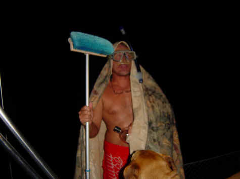
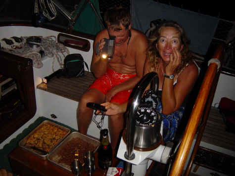
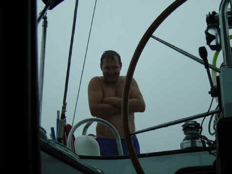
The passage was light air with calm seas and fantastic, colorful sunrises and sunsets. After 5 days we arrived at the equator at 3:00 a.m. and we were surprised by an unexpected visit from Neptune. This was a first equator crossing for Bob and Ash, and Rixzene's second crossing. King Neptune turned out to be Bob with a bed sheet over his head, held on with a snorkeling mask and his scepter was the deck scrub brush. This was a ploy to grab an extra swig or two of the champagne and rum bottles.
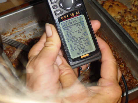
We did scientific studies after Neptune left, and.... did you know that the Garmin GPS model GXL12 reports the latitude of 0 degrees south followed immediately by 0 degrees north. Correctly, it should have recorded neither north nor south at the equator. We turned back south across the equator again to verify that Garmin was indeed correctly reporting the equator. The obvious test was to start pumping the toilet as it is well known that the water in the bowl swirls clockwise south of the equator and switches to a counterclockwise swirl in the north. Ash needed some exercise so he pumped, and pumped, and pumped as Bob watched and Rixzene wove back and forth across the equator.
The Garmin obviously was misreporting our position as
we could only achieve a counterclockwise rotation. The party continued for another two hours as we tried to decide who could best steer directly along the
equator from east to west and to see if drunks spin clockwise or counterclockwise along the equator. Fortunately, the skipper kept her head and
although the crew woke up next day with hangovers, a successful watch was maintained.
With the calm seas and light winds, on a normal day the crew would jump into the
water hundreds of miles from anywhere and take a swim. Both Ash and Bob made sure they stayed out of the water when Rixzene was in with her pink and black
swimsuit. In our experience, that combination of color makes for a perfect fishing lure.
Tarawa, Republic of Kiribati
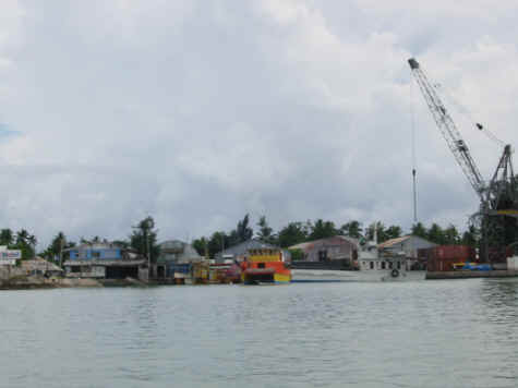
At Tarawa we anchored off the village of Betio which is the main port of entry and the capital of Kiribati. Tarawa is a series of islands connected by a causeway built during WW2. The inhabitable islands stretch around the south and east sides of the atoll for about 30 miles. In l943 during WW2 Betio was a heavily fortified Japanese occupied island. The U.S. needed the island for an air force base to launch attacks against Japanese strongholds in the Marshal Islands to the north. U.S. forces took the island in a 76 hour battle that killed all 4500 Japanese on the island.
The U.S. tragedy in this battle was the
landing at what is now known as Blood Beach where a mistake in determining the
state of the tide resulted in the landing crafts full of marines being hung up on the reef and forcing them to wade through water 1/4 mile into a barrage of
Japanese fire from concrete bunkers and 8 inch guns on the beach. Because the marines had no protection they suffered heavy casualties and the beach and water
ran red with their blood. It is a spiritual beach to be on now, as we toured
the remaining guns and bunkers. Today Betio has the main port and wharf and is dirty with rubbish, beer cans and people living in poverty. Even so, everyone
is unbelievably friendly.
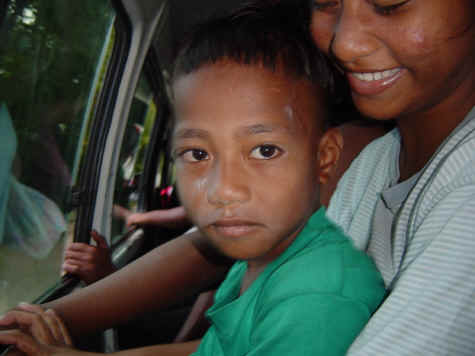
Betio's transportation is a fleet of old, worn out mini buses. And there is ALWAYS room for two more passengers! It was great fun riding on these filled buses to see two more passengers get on, and who was going to sit on who's lap. The lady and her son in the picture are not actually sitting on a seat, but on a board between the seats in front of the side door. Ash always liked sitting close to the door hoping a shapely and attractive native girl was one of the "two more" to get on. The buses were fun because the people were warm and friendly and interesting to talk with. However, we cannot recommend a restaurant in Tarawa. They are the worst in the world.
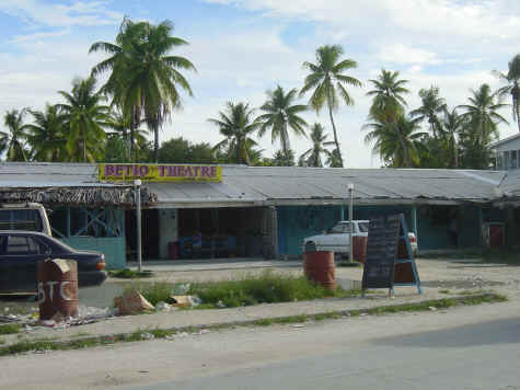
We did get to see a few first run shows at the local theater, which showed DVDs on a large screen. It was probably the only movie theater for several thousand miles!
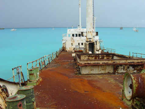
The harbor was filled with old wrecks. We were able to get on board several and
explore. Some of the wrecks sit at a 45 degree angle and crawling around inside
an old shipwreck can be a lot of fun. Tetanus shots are required just to look at these ships! We took a bus trip to the end of the island and as we neared
the farthest villages it was greener and cleaner. What a relief!
We were able to get a Kiribati cruising permit by going to customs, going to immigration, going to immigration, going to immigration, and going back to
customs. This took 4 days of traveling from Betio to the neighboring village of
Bairiki and back. The only good news was the ice cream stand is right beside the bus stop in Bairiki. We finally departed Tarawa on the overnight sail to
Butaritari with the send off of hundreds of dolphins in the pass out of the lagoon.
Butaritari, Republic of Kiribati
We anchored off the main village of Butaritari after a cloudy and rainy entrance into the pass. This atoll is mismarked as the latitude and longitudes on the chart do not match the GPS. We had to visually work our way into and through the lagoon in less than optimal circumstances with little sunshine and lots of shallow reefs.
Butaritari is a change from Tarawa in that the 3000 locals have so little. No electricity, minimal housing with thatched roofs and fala, well or rain water which has to be boiled as it is a contaminated with giardia, few material goods.
In the main village there were two one room stores the size of closets. You would stand outside and order from the shelves. One store sold kerosine for lanterns. Only one place had an icebox with cold drinks. I'm not sure these people even know what ice cream is. The good thing about having almost nothing is that there is no trash. The only processed foods most villagers use are bags of rice, flour and sugar.
The old flour and rice bags are then sewn together as sails for the canoes.
This island has no garbage pickup and is spotless. Everyone lives in primitive conditions but they seem to have a great and simple life. The bathroom for these
people is to go down to the ocean. Butaritari was only visited by 8 yachts this
year. We met 4 peace corps volunteers and with the three of us on Karmaladen we
felt famous. The beaches have lots of war relics including a downed plane near the wharf.
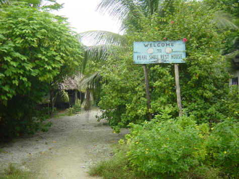
We had Thanksgiving dinner with a wonderful woman named Capbwebwe. She runs the
Pearl Shell Rest House which is the only accommodation on the island. This hotel
is three or four grass roofed huts on the beach. She can accommodate a handful of people. We had a typical Kiribati meal of chicken and local vegetables.
Vegetables and banana are grown in gardens which are pits dug in the sand, flooded, and a mat is woven around the root, filled with mulch, creating a sort
of pot for the plant to grow in.
We rented her scooter and the local ministers scooter for a tour of the island. There is one sand road that runs the length of the island (25 miles) through the 5 or 6 villages. We stopped to look at a memorial in a village that was bombed by the Japanese. The people are so friendly that they invited us over to the main fala to drink coconuts. We learned that the village was bombed by mistake because of a translation error with the Japanese. The mistranslation was that the Japanese were to fire on the second village to the south of the island where the U.S. military was located, but fired instead on the second village to the north. The bombing killed almost all of the unarmed villagers. During the Japanese occupation they forced the villagers to dig large trenches in the south part of the island where they planned to kill the local people and bury them. We believe that the Japanese did this because the locals had sympathy with the U.S. forces. Luckily, the massacre didn't happen as U.S. forces took over the island.
Today, all the local villagers love Americans. Just walking down the street everyone smiles and waves and is glad to see us. If you ever want to feel like a real celebrity, come to Butaritari.
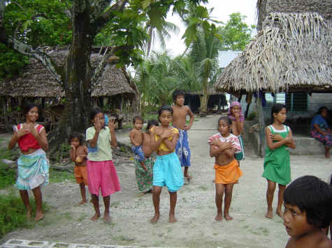
Entertainment included an unplanned dance exhibition by a group of local girls.
As we were passing a small building we heard music and saw several young people looking into the windows. We looked in and saw several local girls ages l0 to
l8 dancing similar to the hula of Tahiti or the dance of the Samoans. We asked them if we could tape them and they all scrambled outside into the yard so
everyone could join in and we were treated to music and dancing. I don't know who enjoyed it more - the villagers, the dancers or us
yachties.
We moved the boat to a remote island in the atoll called Tukerere to do some snorkeling. We thought the island was not inhabited but we found a husband and
wife, and small boy living on the island. Their life is like a movie script, such as the Blue Lagoon or Swiss Family Robinson. We don't believe they know
they are living a life style that some only dream of. The island was 1/4 mile
long, a few hundred feet wide with crystal clear water in the lagoon and lush tropical vegetation. They fished and dried coconut for copra and raised pigs.
They didn't speak English so communication was mostly through sign language but we had a great time sharing coconuts (theirs) and crackers and apples (ours)
with them. Local legend has it that there is an ancient goddess who protects fishermen and sailors and we asked if we could see this stone idol, which was
reportedly on the island. At the idol we left a gift of tobacco for the old woman (goddess). The tobacco is left in a huge clam shell and it ensures fair
winds and calm seas. We had a great time with these three wonderful people.
The snorkeling on the nearby reefs was some of the best the three of us had ever
seen. Piles of stage horn coral rivaled those stag horns found at the entrance to Jacksonhole, Wyoming. There were huge clams (some over 3 feet in diameter) in
a variety of colors, lots of different reef fish, groupers for spear fishing, moray eels, and a big variety of corals. We caught a grouper and a snapper
fishing from the back of the boat anchored in 25 feet of scattered coral heads. Those who were spear fishing were rewarded with fish.
Majuro, Marshall Islands
After a quick trip back to Butaritari Village to say goodbye we departed on our two day passage for Majuro in the Marshall Islands.
The area around the Marshals is known for the formation of tropical disturbances which may travel west, picking up speed and power, and form the cyclones of the western pacific. One such disturbance had formed and we sailed in brisk winds and rain for the majority of the crossing.
As usual, the winds died a few hours before our arrival at Majuro Atoll in the Marshals, and we needed to motor the last few
hours. We dropped a hook into the water at daybreak and before it was fully deployed we had a nice 2 1/2 foot wahoo on the line. It was wonderful to be met
by Karmaladen's friend Carey from the yacht Seal. Carey and Karin on Seal
sailed into the Pacific in l998 after meeting and traveling for several weeks with Karmaladen on the west coast of Mexico. We had continued email contact for
these 4 years and immediately started catching up on old times.
Majuro is a pleasant surprise as the locals and officials, once again in south pacific style, have made us feel comfortable and welcome. Majuro is clean, has
many stores for provisioning and supplies, has some wonderful restaurants, and a
fun and active yachting community. All three of the crew were surprised by the fact that it is Christmas! There are Christmas trees and holiday songs and a
Santa parade where the Marshal Island government distributes 6 tons (yes, that's
correct, 6 tons!!!) of candy by tossing it from 4 floats over a parade route of about 3 miles. They also distribute tooth brushes.
The local governments of both Bikini and Rongalap atolls are found in Majuro.
The people from those islands were moved here after nuclear testing (bombing in Bikini and an unfortunate wind shift and contamination in Rongalap). The
communities have remained alive for 50 years, electing their government representatives and mayors and keeping faith that someday they would be able to
return to their home islands. Bikini is now habitable and has a diving operation dedicated to the wreck diving in their area. Rongalap will open its
first hotel in June, 2003. We have spoken with the mayor of Rongalap and hope to cruise there in January or February. The diving should be outstanding!
Karmaladen is once again a crew of two as Ash and Rixzene said goodbye to Bob so
he could return to Texas, Tex Mex, unlimited hot showers, air conditioning, cold
drinks, dry clothes, ice cream, chili, barbecue, unlimited good restaurants, TV,
first run movies, diet Coke, washing machines, internet, CNN, the market forecast, weather reports, the news, a dry bed that doesn't rock and roll, a
full night of sleep, no decks to wash, non leaking windows, no snapping wind catchers, no flogging rigging, income tax returns, sleeping in, no night
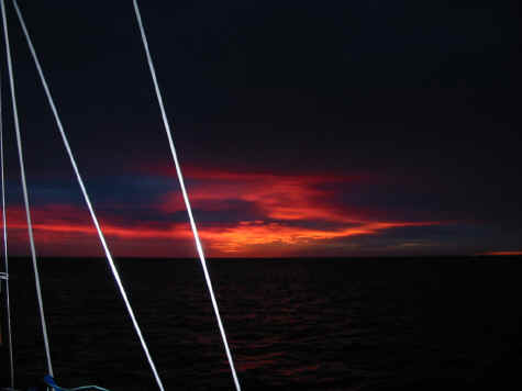
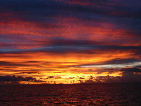
watches, no spear fishing, no coral, no reef, no dramatic doldrums sunrises and sunsets with fiery reds and pinks and corals and oranges and teals and blues
that astound the senses and seem unreal in their grandeur, no sound of the waves
caressing the hull while running with the wind in 30 knots of wind, no flight of
sea birds in the running lights in the darkest night with ghostly reflections on
the sails silently flying with the wind, no dolphins to caper in the bow wake and jump and flip and entertain, no exhilaration when the squall arrives and the
boat is heeled over and bounding through the seas, surfing over the waves, driving powerfully forward to whatever awaits us in the next lagoon, the next
island, the next port.
So, we wish you a Merry Christmas and Happy New Year from our new and temporary
home in Majuro, Marshal Islands.
Karmaladen December l6, 2002 Rixzene, Bob and Ash