(Links and page under construction. April 2007)
For more images please click HERE
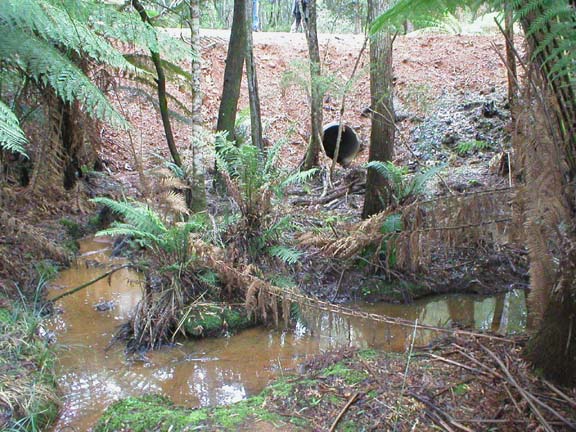
Culvert pipes in the Southern end of Crayfish Creek and its tributaries along the Southern Break Road in the State Forest comprising the Mawbanna Recreation Reserve.
Taken on 1st June 2004 at GPS location (Australian Geodetic datum 66) on the 'MAWBANNA' 1:25,000 map: Elevation 14 metres, 55g 0362296, UTM 5467240
For more images please click HERE
The coupe location should be found on the Mawbanna 1:25,000 map.
GPS location details: Australian Geodetic Data units, Elevation 108m.
55g 0365345, UTM 5471195
The above image shows the pink tape which (I assume) locates where the creek buffer of native vegetation is to begin.
As you can see from the image the clearfell has extended right into the creek itself with the dead vegetation being dumped over the watercourse.
You should be able to see creek water in every image.
For more images please click HERE
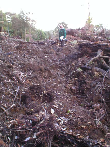
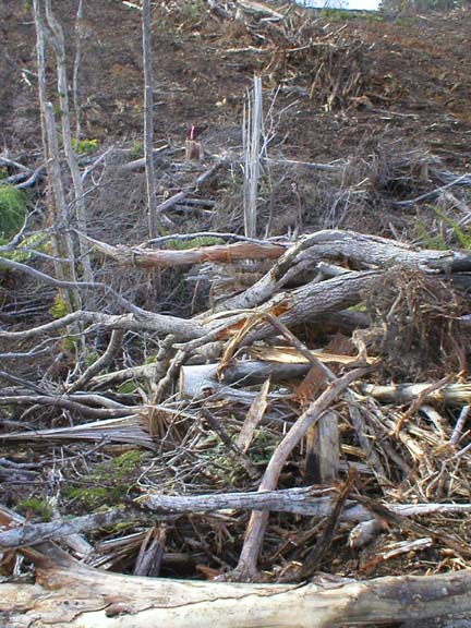
The above and linked images were taken around 16th May and early June 2004 at the clearfelling of deep red myrtle old-growth rainforest behind Preolenna. I understand that the clearfelling of deep red myrtle is a breach of the Regional Forest Agreement. However the clearfelling
(found on the 'Folly' map) appears to be on private land so this may not be the case.
On State land the Forest Industries Association of Tasmania 'Deep Red Myrtle' pamphlet - issued by Forestry Tasmania this month - states that the unreserved deep red myrtle 'on public land in Tasmania'...'is available for selective harvesting and natural
regeneration.'. This coupe had no identification details.
Burrowing crayfish chimneys were found in the vehicle tracks of the dozer. Much of the forest appears to be well over 100 years old. The coupe appears to border the Jessie Gorge and is on the edge of State forest and close to the Pruana forest reserve.
There are many other incidences of deep red myrtle clearfell in a swathe behind Preolenna (for several kilometres at least). These coupes have been converted from rainforest to a large monoculture of Eucalypt Nitens not long after most of the rainforest is piled up and burnt.
For more images please click HERE
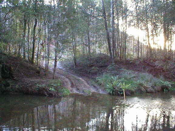
The Calder River near the intersection of the ZigZag (northern end of the
West Calder Road) near the intersection with the Calder Road.
Many more breaches. . . Bookmark this site for further updates.