| Back to Rogue's Home |
| Back to Rogue's Home |
| The REAL Ride Begins
After breakfast at Dave�s house, we headed north on I5 to meet Roger somewhere in Frazier Park, north-west of L.A. By now, the rush hour had long since disappeared and we were able to cruise the Interstate with good speed. Dave was moving along at about 85 mph with, Ken, Russ, and me in tow. Suddenly, a CHP car approached me and Russ and we pulled to the side. The CHP accelerated to Dave�s position then turned on his lights. I was sure it was going to be a ticket for Dave but the CHP car just kept on going. Talk about luck! |
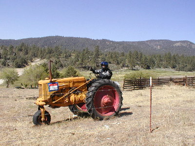 |
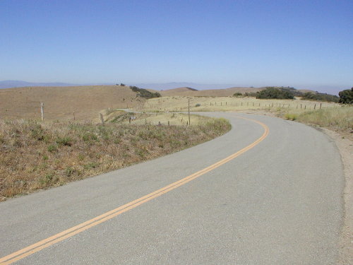
| Above: Ken messing around while we waited for Roger. Go Ken! Below: Mil Potrero Road towards the bottom. What a great road! |
| We got off I5 at Frazier Mountain Park Road to get to the final rendezvous point with Roger and his ZZR1200. Frazier Mountain Park Road was a smooth sweeping road that brought us up to elevation within the Los Padres National Forest, which means brrrrrr.....just a bit chilly. After we picked up Roger, we headed west on Cuddy Valley Road, which was pretty straight. Then the road name switched to Mil Potrero Highway. What a wonderful road it was! Mil Potrero was smooth and curvy as it went from the high elevation of Cerro Noroeste peak down into the central valley of Kern County. The road had great visibility as well as being well marked. |
| We gassed up at McKittrick, then headed onto Highway 58. It was smooth, open, had great visibility, with all the variety of road types from sweepers, to tight switchbacks, to long straightaways. Woohoo!
Highway 58 stretches from Kern to San Luis Obispo Counties. Prior to the construction of Highway 101, the 58 was the only road that went from the town of McKittrick to Santa Margarita. The first part of 58 are long sweepers and a few straightaways. When the road begins its climb up the Temblor Range, it becomes tight and twisty. Many of the corners are smooth decreasing radius turns but with good visibility through the turns. After that, 58 drops down into the Carrizo Plains where it straightens out. The Carrizo Plains has been designated a National Monument as it is home to a diverse community of wildlife and plants. This area was created by the San Andreas Fault, which over hundreds of years, moved the mountain ranges to create this large valley. At the center of this large valley is Soda Lake, which is a glistening bed of white salt set within a wide open grassland. If one was to fly over the Carrizo Plains, it�s possible to see the San Andreas fault line as it stretches right across the plains. Dave was leading the group through Highway 58 on his ZZR1200 and I�m quite sure he was loving every mile of this unique road. About 2/3 of the way into the 58, before it turned west towards Santa Margarita, Dave took a detour on a road called La Panza Road. La Panza was mostly all straights with a few gentle curves here and there to keep us awake. By this time, we had already covered 60 miles of Highway 58. So, at the end of La Panza Road, somewhere in Paso Robles, we really needed a break from riding. Our butts and legs were begging for some circulation! |
 |
| As we approached the valley, the surrounding area went from Pine forest to brown rolling hills with knee high brown grass and the occasional Oak tree, a view so common in this area of California. Mil Potrero deposited us onto Highway 33 somewhere near Maricopa. There, Highway 33 was nothing but boring straights and sweepers.....Yawn. When we got to Taft the views deteriorated into oil fields, since Taft was built around the Navel Oil Reserves. |
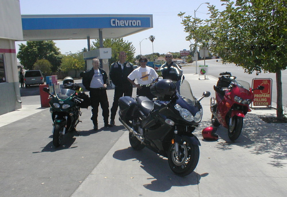
Right: The group after gassing up at McKittrick. Roger's black ZZR1200 is at the forefront. It's fitted with Corbin Beetle bags, GPS, and a host of other aftermarket stuff. Click on pic to enlarge. |
 |