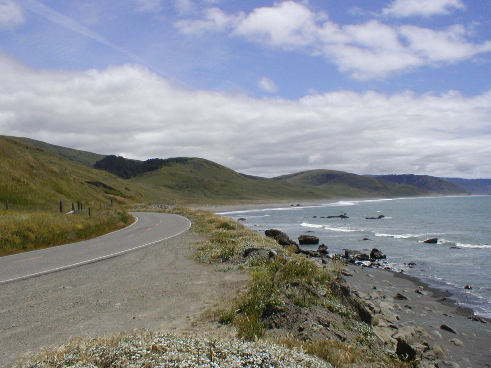
The Shoreline
Just when it felt like the bumpy road would never end, we came up on this clearing then over the top of this large hill. Right before our eyes was the Pacific Ocean. We reached the Lost Coast! Woohoo! The previously cloudy skies opened up to a clear blue, and it met with the sea to give us a tremendous view of the Pacific as we rode down the road right onto the shoreline. Here, Mattole Road smoothed out and I�m guessing because the ground below it no longer rumbled from the tectonic plates and the heavy rainfall like it did back in the mountains. I can imagine the feelings of Josiah Greg and his 7 explorers when he lead them in search of the coast, a trek that took a couple of months through the very same Kings Mountain Range we just rode over, back in 1849. Gregg�s expedition also revealed for the first time to a young America, Humboldt Bay. A year later, a ship from San Francisco called the Laura Virginia entered Humboldt Bay and its sailors named the bay after a famous naturalist by the name of Baron Von Humboldt.
The coastline was devoid of anyone else. There was this one small farmstead right on the road. The only one there. Otherwise, there were nobody else around but us and a few cows. Finally, I got to see a part of the California coast as it was meant to be. It�s beauty lies in its unspoiled, and undeveloped nature, with its clear azure blue waters and crisp, clear blue sky. |