 |
|
|
|
|
|
|
|
|
|
|
|
|
|
|
|
|
|
|
|
|
|
|
|
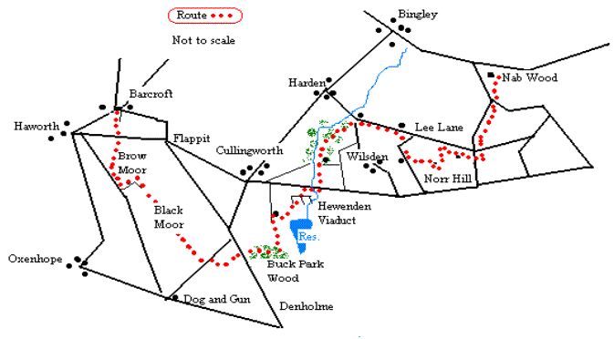
| Run/Walk the Bingley Boundary3: Barcroft to Nab Wood |
|
|
 |
|
|
|
Ten Miles |
|
A nineteenth century local historian suggested flappit was a reference to a bird! More plausible is the suggestion that it is a version of "flay pit",a reference to the treatment of cowhides in the process of tanning leather. The pub sign supports this interpretation. |
|
|
|
|
Take the bridleway, Hardgate Lane, which leaves the road and heads uphill until it meets Brow Top Road on its way to the Flappit crossroads. |
|
|
|
|
|
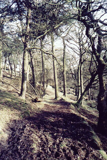
| Carry on over Brow Moor to meet Black Moor Road. Turn left on the road and then take the track left on Cuckoo Park Lane. This is signposted as the Senior Way. Follow the path across the moor to come out on Trough Lane. At Trough Lane the Senior Way follows the road left but it is possible to take the farm track past Pottery Farm and then turn left on a footpath that leads you down onto the Denholme/ Keighley Road. Cross over and take the footpath down through Buck Park Wood which runs parallel to Milking Hole Beck. Head left at the bottom of the wood when you see the Senior Way sign. Take this path to the farm. Go into the yard of East Manywells Farm and turn sharply back right as if heading to the reservoir. There's a stile on the left, leading into the field. Follow the wall down until you come to the stile by a gate. Go through and cut across the field corner to another stile. Follow the signed path under the impressive Hewenden viaduct built for the now dismantled Halifax/Keighley railway in 1880 and head over stiles to the road. Turn right on the road into the dip, cross the beck and take the signed footpath on the left. This path dips, then climbs up to the right before leading down to the old mill. |
|
|
|
Follow the path down and then turn right up the lane to a row of houses. Turn left in front of the houses and over the stile into the field. Follow the path as it goes along the field at the top of the wood. This path dips into the wood after a while and leads to the Harden/Wilsden road above the garden centre. Turn left and then take the stile on the right. Follow the path across the beck and onto the winding track leading from Sandy Banks past the quarry and Bank Top. Just before Lee Farm take the stile on the left and follow the footpath across the fields that leads to Cross Lane. Follow this round the corner where it becomes Coplowe Lane. |
|
 |
|
|
|
|
From Coplowe Lane take the second signed footpath left. As the drive turns into the house take the stile by the wall on the right. |
|
|
|
|
|
Head up the snicket to join the farm track. After a few metres bear right through a metal gate and follow the wall up to the trig point on Norr Hill. Go right across the field to the stile. Head to the next stile and turn left down the side of the wall. Take a stile through the wall and head across the field towards the farm. Follow�� the farm track down towards the road. Another drive comes down from the left. Before you reach the road, turn right over the wall on a stile by a gate. Go across the middle of the field, heading for a stile just below Stocka House farm. Cross the farm track and go through the gate opposite. Pass in front of the farm to another stile. Keep to the wall and go through the wall stile just after the farm. The farm track leads to Sandy Lane. Cross the road, go uphill for a couple of metres and take the signed bridleway. This track heads downhill parallel to Sandy Lane. When you reach� North Bank Road go through the gate just to the right. Its not signed but the path continues downhill. Follow the path until it comes out just before Stoney Lea School. Head downhill, cross Cottingley Road and take the path to Nab Wood School |
|
|
|
|
|
|
Buck Park Wood |
|
|
|
|
|
 |
|
|
|
|
Click to return |
|
|
|
|
|
|