June 25th Evening
Elevation: 4610 ft
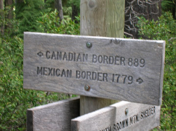
Trail Miles: 735.8 miles
We stayed for lunch at Hyatt Lake. I opted out of taking a shower, because we were going to hike another 8 miles to Klum Landing Campground, where I could shower after a full days hike. Showers are a generally rare but magnificent treat on the trail.
After lunch, I layed in the sun taking a nap, though I did not sleep too much, because I knew that there were still miles to be made. This thru-hiking bit is kind of annoying in the sense that it is harder to relish in the moments your body tells you to. Its easy to enjoy all the things you see, but not being able to enjoy a space a little longer is rather frustrating.
After leaving Hyatt Lake, I felt energized and moved down the trail at a faster pace than usual. Since Debi and Jon where far behind me, I took my pack off and enjoyed one of the side trails. Sure, it was only 400 ft, but I still took it up to WildCat lookout. It was an alright view, but a dangerous clamber up a rock and screet covered hill. I told the others it wasn’t really worth it, too dangerous.
We continued on the last four miles to our destination. My foot started acting up again, and I cursed the load I was carrying. Why am I carrying so much water, Oregon is bountiful with water, unlike Southern California. In fact, today I saw four large lakes, more lakes than I recall seeing in the 700 miles of California I hiked.
Tomorrow I will carry less water.
June 26th Evening
Trail Miles: 760 Miles
My feet hurt. But a journal entry of my pains is not as enjoyable as a journal entry of my joys.
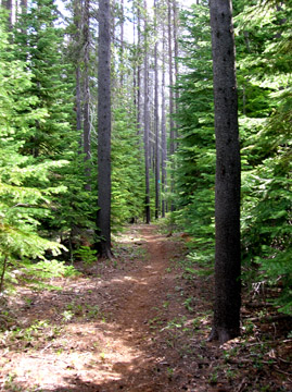
I hiked alone today. Getting ahead of Jon and Debi, I moved along at a descent pace, faster than I usually hiked in California. I walked through dense forests and thick shrubs of broad green leafs. After 12 miles I stopped at a road crossing and ate lunch to myself. Shortly after getting done eating, Jon and Debi arrived. I chatted with them a short while before getting back to the trail.
The long morning shadows of the Douglas firs had retreated to the stumps from where they were born. As the sun started to beam down on my path, I met two mountain bikers on a cross path. After chatting with them for a short while, I continued on into the lava fields.
A path had to be forged over the vast grey lava beds, so the people who built the trail leveled off a path by dumping smaller red pumice into the pathway. What remained was a beautiful red trail winding over grey rocks. In a sense it was like “Follow the yellow brick road,” only it was more like “Traverse the red pumice trail.
With all the large lava rocks, tree growth was limited. So when I rounded a bend, an open field enabled me a spectacular view of Mt. Mcloughlin, a giant conical mountain capped in stripes of white snow. The peak dissappeared into the clouds as the mountain sides sloped steeply into the valley.
Continuing through the lava fields, I arrived at highway 140. The guidebook said there was water in another .3 miles, so I hiked that distance, and did not find water. So I turned around and started back to meet Debi and Jon.
Once I met up with them, they immediately said lets go get a burger. So we did what any thru-hiker would do, we stashed our backpacks, walked to the road and stuck our thumbs out.
Forty-five minutes later we find ourselves enjoying a nice hot meal that isn’t dehydrated.
Happy Trails, Inner Peace, & Harmony
Trail
How far I have not come, and less than how far I have left to go.
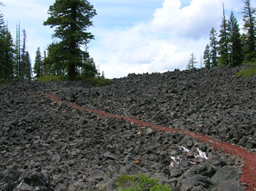
Red pumice trail over gray basalt.