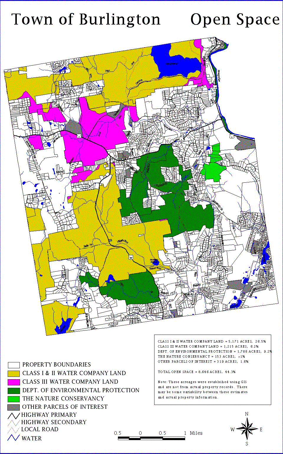
| Does Burlington Have Too Much Open Space? |
| Open space land make up approximately 45% of Burlington. The two primary open space owners--making up 94% of the open space in town are water companies and the state of Connecticut. Most of the land is considered to have long term protection. However 1215 acres of water company land is actually minimally protected. This property is called class three water company property. Considered to be outside the active water supply watersheds, there would be fewer regulatory hurdles if the water companies in question wanted to sell it off for development. |
| The largest section of light purple on this map represents a huge parcel of forestland starting in the middle of town on Route 4 just west of route 69. Residential development of this land would contribute to increased overcrowding in our schools and increased property taxes. Region 10's growth forecasts and subsequent solutions do not include the development of this property. The mill rate in Burlington keeps going up, not down. Residential development in and of itself is a drain on the tax base. |
 |
| The Burlington Land Trust does not oppose development. We advocate planned development which takes into account the impact on our schools, property taxes and the rural nature of our community. |
 |