| Kanata Ontario Weather Data | |||
|---|---|---|---|
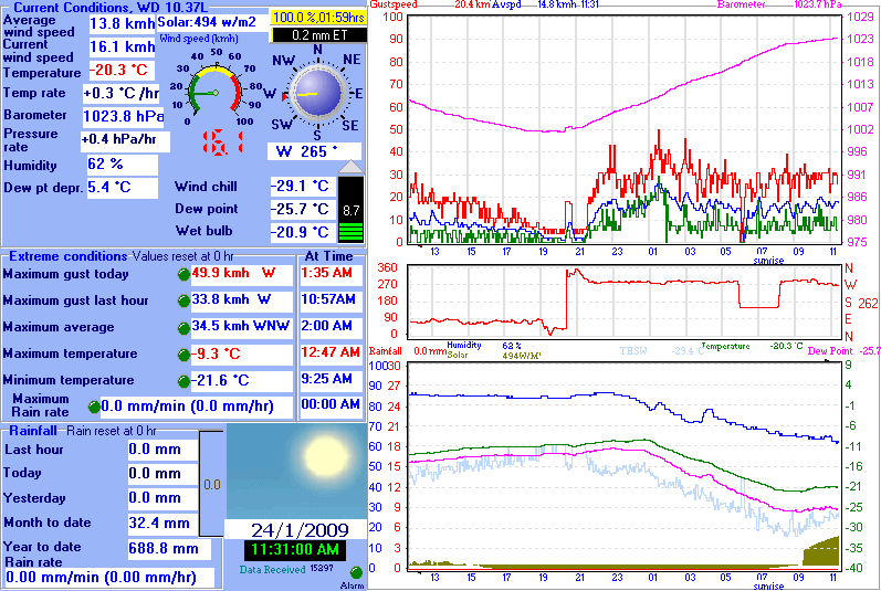
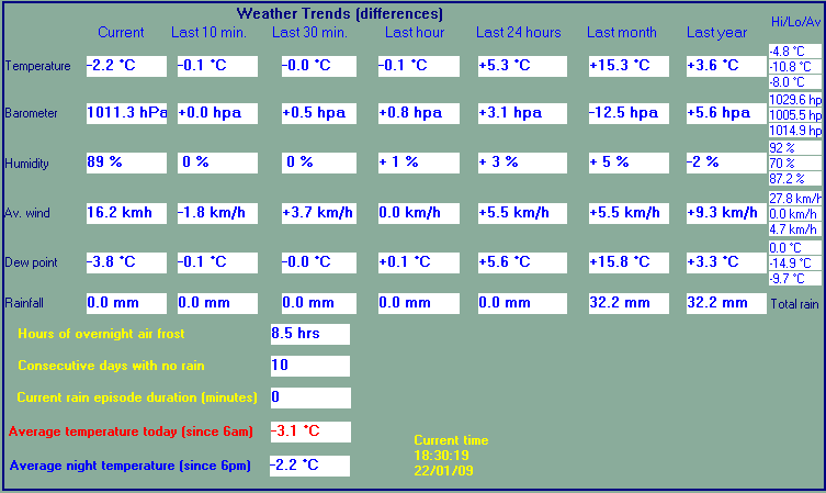
| LAST READING AT TIME: 11:31 AM DATE: 24 January 2009 ,Time of next update: 12:00 PM | |||
| Current Weather | clear_ - low drifting snow_ | Current Temperature | -20.3°C (-4.6°F), Apparent temp -26.2°C, Apparent temp solar -24.7°C |
| Maximum Temperature (since midnight) | -9.3°C at: 12:47 AM | Minimum Temperature (since midnight) | -21.6°C at: 9:25 AM |
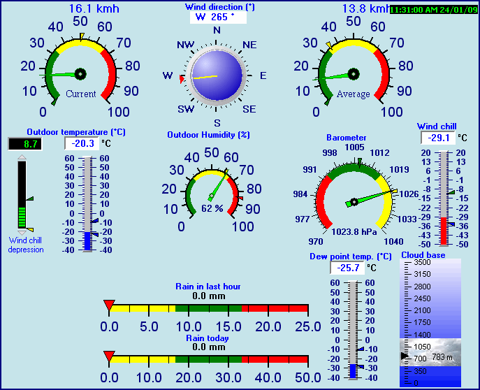
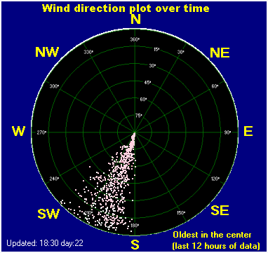
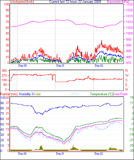
| Average windspeed (ten minute) | 16.5 kmh (8.9 kts) | Wind Direction (ten minute) | W (272°) |
| Windchill Temperature | -29.1°C | Maximum Gust (last hour) | 33.8 kmh (18.3 kts) at: 10:57AM |
| Maximum Gust (since midnight) | 49.9 kmh (27.0 kts) at: 1:35 AM | Maximum 1 minute average (since midnight) | 34.5 kmh (18.7 kts) at: 2:00 AM |
| Rainfall (last hour) | 0.0 mm | Rainfall (since midnight) | 0.0 mm (0.00 in.)--- |
| Rainfall This month | 32.4 mm (1.28 in.) | Rainfall To date this year | 688.8 mm (27.12 in.) |
| Maximum rain per minute (last hour) | 0.0 mm/min | Maximum rain per hour (last 6 hours) | 0.0 mm/hour |
| Yesterdays rainfall | 0.0 mm | DewPoint | -25.7°C (Wet Bulb :-20.9°C ) |
| Humidity | 62 %, Humidex -25.5°C | Barometer corrected to msl | 1023.8 hPa |
| Pressure change | +0.4 hPa (last hour) | Trend (last hour) | STEADY |
| Pressure change (last 12 hours) | +17.1 hPa | Pressure change (last 6 hours) | +7.1 hPa |
| Current Solar 494 W/M˛ | |||
| Maximum solar (since midnight) | 494 W/M˛ | Minimum solar (since midnight) | 0 W/M˛ |
| Current 01:59 hours of sunshine today, current sky: Overcast and gloomy | |||
| Sunshine hours for the year: | 1231:53 hrs | Sunshine hours for the month: | 199:35 hrs |
| Current evapotranspiration rate 0.6 mm per day. Yesterday's reading 0.2 | |||


Use the RELOAD facility on your browser to retrieve the latest data.
